Skip to content
Join our Newsletter

Fri Update: The Front Range Forecast: New Year's quiet weather

In Brief:

Calm dry weather into the New Year.

Friday update:

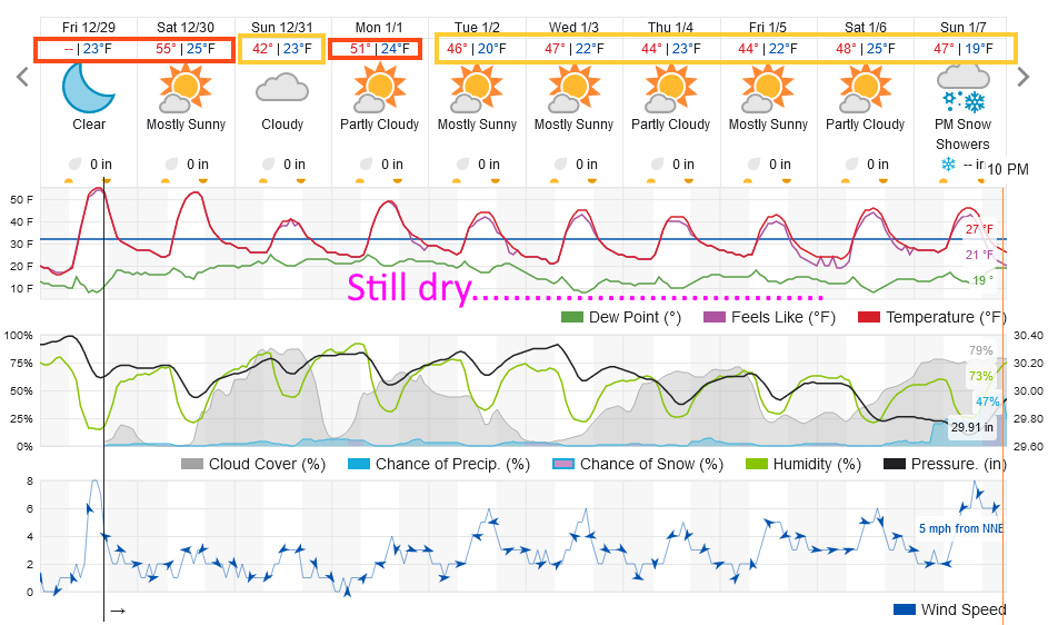
I'm enjoying a quiet holiday week, and so is the weather. Figure 3 update shows that temperatures won't vary much over the next week, and there is basically no chance of precipitation. 

New Year's Eve 11:59pm forecast:

Temperatures:  26F, calm winds, clear skies.  Nice!

figure2u_12292023
Figure 3 update: the 10 day graphical forecast for Longmont from weatherunderground.com

End Friday update.

Christmas Eve Update:

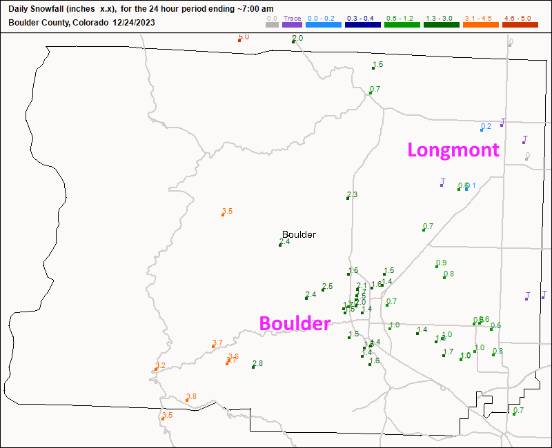
Longmont really got skipped this storm.  I predicted 1-3 inches (0-2" in Firestone).  Figure 2 update shows we got a trace to a quarter inch of snow (a coating).

Boulder did better with 1-3 inches. So, no White Christmas for Longmont this year.

Christmas Day Forecast for Longmont:

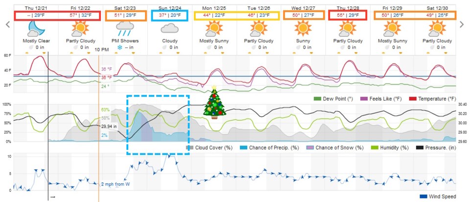
We'll have mostly clear skies in the day with a high of 38F and a low of 25F. Winds will be out of the west at 5mph.


figure2u_12242023
Figure 2 update: snowfall totals as of 12/24 7am from CoCoRaHS

End Christmas Eve update.

Saturday Update:

This isn't shaping up to be a very big or very cold storm at all.  Some folks will get a dusting to a few inches in time for Christmas. Timing is for some rain showers later in the day (temps may get to the 50's briefly) then snow overnight to Christmas Eve morning.

Snowfall Roundup for Longmont:

GFS  1-3"

NAM  Trace-2"

Weatherunderground.com  Tr-1"

Canadian  3-5"

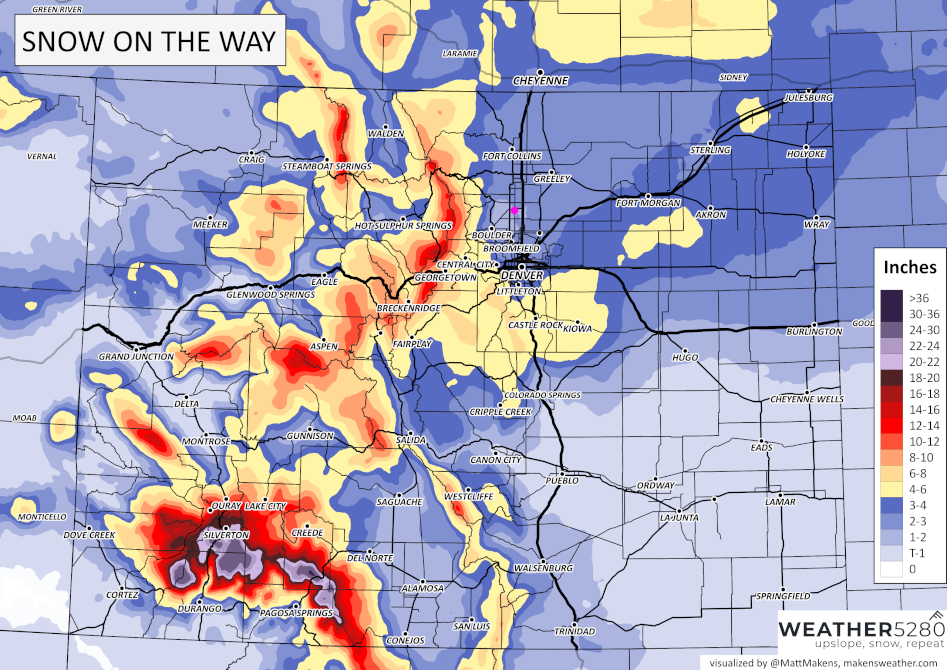
Weather5280  1-3"  (Figure 1 update)

Channel 7  2.6"

Channel 9  1-3"

My forecast:  1-3" is most likely

figure_12232024
Figure 1 update: the weather5280.com snowfall map from Matt Makens.

End Saturday update.

The Forecast Discussion:

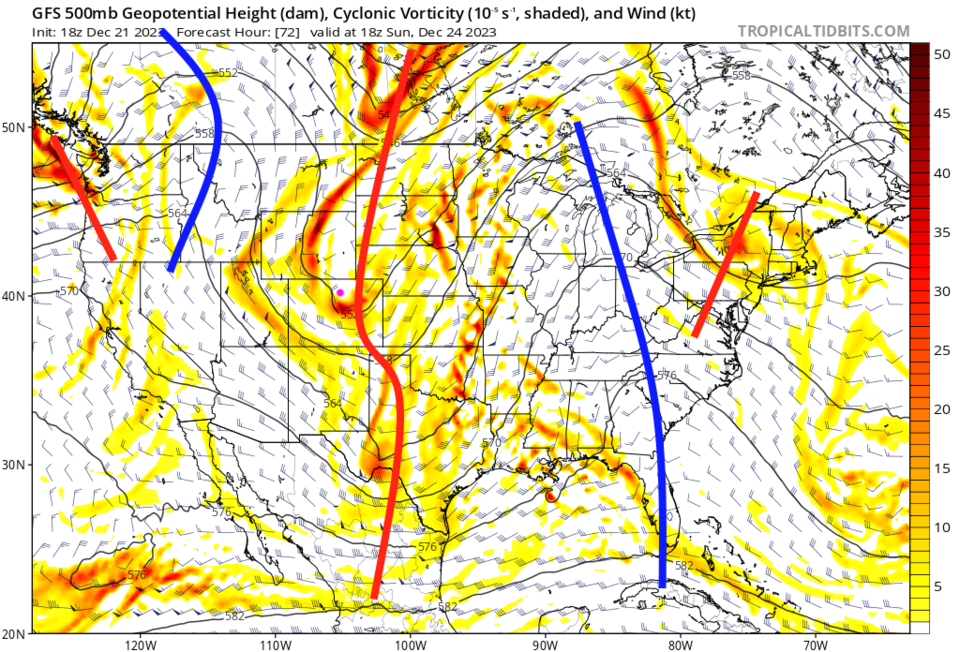
We continue around 20 degrees above normal for now, but changes come Christmas Eve Eve (Saturday) with a Pacific cold front (Figure 1). A storm system from the southwest will almost merge with a system coming in from the Pacific northwest (Figure 2 -curvy red line). They are not expected to work well together so the moist system will not get the cold air from the cold system to create a good snow storm.

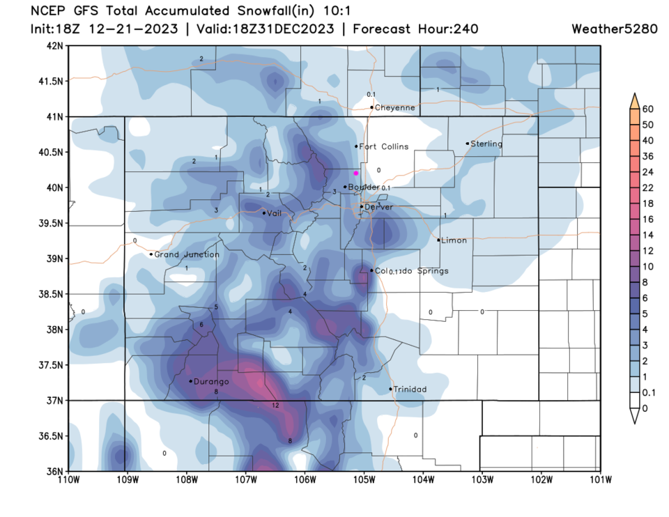
Downslope flow (air coming from the west and dropping off the Rockies) may eat into snow totals along I-25 and eastward north of Denver up to Cheyenne (Figure 3). Most places may see a coating to a few inches of snow on Christmas Eve, according to the GFS.

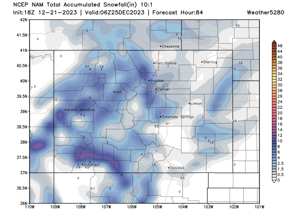
The North American model (Figure 4) has a bit more snow. The Canadian (not shown) thinks the systems will merge well and give us 4-8 inches of snow.  It is an outlier right now. The forecasters at weather5280.com (go read their stuff too!!) give I-25 folks north of Denver 1-2 inches and the mountains good totals.

I'll post an update with the Snowfall Round-Up in the next day or so. And a Christmas morning forecast.  Come on back (but check out the Longer Range Forecast below first...).

figure1_12212023
Figure 1:the 10 day graphical forecast for Longmont from weatherunderground.com
figure2_12212023
Figure 2: the 500mb upper air forecast map for Christmas Eve noon from tropicaltidbits.com and the GFS
figure3_12212023
Figure 3: the 5 day 10:1 snowfall forecast map from the GFS and weather5280.com
figure4_12212023
Figure 4: the 5 day 10:1 snowfall forecast map from the Canadian model and weather5280.com
figure5_12212023
Figure 5: the snowfall forecast from the weather5280.com forecasters (early take).

The Longer Range Forecast:

After this system, not much more snow falls in the next 10 days (Figure 6). Temperatures return to about 10 degrees above normal (Figure 1).  In the long range models, there is a hint of a snowstorm around January 2-4th (not shown).  Come on back for updates!

figure6_12212023
Figure 6: the 10 day 10:1 snowfall forecast map from the GFS and weather5280.com


About the Author: John Ensworth

John Ensworth used to work from Longmont as the PI for the NASA through the IGES (The Institute for Global Environmental Strategies). He now teaches technology, algebra, astronomy, meteorology, film school, and Lego robotics to middle/high school.
Read more


Comments


Current Weather

Cloudy

Cloudy

69°F

UV Index
1 Low
Pressure
30.21 Steady
Visibility
6 miles
Dewpoint
49 °F
Humidity
49%
Wind
W 2.8 mph
Gust
6.4 mph
Wind Chill
69 °F

Hourly Forecast

Today
5 PM
70°F
Cloudy
Today
6 PM
68°F
Mostly cloudy w/ t-storms
Today
7 PM
65°F
Intermittent clouds
Today
8 PM
61°F
Intermittent clouds
Today
9 PM
60°F
Intermittent clouds
Today
10 PM
58°F
Intermittent clouds
Today
11 PM
57°F
Intermittent clouds
Tomorrow
12 AM
56°F
Mostly cloudy w/ t-storms
Tomorrow
1 AM
55°F
Intermittent clouds
Tomorrow
2 AM
54°F
Cloudy
Tomorrow
3 AM
53°F
Cloudy
Tomorrow
4 AM
53°F
Cloudy

7 Day Forecast

Partly sunny w/ t-storms

Tuesday

78 °F

Not as warm with times of clouds and sun; a thunderstorm or two this afternoon; thunderstorms can bring gusty winds, hail and localized flooding


Mostly cloudy w/ t-storms

Tuesday Night

50 °F

A thunderstorm this evening; otherwise, increasing clouds


Mostly cloudy w/ t-storms

Wednesday

73 °F

Some sun, then turning cloudy with a couple of thundershowers in the afternoon


Partly cloudy w/ t-storms

Wednesday Night

50 °F

A couple of showers and a thunderstorm in the evening; otherwise, clearing


Mostly sunny

Thursday

74 °F

Mostly sunny and pleasant


Clear

Thursday Night

45 °F

Clear


Sunny

Friday

81 °F

Plenty of sunshine


Partly cloudy

Friday Night

47 °F

Partly cloudy


Mostly sunny

Saturday

85 °F

Mostly sunny


Clear

Saturday Night

53 °F

Clear


Sunrise and Sunset

Sunrise
6:42 AM
Sunset
7:08 PM

Based on AccuWeather data