Skip to content

Tue Update The Front Range Forecast: More cold fronts and rain

In Brief:

More cool air brings in showers Thursday and Friday.

Tuesday update:

Wednesday will have seasonable temperatures until a couple of cool fronts invade the state cooling us and brining rain. It looks like about 1/2 inch of rain will fall over the region with some thunderstorm activity Thursday night.  Fall is trying to establish itself!

figure2u_09122023
Figure 2 update: the 10 day graphical forecast for Denver from weatherunderground.com

End Tuesday update.

Sunday update:

The cold front has arrived dropping temperatures around 10-15 degrees over the last week's average high.  There is a brief of time, this afternoon, that the first wave of thunderstorms may become severe enough to drop damaging hail.  The atmosphere will stabilize later this afternoon with rain showers off and on through the night through Monday afternoon. 

figure1u_09102023
Figure 1 update: the severe weather outlook from the SPC for Sunday (Day 1).

End Sunday update.

Forecast Discussion:

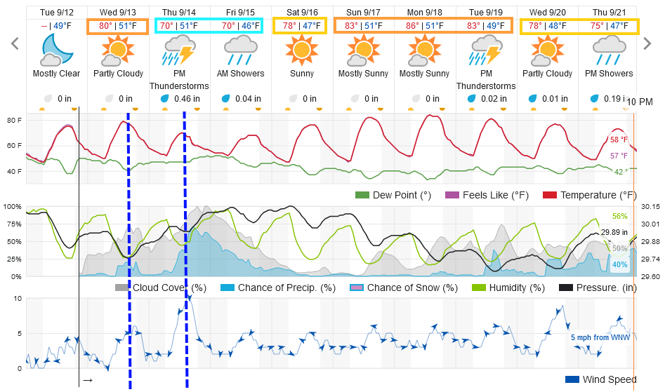
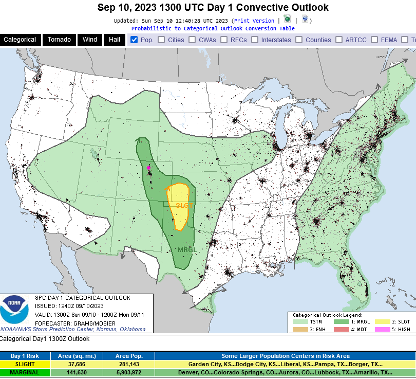
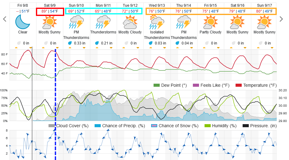
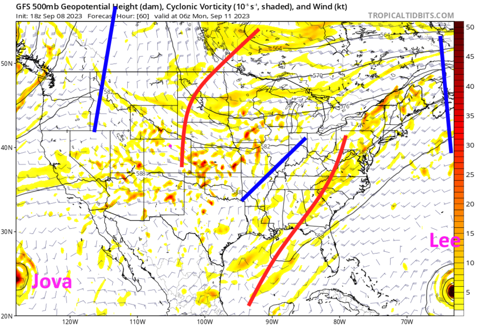
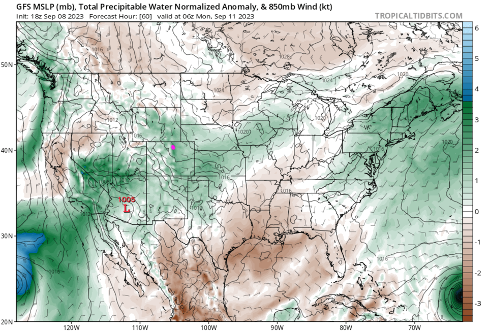
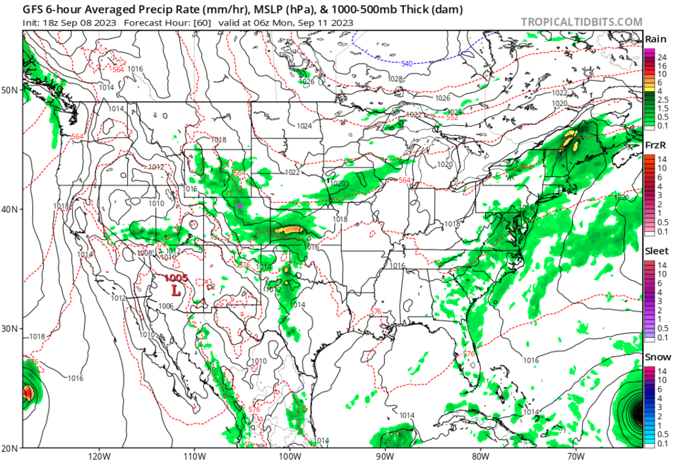
Hold on for one more day, Saturday will be hot before an evening cold front arrives (dashed blue line, Figure 1). This is driven by a trough digging into our high pressure bubble that has influenced the area for much of the last few weeks (Figure 2). Unusually high atmospheric moisture arrives with the front/trough (green shading in Figure 3) yielding a few thunderstorms and showers (Figure 4).

The good shower chances continue through Monday evening with maybe a quarter inch to a third inch of water for most areas (Figure 1).

figure1_09082023
Figure 1: the 10 day graphical forecast for Denver from weatherunderground.com
figure2_09082023
Figure 2: the Sunday night 500 mb forecast from the GFS and tropicaltidbits.com
figure3_09082023
Figure 3: the Sunday night precipitation forecast from the GFS and tropicaltidbits.com
figure4_09082023
Figure 4: the Sunday night precipitation forecast from the GFS and tropicaltidbits.com

The Longer Range Forecast:

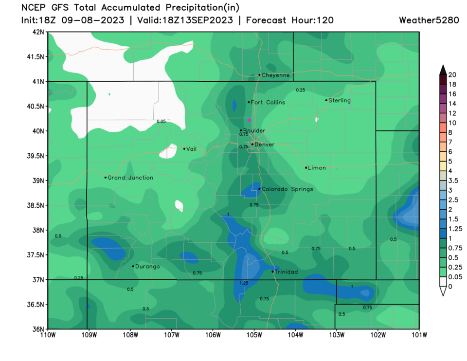
Some shower chances and a slow warm up continues Tuesday and beyond.  Most areas get less than 3/4tth inch over the next 5 days (Figure 5).

Tropical Update:

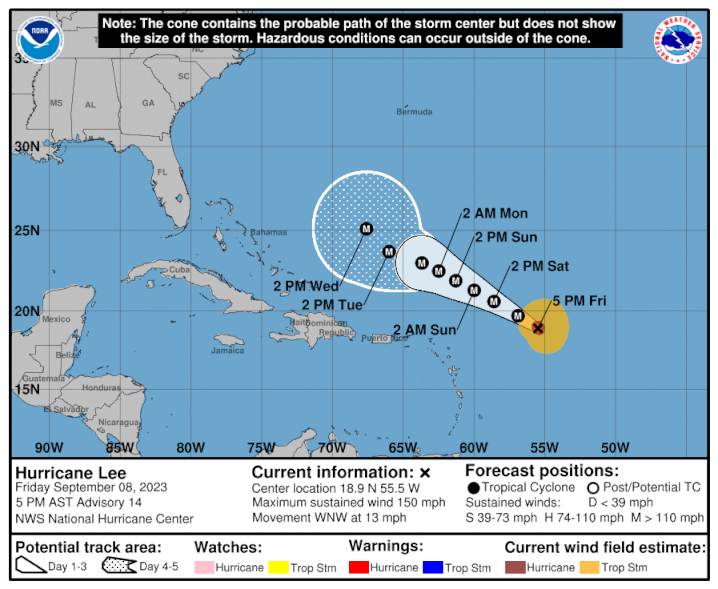
Figure 6 shows the next 5 day forecast for major hurricane Lee out in the Atlantic. Most forecasts keep this storm out to sea, curving north then northeast over the next 10+ days. People on the northern east coast should still keep an eye on it.  This should reach a category 5 storm if it hasn't already. Winds are 150mph now, they only need to get to 157mph.

figure5_09082023
Figure 5: The 5 day precipitation forecast from weather5280.com and the GFS.
figure6_09082023
Figure 6: the NHC forecast for Lee.


About the Author: John Ensworth

John Ensworth works from Longmont as the Principle Investigator for the NASA Science Mission Directorate Earth and space science education product review through the IGES (The Institute for Global Environmental Strategies – www.strategies.org).
Read more


Comments


Current Weather

Clear

Clear

49°F

UV Index
0 Low
Pressure
30.16 Steady
Visibility
7 miles
Dewpoint
43 °F
Humidity
79%
Wind
NW 1.1 mph
Gust
3.7 mph
Wind Chill
49 °F

Hourly Forecast

Today
6 AM
48°F
Clear
Today
7 AM
47°F
Sunny
Today
8 AM
53°F
Sunny
Today
9 AM
60°F
Sunny
Today
10 AM
68°F
Sunny
Today
11 AM
75°F
Sunny
Today
12 PM
80°F
Sunny
Today
1 PM
84°F
Sunny
Today
2 PM
86°F
Sunny
Today
3 PM
87°F
Sunny
Today
4 PM
88°F
Sunny
Today
5 PM
86°F
Sunny

7 Day Forecast

Sunny

Wednesday

88 °F

Very warm with plenty of sunshine


Clear

Wednesday Night

50 °F

Clear


Mostly sunny

Thursday

89 °F

Sunny to partly cloudy and very warm with the temperature approaching the record of 92 set in 1953


Partly cloudy

Thursday Night

49 °F

Partly cloudy


Partly sunny

Friday

86 °F

Partly sunny and very warm


Mostly clear

Friday Night

48 °F

Mainly clear


Mostly cloudy

Saturday

85 °F

Mostly cloudy and very warm


Intermittent clouds

Saturday Night

51 °F

Clearing


Mostly sunny

Sunday

85 °F

Mostly sunny and remaining warm; breezy in the afternoon


Mostly clear

Sunday Night

49 °F

Mainly clear


Sunrise and Sunset

Sunrise
6:53 AM
Sunset
6:50 PM

Based on AccuWeather data