Skip to content

The Front Range Forecast: Cold fronts moderate summer weather

In Brief:

Summer in the short-term, moisture returns for the weekend.

Forecast Discussion:

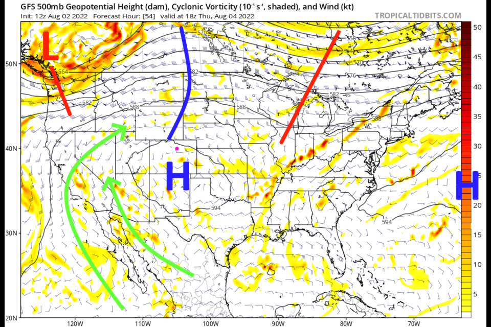
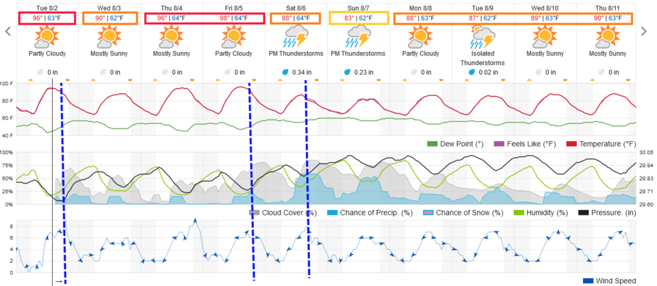
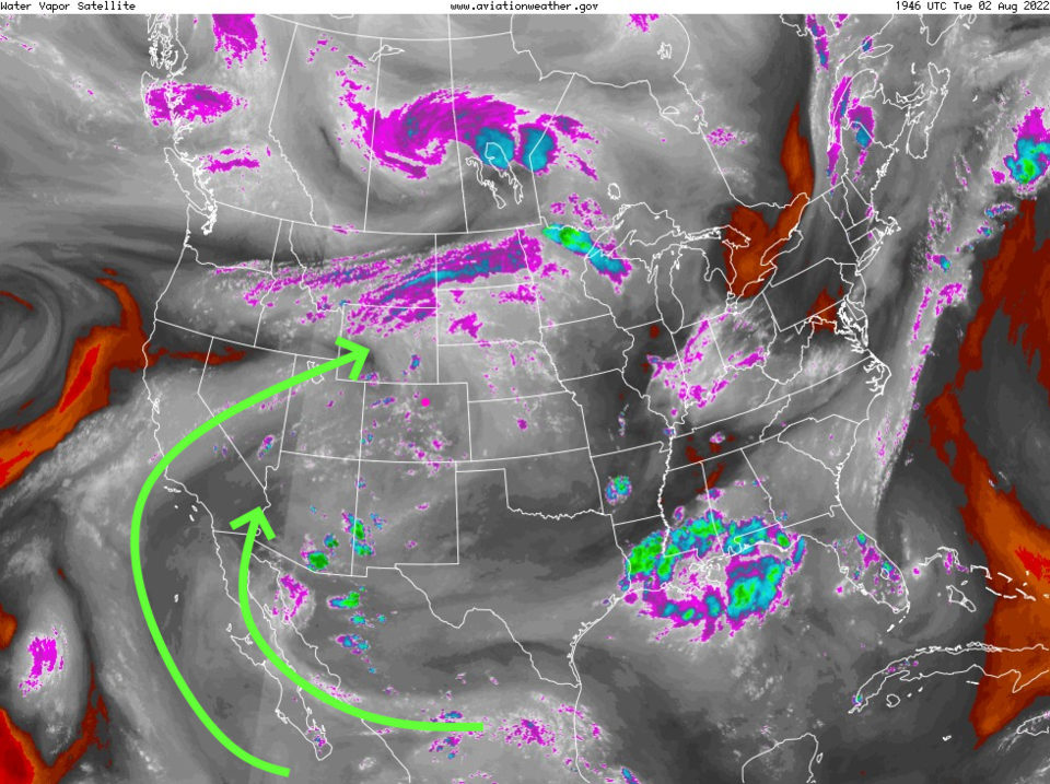
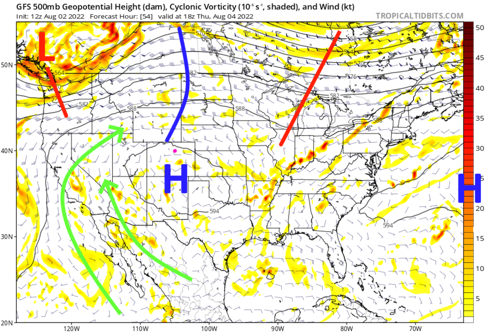
As fall begins to appear on the horizon (only about 6 weeks away), we are seeing cold front pushed across the state by passing troughs.  One arriving Tuesday will cool us to the upper 80-90F (Figure 1).  There is a high located over the state (Figure 3) that is shunting the good moisture further west (Figure 2) and suppressing convection. 

Figure1_08022022
Figure 1: the 10 day graphical forecast for Denver from weatherunderground.com
Figure2_08022022
Figure 2: the water vapor satellite image from the NWS
Figure3_08022022
Figure 3: the 500mb upper air forecast map for Thursday from the GFS and tropicaltidbits.com

The Longer Range Forecast:

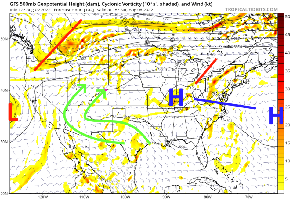
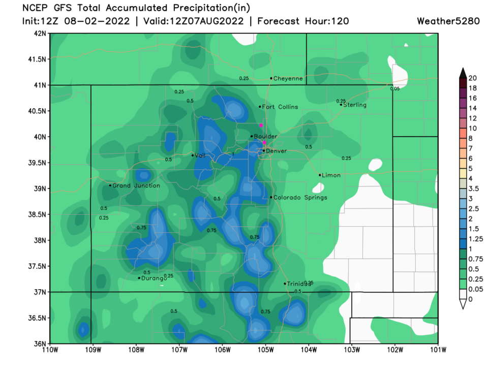
By the end of the week, the high shifts far to the east (Figure 4). With an approaching trough, a couple of cold fronts knocks us down to the lower 80s and rain chances really pick up for the weekend (Figure 1).  Rainfall statewide for the next 5 days is still best over the mountains and minimal on the plains unless you get a lucky thunderstorm (Figure 5).

Figure4_08022022
Figure 4: the 500mb upper air forecast map for Saturday from the GFS and tropicaltidbits.com
Figure5_08022022
Figure 5: the 5 day precipitation total from the GFS and weather5280.com


About the Author: John Ensworth

John Ensworth used to work from Longmont as the PI for the NASA through the IGES (The Institute for Global Environmental Strategies). He now teaches technology, algebra, astronomy, meteorology, film school, and Lego robotics to middle/high school.
Read more


Comments


Current Weather

Mostly sunny

Mostly sunny

64°F

UV Index
4 Moderate
Pressure
29.59 Steady
Visibility
7 miles
Dewpoint
37 °F
Humidity
37%
Wind
WNW 4.6 mph
Gust
11.2 mph
Wind Chill
64 °F

Hourly Forecast

Today
11 AM
66°F
Cloudy
Today
12 PM
67°F
Cloudy
Today
1 PM
68°F
Mostly cloudy
Today
2 PM
69°F
Mostly cloudy
Today
3 PM
70°F
Mostly cloudy
Today
4 PM
68°F
Mostly cloudy
Today
5 PM
66°F
Cloudy
Today
6 PM
63°F
Thunderstorms
Today
7 PM
59°F
Cloudy
Today
8 PM
56°F
Cloudy
Today
9 PM
53°F
Cloudy
Today
10 PM
51°F
Thunderstorms

7 Day Forecast

Mostly cloudy w/ t-storms

Friday

70 °F

Some sun, then increasing clouds with a couple of thundershowers this afternoon; gusty winds and small hail can accompany any downpour


Thunderstorms

Friday Night

44 °F

Cloudy; a couple of showers and a thunderstorm this evening followed by periods of rain late; gusty winds and small hail can accompany any downpour


Rain

Saturday

47 °F

Chilly with periods of rain and a thunderstorm; travel in the foothills and mountains will be slippery due to snow


Rain and snow

Saturday Night

36 °F

Cloudy with rain, mixed with a little snow late; travel in the foothills and mountains will be slippery due to snow


Mostly cloudy

Sunday

61 °F

Mostly cloudy and warmer


Intermittent clouds

Sunday Night

36 °F

A thunderstorm in spots in the evening; otherwise, partly cloudy


Partly sunny

Monday

71 °F

Partly sunny, pleasant and warmer


Partly cloudy

Monday Night

45 °F

Partly cloudy


Mostly sunny

Tuesday

73 °F

Pleasant with sunshine and patchy clouds


Partly cloudy

Tuesday Night

43 °F

Partly cloudy


Sunrise and Sunset

Sunrise
6:06 AM
Sunset
7:51 PM

Based on AccuWeather data