Skip to content
Join our Newsletter

The Front Range Forecast: Cold, not much snow

In Brief:

A potentially big storm seems to have vanished for Monday, colder than normal for a while.

Forecast Discussion:

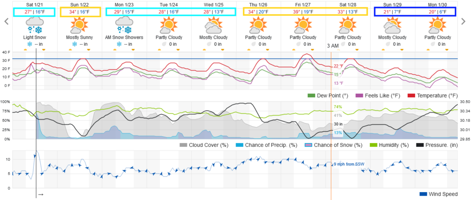
We remain chilly this weekend with very light snow on Saturday (Figure 1).

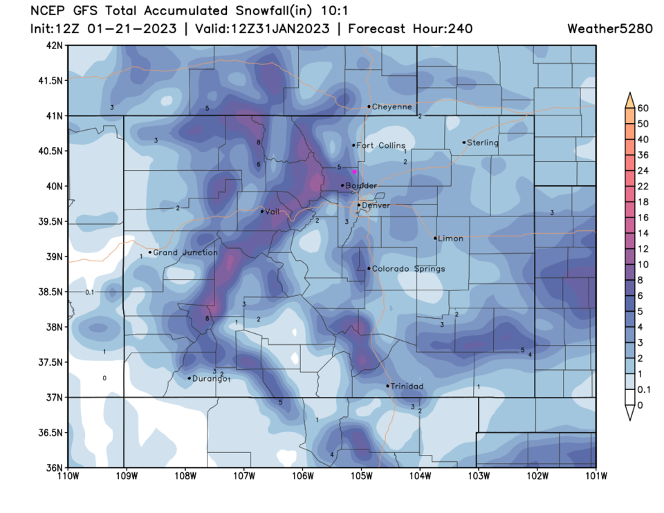
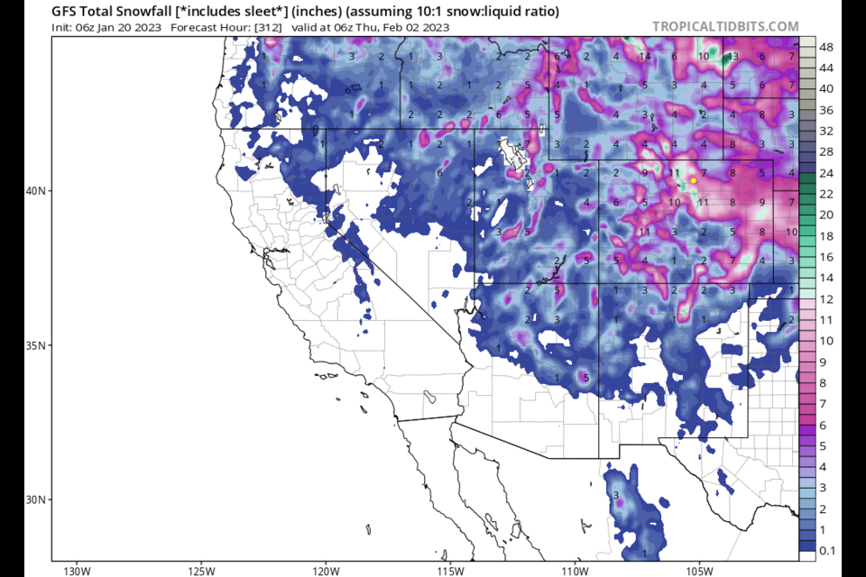
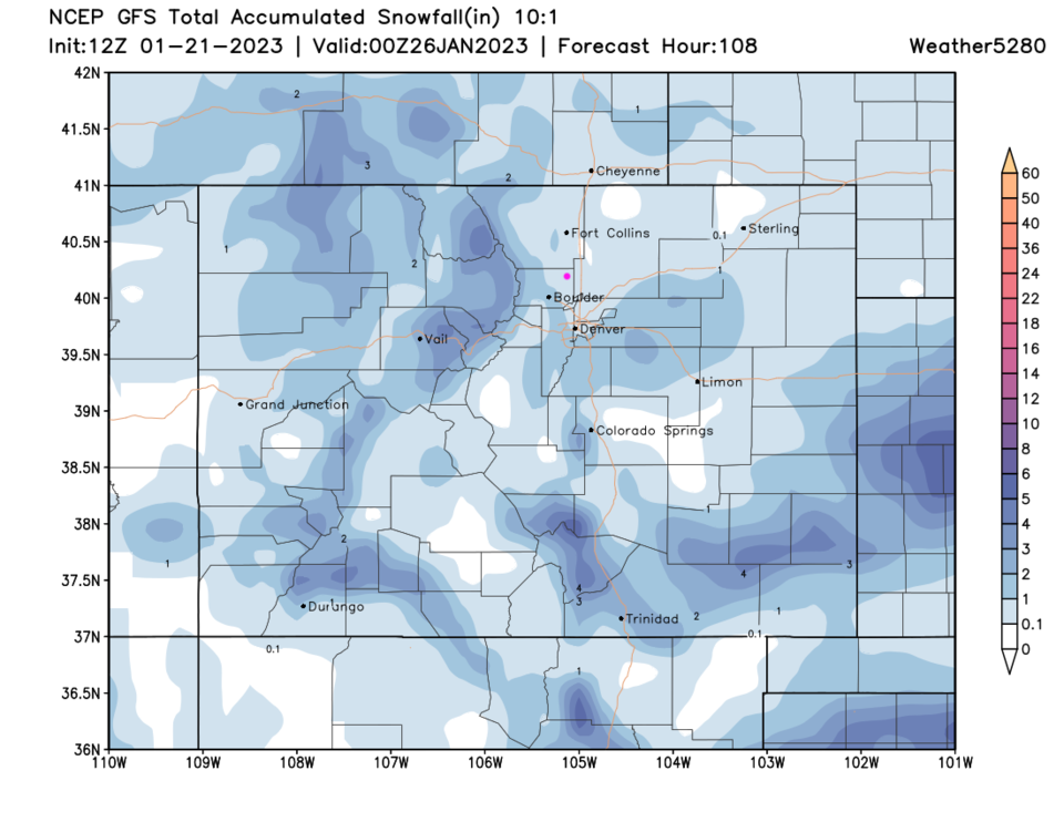
Leading up to the weekend, many (but not all) models were beginning to show another big hit (6+ inches) of snow for the Front Range Sunday into Monday (Figure 2). This morning, it vanished from the models.  Now there is a chance of a coating to an inch or snow around the region (Figure 3). I was so hoping for another snow day.

figure1_01212023
Figure 1: the 10 day graphical forecast for Denver from weatherunderground.com

figure3_01212023
Figure 2: the 1.5 day old forecast for the Monday storm from the GFS and tropicaltidbits.com

​​

figure4_01212023
Figure 3: the GFS forecast for the Monday storm snowfall made Saturday from weather5280.com

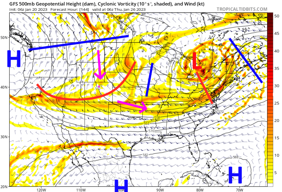
The Longer Range Forecast:

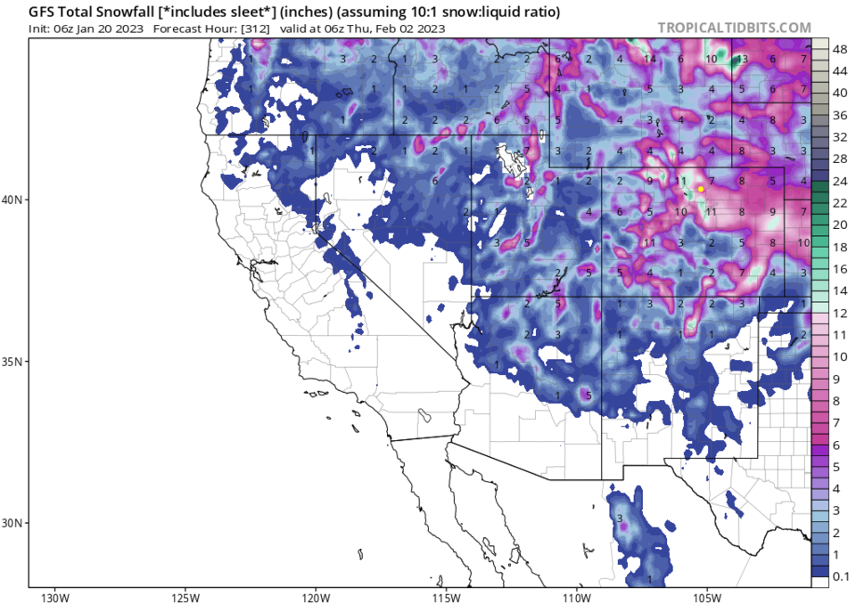
The airflow over the West will be out of the north for much of the week (Figure 4). This north flow will keep the cold air coming. You will see small snow chances now and then as ripples travel down the flow giving us a 2 to 5 inches of snow over the region over the next 10 days (Figure 1 and 5).  It will remain chilly to cold throughout.  Will another big storm form out of the pattern that just isn't showing up now?  It might!  Stay tuned.

figure2_01212023
Figure 4: the 500mb upper air forecast map for midnight Wed/Thur from the GFS and tropicaltidbits.com
figure5_01212023
Figure 5: the 10 day snowfall forecast from the GFS and weather5280.com


About the Author: John Ensworth

John Ensworth used to work from Longmont as the PI for the NASA through the IGES (The Institute for Global Environmental Strategies). He now teaches technology, algebra, astronomy, meteorology, film school, and Lego robotics to middle/high school.
Read more


Comments


Current Weather

Cloudy

Cloudy

72°F

UV Index
1 Low
Pressure
30.21 Steady
Visibility
8 miles
Dewpoint
47 °F
Humidity
41%
Wind
ENE 4.8 mph
Gust
9.3 mph
Wind Chill
72 °F

Hourly Forecast

Today
4 PM
73°F
Thunderstorms
Today
5 PM
70°F
Intermittent clouds
Today
6 PM
68°F
Mostly cloudy w/ t-storms
Today
7 PM
65°F
Intermittent clouds
Today
8 PM
61°F
Intermittent clouds
Today
9 PM
60°F
Intermittent clouds
Today
10 PM
58°F
Intermittent clouds
Today
11 PM
57°F
Intermittent clouds
Tomorrow
12 AM
56°F
Mostly cloudy w/ t-storms
Tomorrow
1 AM
55°F
Intermittent clouds
Tomorrow
2 AM
54°F
Cloudy
Tomorrow
3 AM
53°F
Cloudy

7 Day Forecast

Partly sunny w/ t-storms

Tuesday

78 °F

Not as warm with times of clouds and sun; a thunderstorm or two this afternoon; thunderstorms can bring gusty winds, hail and localized flooding


Mostly cloudy w/ t-storms

Tuesday Night

50 °F

A thunderstorm this evening; otherwise, increasing clouds


Mostly cloudy w/ t-storms

Wednesday

73 °F

Some sun, then turning cloudy with a couple of thundershowers in the afternoon


Partly cloudy w/ t-storms

Wednesday Night

50 °F

A couple of showers and a thunderstorm in the evening; otherwise, clearing


Mostly sunny

Thursday

74 °F

Mostly sunny and pleasant


Clear

Thursday Night

45 °F

Clear


Sunny

Friday

81 °F

Plenty of sunshine


Partly cloudy

Friday Night

47 °F

Partly cloudy


Mostly sunny

Saturday

85 °F

Mostly sunny


Clear

Saturday Night

53 °F

Clear


Sunrise and Sunset

Sunrise
6:42 AM
Sunset
7:08 PM

Based on AccuWeather data