In Brief:
Warmer each day and mostly dry.
Friday update:
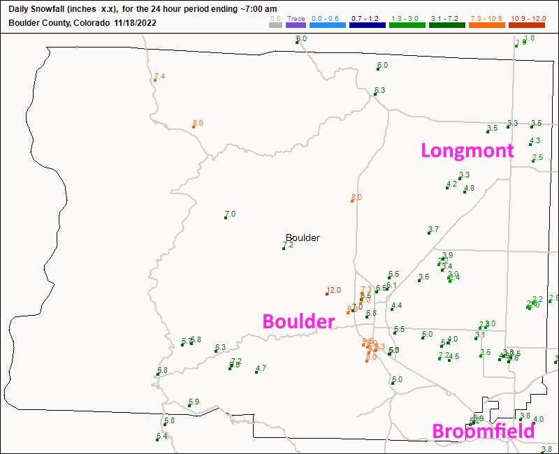
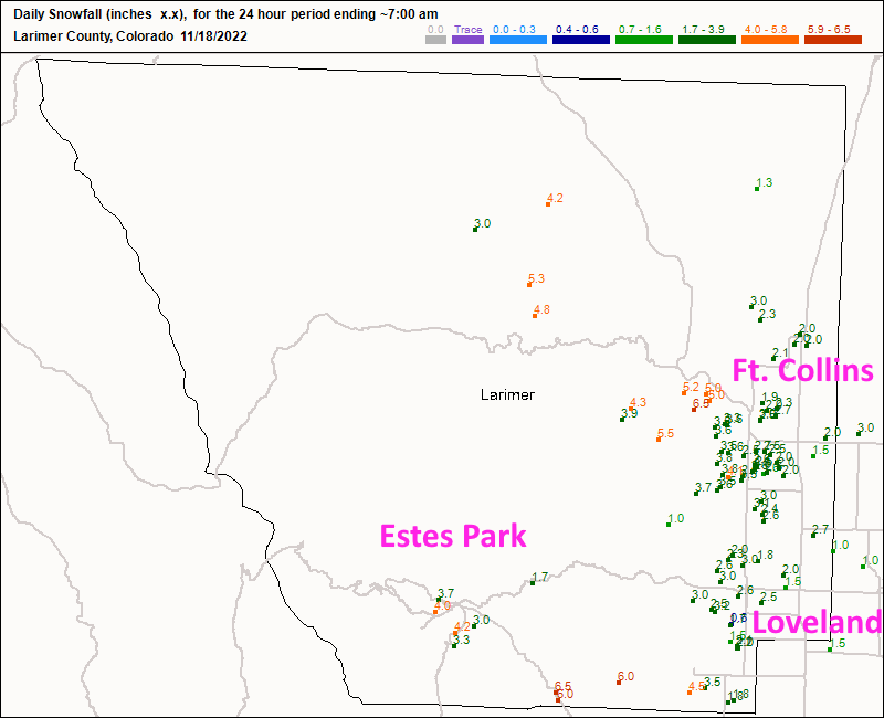
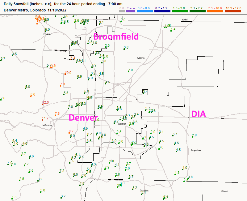
The storm played out almost exactly as forecasted! Figures 3 update, 4 update, and 5 update cover all cities from Fort Collins to Denver. In another forum, I do a city-by-city forecast. Here is my grading for that forecast. I only really missed on the Palmer Divide.
We warm up some and stay dry for most of the upcoming week.
End Friday update.
Wednesday update:
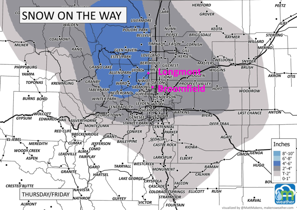
The forecasters at weather5280.com (go check them out! Figure 2 update) have come out with their snowfall forecast map through Friday morning. For Longmont to Broomfield, I'm going with 3-5 inches with local spots able to hit 8 inches if snow bands form.
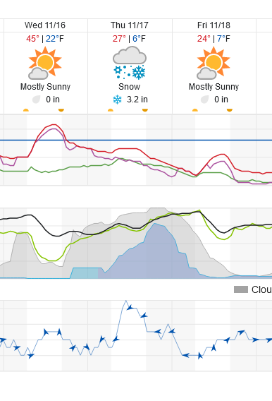
Temperatures are tumbling to where we'll only see highs in the mid to lower 20's Thursday and Friday. Lows will be in the mid to lower single digits. Light snow may begin overnight Wednesday into Thursday. Snow will become more steady but light around sunrise. Snow rates pick up in the afternoon Thursday and continue late into the night Thursday-Friday. Most of the snow should come to an end around 4-5am.
Stay warm and safe!
End Wednesday update.
Tuesday update:
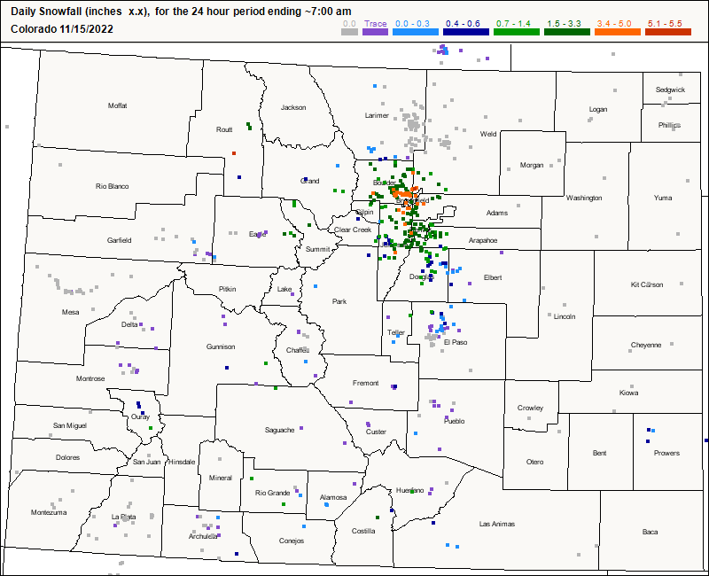
A small-ish system over performed last night and into the morning! From Longmont to Colorado Springs, everything came together for 1-4 inches of snow. My yard picked up 3 inches! Figure 1 update shows, in colored dots, snowfall amounts.
Our next system moves in around 6pm Wednesday with some wind and rapidly dropping temperatures. Snow showers may begin as early as 7-9pm Wednesday but snowfall rates really pick up in the morning Thursday. At present, it looks like a 3-5 inch storm around Longmont to Broomfield. More later! Beware the single digit lows. This is the coldest we've seen in 7-8 months!
End Tuesday update.
Forecast Discussion:
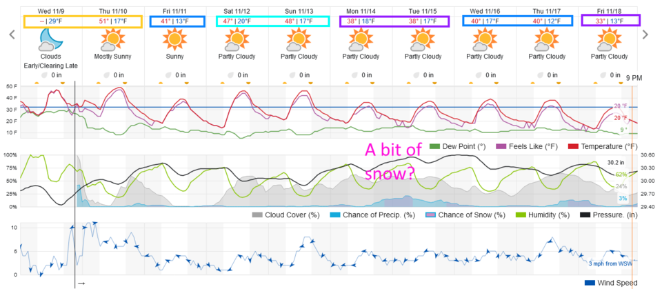
Our first taste of winter temperatures are on the way (longer than one two-day storm). We start Thursday in the 50s, but if you scan Figure 1, you'll see that is real heat compared to what is to come. Next Friday looks to be the coldest weather since last winter with a high near freezing.
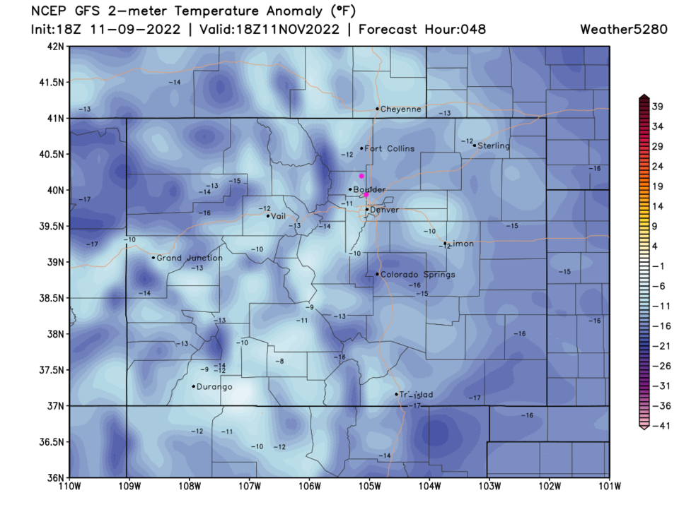
We will continue to see a cold air flow from Canada coming down the Plains (Texas will get quite cold as well - Figure 2). This Friday looks quite chilly as well with temperatures around 10-15 degrees below normal (Figure 3).
The Longer Range Forecast:
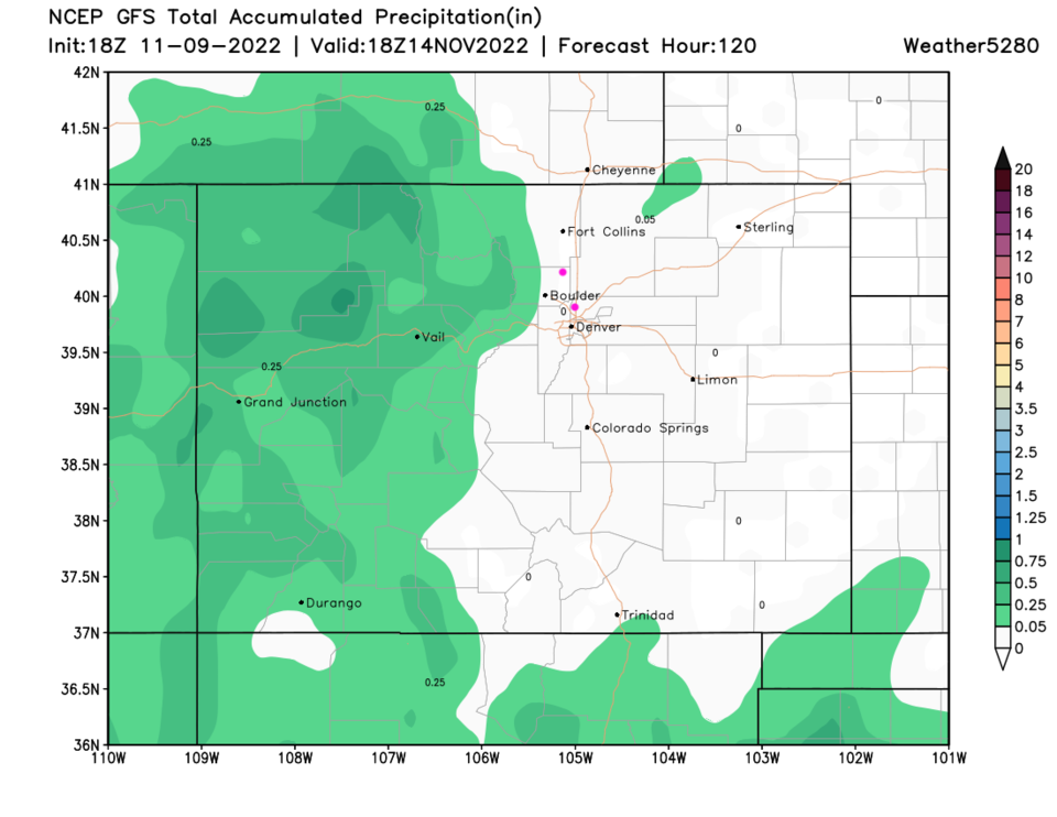
Even with a small chance of snow showers next Monday/Tuesday - it looks like most snow/precipitation will be confined to the mountains (Figure 4). Sorry, cold and dry will be this week's theme.
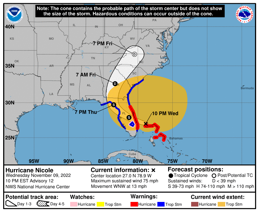
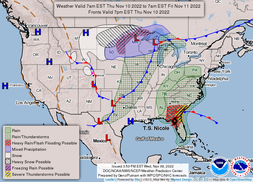
Tropical Update:
Hurricane Nichole is closing in on Florida as I type. It will hit as a Cat 1 or Cat 2 storm, then lose much of its punch going over land. After that is predicted to remain land-locked which will tear it apart quickly over the next couple of days. There will be wind damage in southern Florida and a flooding potential up into the Carolinas and Virginia (Figure 5).