In Brief:
A sudden change in the midterm and long term forecast seem to promise rain!
Friday update:
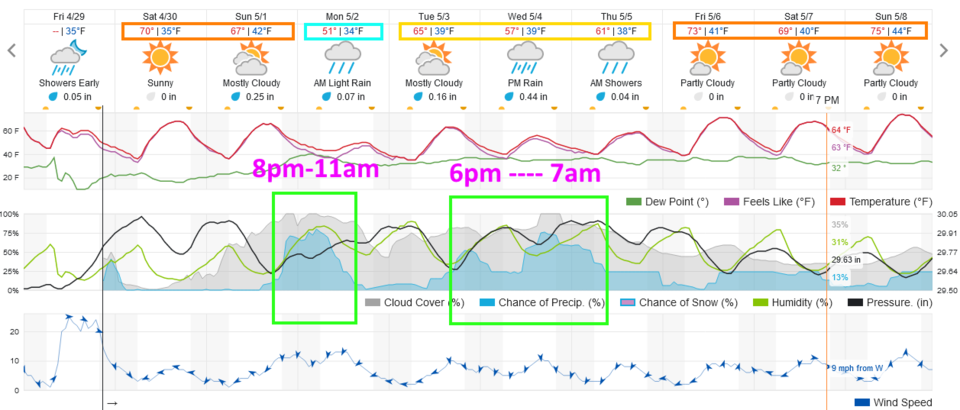
It seems we avoided a major fire event again (whew!). We did have a dry-line set up from west of Ft. Collins to the Airport and down to the Palmer Divide midday. Thunderstorms took off and produced our first lightning (if not much rain) in a long time. BUT the upper air pattern is taking a turn. What looked like another 7-10 days of dry weather just 48 hours ago, now holds the promise of some real rain. There are two main rain events; Sunday PM to Monday AM and again Tuesday PM to Thursday AM (Figure 2 update). Beyond that, there seems to be an ongoing chance of showers as well.
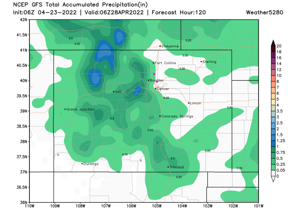
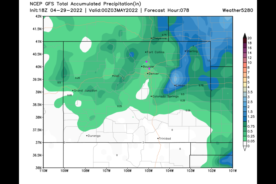
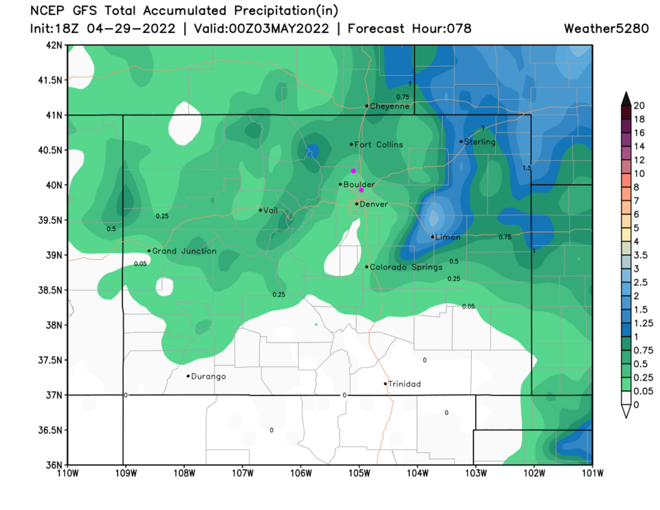
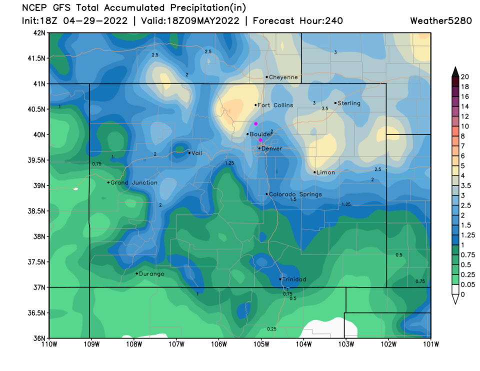
Our first precipitation event promises about 0.1 to 0.25 inch of water for Broomfield and about 0.25 inch for Longmont (Figure 3 update). I don't think it can be believed (the GFS suffers from what is called convective feedback and over-does thunderstorm based precipitation), but if it is true, the next 10 days brings 1.5-2 inches of water to Broomfield and 2 to 2.5 inches of water to Longmont. Rainfall around Fort Collins and to the west and out on the plains tops 3.5 inches. Again, I bet we see rainfall, but maybe totals closer to 1/3rd to 1/2 what Figure 4 update shows. This will be a fun test!
End Friday update.
Thursday update:
There is a chance of showers Sunday PM/Monday AM and again Tuesday/Wednesday (not great chances, but real chances). Sadly, in the meantime, we have very warm temperatures leading into the end of the week and a good 12-18 hours of strong northwest (coming from the northwest) winds. Be careful and alert concerning fire sources. More later!
End Thursday update.
Forecast Discussion:
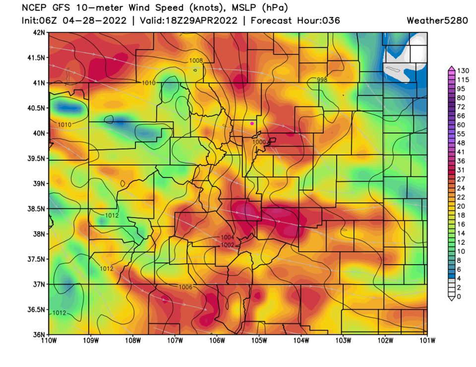
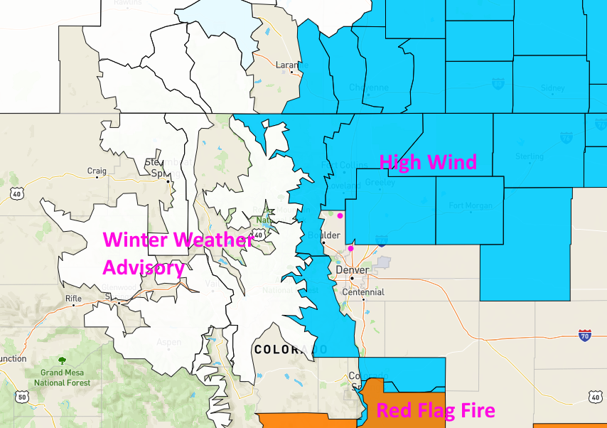
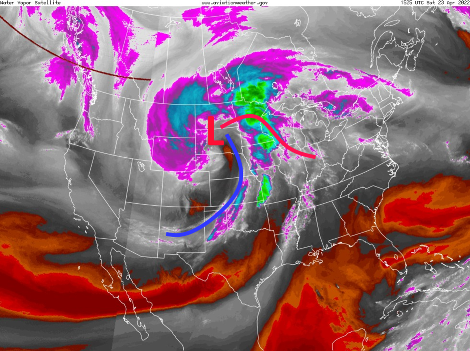
We enter the weekend with a number of warnings and advisories across the region as a large storm system departs the state (Figure 1). Oddly, Longmont and Broomfield just narrowly escape (at this time) being included in any of them. The low center of this system is already up in the Dakotas heading for Canada (Figure 2).
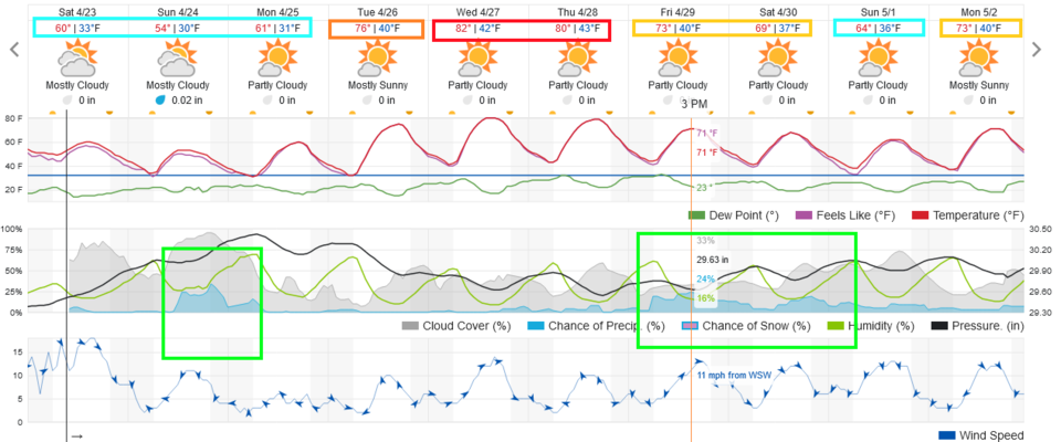
Temperatures remain in 50's and 60's through Monday. A short wave does bring 30-40% chances of precipitation during the day Sunday (Figure 3). Rainfall amounts should remain very light (Figure 4).
The Longer Range Forecast:
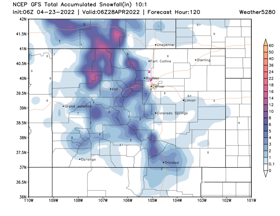
We return to the 80's pretty quickly mid-week (Figure 3). Another cold front arrives Friday bringing a cool down and small rain chances again (Figure 4). Snow should remain mostly light and confined to the higher elevations (Figure 5).