Skip to content

The Front Range Forecast: Cool with showers

In Brief:

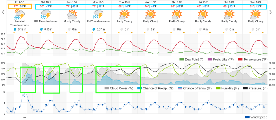
The weather turns to Fall with almost daily showers and seasonably cool temperatures.

Forecast Discussion:

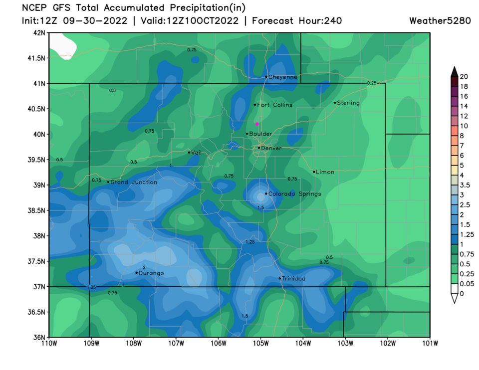
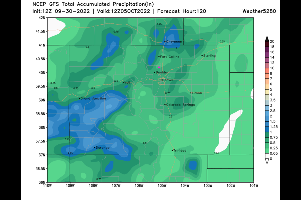
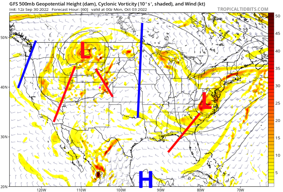
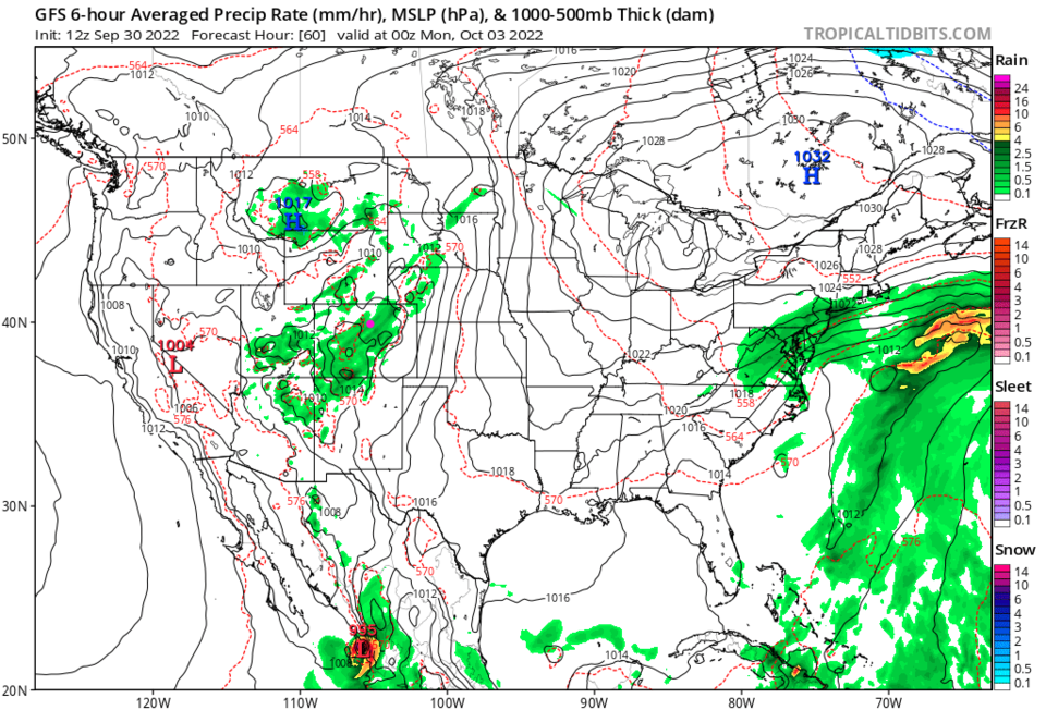
Cool fronts are arriving bringing chances of afternoon and evening showers (and a few thunderstorms) each day (Figure 1). This is being driving by a cut-off low to our north that won't move away for a few days (Figure 2). To the south of the low there will be widespread showers now and then (Figure 3).

Over the next five days, most locations around Longmont and Broomfield should receive 1/4th to 1/2 inch of water. No big news, but a nice change of season.

Figure1_09302022
Figure 1: the 10 day graphical forecast for Denver from weatherunderground.com
Figure2_09302022
Figure 2: the 500 mb upper air map from the GFS for Sunday PM from tropcaltidbits.com
Figure3_09302022
Figure 3: the 6 hour precipitation pattern for Sunday PM from the GFS and tropicaltidbits.com
Figure4_09302022
Figure 4: the 5 day rainfall total from the GFS and weather5280.com


The Longer Range Forecast:

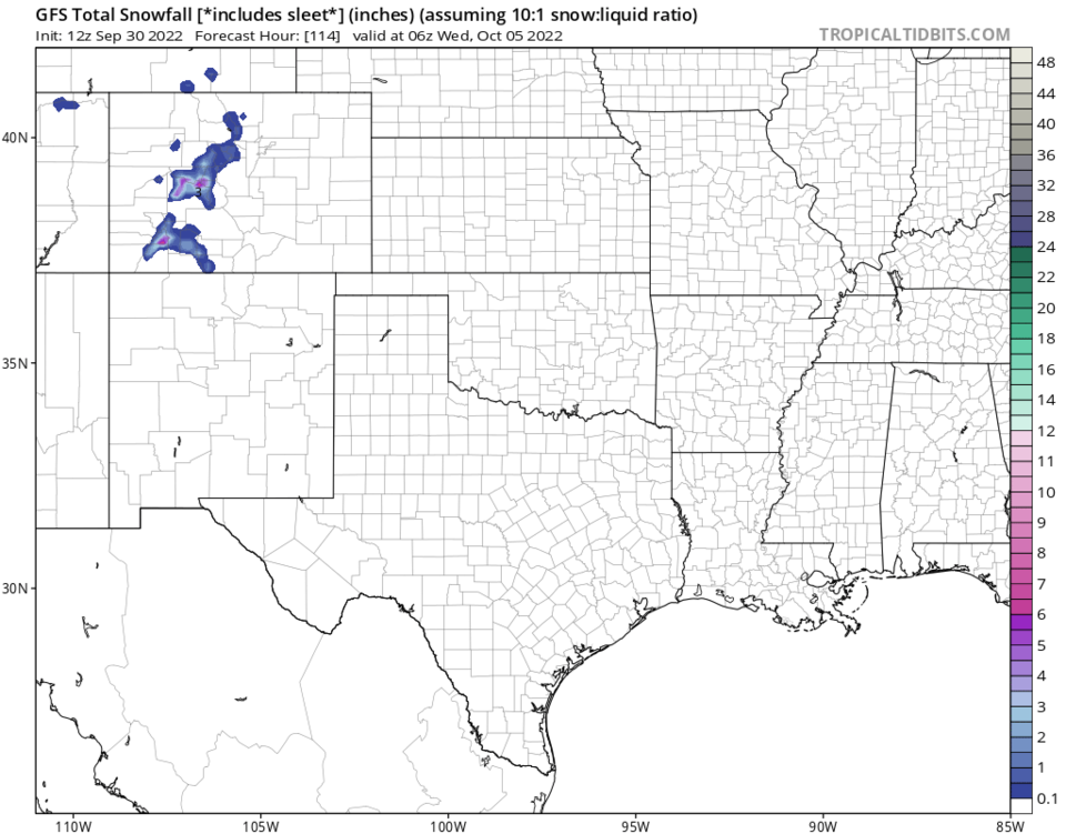
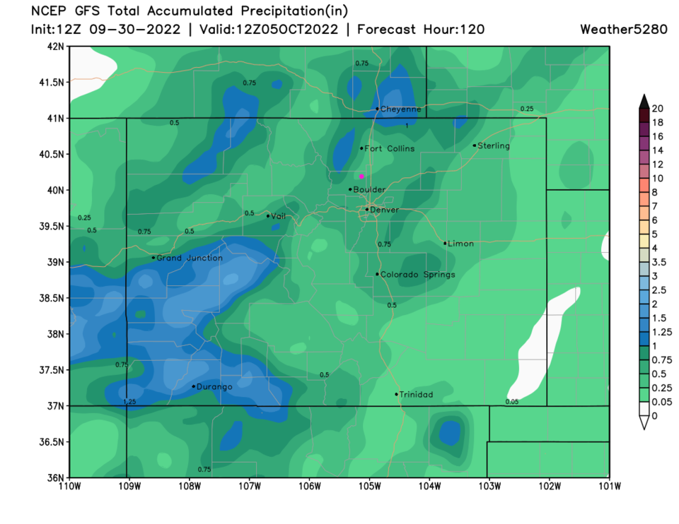
Beyond the next five days, clouds and some rain chances remain each day (Figure 1). The mountains pick up more of the rain showers over the next 10 days than the low lands. For fun, you can see some higher elevation snow over the next five days (Figure 6) as well!

Figure5_09302022
Figure 5: the 10 day rainfall total from the GFS and weather5280.com
Figure6_09302022
Figure 6: the snowfall total map for the next 4 days from the GFS and tropicaltidbits.com


About the Author: John Ensworth

John Ensworth used to work from Longmont as the PI for the NASA through the IGES (The Institute for Global Environmental Strategies). He now teaches technology, algebra, astronomy, meteorology, film school, and Lego robotics to middle/high school.
Read more


Comments


Current Weather

Light snow

Light snow

32°F

UV Index
0 Low
Pressure
30.35 Steady
Visibility
3 miles
Dewpoint
30 °F
Humidity
93%
Wind
ENE 1.1 mph
Gust
2.2 mph
Wind Chill
32 °F

Hourly Forecast

Today
3 AM
33°F
Cloudy
Today
4 AM
33°F
Snow
Today
5 AM
33°F
Snow
Today
6 AM
33°F
Snow
Today
7 AM
33°F
Cloudy
Today
8 AM
30°F
Flurries
Today
9 AM
32°F
Snow
Today
10 AM
33°F
Cloudy
Today
11 AM
34°F
Cloudy
Today
12 PM
35°F
Cloudy
Today
1 PM
37°F
Cloudy
Today
2 PM
38°F
Cloudy

7 Day Forecast

Rain and snow

Friday

41 °F

Chilly; rain and snow showers in the morning with little or no accumulation followed by rain and drizzle in the afternoon


Snow

Friday Night

30 °F

Periods of wet snow, accumulating 1-3 inches; roads could be slippery


Flurries

Saturday

40 °F

A bit of morning snow with little or no accumulation; otherwise, cloudy and cold; storm total snowfall 1-3 inches


Intermittent clouds

Saturday Night

32 °F

A shower in places this evening; otherwise, partly cloudy


Partly sunny

Sunday

63 °F

Partly sunny and warmer


Mostly clear

Sunday Night

40 °F

Mainly clear


Intermittent clouds

Monday

79 °F

Warmer with intervals of clouds and sun


Partly cloudy

Monday Night

40 °F

Partly cloudy


Mostly cloudy

Tuesday

66 °F

Mostly cloudy and not as warm


Intermittent clouds

Tuesday Night

40 °F

Partly cloudy


Sunrise and Sunset

Sunrise
6:15 AM
Sunset
7:44 PM

Based on AccuWeather data