Skip to content
Join our Newsletter

Monday Update: The Front Range Forecast: Winter cold finally arrives, snow Friday/Saturday?

The Video Forecast for this week

In Brief:

Temperatures will finally be below normal for most of the upcoming week - models disagree on a 3-5" snow for Friday.

Monday Update:

I'll post a full update Tuesday (on vacation in Texas) - but the temperatures are finally centring (high temperatures) around 40F for much of the upcoming week.  The GFS gives us 2-4 inches while the weatherunderground model gives us 3-5 inches Friday into Saturday AM.

More to come!


End Monday Update.

Christmas Eve-Eve Forecast:

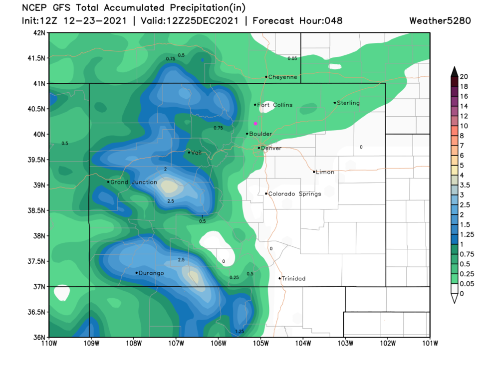
The mild weather continues along I-25 while another snow storm hits the mountains.  It looks like some rain showers will spread out on the Plains Friday (Christmas Eve - Figure 1 update and Figure 2 update). Many mountain communities are going to have a White Christmas!

Figure1u_12232021
Figure 1 update: snippet of the 10 day graphical forecast for Denver from weather5280.com
Figure2u_12232021
Figure 2 update: the 48 hour precipitation total from the GFS and weather5280.com

End Christmas Eve-Eve forecast.

The Forecast Discussion:

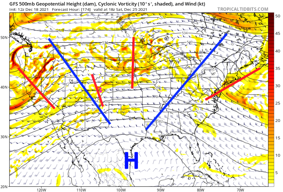
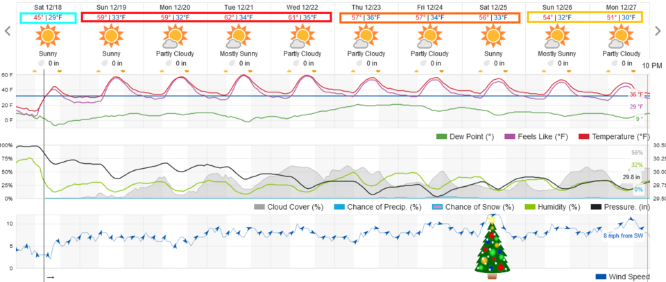
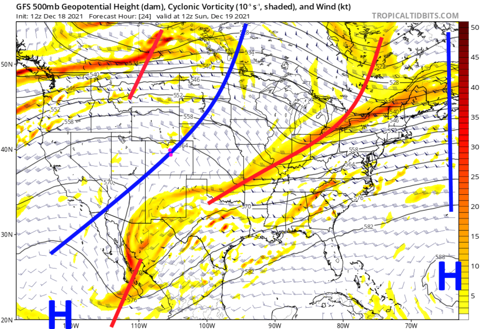
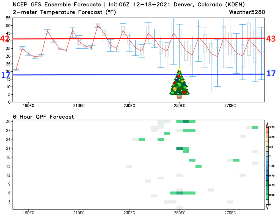
After our last windy cold front, things are warming up with another extended stretch of dry weather for the Front Range (Figure 1). The western U.S. is still topped with a giant ridge (blue line Figure 2). The next 6-7 days will have high and low temperatures above normal (Figure 3).  The GFS ensemble (many runs of the same model with variations) shows a small chance of showers around Christmas Eve and Day along I-25.  But it is a very small chance (green dashes in the lower panel).

Figure1_12182021
Figure 1: the 10 day graphical forecast from weatherunderground.com for Denver, CO.
Figure2_12182021
Figure 2: the 500mb upper air forecast map for Friday noon from the GFS and tropicaltidbits.com
Figure3_12182021
Figure 3: the 10 day GFS ensemble forecast for Denver, CO from tropicaltidbits.com

The Longer Range Front Range forecast:

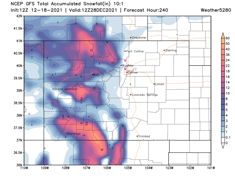
That small chance of Christmas precipitation is created by a small short wave rippling through the persistent ridge (Figure 4). The mountains should get healthy snow this week.  Our snow pack has gone from around 50% to 76% of normal in the mountains.  That is a good trend that should continue. 
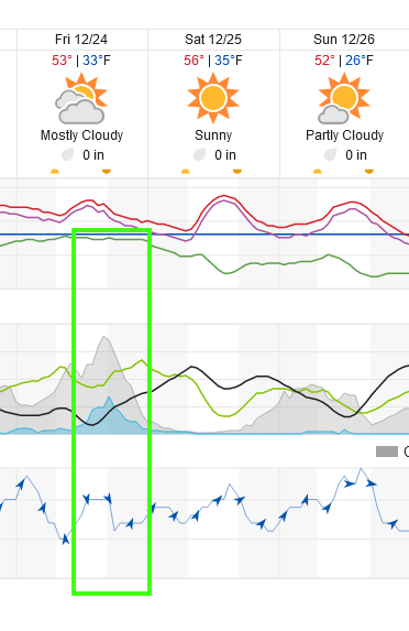
Christmas Forecast:

High temperature of 55F, a low temperature of 28F. Gusty west winds and partly cloudy skies.


Figure4_12182021
Figure 4: the 500mb upper air forecast map for Friday noon from the GFS and tropicaltidbits.com
Figure5_12182021
Figure 5: the 10 day (10:1 ratio) total snowfall forecast from the GFS and weather5280.com


About the Author: John Ensworth

John Ensworth used to work from Longmont as the PI for the NASA through the IGES (The Institute for Global Environmental Strategies). He now teaches technology, algebra, astronomy, meteorology, film school, and Lego robotics to middle/high school.
Read more


Comments


Current Weather

Partly sunny

Partly sunny

69°F

UV Index
3 Moderate
Pressure
30.17 Steady
Visibility
9 miles
Dewpoint
58 °F
Humidity
68%
Wind
NNW 1.1 mph
Gust
3.2 mph
Wind Chill
69 °F

Hourly Forecast

Today
9 AM
75°F
Mostly sunny
Today
10 AM
79°F
Partly sunny
Today
11 AM
83°F
Partly sunny
Today
12 PM
85°F
Partly sunny
Today
1 PM
88°F
Partly sunny
Today
2 PM
91°F
Mostly cloudy
Today
3 PM
93°F
Mostly cloudy
Today
4 PM
90°F
Mostly cloudy
Today
5 PM
87°F
Mostly cloudy
Today
6 PM
83°F
Thunderstorms
Today
7 PM
80°F
Mostly cloudy
Today
8 PM
77°F
Partly sunny

7 Day Forecast

Mostly cloudy w/ t-storms

Monday

93 °F

Some sunshine giving way to clouds with a thunderstorm in the area late this afternoon; thunderstorms can bring hail and damaging winds


Partly cloudy w/ t-storms

Monday Night

60 °F

A thunderstorm in spots this evening; otherwise, clear to partly cloudy; thunderstorms can bring hail and damaging winds


Intermittent clouds

Tuesday

96 °F

Intervals of clouds and sunshine


Partly cloudy

Tuesday Night

61 °F

Partly cloudy


Partly sunny w/ t-storms

Wednesday

82 °F

Clouds and sun with a thunderstorm in the afternoon; thunderstorms can bring hail and damaging winds


Partly cloudy w/ t-storms

Wednesday Night

58 °F

An evening thunderstorm; otherwise, partly cloudy


Mostly cloudy

Thursday

89 °F

Mostly cloudy with a thunderstorm in spots in the afternoon


Partly cloudy

Thursday Night

58 °F

Partly cloudy


Intermittent clouds

Friday

89 °F

Times of clouds and sun


Intermittent clouds

Friday Night

61 °F

Partly cloudy


Sunrise and Sunset

Sunrise
5:43 AM
Sunset
8:29 PM

Based on AccuWeather data