In Brief:
Mild weather with above normal temperatures. High winds increase fire danger.
Thursday Update:
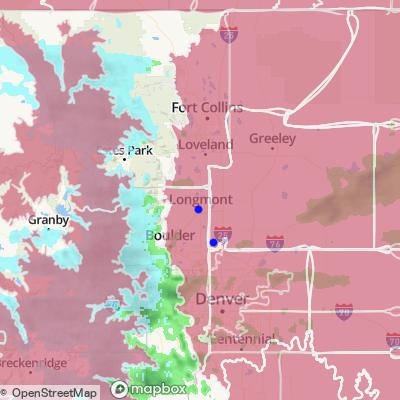
Winds are decreasing today but still meet red flag fire danger levels (Figure 2 update). Temperatures warm into the weekend without the wind.
Red Flag Warning
Issued: 2:17 AM Apr. 7, 2022 – National Weather Service
...RED FLAG WARNING REMAINS IN EFFECT FROM 9 AM THIS MORNING TO 8 PM MDT THIS EVENING FOR WIND AND LOW RELATIVE HUMIDITY FOR ALL OF THE PLAINS AND I-25 CORRIDOR...
* Timing...9 AM until 8 PM.
* Winds...North 30 to 40 mph with gusts up to 65 mph.
* Relative Humidity...10 to 20 percent.
* Impacts...Any fire that develops will likely spread rapidly. Outdoor burning should be avoided, as well as any activity that may produce a spark and start a fast moving wildfire.
PRECAUTIONARY/PREPAREDNESS ACTIONS...
A Red Flag Warning means that critical fire weather conditions are either occurring now....or will shortly. A combination of strong winds...low relative humidity...and warm temperatures can contribute to extreme fire behavior.

End Thursday update.
Tuesday Update:
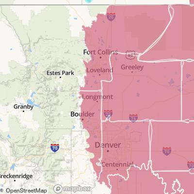
The NWS has issued a red flag (fire) warning for Tuesday and Wednesday for the counties in red (Figure 1 update).
Red Flag Warning
Issued: 4:00 AM Apr. 5, 2022 – National Weather Service
...RED FLAG WARNING REMAINS IN EFFECT FROM 11 AM THIS MORNING TO
9 PM MDT THIS EVENING FOR WIND AND LOW RELATIVE HUMIDITY FOR THE
NORTHEASTERN COLORADO PLAINS AND PALMER DIVIDE...
...FIRE WEATHER WATCH IN EFFECT FROM 11 AM WEDNESDAY MORNING
THROUGH 8 PM WEDNESDAY EVENING FOR WIND AND LOW RELATIVE HUMIDITY
FOR THE NORTHEASTERN COLORADO PLAINS AND PALMER DIVIDE...
The National Weather Service in Denver has issued a Fire Weather
Watch for wind and low relative humidity, which is in effect from
Wednesday morning through Wednesday evening.
* Timing...Tuesday, from 11 AM until 9 PM; Wednesday, from 11 AM until 10 PM.
* Winds...Northwest 30 to 40 mph with gusts up to 65 mph.
* Relative Humidity...15 to 25 percent.
* Impacts...Any fire that develops will likely spread rapidly.
Outdoor burning should be avoided, as well as any activity
that may produce a spark.
PRECAUTIONARY/PREPAREDNESS ACTIONS...
A Red Flag Warning means that critical fire weather conditions
are either occurring now or will shortly. A combination of
strong winds, low relative humidity and warm temperatures can
contribute to extreme fire behavior.
A Fire Weather Watch means that critical fire weather conditions
are forecast to occur. Listen for later forecasts and possible
Red Flag Warnings.
End Tuesday Update.
Forecast Discussion:
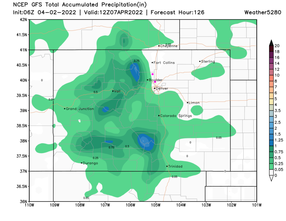
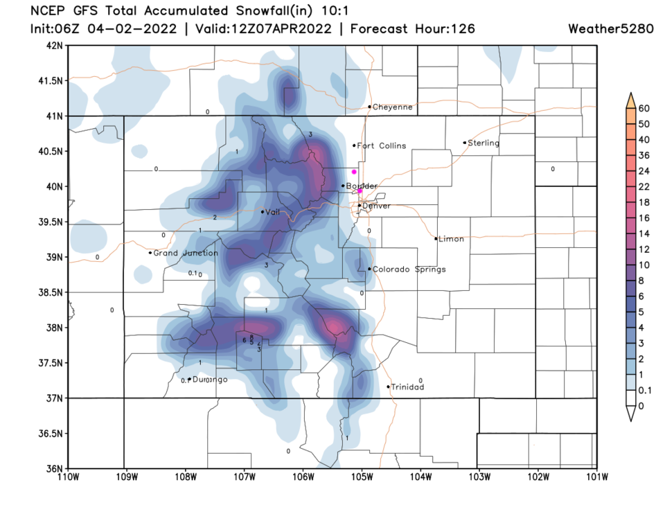
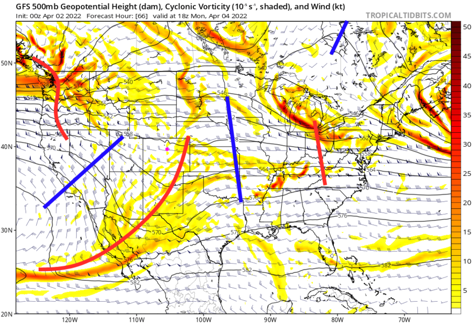
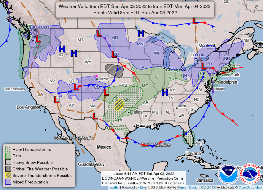
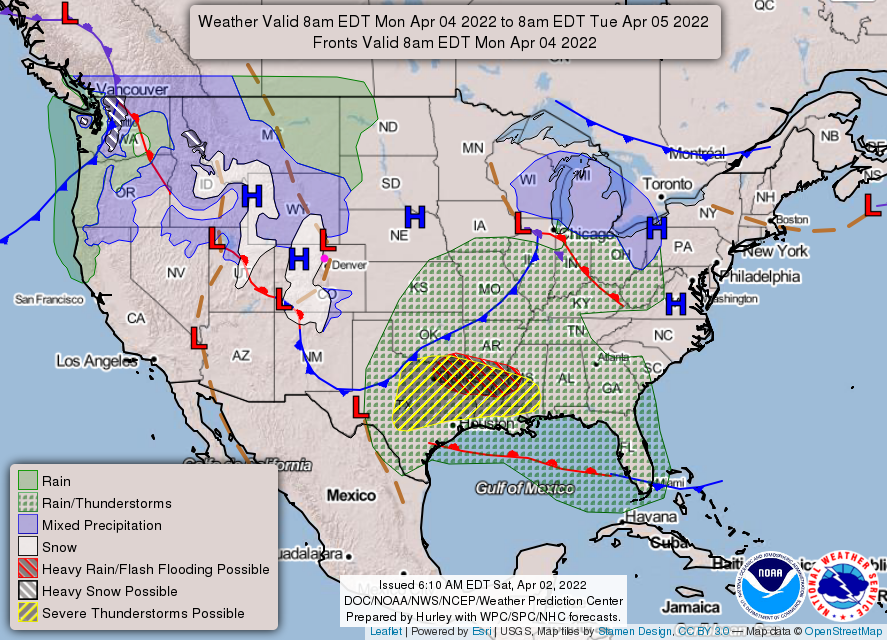
There isn't much to cover this weekend. A minor trough will pass over Colorado Sunday/Monday (Figure 1) kicking off a rain/snow mix in the central and southern mountains and western slopes of Colorado Sunday (Figure 2). A bit more snow falls in the mountains Monday (Figure 3) but the Plains remain mostly dry (maybe some sprinkles??).
The Longer Range Forecast:
Temperatures for the next week bounce around the upper 50s (close to normal) to the mid 70s along I-25. The mountains and Palmer Divide get some moisture, but snowfall will be confined to the higher elevations. Enjoy Spring as it begins!