Skip to content
Join our Newsletter

The Front Range Forecast: Frequent cool precipitation returns

In Brief:

Cool temperatures settle in this week with a number of rain/snow chances!

The Forecast Discussion:

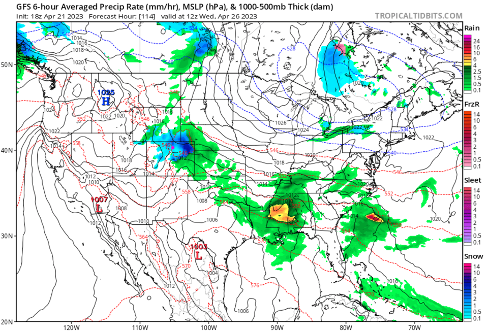
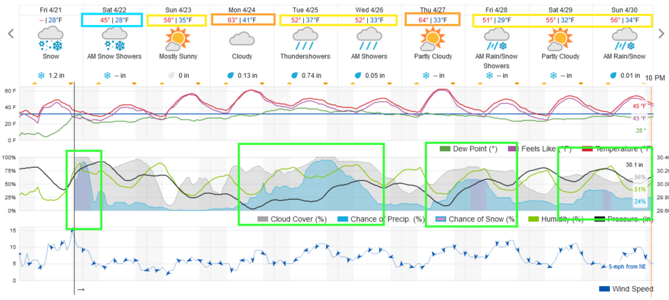
We will have what is called northwest flow set up for much of the next week. The upper air flow comes from the Pacific northwest and flows to the southeast over the state. This allows ripples in the flow to create quick bursts of rain and snow over Colorado and many other Great Plains states. Our first short hit comes Friday night into Saturday (Figure 1). We might see a slushy inch or so on grassy surfaces by Saturday morning.

We warm briefly until another front late Monday arrives bringing rain and thunderstorm chances.

figurre1_04212023
Figure 1: the 10 day graphical forecast for Denver from weatherunderground.com

The Longer Range Forecast:

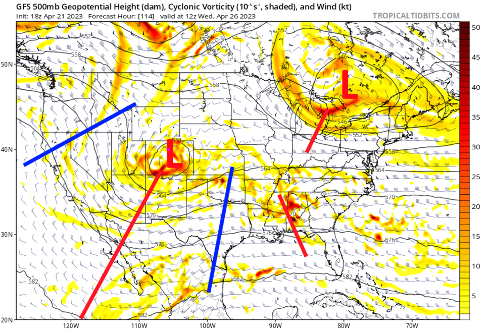
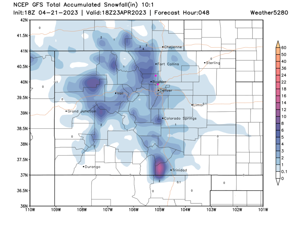
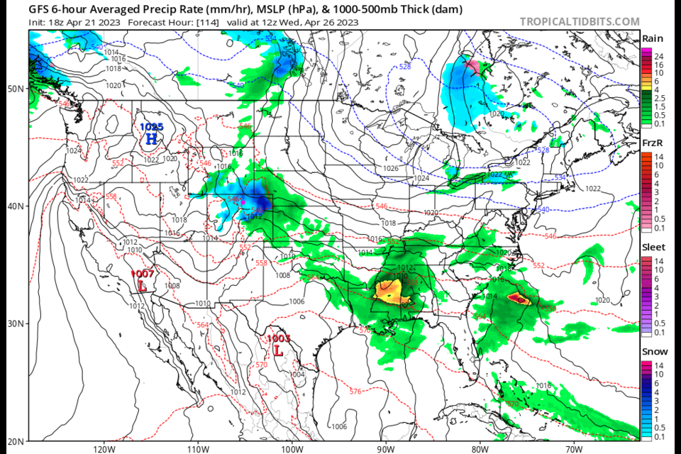
The peak of the storm comes Tuesday and Wednesday morning (Figure 1) with a cutoff low travelling overhead (Figure 2). The GFS gives us a short but intense burst of snow! (Figure 3). Beyond that, there is another chance of rain/snow Thursday/Friday and again on Sunday.  Lots of interesting weather is coming!

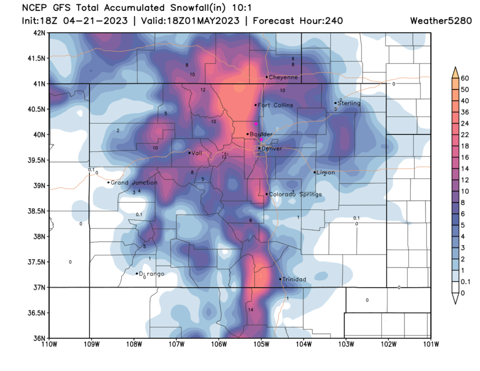
The GFS gives the I-25 folks a bit of snow over the next 48 hours (Figure 4) but some good snows for the mountains to the west. If true, the next 10 days sees an inch of snow east of I-25 but a rapid increase to a foot of snow just west of I-25 (Figure 5).  We'll see what happens!

figure2_04212023
Figure 2: the 500mb upper air forecast map for Wednesday morning from the GFS and tropicaltidbits.com
figure3_04212023
Figure 3: the surface forecast map for Wednesday morning from the GFS and tropicaltidbits.com
figure4_04212023
Figure 4: the 48 hour snowfall forecast from the GFS and weather5280.com
figure5_04212023
Figure 5: the 10 day snowfall forecast from the GFS and weather5280.com


About the Author: John Ensworth

John Ensworth used to work from Longmont as the PI for the NASA through the IGES (The Institute for Global Environmental Strategies). He now teaches technology, algebra, astronomy, meteorology, film school, and Lego robotics to middle/high school.
Read more


Comments


Current Weather

Sunny

Sunny

74°F

UV Index
5 Moderate
Pressure
30.28 Steady
Visibility
13 miles
Dewpoint
60 °F
Humidity
61%
Wind
ENE 1.3 mph
Gust
3.9 mph
Wind Chill
74 °F

Hourly Forecast

Today
12 PM
74°F
Mostly cloudy
Today
1 PM
75°F
Mostly cloudy
Today
2 PM
76°F
Mostly cloudy
Today
3 PM
77°F
Mostly cloudy
Today
4 PM
74°F
Mostly cloudy
Today
5 PM
73°F
Thunderstorms
Today
6 PM
71°F
Mostly cloudy
Today
7 PM
69°F
Thunderstorms
Today
8 PM
68°F
Thunderstorms
Today
9 PM
65°F
Mostly cloudy
Today
10 PM
63°F
Mostly cloudy
Today
11 PM
60°F
Mostly cloudy

7 Day Forecast

Thunderstorms

Thursday

77 °F

Rather cloudy with a couple of showers and a thunderstorm this afternoon; thunderstorms can bring flash flooding and localized damaging wind gusts


Thunderstorms

Thursday Night

56 °F

A thunderstorm this evening; otherwise, rather cloudy; thunderstorms can bring flash flooding and localized damaging wind gusts


Partly sunny w/ t-storms

Friday

77 °F

Partly sunny with a thunderstorm in the afternoon


Partly cloudy w/ t-storms

Friday Night

56 °F

A thunderstorm around in the evening; otherwise, mainly clear


Intermittent clouds

Saturday

74 °F

Clouds and sunshine with a thunderstorm in parts of the area in the afternoon


Clear

Saturday Night

52 °F

Clear


Partly sunny w/ showers

Sunday

82 °F

Partly sunny with a couple of showers in the afternoon


Clear

Sunday Night

51 °F

Clear


Mostly sunny

Monday

83 °F

Mostly sunny with a thunderstorm in the afternoon


Clear

Monday Night

51 °F

Clear


Sunrise and Sunset

Sunrise
6:24 AM
Sunset
7:39 PM

Based on AccuWeather data