In Brief:
Cold front brings almost chilly weather and increased rain chances.
Wednesday Update:
I'm back from our last camping trip (early). A cold front arrives tonight dropping high temperatures to the mid 70's along I-25 down to Denver. Amazing! Rain chances pick up late Wednesday PM and continue through Friday afternoon with upslope flow. I'll be able to post a full update on Thursday! It is nice to be back to the land of high speed internet!
End Wednesday update.
Sunday Update:
As my last vacation of the summer comes to an end (hence the updates), a LOT of moisture is present for afternoon storms and rain. The atmosphere will also be in a state that can efficiently create rain. Thunderstorms will be capable of dropping really heavy amounts of water. In the mountains, thunderstorm cores may drop 1 to 1.5 inches of water in 30 minutes. On the Plains and along I-25, storms may drop 2-3 inches in 1/2 hour. There will be flash flood watches for burn scars.
There is also a Marginal Risk just east of I-25 for damaging straight line thunderstorm winds. Highs are back in the low 80's as a short wave approaches to kick off today's rain. For the remainder of the week, we'll see low 90's upper 80's for highs and daily storm chances.
End Sunday Update.
Tuesday update:
As advertised, yesterday's heat set a new record. DIA hit 100F breaking the previous high temperature record of 99F set in 2020. We probably will not crack any more records this week before things return closer to normal. The records (and years set) through Saturday are: July 20 105 (2005), July 21 104 (2005), July 22 102 (2005), July 23 102 (2005).
Variations in heat and moisture this upcoming week are slight and somewhat random. The models were showing Sunday with record heat again, but most are now coming around to a "cool" front arriving and taking us back to normal instead. Keep watching the western skies in the afternoons, watch the heat outside and enjoy the cool nights!
End Tuesday update.
Forecast Discussion:
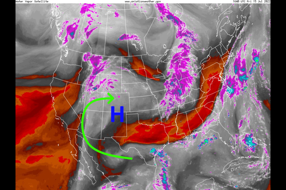
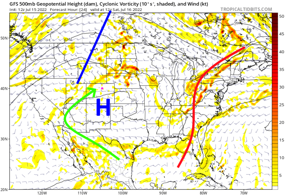
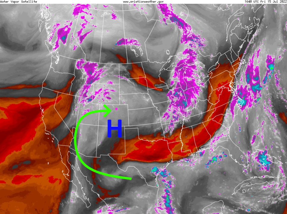
It is that time of the summer when I sound like a broken record. The mid-nation high (Figure 2) remains positioned to keep moisture streaming (Figure 3) into the West from the Gulf of California and the Gulf of Mexico. The proximity of the high-pressure center to Colorado means temperatures are hovering near their Colorado maximum. (We are not reaching the highest ever temperature of 105F — seen in 1878, 2005, 2012, and 2018). (Figure 1).
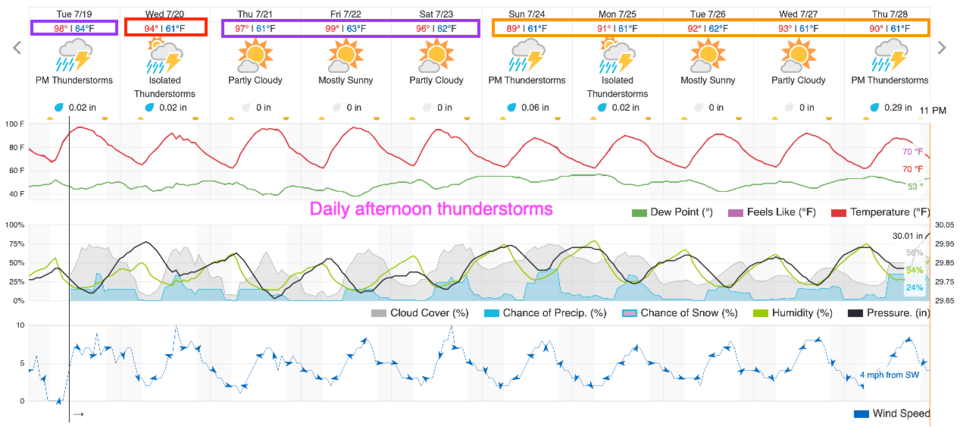
Except for a period of drying Sunday/Monday where temperatures will rise a bit more, the entire week ahead will see 90s for highs and afternoon storm chances at around 30-50%.
The Longer Range Forecast:
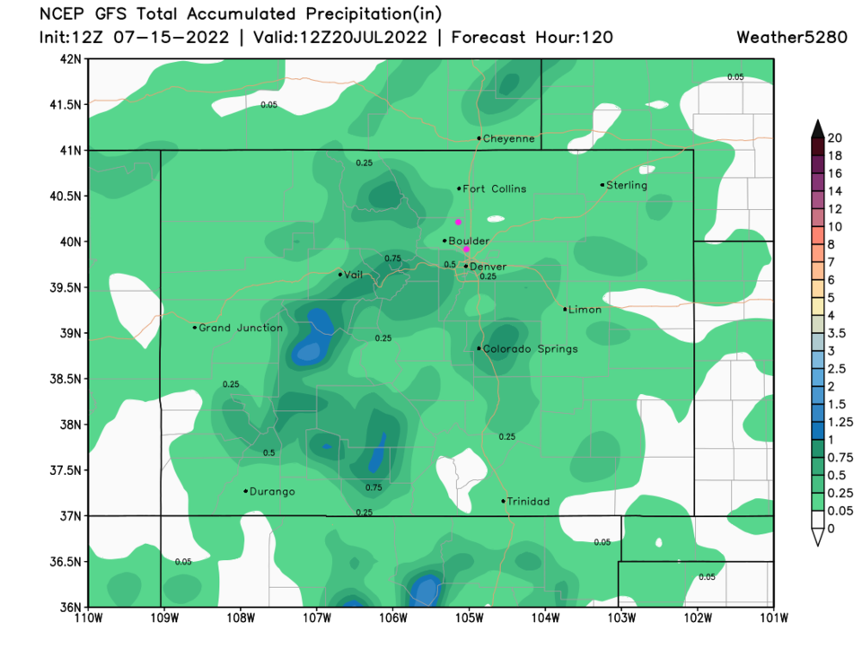
That pattern holds for the next 10 days. Total precipitation over the next 5 days (Figure 4) will be light overall except where the stronger storms happen to travel. Stay hydrated!