In Brief:
Near record heat and dry and smoke returns.
Wednesday Update:
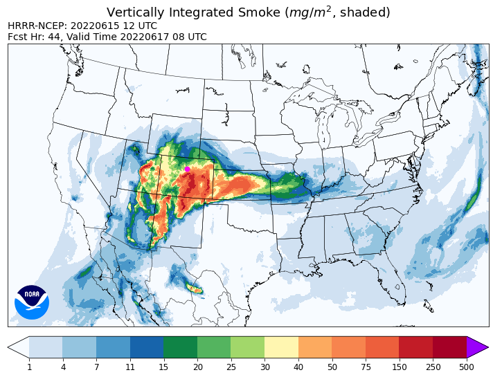
After a brief cool down with a couple of cold fronts, the heat returns with possible 100's for highs on the Plains by Friday. A change to a southwest air flow, smoke will return by Thursday morning over Colorado (Figure 1 update). Moisture returns on Saturday with good thunderstorm chances Sunday. We are going to be hot and hazy for a while.

End Wednesday update.
Forecast Discussion:
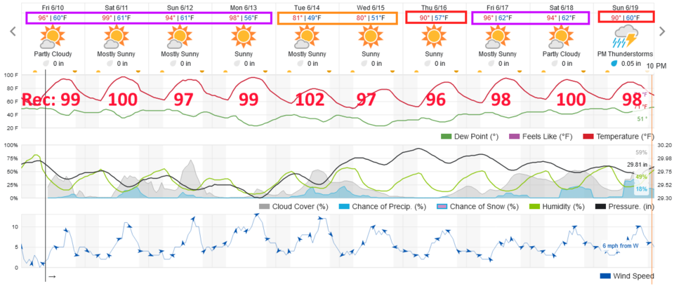
If you haven't felt like it is summer (meteorological summer begins June 1st even if astronomical summer begins June 21st), you will feel the heat this week! Over the next 10 days, we'll see many days in the mid to upper 90's (Figure 1). I put the record high temperatures for each day in Figure 1. We might see a few records set on the days that the two numbers are only a few digits apart (i.e. Sat, Mon, next Friday). You'll also notice there are only a few days where this a chance of an afternoon storm wandering by.
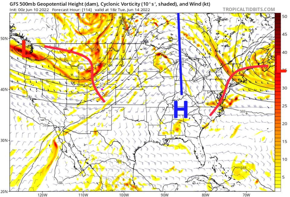
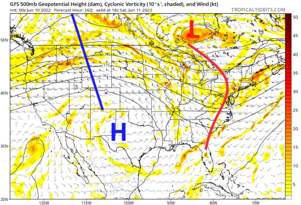
This heat and dry weather is due to the giant ridge parked over the western U.S. (Figure 2). You'll need to find a pool and sit in it.
The Longer Range Forecast:
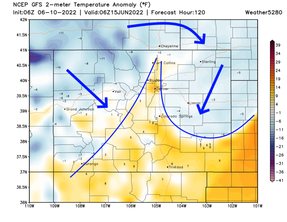
The next hint of a change in the weather comes Monday/Tuesday with a trough passing to the north (Figure 3). There is very little precipitation expected over the next 5 (Figure 4) or even 10 days. That trough will kick down a cool front that takes us, briefly, back to the 80's (Figure 1). You can see the cool air sweeping southward in Figure 5. Stay hydrated!