Skip to content
Join our Newsletter

The Front Range Forecast: "Hot" now, rain showers later

In Brief:

Near record warmth gets chased away by a couple of cool fronts that bring spring showers.

Forecast Discussion:

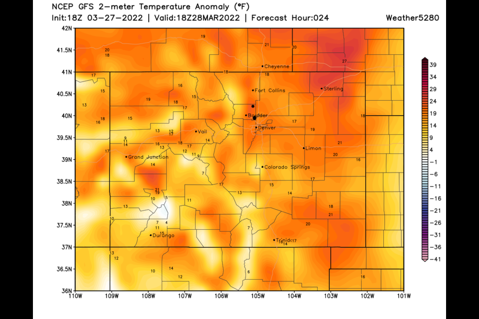
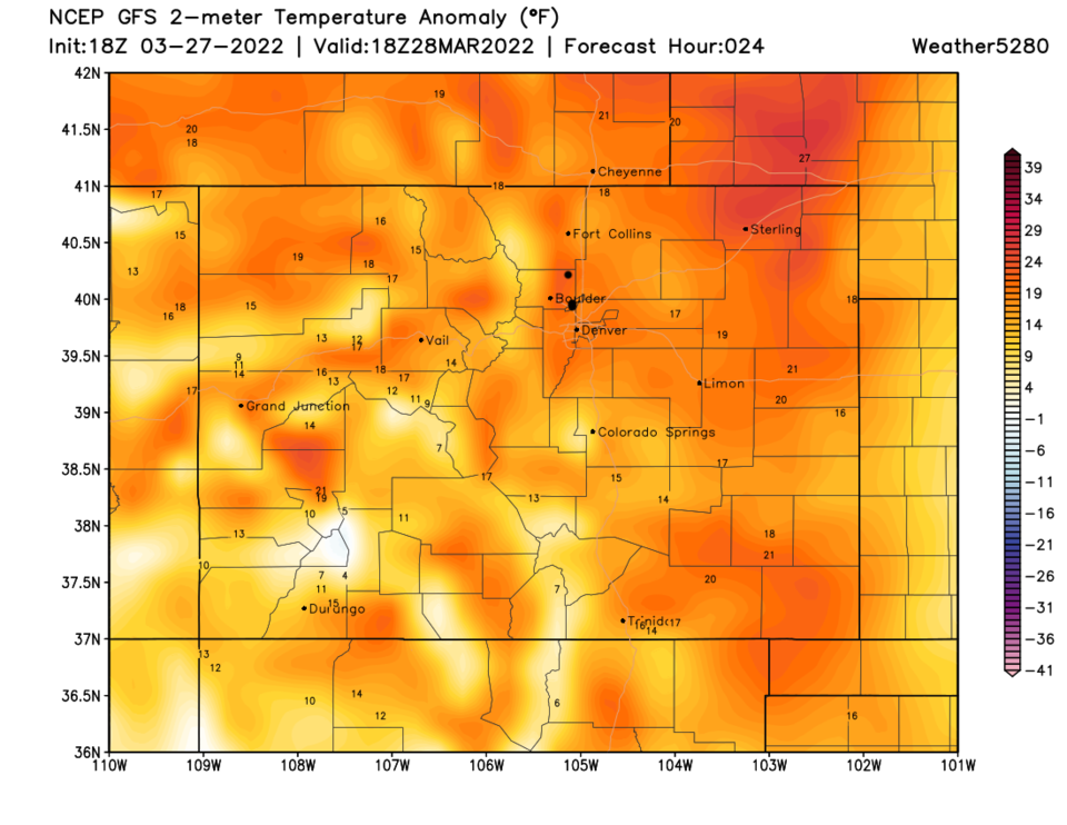
We had a (mostly) great weekend (minus a chilly Sunday morning and a wind blown NCAR fire!).  Before our next front, temperatures will soar on Monday.  The record hig for Monday is 83F set in 1963. It looks like many places along I-25 will break 80F (Figure 1 and Figure 2).

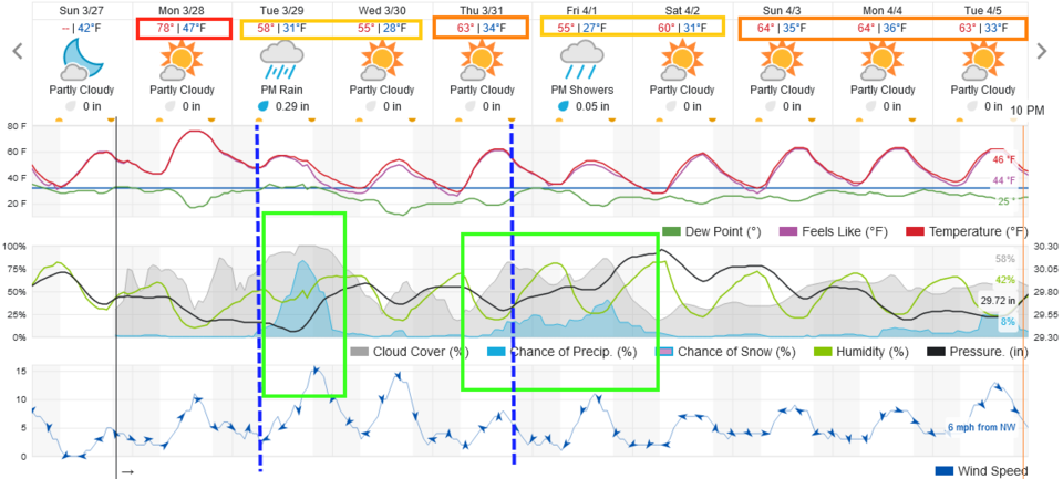
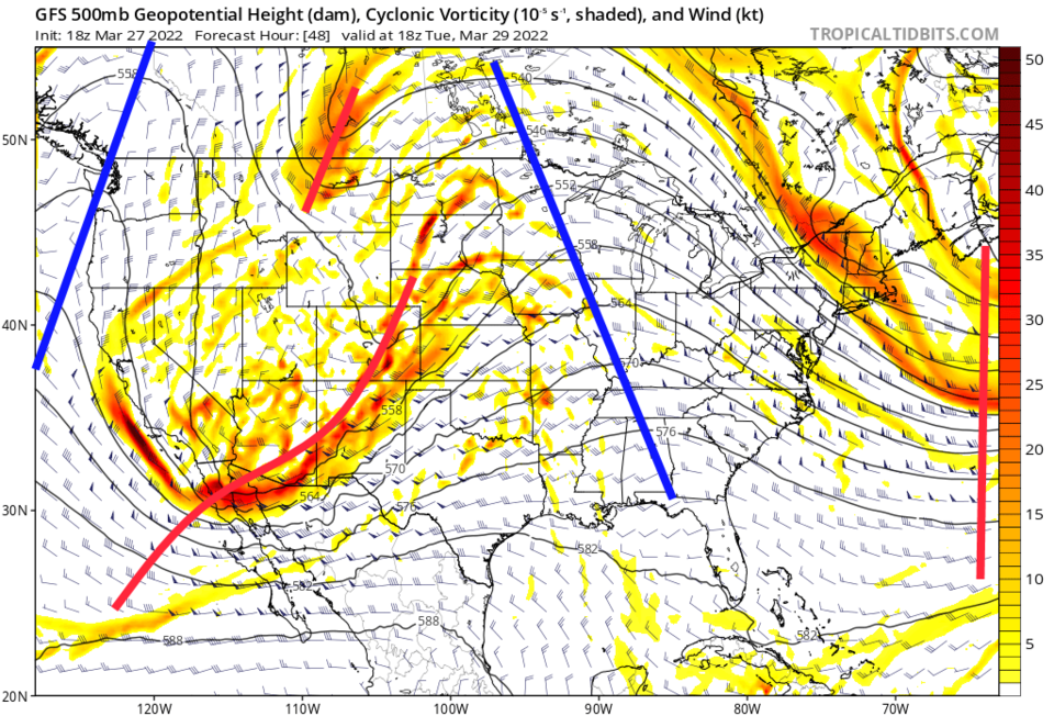
The next front arrives Tuesday early morning (blue dashed line Figure 1) brought in by a disjointed series of upper air troughs (Figure 3).

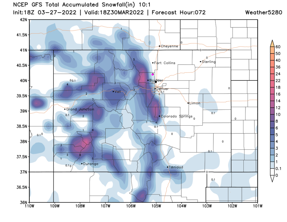
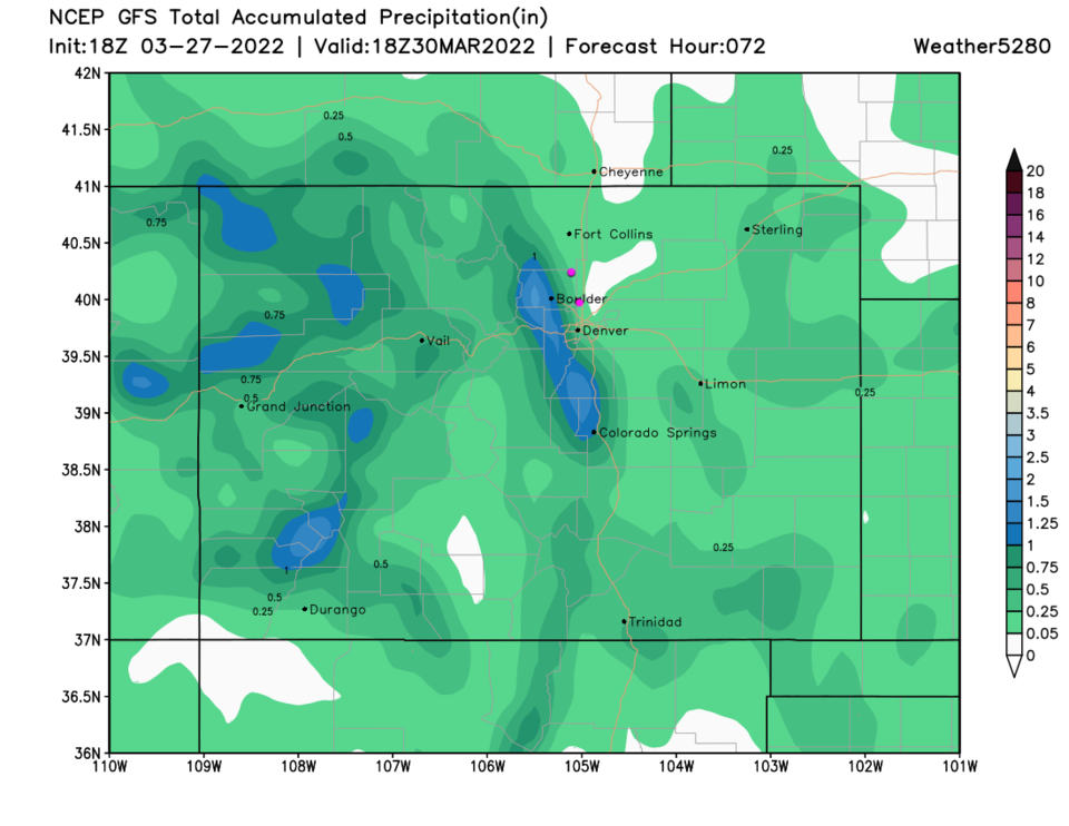
Along I-25, it looks like 1/4th to 1/3rd inch of precipitation is possible (Figure 1 and Figure 5).  Snowfall should be confined to overnight flurries mixed with light rain maybe making a bit of slush on grass along I-25 (Figure 4).  Higher mountain locations like Nederland and Allenspark may see 1-3 inches, but Estes Park should only get a Trace to an inch or so. Things are too warm this time!

Figure1_03272022
Figure 1: the 10 day graphical forecast for Denver from weatherunderground.com
Figure2_03272022
Figure 2: the surface temperature anomaly (the departure from normal) for Monday noon from weather5280.com
Figure3_03272022
Figure 3: the 500mb upper air map for Tuesday noon from tropicaltidbits.com
Figure4_03272022
Figure 4: the (10:1 ratio) snowfall forecast for the next 3 days from the GFS and weather5280.com.
Figure5_03272022
Figure 5: the precipitation forecast for the next 3 days from the GFS and weather5280.com.

The Longer Range Forecast:

We return to the 60's Thursday before another weak front that brings showers Thursday/Friday.  Next weekend looks Great again!


About the Author: John Ensworth

John Ensworth used to work from Longmont as the PI for the NASA through the IGES (The Institute for Global Environmental Strategies). He now teaches technology, algebra, astronomy, meteorology, film school, and Lego robotics to middle/high school.
Read more


Comments


Current Weather

Cloudy

Cloudy

45°F

UV Index
0 Low
Pressure
30.2 Rising
Visibility
8 miles
Dewpoint
43 °F
Humidity
94%
Wind
NW 1.1 mph
Gust
2.9 mph
Wind Chill
45 °F

Hourly Forecast

Today
9 PM
45°F
Showers
Today
10 PM
45°F
Showers
Today
11 PM
45°F
Rain
Tomorrow
12 AM
45°F
Rain
Tomorrow
1 AM
45°F
Cloudy
Tomorrow
2 AM
45°F
Cloudy
Tomorrow
3 AM
46°F
Cloudy
Tomorrow
4 AM
46°F
Cloudy
Tomorrow
5 AM
46°F
Rain
Tomorrow
6 AM
46°F
Rain
Tomorrow
7 AM
46°F
Rain
Tomorrow
8 AM
48°F
Rain

7 Day Forecast

Rain

Tuesday

49 °F

Chilly with rain


Rain

Tuesday Night

45 °F

Periods of rain


Showers

Wednesday

56 °F

Occasional morning rain and drizzle; otherwise, low clouds and cool


Mostly clear

Wednesday Night

41 °F

Mainly clear


Partly sunny

Thursday

70 °F

Partly sunny, pleasant and warmer


Mostly clear

Thursday Night

45 °F

Mainly clear


Mostly cloudy

Friday

72 °F

Mostly cloudy


Clear

Friday Night

45 °F

Clear


Mostly sunny

Saturday

78 °F

Sunny to partly cloudy and nice


Mostly clear

Saturday Night

44 °F

Mainly clear


Sunrise and Sunset

Sunrise
5:54 AM
Sunset
8:00 PM

Based on AccuWeather data