
In Brief:
A slow or maybe very slow moving upper level low brings feet of snow to the mountains, inches of rain to the Plains.
Monday PM update.
A quick update: for Broomfield to Longmont, precipitation amounts are trending downward to the 0.5-1.5 inch area. Thunderstorms may give local areas more water. The amount of snow at the end of the storm is trending towards a coating to an inch (locally two) along I-25. Estes Park may see 2-4 inches. Nederland may pick up 4-7 inches. Castle Rock is expected to get 2-5 inches of snow. I don't expect school closures north of southwest Denver.
End Monday update.
The Forecast Discussion:
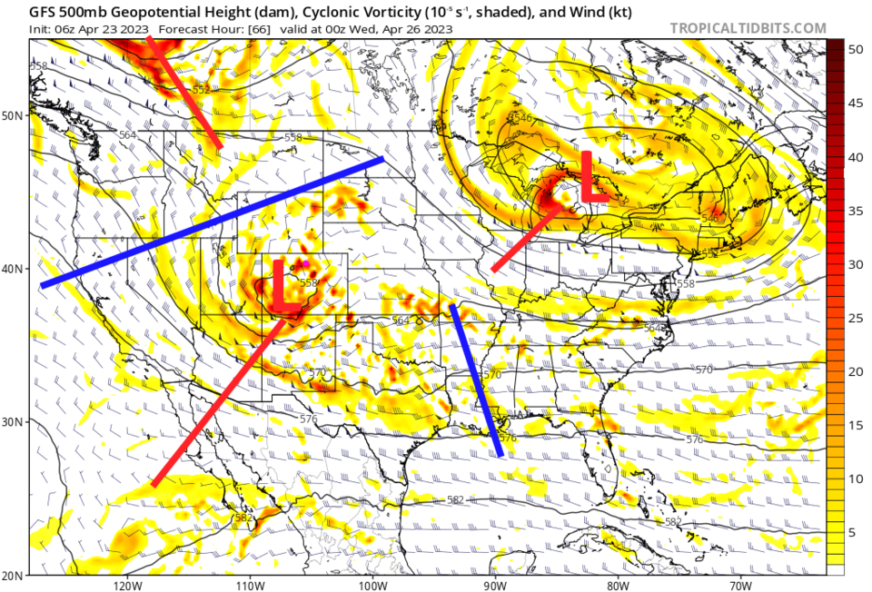
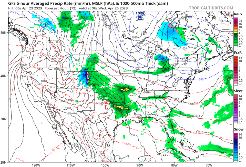
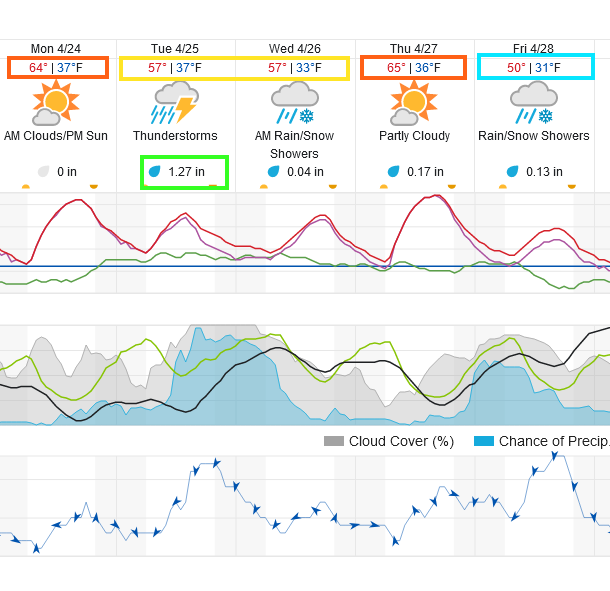
The upper air map (Figure 1) shows a cut off upper level low (red l) sliding into southwestern then southeastern Colorado Monday through Wednesday. It is in a very good position to bring near record amounts of atmospheric water into the state through Wednesday morning. Figure 2 shows one of a number of 6 hour frames of heavy precipitation hitting the mountains (as snow) and rain/thunderstorms along I-25. The graphical forecast in Figure 3 shows rain picking up rapidly around 11am Tuesday with an average of an inch and a quarter of water hitting Longmont/Broomfield (the wunderground model).
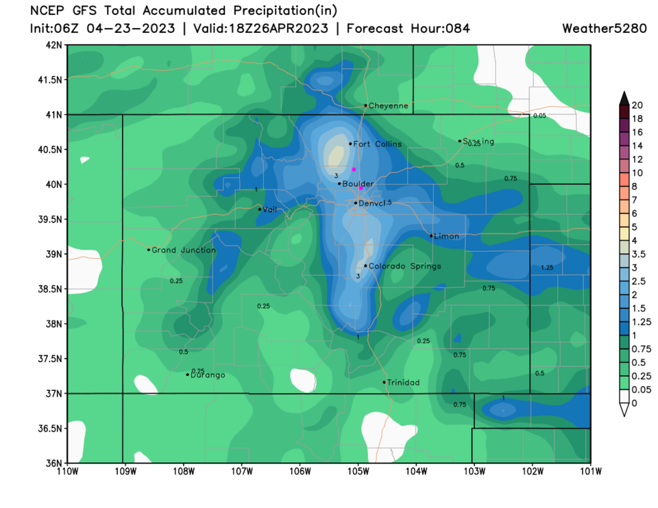
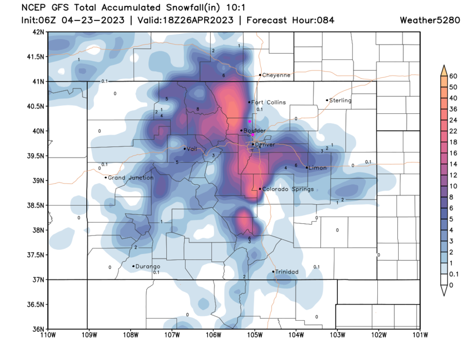
The precipitation totals on the GFS (that actually takes the storm off to the east a bit quicker than other models has been consistently dropping 2.5 to 3.5 inches of water in Boulder Co. and Larimer Co. (Figure 4). There is good agreement among models that this will be a major water (flooding?) event. The Canadian goes as far as giving us 3.5-4.5 inches of water!!
The other story is snow. The, very nearby, foothills and east facing mountain slopes have the potential see 1-3 feet of heavy snow during this period (Figure 5).
Finally - a word of caution. The slower models allow colder air to come in overnight into Wednesday morning with snow continuing later into the day. Heavy snow spreads down to I-25 with 10-12 inches of snow possible (the Canadian model again). This is a developing situation with a knife-edge dependence on storm speed and temperatures. I'm not making a forecast on snow along I-25 until things come more into focus. Today's post is a 'heads-up!"
The Longer Range Forecast:
Another, potentially strong storm could hit Thursday night and throughout the day on Friday. A rule-of-thumb is to NOT forecast the NEXT storm until the current one has played out. BUT some models make it a colder heavy snow producer along I-25 as well.


