Skip to content
Join our Newsletter

Sat Update: The Front Range Forecast:: Warm, small storm Sunday

In Brief:

A brief quick system passes Sunday night/Monday AM.  A better chance of snow is possible Thanksgiving.

Saturday Update:

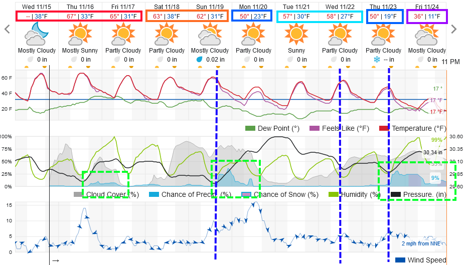
As we "roast" in temperatures more than 15 degrees above normal (which is around 50F), attention turns to a weak, fast moving system that will impact the state Sunday afternoon/night.  Figure 2 update shows the low snow totals are mainly going to show in the mountains and Palmer Divide.  With air sinking down off the Rockies north of Denver, it looks like even rain will be hard to come by.  Like the showers earlier in the week, you might get a brief spot of rain, if  you are lucky.

There DOES seem to be a better snow-maker coming Thanksgiving night and Friday morning.  More on that later!

figure3u_11182023
Figure 2 update: the 10:1 snowfall ratio forecast from the GFS and weather5280.com

End Saturday update.

Wednesday Update:

A passing ripple will create some rain in the mountains (snow very high up) Thursday (Figure 1 update).  A few showers may stray out to I-25 folks. There is a chance of snow on Monday in the mountains and a very small chance of some low altitude snow as well.  More later if needed.  There is a hint of a bigger change in the weather right after Thanksgiving.  Keep checking back!


figure2u_11152023
Figure 1 update: the 10 day graphical forecast for Longmont from weatherunderground.com

End Wednesday update.

Forecast Discussion:

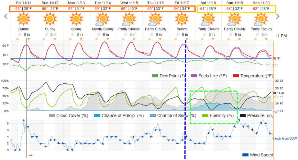
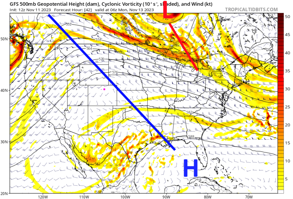
The normal high temperature for the next week drops from around 55F to 50F.  Even during the cool-down next weekend, we will just approach normal (Figure 1).  The big western ridge (blue line - Figure 2) is parked over us for days to come.

figure1_11112023
Figure 1: the 10 day graphical forecast for Longmont from weatherunderground.com
figure2_11112023
Figure 2: the 500mb upper air forecast map for Monday from the GFS and tropicaltidbits.com

The Longer Range Forecast:

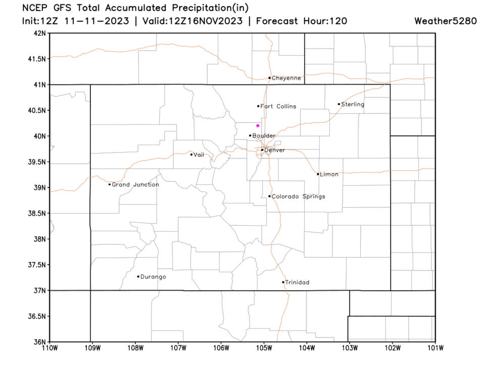
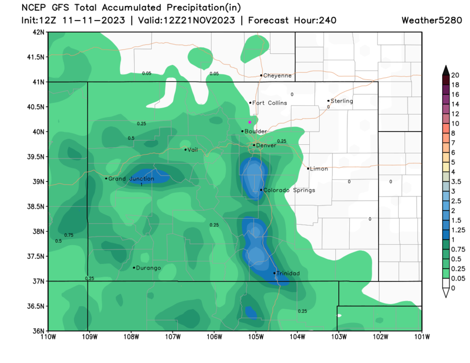
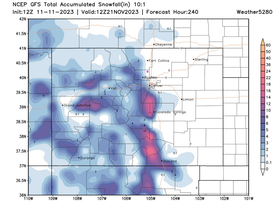
Over the next 5 days, the GFS gives us NO precipitation (Figure 3). We do see the southwest half of the state getting *some* moisture next weekend (Figure 4) and some mountain snows (Figure 5). Super quiet for now.

figure3_11112023
Figure 3: the 5 day precipitation forecast from the GFS and weather5280.com
figure4_11112023
Figure 4: the 10 day precipitation forecast from the GFS and weather5280.com
figure5_11112023
Figure 5: the 10 day precipitation forecast from the GFS and weather5280.com


About the Author: John Ensworth

John Ensworth used to work from Longmont as the PI for the NASA through the IGES (The Institute for Global Environmental Strategies). He now teaches technology, algebra, astronomy, meteorology, film school, and Lego robotics to middle/high school.
Read more


Comments


Current Weather

Clear

Clear

45°F

UV Index
0 Low
Pressure
30.31 Steady
Visibility
8 miles
Dewpoint
40 °F
Humidity
84%
Wind
WNW 1.1 mph
Gust
5 mph
Wind Chill
45 °F

Hourly Forecast

Today
4 AM
45°F
Mostly clear
Today
5 AM
44°F
Mostly clear
Today
6 AM
44°F
Mostly sunny
Today
7 AM
47°F
Mostly sunny
Today
8 AM
53°F
Intermittent clouds
Today
9 AM
59°F
Intermittent clouds
Today
10 AM
64°F
Intermittent clouds
Today
11 AM
68°F
Intermittent clouds
Today
12 PM
71°F
Partly sunny
Today
1 PM
73°F
Partly sunny
Today
2 PM
75°F
Partly sunny
Today
3 PM
75°F
Intermittent clouds

7 Day Forecast

Mostly sunny

Thursday

71 °F

Sunny to partly cloudy, pleasant and warmer


Clear

Thursday Night

44 °F

Clear


Partly sunny w/ t-storms

Friday

76 °F

Sun and clouds with widely separated thunderstorms this afternoon


Mostly clear

Friday Night

46 °F

Clear to partly cloudy


Mostly sunny

Saturday

80 °F

Sunny to partly cloudy and warm


Mostly clear

Saturday Night

45 °F

Clear to partly cloudy


Partly sunny

Sunday

83 °F

Very warm with sunshine mixing with some clouds; windy in the afternoon


Partly cloudy

Sunday Night

50 °F

Partly cloudy


Mostly cloudy

Monday

84 °F

Mostly cloudy and very warm


Partly cloudy

Monday Night

52 °F

Partly cloudy


Sunrise and Sunset

Sunrise
5:52 AM
Sunset
8:02 PM

Based on AccuWeather data