Skip to content
Join our Newsletter

The Front Range Forecast: Mild and dry for a while...

figure5_11212022
Figure 5: the 5 day precipitation total from the GFS and weather5280.com

In Brief:

Pretty mild and pretty dry for the week.

Forecast Discussion:

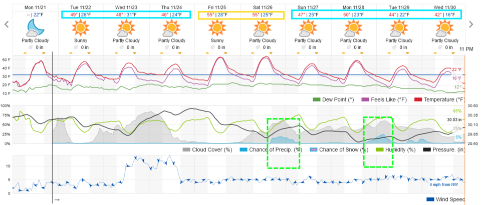
A very quiet period stretches out ahead of us. Figure 1 shows periods of clouds mid-week with pretty normal/mild temperatures. You won't see much this week but a slow snow melt. There are chances of mountain snows on Thanksgiving Eve and Thanksgiving morning (Figure 2), but even up there, snow will be scattered.

figure1_11212022
Figure 1: the 10 day graphical forecast for Denver.
figure2_11212022
Figure 2: the surface map and precipitation map for Wed/Thur midnight as Thanksgiving starts from the GFS and tropicaltidbits.com

The Longer Range Forecast:

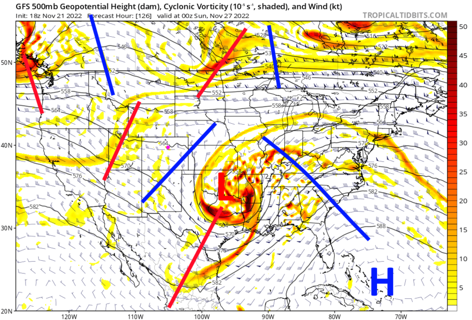
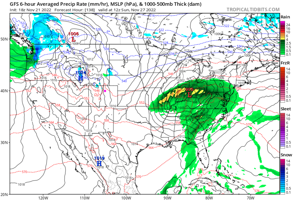
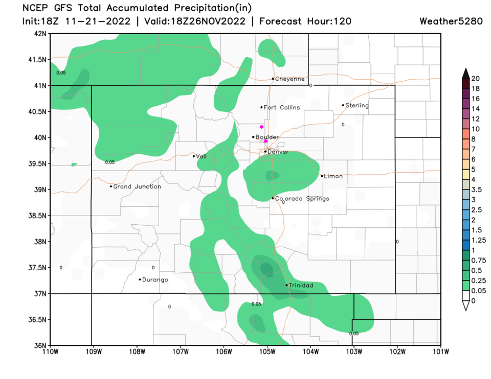
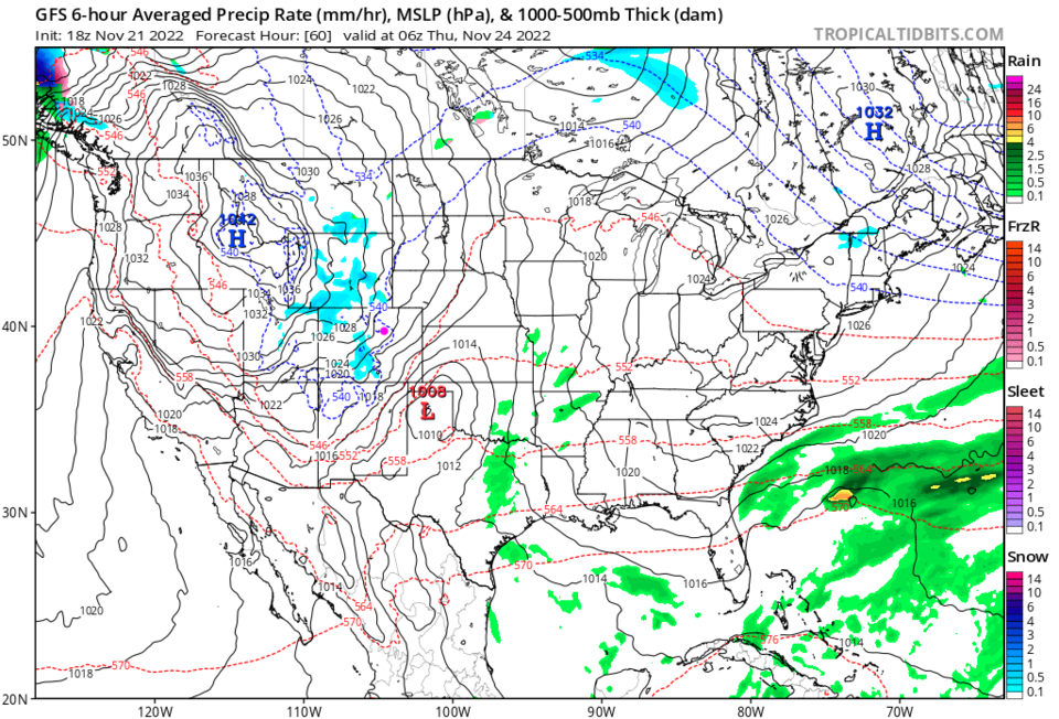
Our next small chance of precipitation comes with a minor trough (red line in Figure 3) approaching the state Saturday evening. The GFS doesn't give us any precipitation with this trough (Figure 4) even when the weatherunderground model sees a small chance (Figure 1). Over the next full 5 days, precipitation will be very light state-wide except for a few spots in the mountains and Palmer Divide (Figure 5). 

Thanksgiving Forecast:

We should see a high around 47F and a low around 23F with clearing skies. Winds will be dying down as the day progresses. Happy Thanksgiving everyone!

figure3_11212022
Figure 3: the 500mb upper air forecast map from the GFS and tropicaltidbits for Saturday PM.
figure4_11212022
Figure 4: the surface map and precipitation map for Sunday morning from the GFS and tropicaltidbits.com
figure5_11212022
Figure 5: the 5 day precipitation total from the GFS and weather5280.com


About the Author: John Ensworth

John Ensworth used to work from Longmont as the PI for the NASA through the IGES (The Institute for Global Environmental Strategies). He now teaches technology, algebra, astronomy, meteorology, film school, and Lego robotics to middle/high school.
Read more


Comments


Current Weather

Sunny

Sunny

83°F

UV Index
5 Moderate
Pressure
30.12 Falling
Visibility
7 miles
Dewpoint
40 °F
Humidity
21%
Wind
SE 3.9 mph
Gust
10.2 mph
Wind Chill
83 °F

Hourly Forecast

Today
2 PM
85°F
Partly sunny
Today
3 PM
85°F
Mostly cloudy w/ t-storms
Today
4 PM
85°F
Intermittent clouds
Today
5 PM
84°F
Partly sunny
Today
6 PM
81°F
Partly sunny
Today
7 PM
76°F
Intermittent clouds
Today
8 PM
72°F
Mostly clear
Today
9 PM
69°F
Mostly clear
Today
10 PM
65°F
Mostly clear
Today
11 PM
61°F
Clear
Tomorrow
12 AM
59°F
Clear
Tomorrow
1 AM
58°F
Clear

7 Day Forecast

Partly sunny w/ t-storms

Monday

85 °F

Warmer with sunshine mixing with some clouds; a thunderstorm around this afternoon


Partly cloudy

Monday Night

52 °F

Partly cloudy


Partly sunny w/ t-storms

Tuesday

75 °F

Not as warm with times of clouds and sun; a thunderstorm in the area in the afternoon; thunderstorms can bring localized damaging wind gusts


Mostly cloudy w/ t-storms

Tuesday Night

52 °F

A thunderstorm in the evening; otherwise, increasing clouds


Mostly cloudy w/ t-storms

Wednesday

64 °F

Some sun, then turning cloudy with a couple of thundershowers in the afternoon


Partly cloudy w/ t-storms

Wednesday Night

47 °F

A couple of showers and a thunderstorm in the evening; otherwise, clearing


Mostly sunny

Thursday

72 °F

Mostly sunny and pleasant


Clear

Thursday Night

47 °F

Clear


Sunny

Friday

81 °F

Sunshine


Mostly clear

Friday Night

44 °F

Mainly clear


Sunrise and Sunset

Sunrise
6:41 AM
Sunset
7:09 PM

Based on AccuWeather data