In Brief:
Mild and seasonable weather this week, a chance of a rain/snow mix on Wednesday is the only weather event.
Tuesday Update:
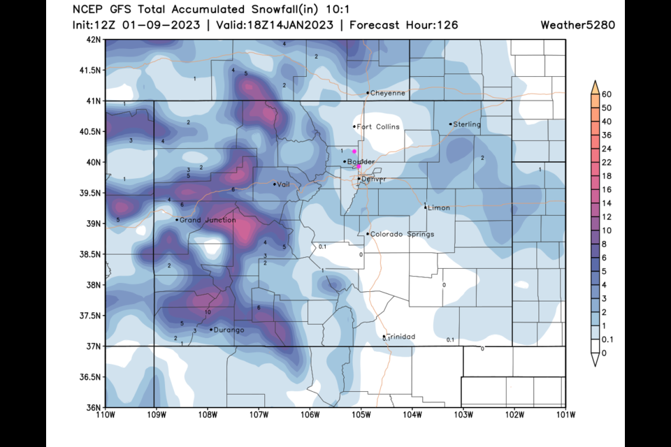
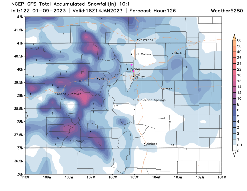
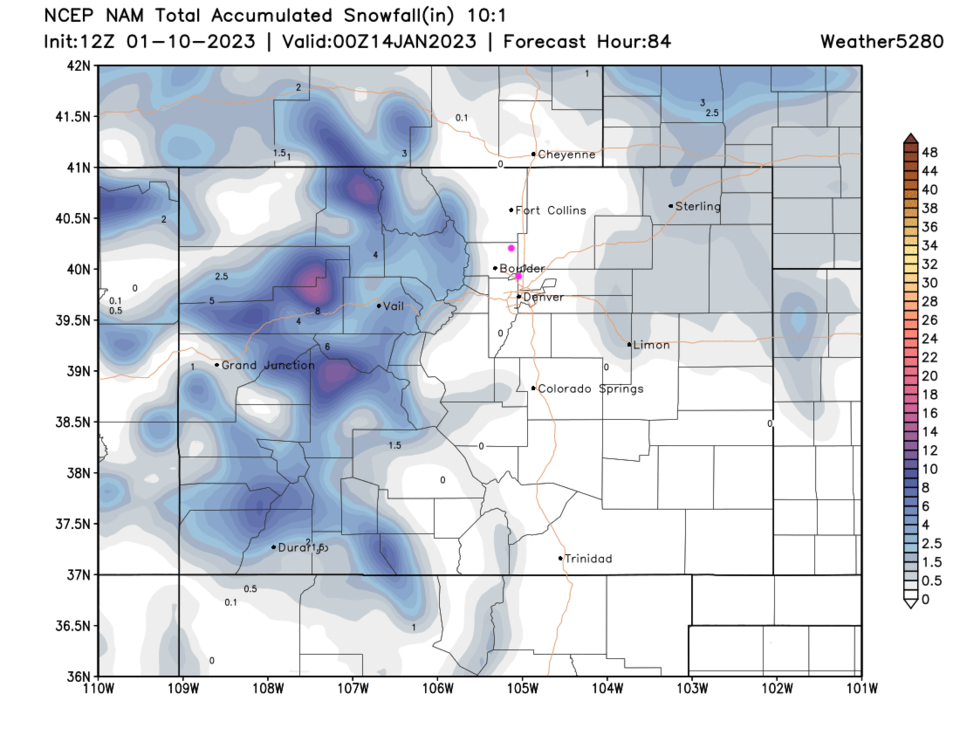
Our mid-week shot of showers is almost here. For a bit, it looked like 2-4 inches might hit the I-25 folks, but that has backed off in most modeling except for some of the 'global' models. The GFS is one such model and it has an inch of snow in spots around Boulder and southern Denver (Figure 1 update). Elsewhere, it is more like nothing or maybe a half inch of snow. Even the nearby foothills only see 2-3 inches. The NAM really underplays the snow and predicts nothing but maybe snow falling in the air or a dusting on grassy surfaces (Figure 2 update).
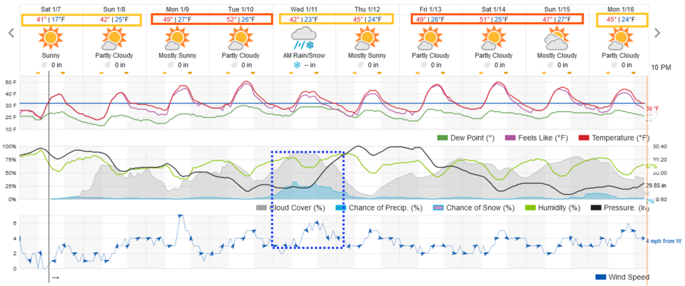
Temperatures remain pretty warm as well with highs only dipping into the lower 40's Wednesday. They bounce back to upper 40's the next day and 50's beyond that.
End Tuesday update.
Forecast Discussion:
Temperatures will climb, first, into the 40's then the 50's as the weekend progresses and the new week begins (Figure 1). Snow will melt, just slowly.
The Longer Range Forecast:
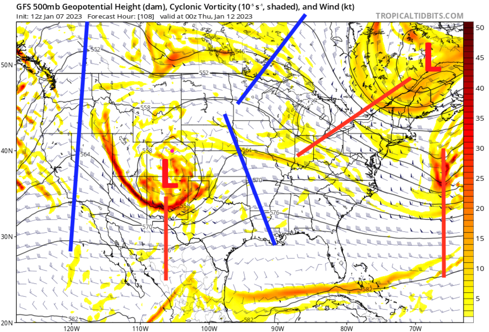
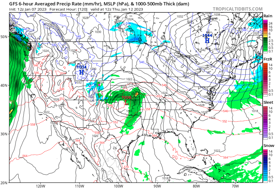
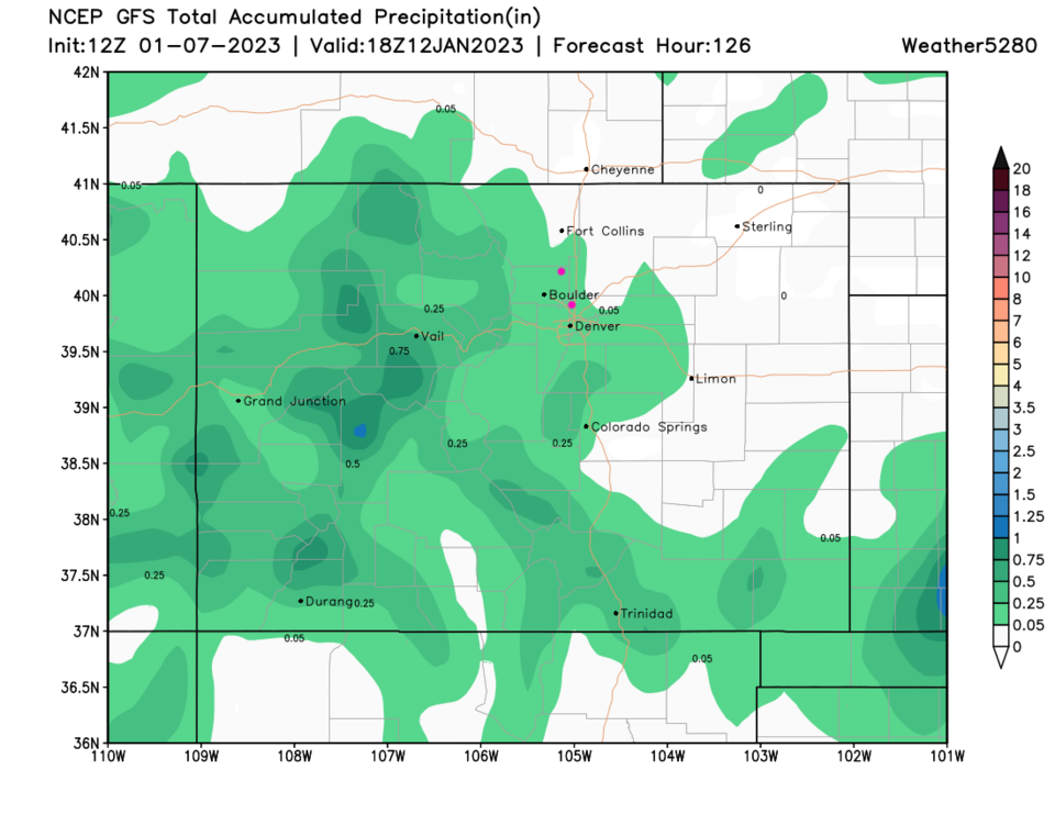
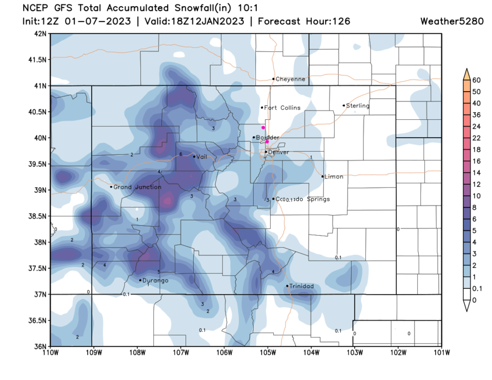
A somewhat weak (as it looks now) cut-off low will cross the state Tuesday and Wednesday (Figure 2). This means yet more snow for the mountains and a small chance of rain and snow on the Plains (Figure 3). Rainfall/moisture totals are fairly unimpressive with nothing out on the northeast Plains (Figure 4). The GFS does give the I-25 folks 'some' snow from Longmont south, but it is very minimal (Figure 5).
We resume our warmer weather the next day and into the next weekend (Figure 1). Check back here to see if this storm becomes anything more!