Skip to content
Join our Newsletter

Sat Update: The Front Range Forecast: More heat then few showers

In Brief:

Unusual warmth into the new week, then a return of fall showers.

Saturday PM update:

A strong upper ripple in the atmosphere (short wave) is working on the very small amount of moisture we have over the state to create a few thunderstorms this evening. Much of the rain is re-evaporating on the way down (virga) but there have been a few showers that have almost made the ground wet.

End Saturday PM update.

The Forecast Discussion:

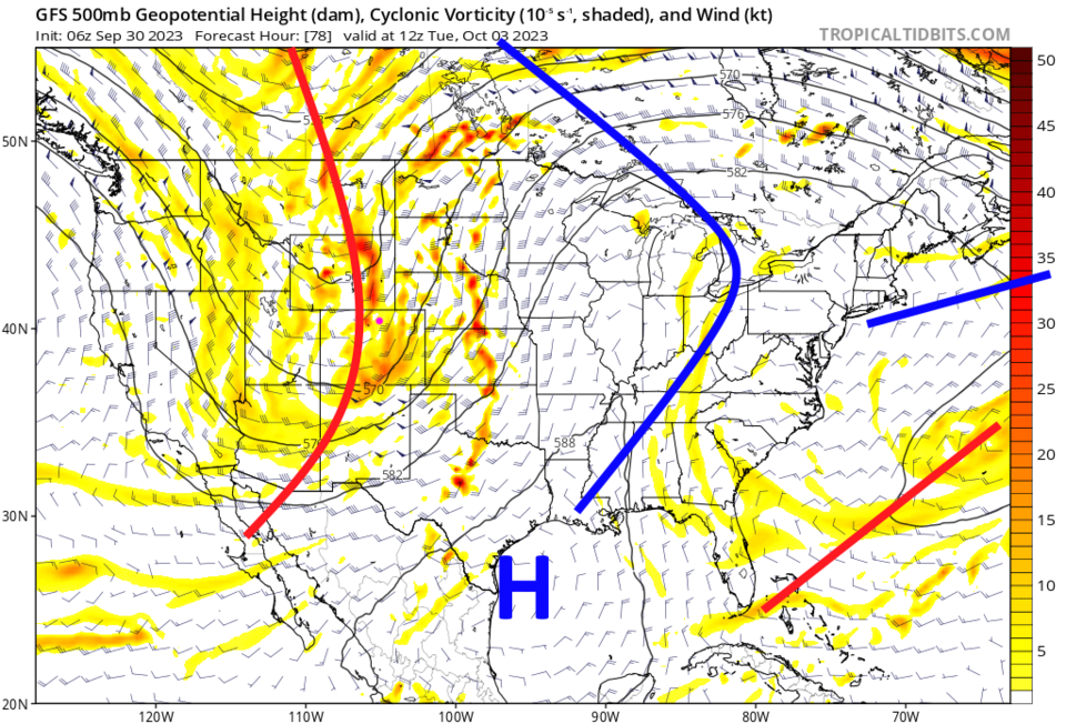
The persistent Western ridge remains in place through Monday keeping temperatures about 10 degrees above normal and giving us dry conditions (Figure 1).


figure1_09302023
Figure 1: the 10 day graphical forecast for Longmont from weatherunderground.com

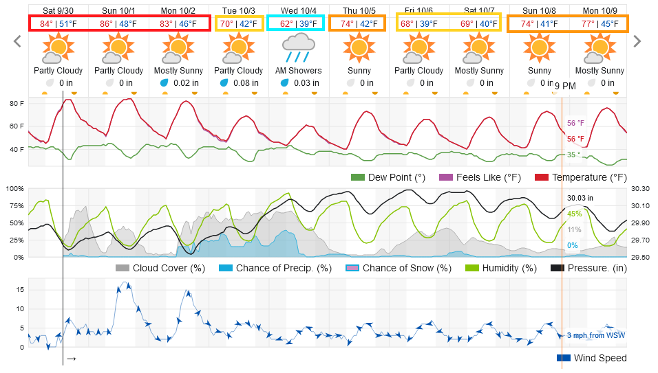
The Longer Range Forecast:

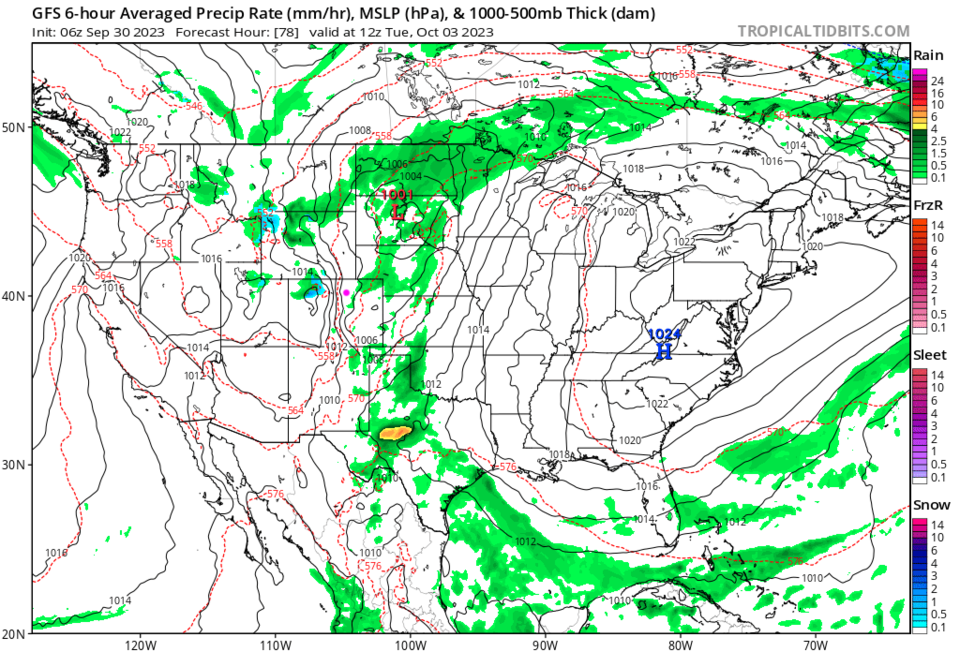
Monday night, a trough replaces the ridge brining cooler windy weather to the state (Figure 2). Moisture will be low and showers very scattered (Figure 3).

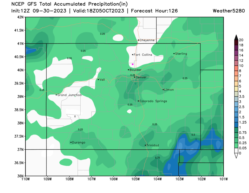
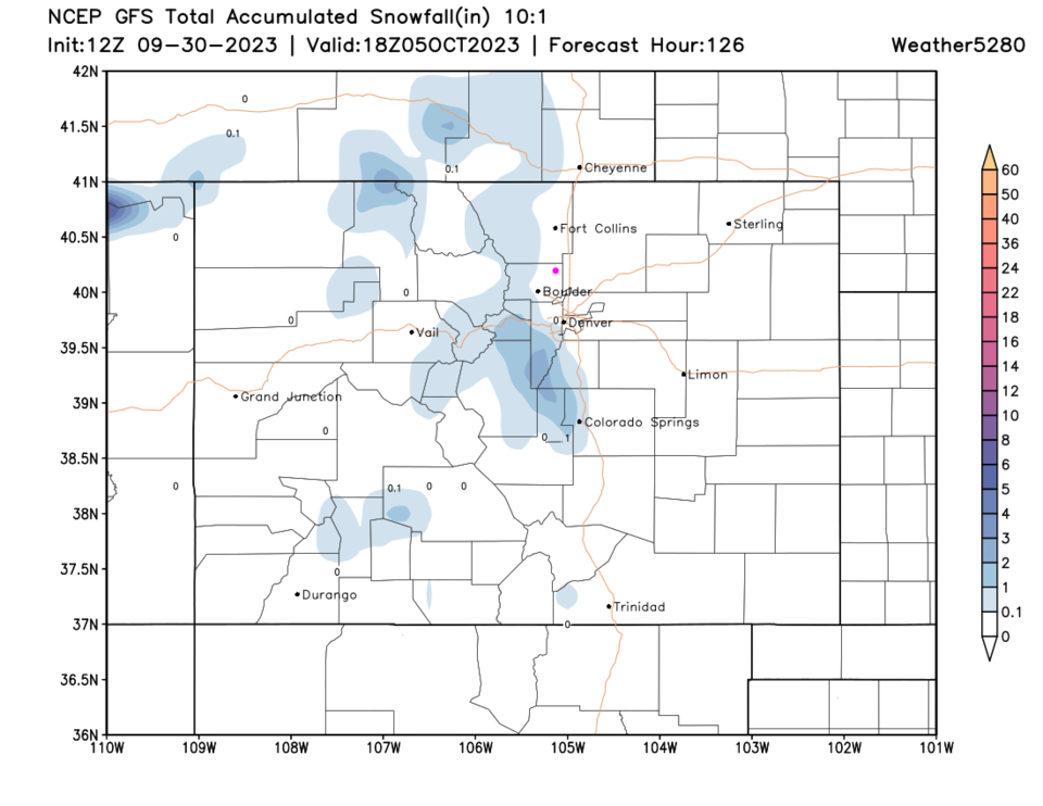
Rainfall totals are light with many locations seeing nothing (Figure 4). There will be a dusting of high altitude snow as well (Figure 5).  It won't break our dry streak, but it may be a sign of more seasonable weather settling in.

figure2_09302023
Figure 2: the 500mb upper air forecast for Tuesday morning from the GFS and tropicaltidbits.com
figure3_09302023
Figure 3: the 6 hour window precipitation forecast for Tuesday morning from the GFS and tropicaltidbits.com
figure4_09302023
Figure 4: the 5 day 1precipitation forecast from the GFS and weather5280.com
figure5_09302023
Figure 5: the 5 day 10:1 ratio snowfall forecast from the GFS and weather5280.com


About the Author: John Ensworth

John Ensworth used to work from Longmont as the PI for the NASA through the IGES (The Institute for Global Environmental Strategies). He now teaches technology, algebra, astronomy, meteorology, film school, and Lego robotics to middle/high school.
Read more


Comments


Current Weather

Clear

Clear

68°F

UV Index
0 Low
Pressure
30.14 Steady
Visibility
6 miles
Dewpoint
58 °F
Humidity
70%
Wind
WNW 1.7 mph
Gust
2.9 mph
Wind Chill
68 °F

Hourly Forecast

Tomorrow
12 AM
67°F
Partly cloudy w/ showers
Tomorrow
1 AM
65°F
Partly cloudy
Tomorrow
2 AM
64°F
Mostly clear
Tomorrow
3 AM
62°F
Clear
Tomorrow
4 AM
61°F
Clear
Tomorrow
5 AM
60°F
Clear
Tomorrow
6 AM
58°F
Sunny
Tomorrow
7 AM
62°F
Sunny
Tomorrow
8 AM
68°F
Mostly sunny
Tomorrow
9 AM
74°F
Mostly sunny
Tomorrow
10 AM
80°F
Mostly sunny
Tomorrow
11 AM
84°F
Mostly sunny

7 Day Forecast

Intermittent clouds

Saturday

82 °F

Clouds giving way to sun; high levels of ozone will lead to poor air quality


Mostly clear

Saturday Night

58 °F

A shower in spots late this evening; otherwise, clear to partly cloudy


Partly sunny w/ showers

Sunday

94 °F

Partly sunny with a passing shower in the afternoon


Partly cloudy

Sunday Night

61 °F

Partly cloudy


Mostly cloudy w/ t-storms

Monday

94 °F

Some sun, then increasing clouds with a thundershower in spots in the afternoon


Mostly clear

Monday Night

60 °F

Clear to partly cloudy


Intermittent clouds

Tuesday

92 °F

Sun through high clouds


Partly cloudy

Tuesday Night

60 °F

Partly cloudy


Intermittent clouds

Wednesday

81 °F

Not as warm with times of clouds and sun; a thunderstorm in spots in the afternoon


Intermittent clouds

Wednesday Night

58 °F

An evening thunderstorm; otherwise, partly cloudy


Sunrise and Sunset

Sunrise
5:41 AM
Sunset
8:30 PM

Based on AccuWeather data