Skip to content
Join our Newsletter

The Front Range Forecast: More quiet summer weather

In Brief:

Hot, above normal summer temperatures with few afternoon storms. A cold front is in our future.

The Tuesday Update:

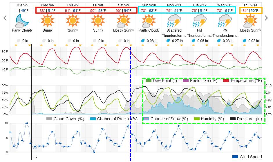
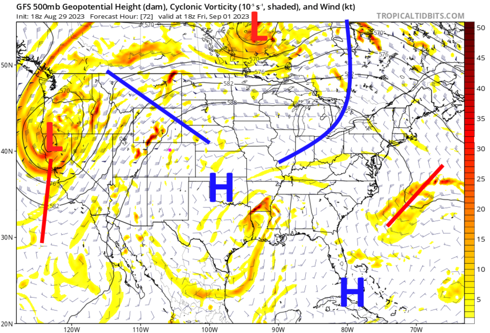
Not much to report for the short term.  We will continue to have above normal temperatures into the weekend when a cold front arrives (dotted blue line Figure 1 update). After that, storm chances increase with bit of a taste of early Fall weather.

figure1u_09052023
Figure 1 update: the 10 day graphical forecast for Denver from weather5280.com

End Tuesday Update.

The Forecast Discussion:

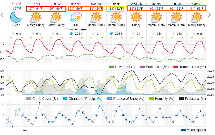
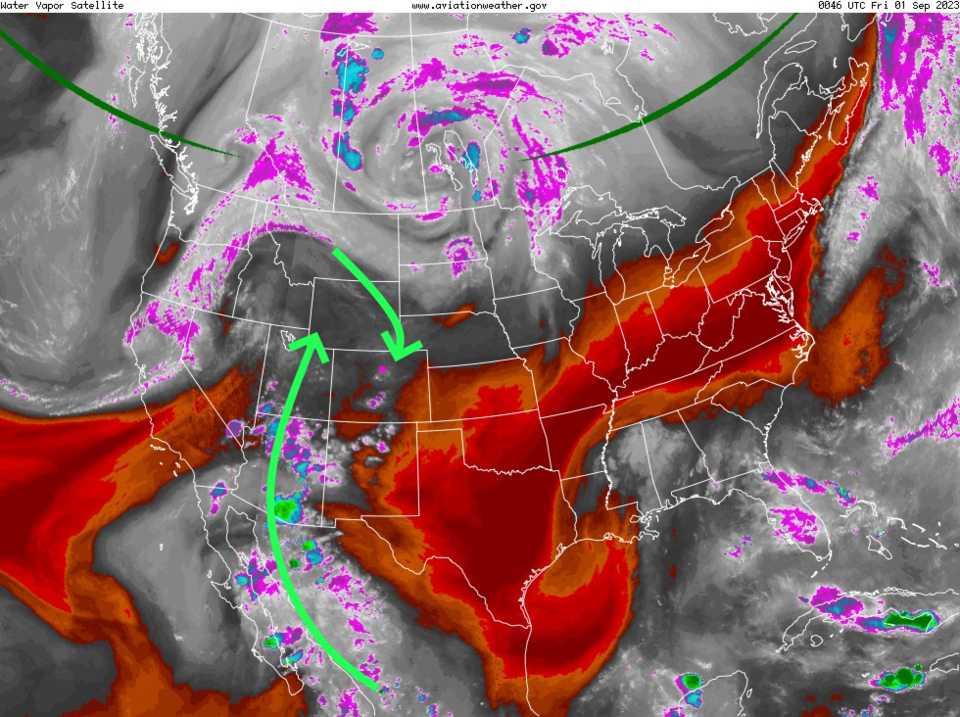
Exciting weather is not to be found in Colorado for a while. We are sitting at about 15 degrees above normal for high temperatures (Figure 1) with only small afternoon storm chances Friday then Sunday through Tuesday. There is some limited "monsoon" moisture flowing into the West (Figure 2) but the big High Pressure center and ridge nearby is keeping most weather quiet (Figure 3).

figure1_08312023
Figure 1: the 10 day graphical forecast for Denver from weatherunderground.com
figure2_08312023
Figure 2: the water vapor satellite image from Thursday PM from NOAA.
figure3_08312023
Figure 3: the 500mb upper air map for noon Friday from the GFS and tropicaltidbits.com

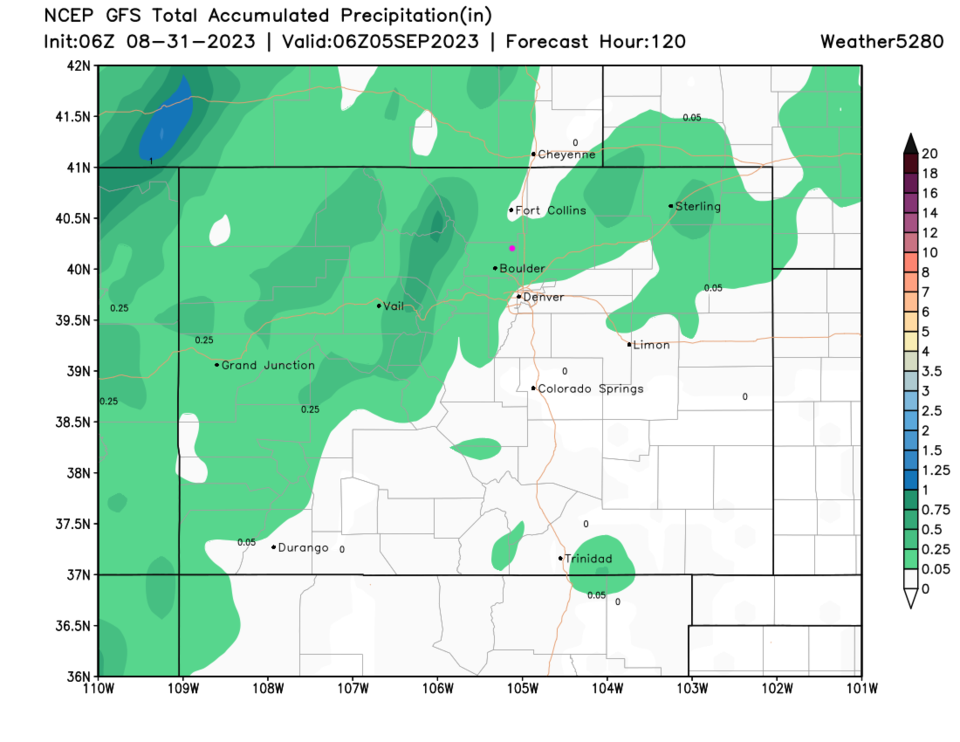
The Longer Range Forecast:

The GFS also gives the state little precipitation over the next five days (Figure 4).  Sorry - there isn't much to cover this late in the season!

figure4_08312023
Figure 4: the 5 day precipitation forecast from the GFS and weather5280.com


About the Author: John Ensworth

John Ensworth used to work from Longmont as the PI for the NASA through the IGES (The Institute for Global Environmental Strategies). He now teaches technology, algebra, astronomy, meteorology, film school, and Lego robotics to middle/high school.
Read more


Comments


Current Weather

Cloudy

Cloudy

68°F

UV Index
2 Low
Pressure
30.22 Falling
Visibility
5 miles
Dewpoint
59 °F
Humidity
73%
Wind
ENE 1.2 mph
Gust
3.2 mph
Wind Chill
68 °F

Hourly Forecast

Today
11 AM
69°F
Mostly cloudy
Today
12 PM
72°F
Mostly cloudy
Today
1 PM
75°F
Mostly cloudy
Today
2 PM
77°F
Mostly cloudy
Today
3 PM
79°F
Mostly cloudy
Today
4 PM
82°F
Mostly cloudy
Today
5 PM
84°F
Intermittent clouds
Today
6 PM
82°F
Intermittent clouds
Today
7 PM
79°F
Intermittent clouds
Today
8 PM
77°F
Intermittent clouds
Today
9 PM
73°F
Partly cloudy
Today
10 PM
69°F
Partly cloudy

7 Day Forecast

Mostly cloudy

Saturday

84 °F

Clouds and breaks of sun; smoke from area fires will lead to poor air quality


Partly cloudy

Saturday Night

58 °F

Partly cloudy


Partly sunny w/ showers

Sunday

94 °F

Partly sunny with a passing shower in the afternoon


Partly cloudy

Sunday Night

61 °F

Partly cloudy


Mostly cloudy

Monday

91 °F

Considerable cloudiness


Mostly clear

Monday Night

60 °F

Clear to partly cloudy


Intermittent clouds

Tuesday

92 °F

Sun through high clouds


Partly cloudy

Tuesday Night

58 °F

Partly cloudy


Intermittent clouds

Wednesday

84 °F

Not as warm with times of clouds and sun; a thunderstorm in spots in the afternoon


Intermittent clouds

Wednesday Night

58 °F

An evening thunderstorm; otherwise, partly cloudy


Sunrise and Sunset

Sunrise
5:41 AM
Sunset
8:30 PM

Based on AccuWeather data