Skip to content

The Front Range Forecast: Mostly quiet and warm

In Brief:

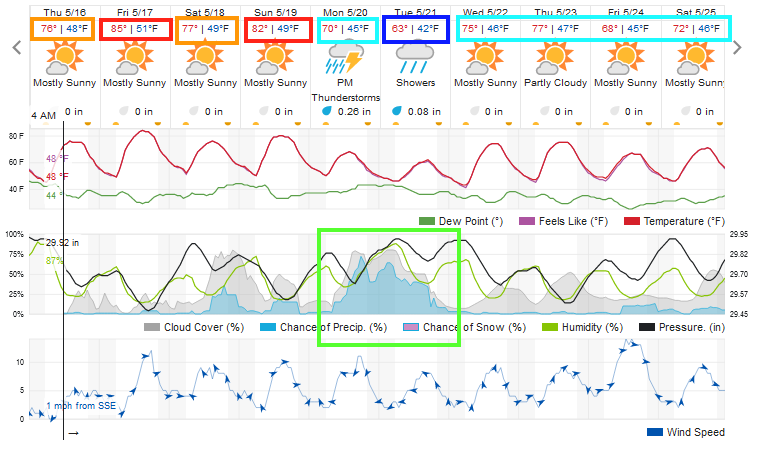
Late Spring weather settles in with only a weak cold front cooling and bring moisture Monday.

Forecast Discussion:

Things are quite warm and quiet as we sail through the weekend (Figure 1). There will be a return of wandering afternoon thunderstorms for the weekend.


figure1_05162024
Figure 1: the 10 day graphical forecast for Longmont from weatherunderground.com

The Longer Range Forecast:

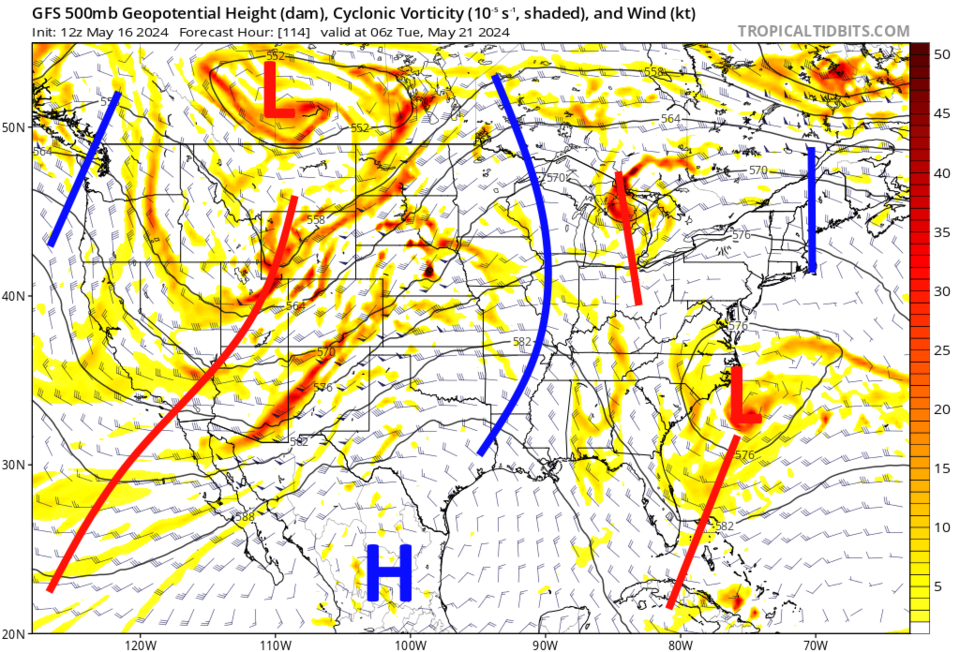
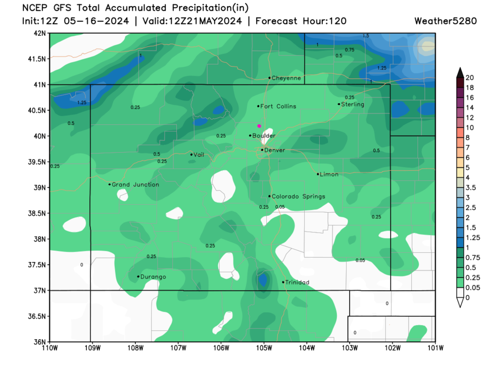
The next 'system' is weak cold front pushed by the trough approaching from the west in Figure 2. Temperatures do drop below normal, but don't even approach freezing (Figure 1).  At this time, the weatherunderground model has about 1/3rd of an inch of liquid falling. The GFS gives us 1/10th to 1/4th of an inch.  Thunderstorms may drop locally heavier totals.

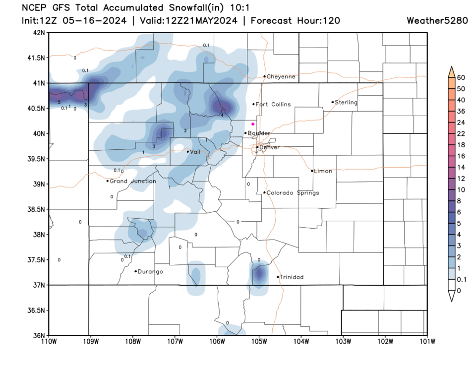
For fun, I included the snowfall forecast.  It is only the highest elevations that will see falling flakes.

figure2_05162024
Figure 2: the 500mb upper air forecast model for Monday night from the GFS and tropicaltidbits.com

figure3_05162024
Figure 3: the 5 day precipitation forecast from the GFS and weather5280.com
figure4_05162024
Figure 4: the 5 day 10:1 snowfall forecast from the GFS and weather5280.com


About the Author: John Ensworth

John Ensworth used to work from Longmont as the PI for the NASA through the IGES (The Institute for Global Environmental Strategies). He now teaches technology, algebra, astronomy, meteorology, film school, and Lego robotics to middle/high school.
Read more


Comments


Current Weather

Cloudy

Cloudy

64°F

UV Index
0 Low
Pressure
30.02 Falling
Visibility
8 miles
Dewpoint
59 °F
Humidity
83%
Wind
WNW 1.1 mph
Gust
2.2 mph
Wind Chill
64 °F

Hourly Forecast

Today
4 AM
63°F
Mostly clear
Today
5 AM
62°F
Mostly clear
Today
6 AM
62°F
Mostly sunny
Today
7 AM
65°F
Mostly sunny
Today
8 AM
66°F
Mostly sunny
Today
9 AM
72°F
Mostly sunny
Today
10 AM
78°F
Partly sunny
Today
11 AM
83°F
Partly sunny
Today
12 PM
88°F
Partly sunny
Today
1 PM
90°F
Partly sunny
Today
2 PM
92°F
Partly sunny
Today
3 PM
90°F
Partly sunny

7 Day Forecast

Partly sunny w/ t-storms

Friday

93 °F

Not as hot with times of clouds and sun; a couple of thunderstorms in the afternoon


Intermittent clouds

Friday Night

62 °F

Clearing


Partly sunny w/ t-storms

Saturday

92 °F

Partly sunny with a heavy thunderstorm this afternoon; thunderstorms could bring damaging winds, flash flooding and hail


Partly cloudy w/ t-storms

Saturday Night

59 °F

A thundershower in spots this evening; otherwise, mainly clear


Mostly sunny

Sunday

98 °F

Mostly sunny and very warm


Clear

Sunday Night

56 °F

Clear


Sunny

Monday

100 °F

Hot with the temperature tying the record from 1995 with plenty of sunshine; caution advised if outside for extended periods of time


Clear

Monday Night

58 °F

Clear


Mostly sunny

Tuesday

103 °F

Mostly sunny and hot with the temperature approaching the record of 105 set in 1980; caution advised if outside for extended periods of time


Partly cloudy

Tuesday Night

62 °F

Partly cloudy


Sunrise and Sunset

Sunrise
5:54 AM
Sunset
8:20 PM

Based on AccuWeather data