In Brief:
Bitter cold, less wind, and our first real snow since the last winter season.
Friday update:
Precipitation is moving into the area quickly this morning. Snow is falling in Fort Collins. Winds will come out of the north today, but no where near as strong as winds were yesterday. Snow should continue from mid-morning through the early morning hours Saturday. Serious cold is arriving with this system. We will see single digit lows tonight (a few spots below 0F is possible) and a high in the teens in many locations Saturday with wind chills tonight approaching -20F at times. The winter storm warning is still in effet
Snowfall Roundup:
For the Longmont/Broomfield corridor:
Weather5280.com forecasters: 2-5"
Channel 7: 3-6”
Channel 9: 2-6”
The GFS model: 4-6”
The NAM model: 3-6”
The NWS (National Weather Service): 4-6”
My forecast from yesterday: 3-6"
End Friday update.
Thursday update:
There are high wind warnings and air quality alerts as the storm approaches and wildfires have broken out near I-25. We are also under the following winter weather warning. I'll return tonight with a Snowfall Roundup for amounts.
...WINTER STORM WARNING IN EFFECT FROM 5 AM FRIDAY TO 11 AM MST
SATURDAY...
* WHAT...Heavy snow likely. Total snow accumulations between 5 and
10 inches expected. Higher amounts to 1 foot possible for higher
terrain in the foothills and near Estes Park.
* WHERE...The Northern Front Range Foothills, The Southern Front
Range Foothills, Fort Collins, and Boulder and the western suburbs
of Denver.
* WHEN...From 5 AM Friday to 11 AM MST Saturday.
* IMPACTS...Travel could be very difficult. The hazardous conditions
could impact the Friday morning and evening commutes.
PRECAUTIONARY/PREPAREDNESS ACTIONS...
If you must travel, keep an extra flashlight, food, and water in
your vehicle in case of an emergency. The latest road conditions for
Colorado can be obtained by calling 5 1 1 or by going to www.cotrip.
org
End Thursday.
Wednesday update:
Just putting out a quick update to highlight that most models and media outlets are inching up the inches of snow we'll see on Friday. Along I-25 4-6 inches is looking more likely. Mountain communities like Estes Park will get around 5-10" or more. This is the storm we have been waiting for!
End Wednesday update:
Forecast Discussion:
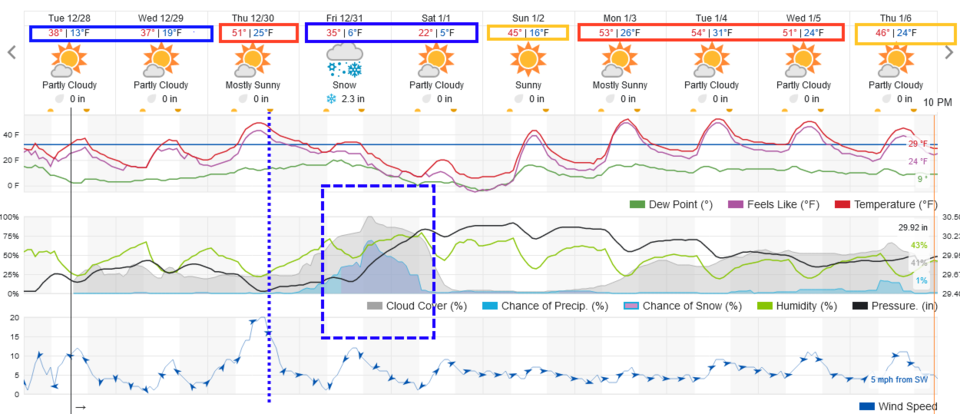
Winter is finally making an appearance! Very cold conditions hold through Wednesday (Figure 1). Southwest winds ahead of the big front warms us to around 50F on Thursday, then cold air pours back down the Front Range (dotted line).
The Longer-Range Forecast:
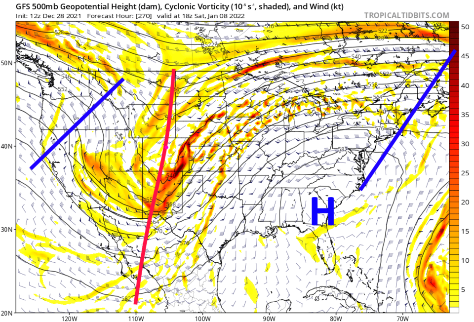
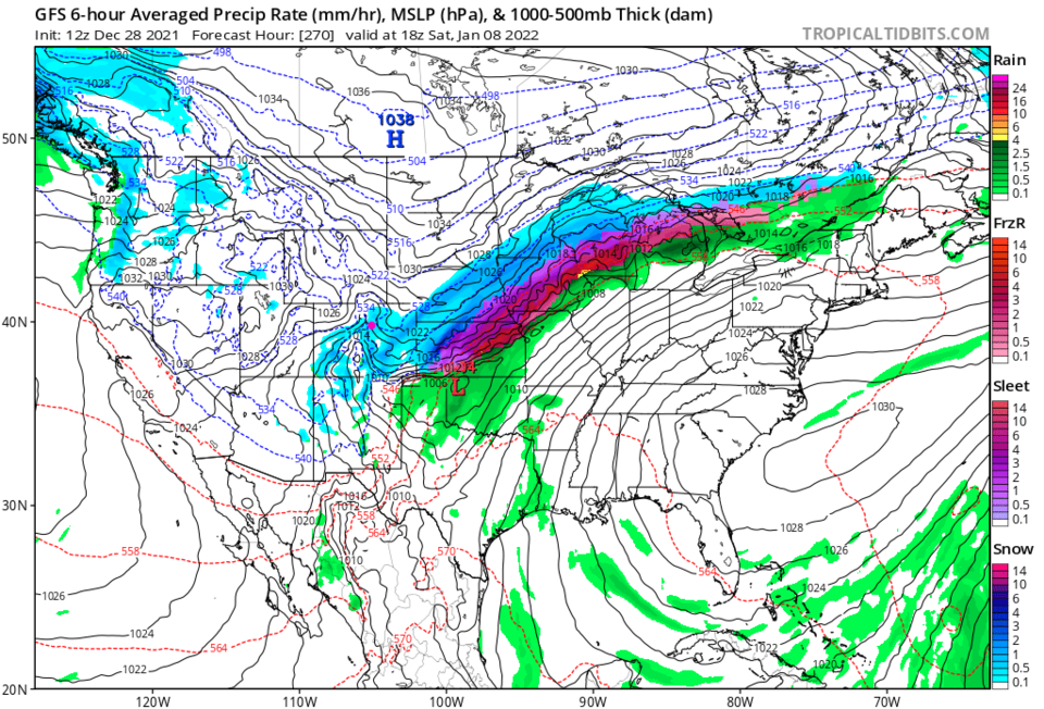
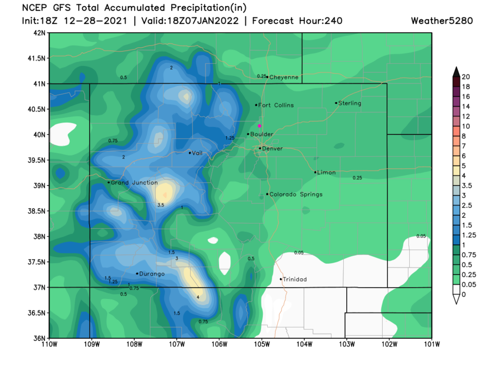
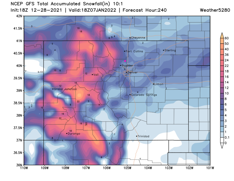
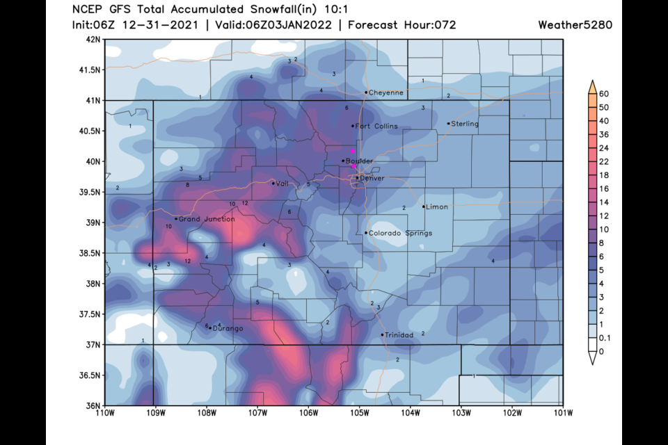
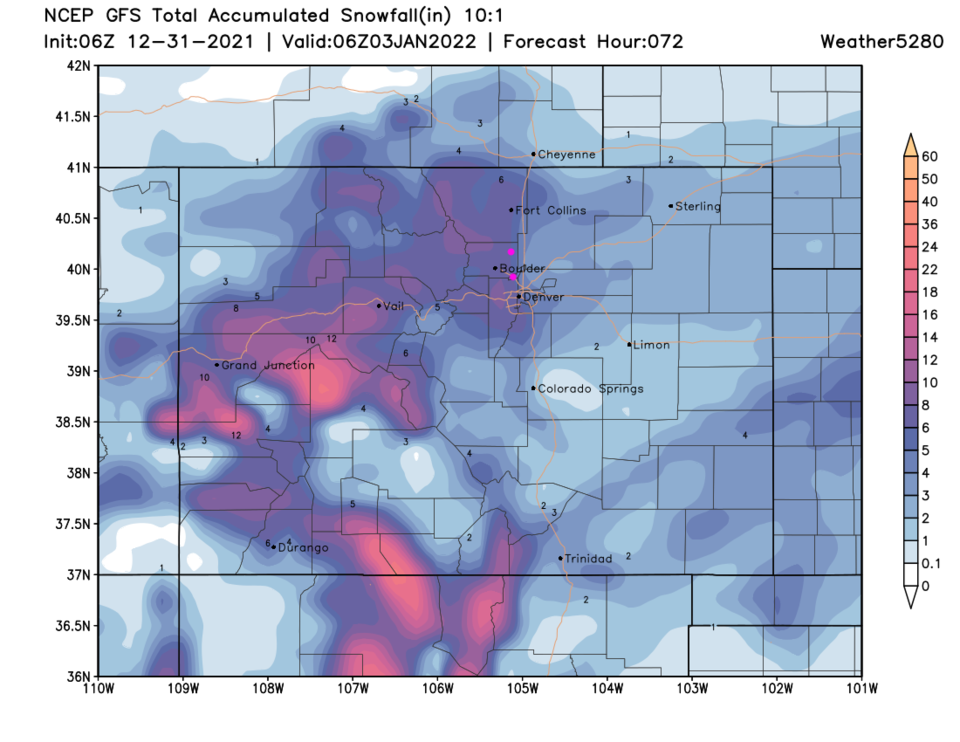
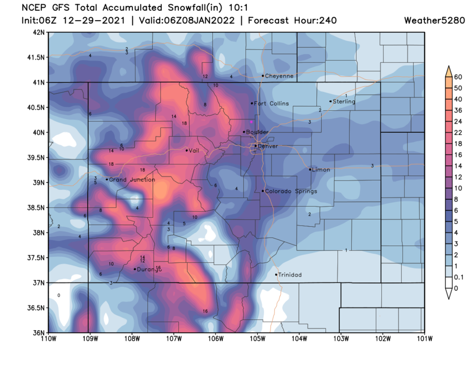
That front is driven by a strong trough zipping across the state (red line, Figure 2). At about the peak of the storm (Figure 3), the snow is hitting the mountains and eastern plains (a rarity!). The total amount of moisture (melted) that will fall looks to be about 1/2 an inch along I-25 and up to 3-4 inches in the mountains (Figure 4). This equates to two feet of snow in the higher elevations and about 3-5 inches along I-25 (Figure 5). The weatherunderground model gives us 2-4 inches (Figure 1). I'll keep an eye on the models and forecasts and post updates as the week progresses!