Skip to content

Sat Update: The Front Range Forecast: Quiet Fall Weather- Still

In Brief:

Very calm and seasonable Fall weather. No excitement for a while.

The Saturday Update:

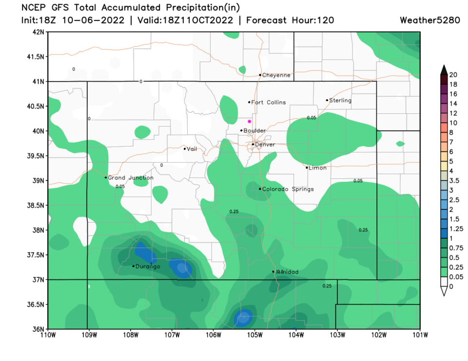
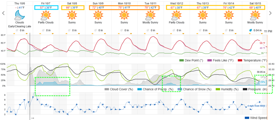
We enjoyed some clouds, winds and a drop in temperatures with a cold front Saturday afternoon, but no rain fell.  For the next week, we just keeping having only slightly above normal temperatures, clear skies, and dry conditions (Figure 2 update). There is a hint of a change coming next weekend, but rain signals like that have appeared 'about a week out' and have then vanished from the models.  Most of Colorado is expected to stay very dry for the next 5-7 days (Figure 3 update).

figure2u_10152022
Figure 2 update: the 10 day graphical forecast for Denver from weatherunderground.com
figure3u_10152022
Figure 3 update: the 5 day precipitation total from the GFS and weather5280.com

End Saturday update.

The Monday Update:

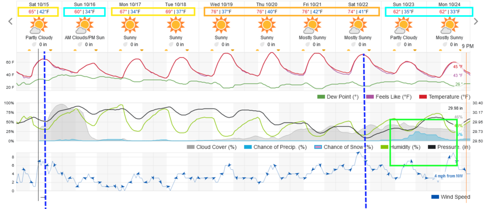
Other than Tuesday being a bit warmer and a touch windy, we have very calm and seasonable weather for the week (Figure 1 update).  Enjoy!
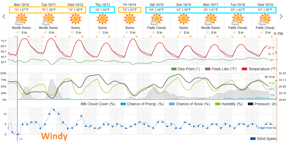
Figure1u_10102022
Figure 1 update: the 10 day graphical forecast for Denver from weatherunderground.com

End Monday update.

Forecast Discussion:

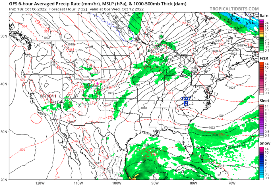
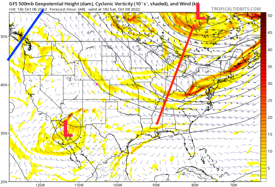
A dry cold front will make Friday a bit chilly but rain chances are low (Figure 1). Beyond that, we stay very close to seasonable temperatures for the next week (except Tuesday where we approach 80F).  There are record high's in the 80s through October and we have broken 80F twice in November historically. We may not yet be done with temperatures that warm.  You just won't notice the weather much this week as we have dry northwest flow aloft (with a distant low over the southern AZ and CA region) all week.

Figure1_10062022
Figure 1: the 10 day graphical forecast for Denver from weatherunderground.com
Figure2_10062022
Figure 2: the 500mb upper air forecast from the GFS and tropicaltidbits.com for Noon Saturday.

The Longer Range Forecast:

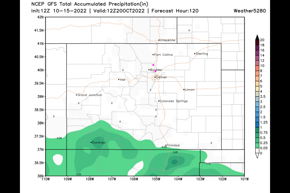
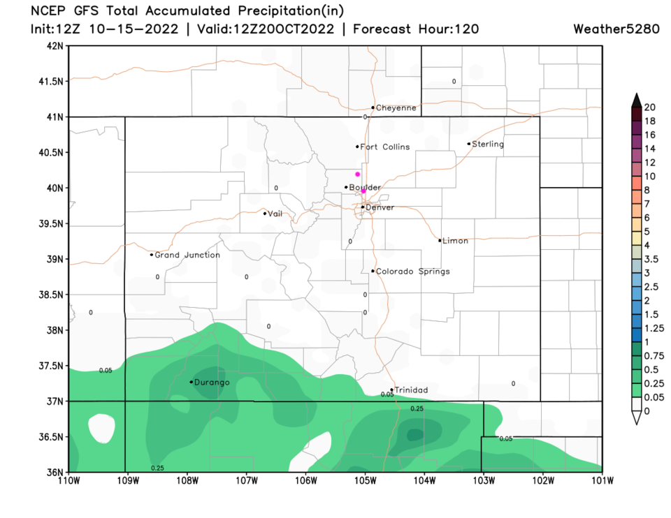
Next Tuesday/Wednesday, there is a trough that swings past the state. There are very low (at this time) rain chances in Colorado (Figure 1 and 3) next week. The five-day precipitation totals hit mainly southern counties only (Figure 4). 

Figure3_10062022
Figure 3: the 6 hour precipitation total around midnight Tuesday/Wednesday next week from the GFS and tropicaltidbits.com
Figure4_10062022
Figure 4: the 5 day precipitation forecast from the GFS and weather5280.com


About the Author: John Ensworth

John Ensworth used to work from Longmont as the PI for the NASA through the IGES (The Institute for Global Environmental Strategies). He now teaches technology, algebra, astronomy, meteorology, film school, and Lego robotics to middle/high school.
Read more


Comments


Current Weather

Sunny

Sunny

58°F

UV Index
6 High
Pressure
30.04 Falling
Visibility
8 miles
Dewpoint
33 °F
Humidity
39%
Wind
SE 3.2 mph
Gust
7.4 mph
Wind Chill
58 °F

Hourly Forecast

Today
3 PM
62°F
Partly sunny
Today
4 PM
65°F
Intermittent clouds
Today
5 PM
66°F
Intermittent clouds
Today
6 PM
65°F
Intermittent clouds
Today
7 PM
63°F
Intermittent clouds
Today
8 PM
60°F
Mostly clear
Today
9 PM
57°F
Mostly clear
Today
10 PM
55°F
Mostly clear
Today
11 PM
52°F
Mostly clear
Tomorrow
12 AM
50°F
Mostly clear
Tomorrow
1 AM
48°F
Mostly clear
Tomorrow
2 AM
47°F
Mostly clear

7 Day Forecast

Intermittent clouds

Saturday

66 °F

Not as warm with intervals of clouds and sunshine


Mostly clear

Saturday Night

39 °F

Clear to partly cloudy


Mostly cloudy

Sunday

77 °F

Mostly cloudy and warmer; breezy in the afternoon


Mostly cloudy

Sunday Night

45 °F

Rather cloudy; breezy late


Windy

Monday

60 °F

Very windy; cloudy and cooler


Intermittent clouds

Monday Night

43 °F

Partly cloudy


Intermittent clouds

Tuesday

62 °F

Times of clouds and sun; windy in the afternoon


Partly cloudy

Tuesday Night

36 °F

Partly cloudy


Intermittent clouds

Wednesday

60 °F

Times of clouds and sun


Intermittent clouds

Wednesday Night

35 °F

Partly cloudy


Sunrise and Sunset

Sunrise
5:55 AM
Sunset
7:59 PM

Based on AccuWeather data