Skip to content
Join our Newsletter

Tuesday update: The Front Range Forecast: Severe still!

In Brief:

Severe weather again today then dry. 

Tuesday update:

Amazingly, the afternoon severe weather chances continue now into the second week of August (Figure 2 update). The risk near I-25 and in the mountains is for hail and high winds.  Just a bit east of I-25, there is a chance of an isolated tornado or two. As always, keep an eye out to the western/northwestern sky this afternoon. It looks like we get a break Wednesday!


figure2u_08082023
Figure 2 update: the Day 1, Tuesday SPC severe weather forecast.

End Tuesday update.

Sunday update:

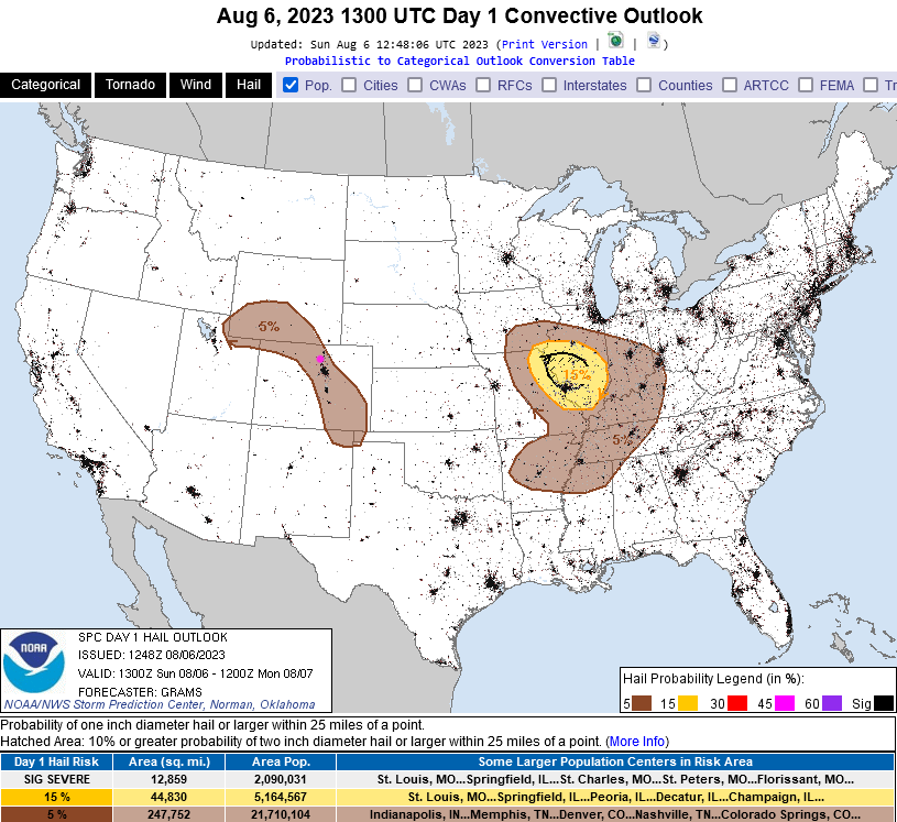
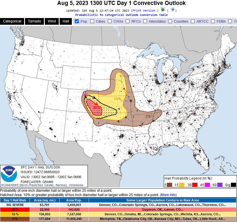
High surface moisture levels and favorable wind directions and speeds throughout the atmosphere over Colorado means, yes, more hail in the stronger late afternoon and evening storms today (Figure 1 update). The Storm Prediction Center also noted that they may need to up the hail chances from Marginal (1 out of 5 risk) to Slight (2 out of 5) as more data comes in today,

figure1_08062023
Figure 1 update: the hail forecast map from the SPC and NOAA for Sunday.

End Sunday update.

Forecast Discussion:

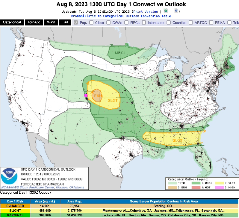
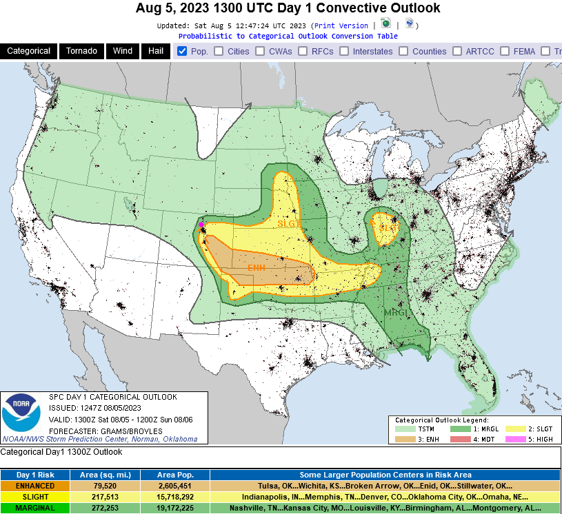
A cool front has arrived and is bringing a surge of moisture back to the I-25 communities. With a short wave expected to arrive this afternoon, we should see a spike in thunderstorm activity again (Figure 1). There is a marginal risk (1 out of 5) of severe weather north of Longmont, a slight risk (2 out of 5) south and east of Longmont, and an enhanced risk (3 out of 5) southeast of Denver and east of Colorado Springs (Figure 2).

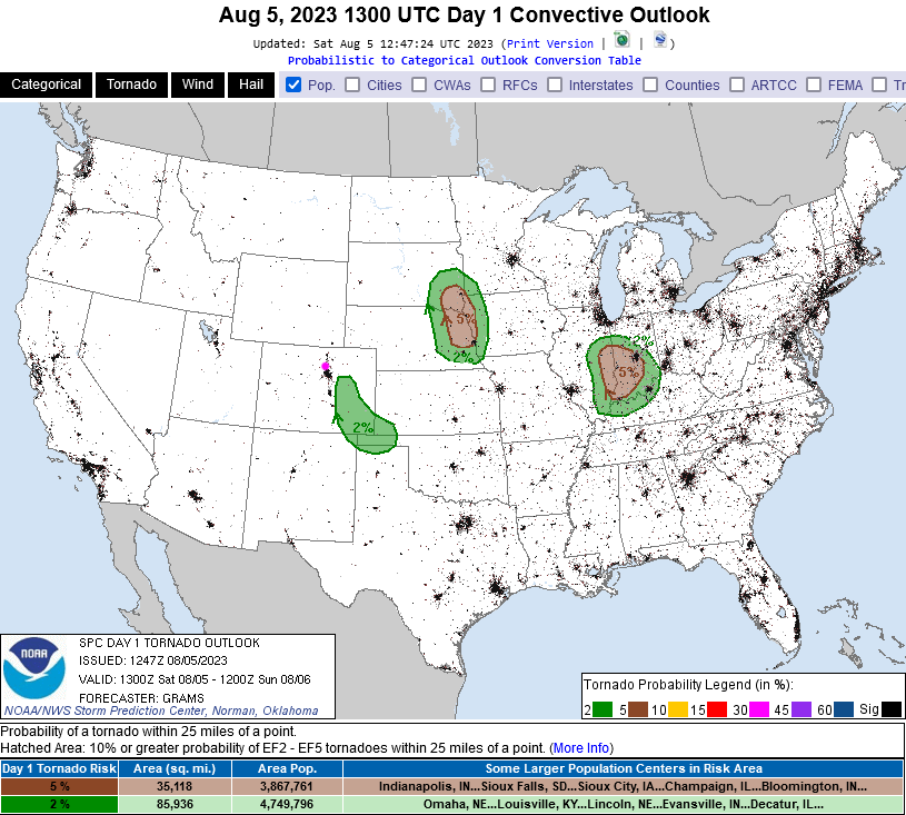
The enhanced risk region has a chance of tornadoes (Figure 3) while the marginal and slight regions have a chance for damaging hail and high winds (Figure 4). The severe chances keep rolling!

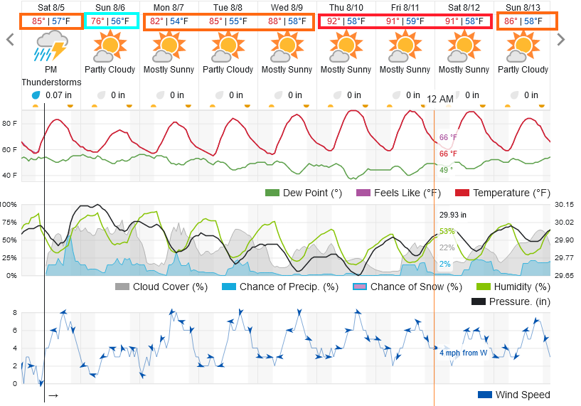
We will see pretty cool weather Sunday and remain below normal through mid-week (Figure 1).

figure1_08052023
Figure 1: the 10 day graphical forecast for Denver from weatherunderground.com
figure2_08052023
Figure 2: the SPC severe weather outlook for Saturday (Day 1).
figure3_08052023
Figure 3: the SPC tornado outlook for Saturday (Day 1).
figure4_08052023
Figure 4: the SPC hail outlook for Saturday (Day 1).

The Longer Range Forecast:

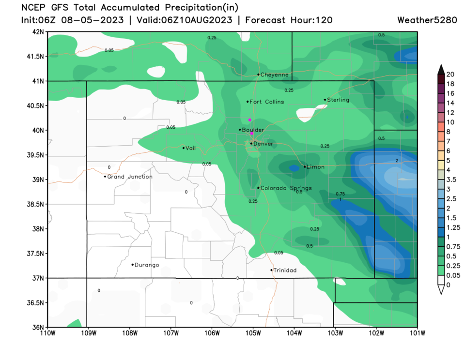
The end of the week sees normal high temperatures return (Figure 1) with rain, over the next 5 days, falling largely in the mountains and eastern plains.

figure5_08052023
Figure 5: the 5 day precipitation forecast from the GFS and weather5280.com


About the Author: John Ensworth

John Ensworth used to work from Longmont as the PI for the NASA through the IGES (The Institute for Global Environmental Strategies). He now teaches technology, algebra, astronomy, meteorology, film school, and Lego robotics to middle/high school.
Read more


Comments


Current Weather

Cloudy

Cloudy

57°F

UV Index
0 Low
Pressure
30.27 Rising
Visibility
7 miles
Dewpoint
47 °F
Humidity
68%
Wind
NNE 3.2 mph
Gust
7.7 mph
Wind Chill
57 °F

Hourly Forecast

Today
9 PM
56°F
Thunderstorms
Today
10 PM
55°F
Thunderstorms
Today
11 PM
54°F
Intermittent clouds
Tomorrow
12 AM
53°F
Mostly cloudy w/ t-storms
Tomorrow
1 AM
53°F
Intermittent clouds
Tomorrow
2 AM
52°F
Cloudy
Tomorrow
3 AM
51°F
Cloudy
Tomorrow
4 AM
51°F
Cloudy
Tomorrow
5 AM
50°F
Cloudy
Tomorrow
6 AM
50°F
Cloudy
Tomorrow
7 AM
51°F
Cloudy
Tomorrow
8 AM
53°F
Partly sunny

7 Day Forecast

Partly sunny w/ t-storms

Tuesday

78 °F

Not as warm with times of clouds and sun; a thunderstorm or two this afternoon; thunderstorms can bring gusty winds, hail and localized flooding


Mostly cloudy w/ t-storms

Tuesday Night

50 °F

A couple of thunderstorms this evening; otherwise, increasing clouds


Mostly cloudy w/ t-storms

Wednesday

73 °F

Some sun, then turning cloudy with a couple of thundershowers in the afternoon


Partly cloudy w/ t-storms

Wednesday Night

50 °F

A couple of showers and a thunderstorm in the evening; otherwise, clearing


Mostly sunny

Thursday

74 °F

Mostly sunny and pleasant


Clear

Thursday Night

45 °F

Clear


Sunny

Friday

81 °F

Plenty of sunshine


Partly cloudy

Friday Night

47 °F

Partly cloudy


Mostly sunny

Saturday

85 °F

Mostly sunny


Clear

Saturday Night

53 °F

Clear


Sunrise and Sunset

Sunrise
6:42 AM
Sunset
7:08 PM

Based on AccuWeather data