Skip to content
Join our Newsletter

The Front Range Forecast: Small storm now, larger storm later

In Brief:

A small storm moves by Sunday/Monday followed by another warm-up.  Much better snows possible Thanksgiving night.

Forecast Discussion:

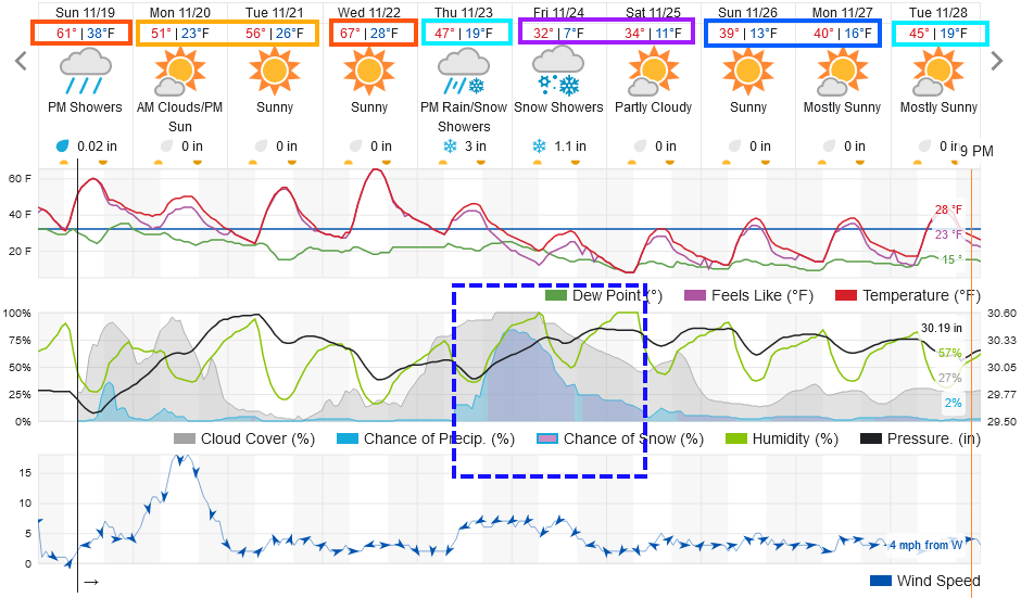
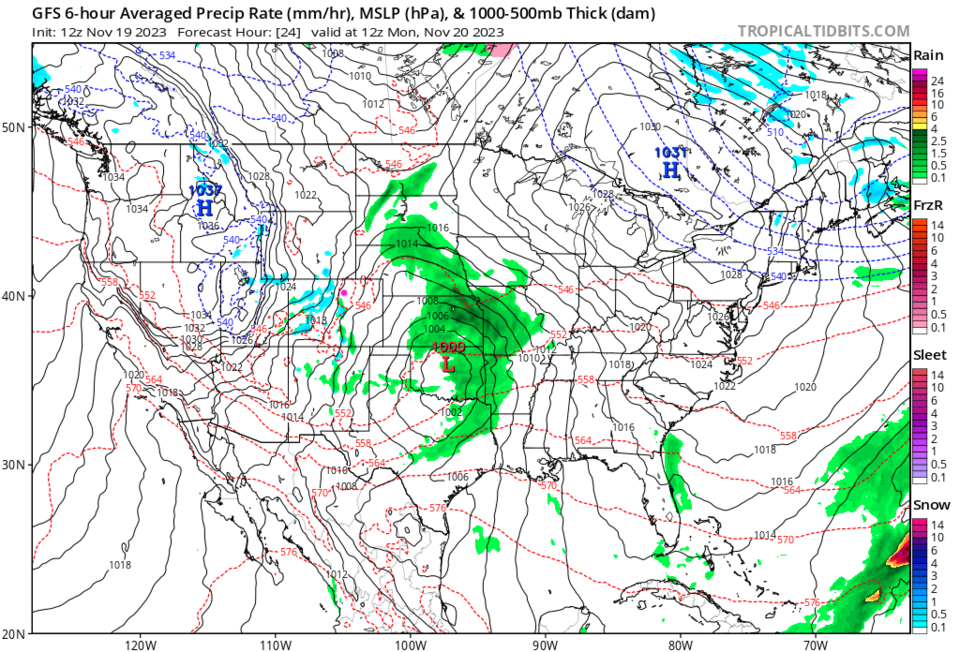
A quick moving, weakening system, is sweeping the state Sunday night and Monday morning.  There are very low chances of rain (overnight flurry?) along I-25 (Figure 1).

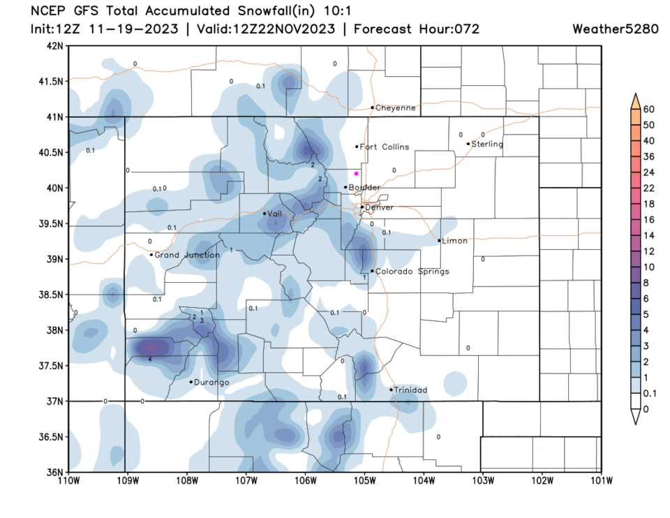
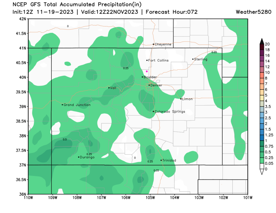
Showers will be scattered and mainly found in the mountains (Figure 2). The GFS does not give areas north of Denver any measurable snow (Figure 3) or rain (Figure 4). We warm up again through Wednesday (Figure 1).

figure1_11192023
Figure 1: the 10 day graphical forecast for Longmont from weatherunderground.com
figure2_11192023
Figure 2: the 6 hour precipitation forecast map centered on Monday sunrise from the GFS and tropicaltidbits.com
figure4_11192023
Figure 3: the 3 day 10:1 snowfall forecast from the GFS and weather5280.com
figure5_11192023
Figure 4: the 3 day liquid equivalent precipitation forecast from the GFS and weather5280.com

The Longer Range Forecast:

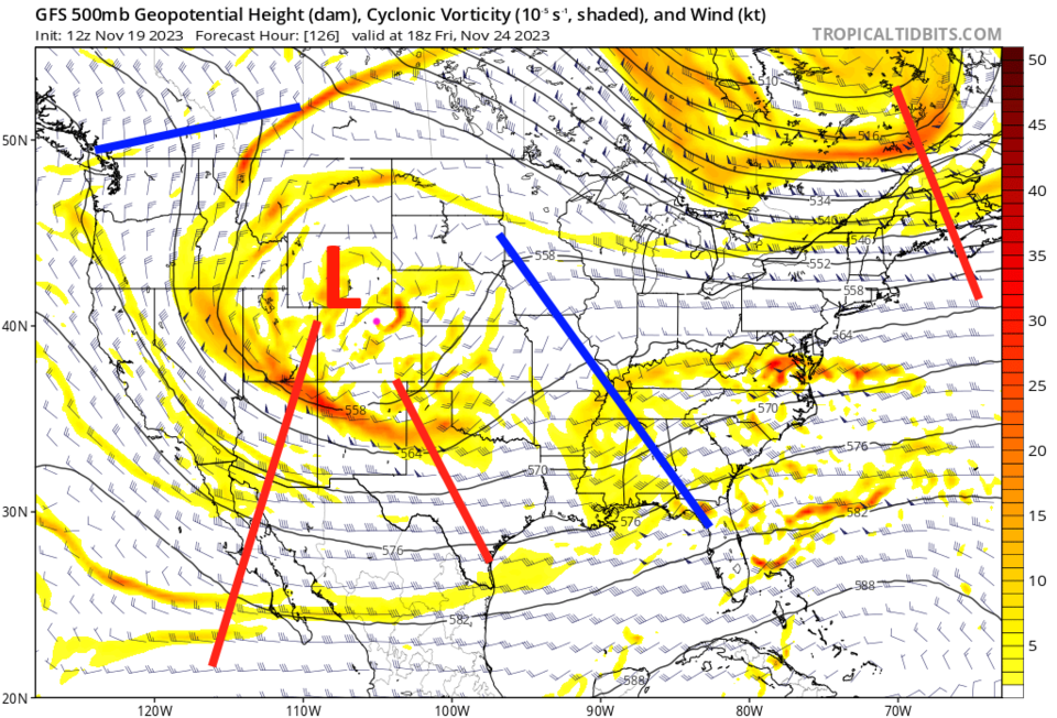
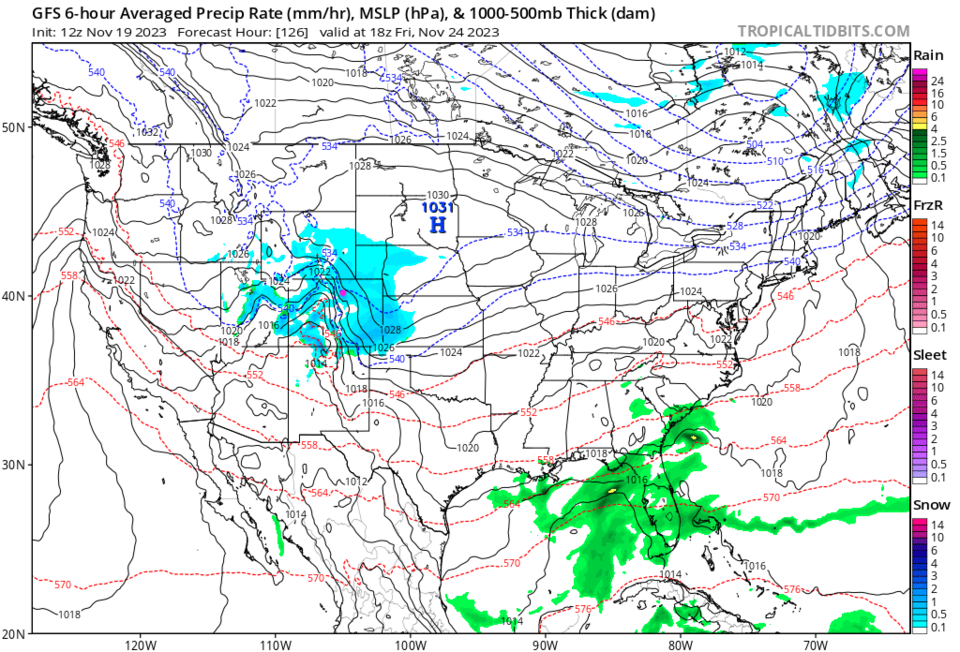
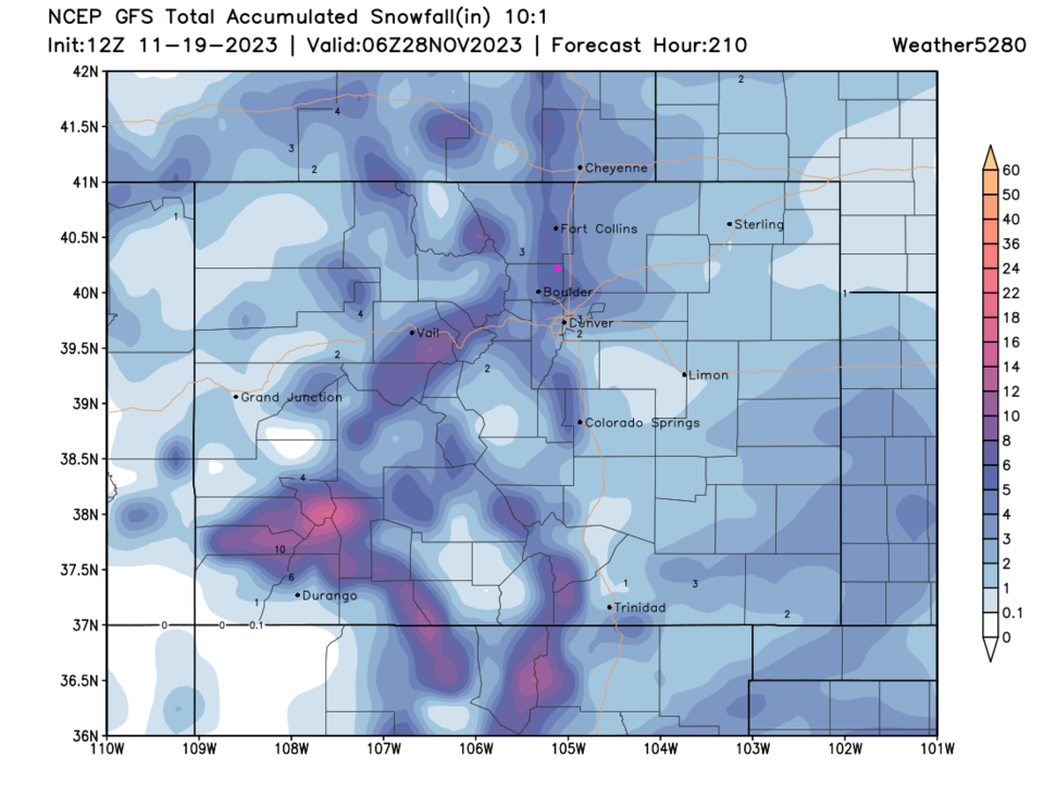
The next series of cold fronts begin to hit Thursday/Thanksgiving and Friday dropping temperatures to freezing levels for highs (Figure 1). This is a slower and larger system than the current one (Figure 6) powered by a deep upper air Low (Figure 5). It looks like mountain locations get 4-12 inches in spots while areas along I-25 may see a 3-6 inch storm.  I'll keep you updated with a Snowfall Roundup later in the week.

figure3_11192023
Figure 5: the 500mb upper air forecast map centered for Monday sunrise from the GFS and tropicaltidbits.com

figure6_11192023
Figure 6: the 6 hour precipitation forecast map centered on Friday noon from the GFS and tropicaltidbits.com
figure7_11192023
Figure 7: the 9 day 10:1 snowfall forecast from the GFS and weather5280.com


About the Author: John Ensworth

John Ensworth used to work from Longmont as the PI for the NASA through the IGES (The Institute for Global Environmental Strategies). He now teaches technology, algebra, astronomy, meteorology, film school, and Lego robotics to middle/high school.
Read more


Comments


Current Weather

Cloudy

Cloudy

69°F

UV Index
1 Low
Pressure
30.21 Steady
Visibility
6 miles
Dewpoint
49 °F
Humidity
49%
Wind
W 2.8 mph
Gust
6.4 mph
Wind Chill
69 °F

Hourly Forecast

Today
5 PM
70°F
Cloudy
Today
6 PM
68°F
Mostly cloudy w/ t-storms
Today
7 PM
65°F
Intermittent clouds
Today
8 PM
61°F
Intermittent clouds
Today
9 PM
60°F
Intermittent clouds
Today
10 PM
58°F
Intermittent clouds
Today
11 PM
57°F
Intermittent clouds
Tomorrow
12 AM
56°F
Mostly cloudy w/ t-storms
Tomorrow
1 AM
55°F
Intermittent clouds
Tomorrow
2 AM
54°F
Cloudy
Tomorrow
3 AM
53°F
Cloudy
Tomorrow
4 AM
53°F
Cloudy

7 Day Forecast

Partly sunny w/ t-storms

Tuesday

78 °F

Not as warm with times of clouds and sun; a thunderstorm or two this afternoon; thunderstorms can bring gusty winds, hail and localized flooding


Mostly cloudy w/ t-storms

Tuesday Night

50 °F

A thunderstorm this evening; otherwise, increasing clouds


Mostly cloudy w/ t-storms

Wednesday

73 °F

Some sun, then turning cloudy with a couple of thundershowers in the afternoon


Partly cloudy w/ t-storms

Wednesday Night

50 °F

A couple of showers and a thunderstorm in the evening; otherwise, clearing


Mostly sunny

Thursday

74 °F

Mostly sunny and pleasant


Clear

Thursday Night

45 °F

Clear


Sunny

Friday

81 °F

Plenty of sunshine


Partly cloudy

Friday Night

47 °F

Partly cloudy


Mostly sunny

Saturday

85 °F

Mostly sunny


Clear

Saturday Night

53 °F

Clear


Sunrise and Sunset

Sunrise
6:42 AM
Sunset
7:08 PM

Based on AccuWeather data