Skip to content
Join our Newsletter

Thur Update: The Front Range Forecast: Dense Fog Advisory

In Brief:

Winds and warming temperatures, a small chance of snow/rain early in the week.

Thursday Update.

Issued: 4:51 AM Dec. 14, 2023 – National Weather Service

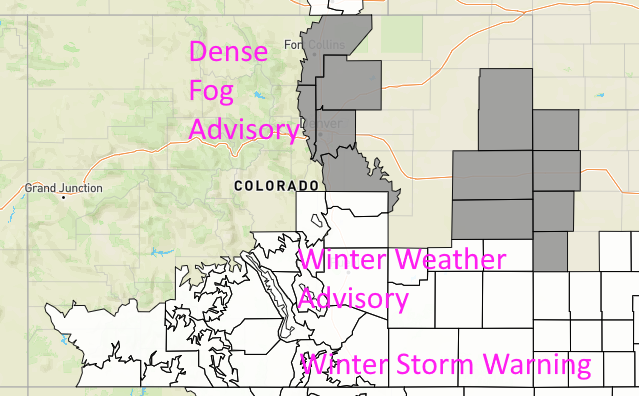
...DENSE FOG ADVISORY IN EFFECT UNTIL 10 AM MST THIS MORNING...

* WHAT...Visibility less than a quarter mile in dense fog.

* WHERE...Fort Collins, Boulder and the western suburbs of Denver,
Denver, Castle Rock, and Greeley.

* WHEN...Until 10 AM MST this morning.

* IMPACTS...Low visibility could make driving conditions hazardous.

PRECAUTIONARY/PREPAREDNESS ACTIONS...

If driving, slow down, use your headlights, and leave plenty of
distance ahead of you.

figure1u_12142023
Figure 1 update: the current advisory, watch, and warning map from the NWS and weatherunderground.com

End Thrusday update.

Forecast Discussion:

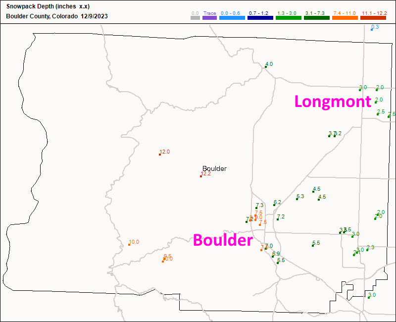
I called for 0-1 inch around Longmont and we got 2-3 inches last night (Figure 1). My forecast was a bust, but that is more moisture for us (about 0.20 inch).

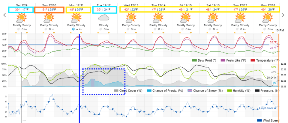
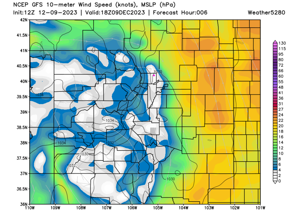
Winds coming off the Rockies will be pretty high today out on the Plains (Figure 3). With the downslope flow, we'll warm to the 50's Sunday (Figure 2). A cold front arrives Monday evening (blue line) bringing a wimpy chance of precipitation along I-25 (blue dotted box).

figure1_12092023
Figure 1: the 7am snowfall reports from CoCoRaHS for Boulder Co.
figure2_12092023
Figure 2: the 10 day graphical forecast for Longmont from weatherunderground.com
figure3_12092023
Figure 3: the wind speed forecast from the GFS and weathe5280.com for noon Saturday.

The Longer Range Forecast:

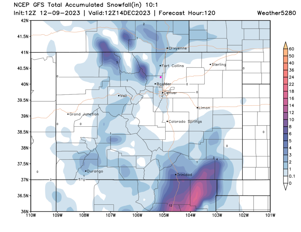
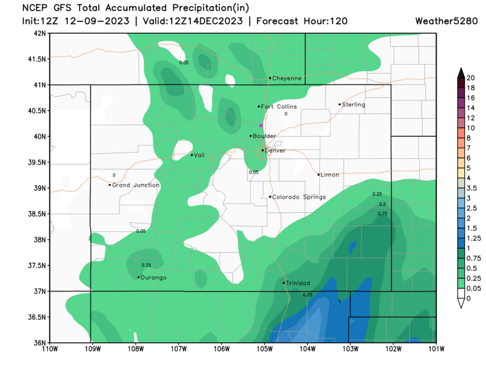
Beyond that system, it looks like the weather gets quite quiet with slightly above normal temperatures (Figure 2). Snowfall over the next 5 days will be confined to north central Colorado, central, and southeast Colorado (Figure 4). The precipitation map shows that what does fall will be mainly as snow (Figure 5).

figure4_12092023
Figure 4: the 10:1 snowfall ratio forecast for the next 5 days from the GFS and weather5280.com
figure5_12092023
Figure 5: the precipitation forecast for the next 5 days from the GFS and weather5280.com


About the Author: John Ensworth

John Ensworth used to work from Longmont as the PI for the NASA through the IGES (The Institute for Global Environmental Strategies). He now teaches technology, algebra, astronomy, meteorology, film school, and Lego robotics to middle/high school.
Read more


Comments


Current Weather

Cloudy

Cloudy

69°F

UV Index
1 Low
Pressure
30.21 Steady
Visibility
8 miles
Dewpoint
48 °F
Humidity
46%
Wind
E 2.9 mph
Gust
6.5 mph
Wind Chill
69 °F

Hourly Forecast

Today
5 PM
70°F
Cloudy
Today
6 PM
68°F
Mostly cloudy w/ t-storms
Today
7 PM
65°F
Intermittent clouds
Today
8 PM
61°F
Intermittent clouds
Today
9 PM
60°F
Intermittent clouds
Today
10 PM
58°F
Intermittent clouds
Today
11 PM
57°F
Intermittent clouds
Tomorrow
12 AM
56°F
Mostly cloudy w/ t-storms
Tomorrow
1 AM
55°F
Intermittent clouds
Tomorrow
2 AM
54°F
Cloudy
Tomorrow
3 AM
53°F
Cloudy
Tomorrow
4 AM
53°F
Cloudy

7 Day Forecast

Partly sunny w/ t-storms

Tuesday

78 °F

Not as warm with times of clouds and sun; a thunderstorm or two this afternoon; thunderstorms can bring gusty winds, hail and localized flooding


Mostly cloudy w/ t-storms

Tuesday Night

50 °F

A thunderstorm this evening; otherwise, increasing clouds


Mostly cloudy w/ t-storms

Wednesday

73 °F

Some sun, then turning cloudy with a couple of thundershowers in the afternoon


Partly cloudy w/ t-storms

Wednesday Night

50 °F

A couple of showers and a thunderstorm in the evening; otherwise, clearing


Mostly sunny

Thursday

74 °F

Mostly sunny and pleasant


Clear

Thursday Night

45 °F

Clear


Sunny

Friday

81 °F

Plenty of sunshine


Partly cloudy

Friday Night

47 °F

Partly cloudy


Mostly sunny

Saturday

85 °F

Mostly sunny


Clear

Saturday Night

53 °F

Clear


Sunrise and Sunset

Sunrise
6:42 AM
Sunset
7:08 PM

Based on AccuWeather data