Skip to content
Join our Newsletter

The Front Range Forecast: Snow totals, rain this week, then heat

In Brief:

The week starts cool and wet then the heat returns.

Forecast Discussion:

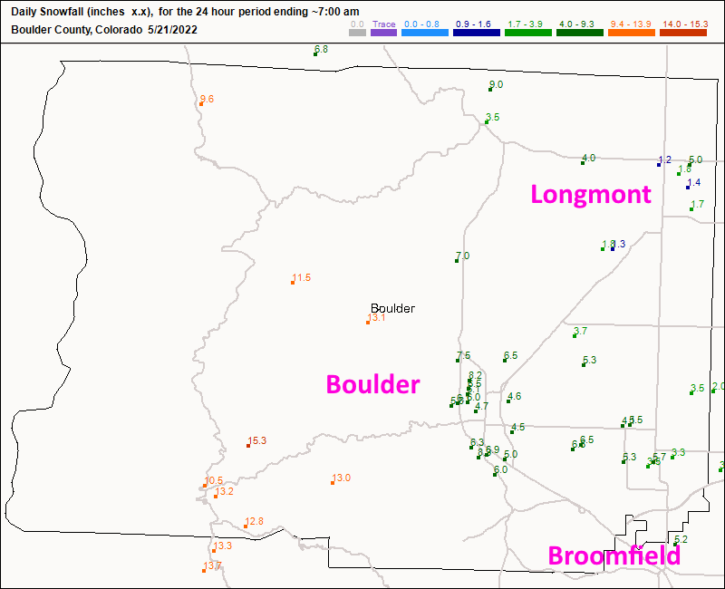
The snowfall reports are coming in (as of 7am) while the storm seems to have ended earlier than expected. Longmont received about 1.5 inches (though there are a couple of higher reports, 4 and 5 inches, I'm not sure about those- Figure 1). Boulder received 5-7 inches.  Broomfield got about 5-6 inches. Most locations received about 3/4th of an inch of water.

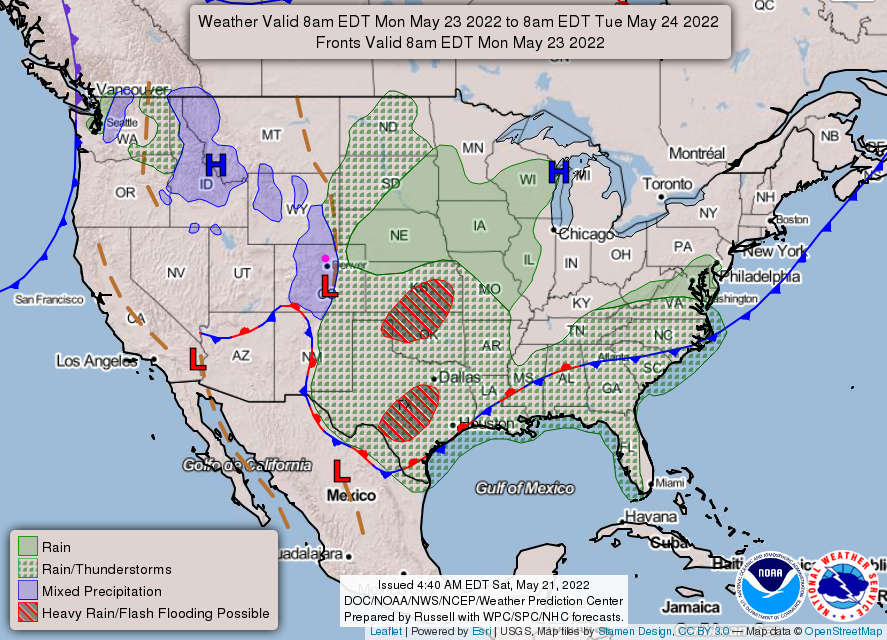
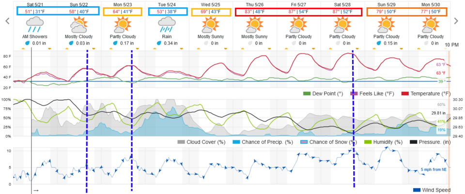
Our next front arrives Sunday afternoon followed by some low elevation rain (about a quarter inch) and mountain snows (Figure 2 and 3).


Figure0_05212022
Figure 1: the snowfall totals from CoCoRaHS as of Saturday 7am.
Figure1_05212022
Figure 2: the 10 day graphical forecast for Denver from weatherunderground.com
Figure2_05212022
Figure 3: the surface analysis map for Sunday from NOAA.

The Longer Range Forecast:

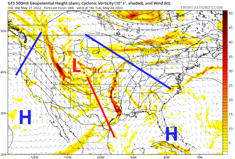
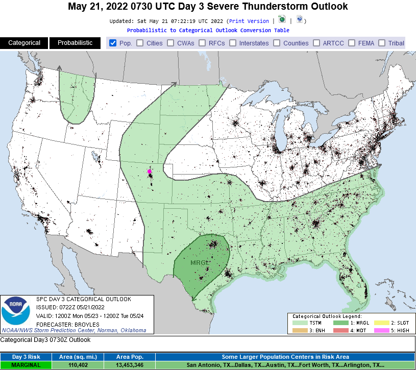
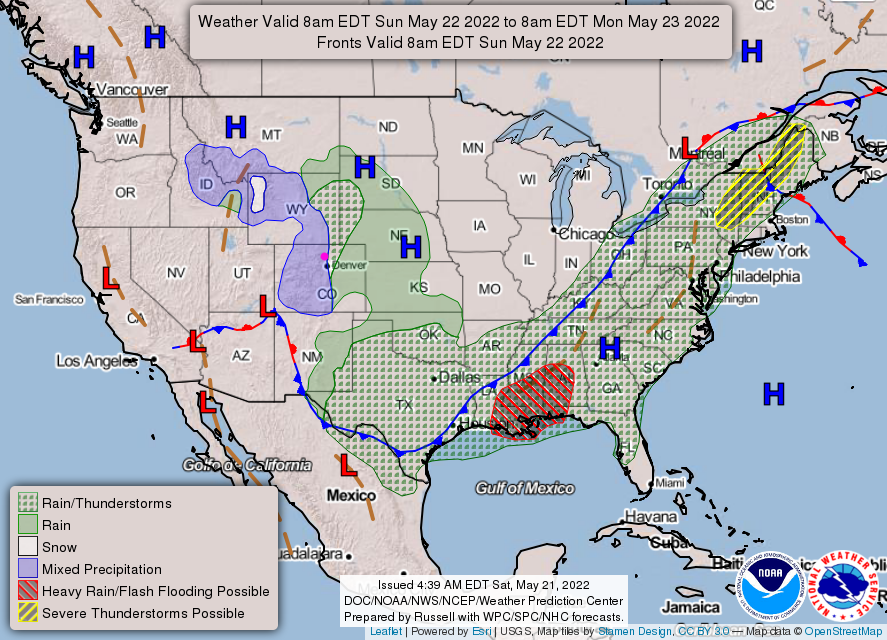
Yet another front arrives Monday afternoon with maybe 1/3 ro 1/2 inch of rain (Figure 2 and 5). This is driven by another healthy upper air trough (Figure 4). There is thunder possible with both Sunday's and Monday's fronts (Figure 6).

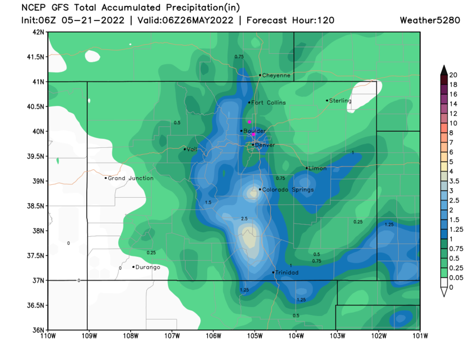
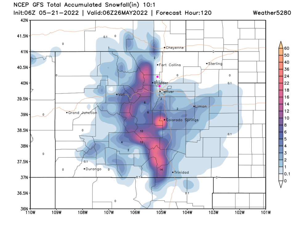
Over the next 5 days, Longmont should see about 3/4th inch of rain.  Broomfield should do better and top an inch. I-25 north of Denver should remain snow free, but the nearby mountains will get buried (Figure 7).

The heat really returns Thursday through Saturday until a Saturday front cools us a bit and brings back a few thunderstorms.

Figure4_05212022
Figure 4: the 500mb map for Tuesday from the GFS and tropicaltidbits.com
Figure5_05212022
Figure 5: the surface analysis map for Monday from NOAA.
Figure3_05212022
Figure 6: the severe and thunderstorm forecast for Monday from the SPC.
Figure6_05212022
Figure 7: the 5 day precipitation total forecast from the GFS and weather5280.com
Figure7_05212022
Figure 7: the 5 day snowfall total forecast from the GFS and weather5280.com


About the Author: John Ensworth

John Ensworth used to work from Longmont as the PI for the NASA through the IGES (The Institute for Global Environmental Strategies). He now teaches technology, algebra, astronomy, meteorology, film school, and Lego robotics to middle/high school.
Read more


Comments


Current Weather

Mostly cloudy

Mostly cloudy

44°F

UV Index
0 Low
Pressure
29.73 Rising
Visibility
8 miles
Dewpoint
40 °F
Humidity
86%
Wind
NNE 5.9 mph
Gust
14.3 mph
Wind Chill
41 °F

Hourly Forecast

Today
9 PM
45°F
Showers
Today
10 PM
45°F
Cloudy
Today
11 PM
45°F
Cloudy
Tomorrow
12 AM
45°F
Cloudy
Tomorrow
1 AM
45°F
Cloudy
Tomorrow
2 AM
45°F
Cloudy
Tomorrow
3 AM
45°F
Cloudy
Tomorrow
4 AM
45°F
Cloudy
Tomorrow
5 AM
45°F
Cloudy
Tomorrow
6 AM
45°F
Cloudy
Tomorrow
7 AM
47°F
Cloudy
Tomorrow
8 AM
52°F
Cloudy

7 Day Forecast

Partly sunny w/ t-storms

Wednesday

74 °F

Cooler with sunshine giving way to clouds, becoming windy this afternoon with heavy thunderstorms; gusty winds and small hail can accompany any downpour


Cloudy

Wednesday Night

45 °F

An evening shower in the area; otherwise, overcast


Intermittent clouds

Thursday

68 °F

Windy with intervals of clouds and sunshine


Mostly cloudy

Thursday Night

46 °F

Overcast in the evening, then partly cloudy late


Intermittent clouds

Friday

73 °F

Beautiful with times of clouds and sun


Mostly cloudy

Friday Night

44 °F

Mostly cloudy


Mostly cloudy

Saturday

75 °F

Mostly cloudy


Intermittent clouds

Saturday Night

45 °F

Clearing


Mostly cloudy w/ showers

Sunday

71 °F

Turning cloudy with a couple of showers in the afternoon


Mostly cloudy

Sunday Night

44 °F

A thunderstorm in parts of the area in the evening; otherwise, mostly cloudy


Sunrise and Sunset

Sunrise
5:46 AM
Sunset
8:08 PM

Based on AccuWeather data