Skip to content

The Front Range Forecast: Spring Arrives with mid-week showers

In Brief:

Beautiful Spring-like weather with mid-week spring showers.

Forecast Discussion:

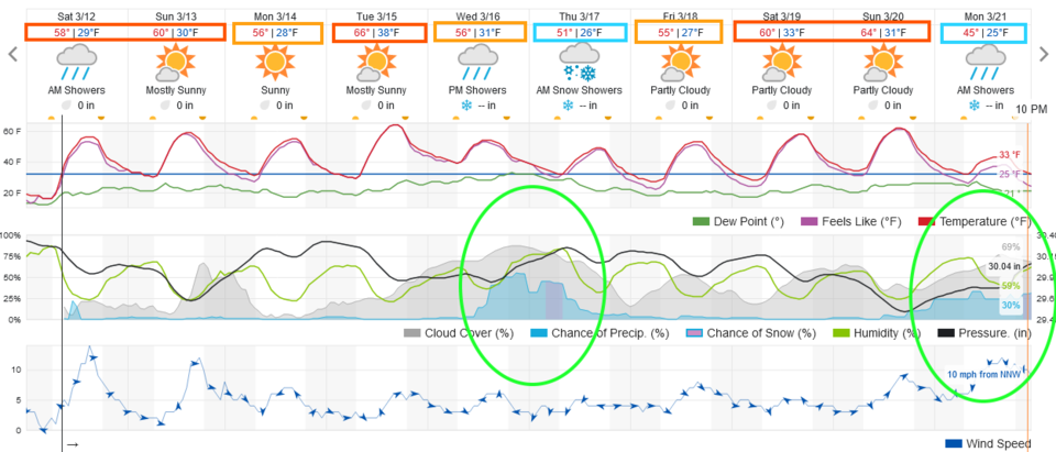
The first day of meteorological spring is March 1st.  The moment astronomical spring arrives is March 20th at 9:33 a.m. this year. The normal high today is 54F, the normal low is 26F. Temperatures rise to about 10 degrees above this.  It is going to be beautiful (especially if you have Spring Break this week- Figure 1).

Figure1_03122022
Figure 1: the 10 day graphical forecast for Denver from weatherunderground.com

The Long Range Forecast:

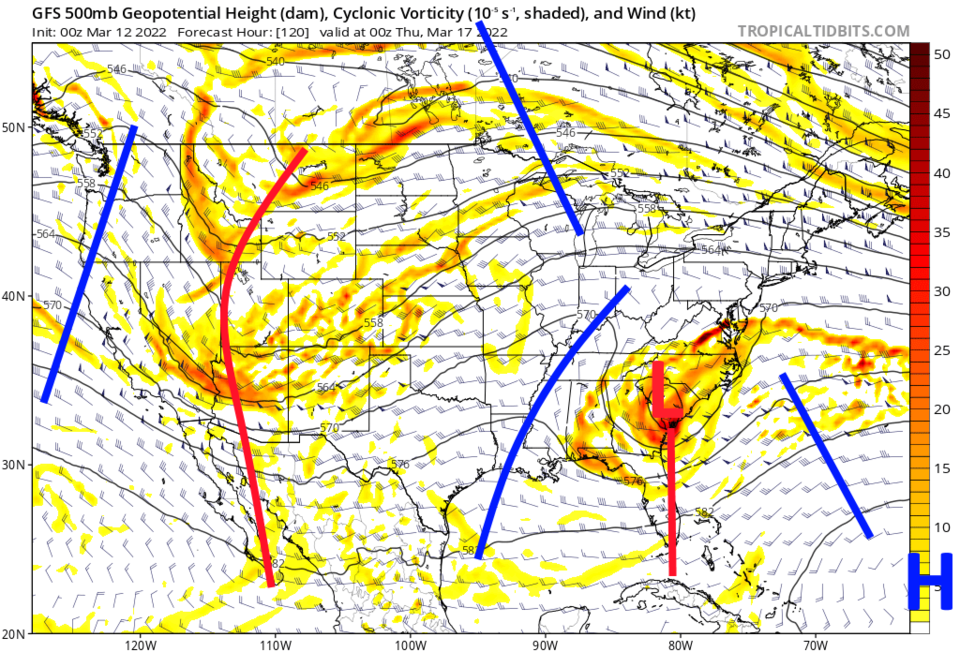
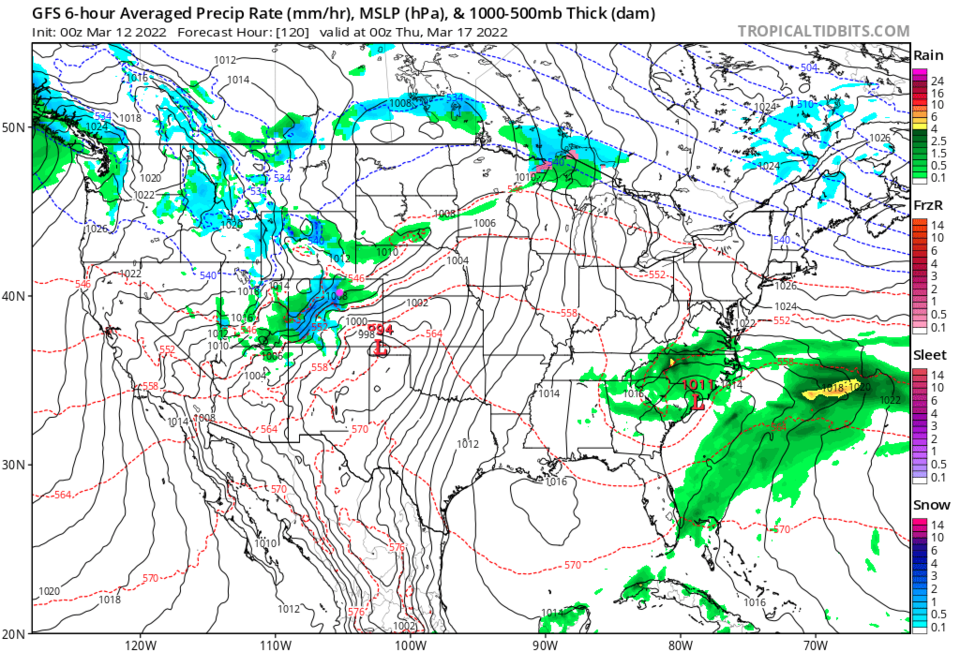
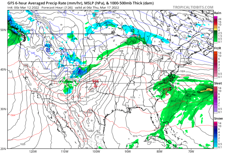
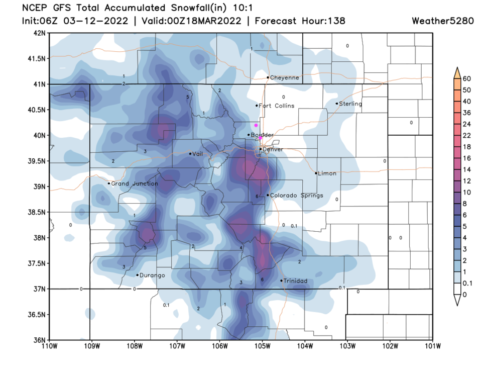
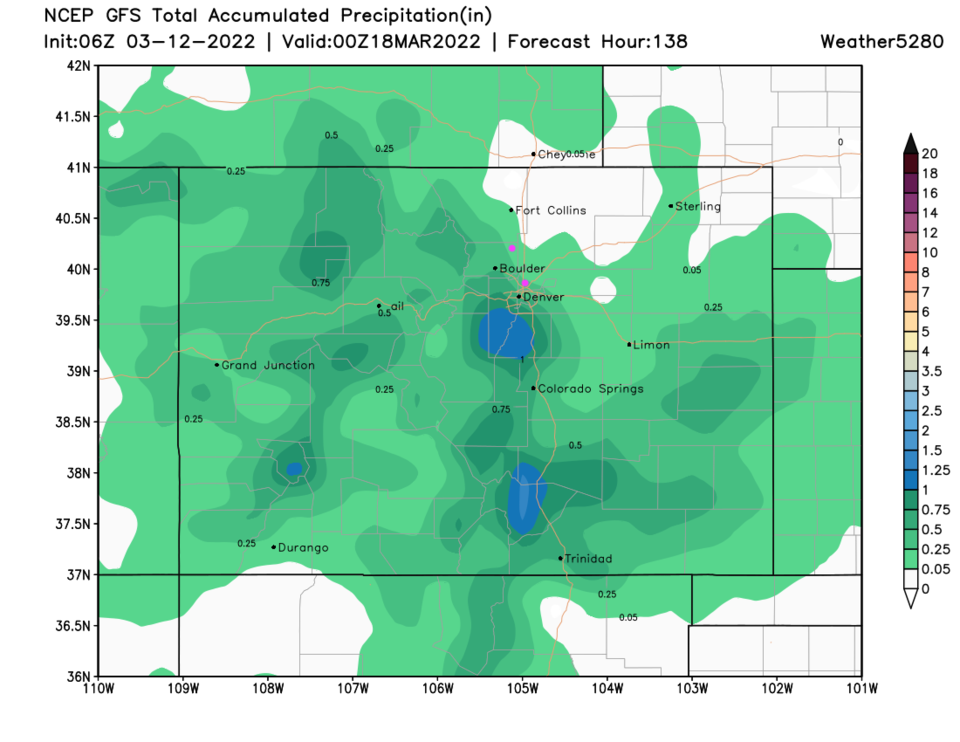
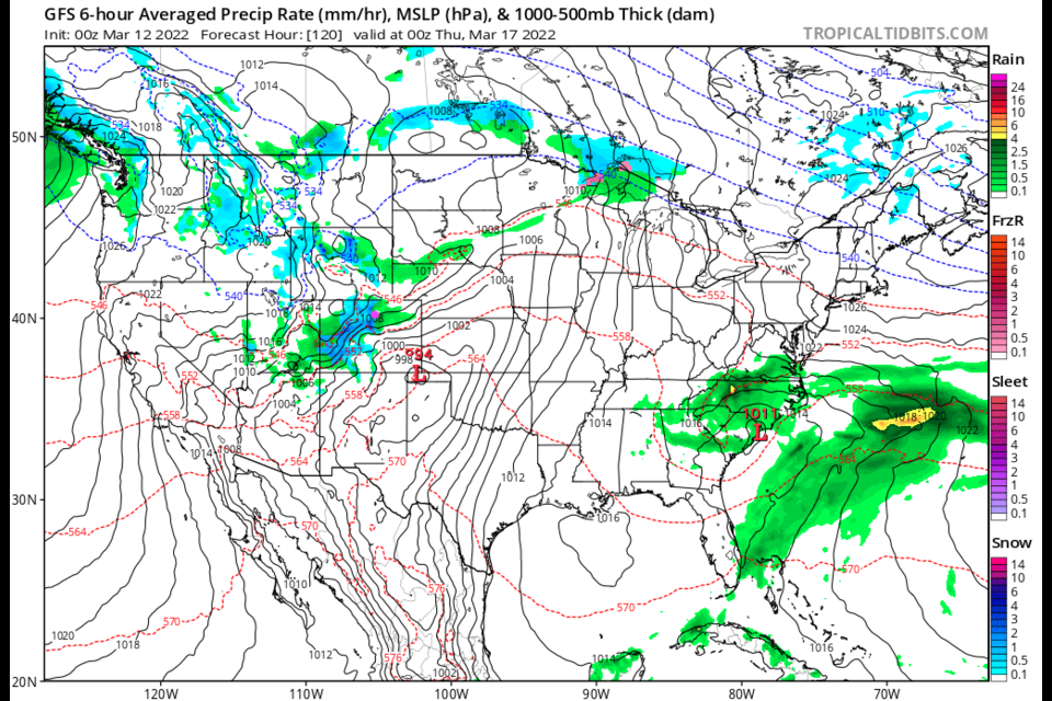
A broad trough approaches Colorado Wednesday bringing cool (not cold) air and our next system (Figure 2). It begins with mountain snows and low-land rain (Figure 3). Later in the evening, it just gets cool enough from some snow on the plains (Figure 4). Areas north and east of Denver may not see anything but a dusting of snow.  Some good snow amounts will pile up in the mountains southwest of Denver (Figure 5). Total moisture from Longmont to Broomfield looks like it will come in at between 0.05 and 0.25 inch of water (Figure 6).  Then we warm up again (Figure 1)!

Figure2_03122022
Figure 2: the 500mb upper air weather map Wednesday PM from tropicaltidbits.com
Figure3_03122022
Figure 3: the 6 hour precipitation surface weather map Wednesday evening from tropicaltidbits.com


Figure4_03122022
Figure 4: the 6 hour precipitation surface weather map Wednesday late night from tropicaltidbits.com
Figure5_03122022
Figure 5: the snowfall total forecast from the GFS through Thursday PM from weather5280.com
Figure6_03122022
Figure 6: the precipitation total forecast from the GFS through Thursday PM from weather5280.com


About the Author: John Ensworth

John Ensworth used to work from Longmont as the PI for the NASA through the IGES (The Institute for Global Environmental Strategies). He now teaches technology, algebra, astronomy, meteorology, film school, and Lego robotics to middle/high school.
Read more


Comments


Current Weather

Cloudy

Cloudy

50°F

UV Index
3 Moderate
Pressure
30.17 Steady
Visibility
8 miles
Dewpoint
27 °F
Humidity
40%
Wind
SE 3.4 mph
Gust
7.7 mph
Wind Chill
50 °F

Hourly Forecast

Today
12 PM
54°F
Mostly sunny
Today
1 PM
58°F
Mostly sunny
Today
2 PM
61°F
Partly sunny
Today
3 PM
63°F
Partly sunny
Today
4 PM
65°F
Intermittent clouds
Today
5 PM
66°F
Intermittent clouds
Today
6 PM
65°F
Intermittent clouds
Today
7 PM
63°F
Intermittent clouds
Today
8 PM
60°F
Mostly clear
Today
9 PM
57°F
Mostly clear
Today
10 PM
55°F
Mostly clear
Today
11 PM
52°F
Mostly clear

7 Day Forecast

Intermittent clouds

Saturday

66 °F

Not as warm with intervals of clouds and sunshine


Mostly clear

Saturday Night

39 °F

Clear to partly cloudy


Mostly cloudy

Sunday

77 °F

Mostly cloudy and warmer; breezy in the afternoon


Mostly cloudy

Sunday Night

45 °F

Rather cloudy; breezy late


Windy

Monday

60 °F

Very windy; cloudy and cooler


Intermittent clouds

Monday Night

43 °F

Partly cloudy


Intermittent clouds

Tuesday

62 °F

Times of clouds and sun; windy in the afternoon


Partly cloudy

Tuesday Night

36 °F

Partly cloudy


Intermittent clouds

Wednesday

60 °F

Times of clouds and sun


Intermittent clouds

Wednesday Night

35 °F

Partly cloudy


Sunrise and Sunset

Sunrise
5:55 AM
Sunset
7:59 PM

Based on AccuWeather data