Skip to content
Join our Newsletter

The Front Range Forecast: Spring plus some moisture

In Brief:

Spring marches on with showers returning mid-week.

Forecast Discussion:

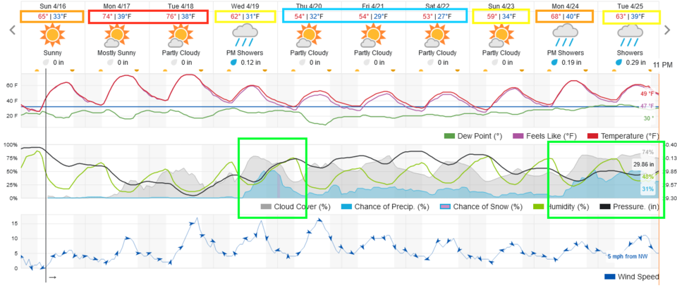
Our normal high temperature for this week is about 62F. We start the week somewhat above normal until a cold front arrives on Wednesday (Figure 1). 

figure1_04162023
Figure 1: the 10 day graphical forecast for Denver from weatherunderground.com

The Longer Range Forecast:

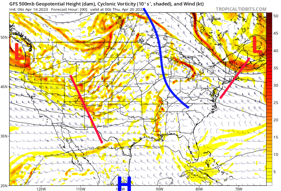
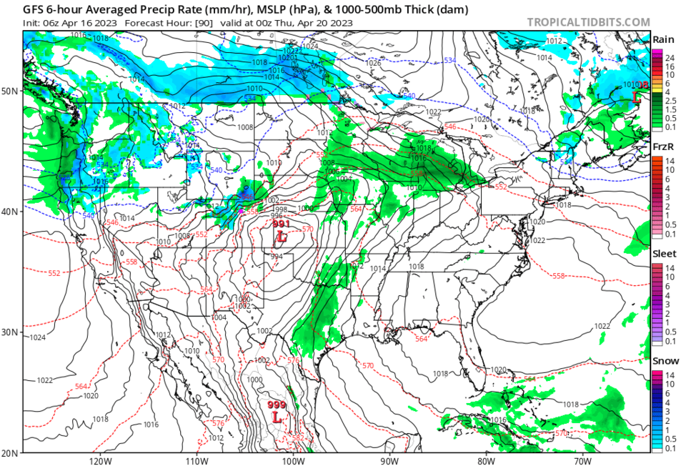
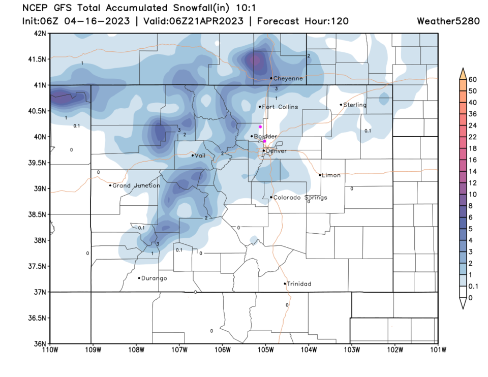
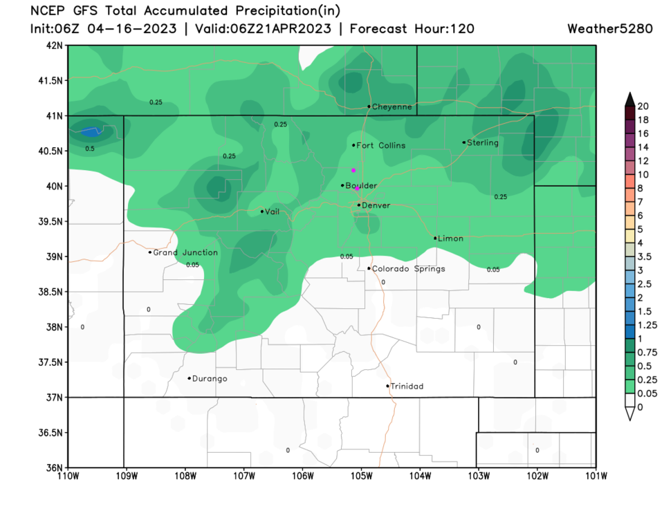
That cold front is driven down by an upper air trough (red line, Figure 2). We have a period of upslope flow behind a low slipping into Kansas (Figure 3). This should be a northern Colorado storm with a bit of nighttime snow along I-25 (Figure 4) and a bit of moisture north of Colorado Springs (Figure 5).

In the week beyond (Figure 1), we remain cool with chances of showers now and then.  More later!

figure2_04162023
Figure 2: the 500mb upper air map for Wednesday PM from the GFS and tropicaltidbits.com
figure3_04162023
Figure 3: the 6 hour precipitation map for Wednesday PM from the GFS and tropicaltidbits.com
figure4_04162023
Figure 4: the 5 day 10:1 ratio snow forecast from the GFS and weather5280.com
figure5_04162023
Figure 5: the 5 day precipitation forecast from the GFS and weather5280.com


About the Author: John Ensworth

John Ensworth used to work from Longmont as the PI for the NASA through the IGES (The Institute for Global Environmental Strategies). He now teaches technology, algebra, astronomy, meteorology, film school, and Lego robotics to middle/high school.
Read more


Comments


Current Weather

Mostly clear

Mostly clear

64°F

UV Index
0 Low
Pressure
30.04 Rising
Visibility
8 miles
Dewpoint
53 °F
Humidity
67%
Wind
NNE 2.2 mph
Gust
4.4 mph
Wind Chill
64 °F

Hourly Forecast

Today
11 PM
61°F
Partly cloudy
Tomorrow
12 AM
59°F
Partly cloudy
Tomorrow
1 AM
57°F
Partly cloudy
Tomorrow
2 AM
56°F
Partly cloudy
Tomorrow
3 AM
55°F
Partly cloudy
Tomorrow
4 AM
54°F
Partly cloudy
Tomorrow
5 AM
53°F
Intermittent clouds
Tomorrow
6 AM
53°F
Intermittent clouds
Tomorrow
7 AM
54°F
Intermittent clouds
Tomorrow
8 AM
56°F
Partly sunny
Tomorrow
9 AM
59°F
Partly sunny
Tomorrow
10 AM
61°F
Partly sunny

7 Day Forecast

Mostly cloudy

Friday

82 °F

Thickening clouds


Intermittent clouds

Friday Night

53 °F

Partly cloudy


Mostly cloudy w/ showers

Saturday

68 °F

Cooler with some sun, then increasing clouds; occasional rain and a thunderstorm in the afternoon


Rain

Saturday Night

51 °F

Overcast with occasional rain and a thunderstorm


Thunderstorms

Sunday

63 °F

Cool; a morning shower in spots followed by a couple of thunderstorms in the afternoon; thunderstorms can bring hail and damaging winds


Thunderstorms

Sunday Night

49 °F

A thunderstorm in the area in the evening; otherwise, low clouds


Thunderstorms

Monday

60 °F

Cloudy and cool; an afternoon thunderstorm in the area


Dreary

Monday Night

47 °F

An evening thunderstorm in parts of the area; otherwise, low clouds


Intermittent clouds

Tuesday

72 °F

Warmer with times of clouds and sun; a thundershower in the afternoon


Partly cloudy

Tuesday Night

48 °F

Partly cloudy


Sunrise and Sunset

Sunrise
5:38 AM
Sunset
8:16 PM

Based on AccuWeather data