Skip to content
Join our Newsletter

The Front Range Forecast: Spring showers and warm

In Brief:

Warmth, mountains, and atmospheric moisture bring wandering afternoon showers.

The Forecast Discussion:

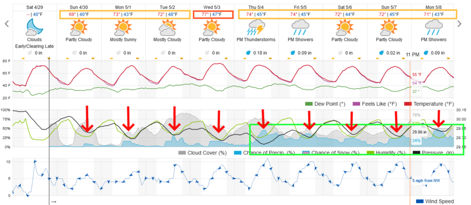
The normal high temperatures over this week rise from the mid-60's to the upper 60's.  The highs this week will hover, warmly, in the 70's. There is an increasing supply of moisture over the region allowing daytime heating to kick off a slowly increasing chance of afternoon thunderstorms (red arrows in Figure 1).

figure1_04302023
Figure 1: the 10 day graphical forecast for Denver from weatherunderground.com

The Longer Range Forecast:

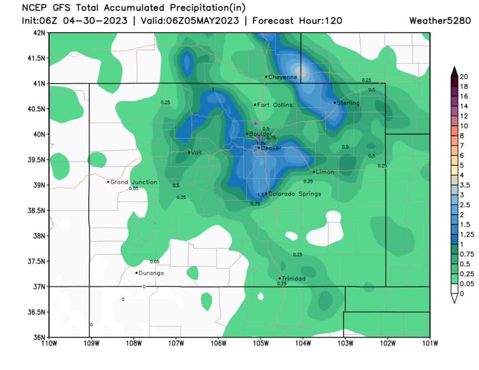
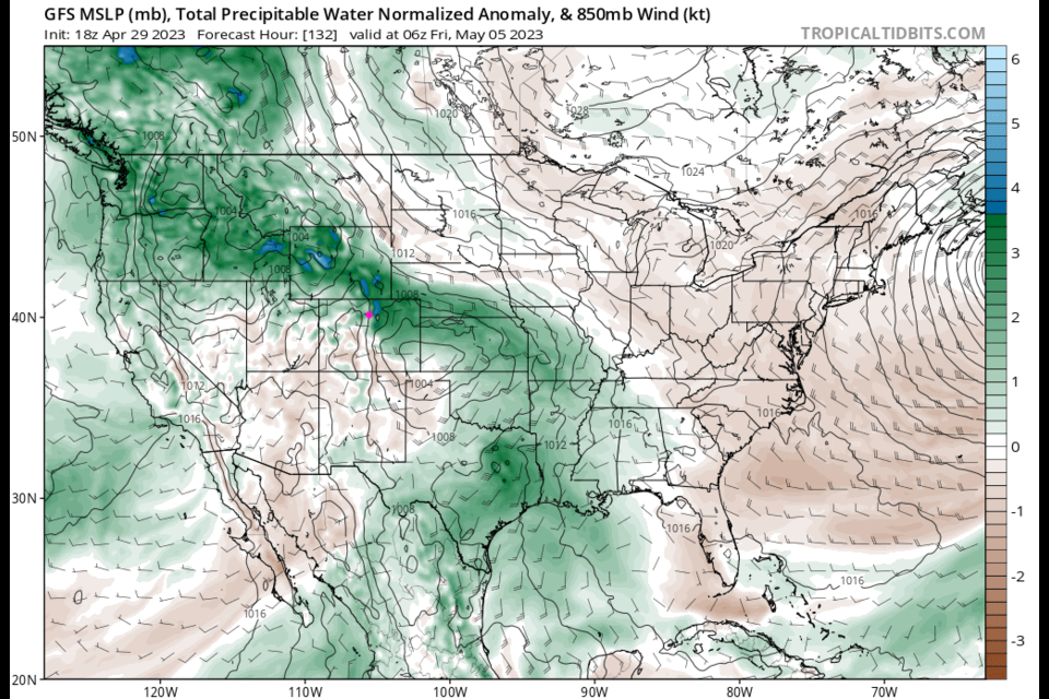
A cutoff low drifts towards Colorado later in the week (the red L in Figure 2). This pushes more moisture into Colorado (green shading in Figure 3). This will allow for more precipitation coverage and thunderstorm formation (Figure 4). We'll have to keep our eyes open for a chance for severe weather later in the week - this is the right season for it.

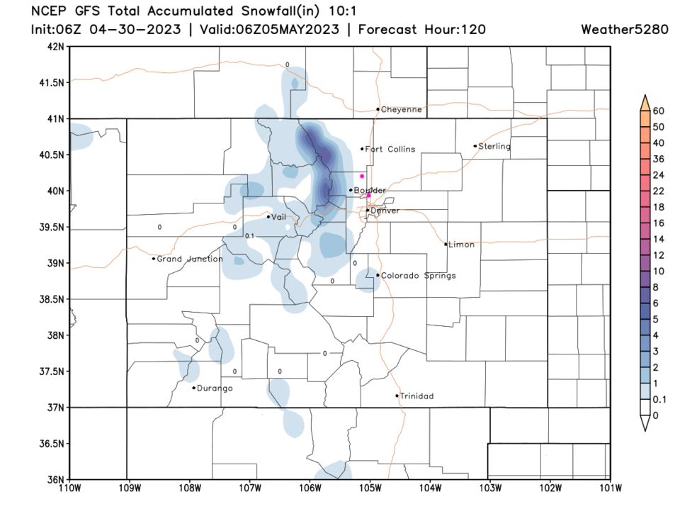
The GFS gives the Front Range mountains and areas south of Denver some good precipitation this week (Figure 5).  The random nature of the storms will make this map look different every day. Just for fun, you can see how little snow we'll get over the next 5 days (Figure 6).  Enjoy the Spring!

figure2_04302023
Figure 2: the 500mb upper air map for Thursday PM from the GFS and tropicaltidbits.com
figure3_04302023
Figure 3: the precipitatable water map for Thursday PM from the GFS and tropicaltidbits.com
figure4_04302023

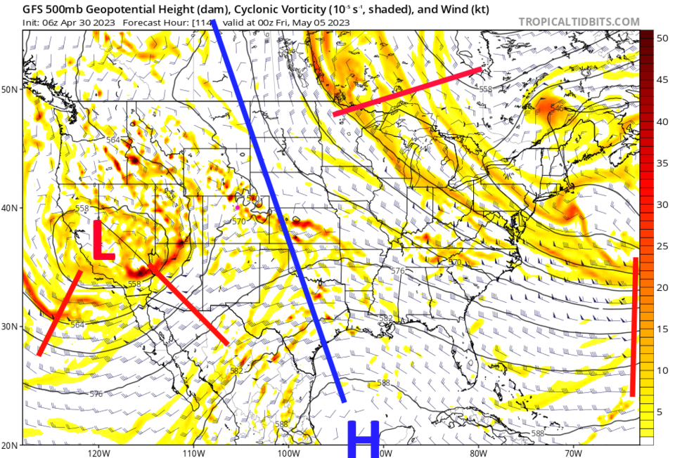
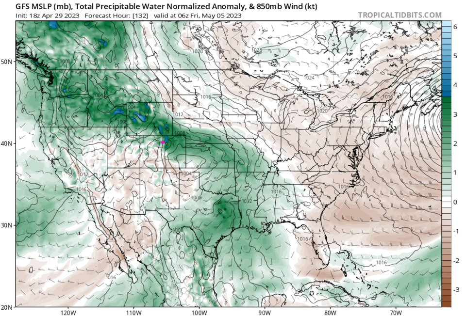
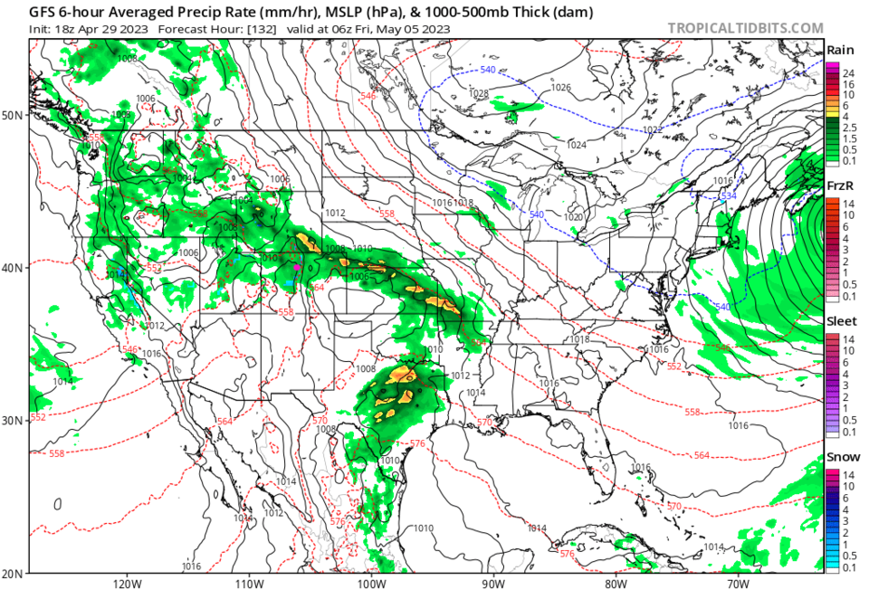
Figure 4: the precipitation map for Thursday PM from the GFS and tropicaltidbits.com
figure5_04302023
Figure 5: the 5 day precipitation forecast from the GFS and weather5280.com
figure6_04302023
Figure 6: the 5 day 10:1 snowfall forecast from the GFS and weather5280.com


About the Author: John Ensworth

John Ensworth used to work from Longmont as the PI for the NASA through the IGES (The Institute for Global Environmental Strategies). He now teaches technology, algebra, astronomy, meteorology, film school, and Lego robotics to middle/high school.
Read more


Comments


Current Weather

Mostly cloudy

Mostly cloudy

51°F

UV Index
0 Low
Pressure
30.09 Steady
Visibility
8 miles
Dewpoint
37 °F
Humidity
58%
Wind
SE 2.2 mph
Gust
5.4 mph
Wind Chill
51 °F

Hourly Forecast

Today
3 AM
49°F
Showers
Today
4 AM
47°F
Mostly clear
Today
5 AM
45°F
Mostly clear
Today
6 AM
43°F
Mostly sunny
Today
7 AM
47°F
Mostly sunny
Today
8 AM
52°F
Mostly sunny
Today
9 AM
57°F
Mostly sunny
Today
10 AM
62°F
Sunny
Today
11 AM
67°F
Mostly sunny
Today
12 PM
70°F
Mostly sunny
Today
1 PM
73°F
Mostly sunny
Today
2 PM
75°F
Mostly sunny

7 Day Forecast

Partly sunny w/ showers

Tuesday

70 °F

Partly sunny, becoming breezy in the afternoon with a brief shower or two


Partly cloudy w/ showers

Tuesday Night

43 °F

Partly cloudy with a couple of brief showers beginning late evening


Mostly sunny

Wednesday

77 °F

Mostly sunny, becoming windier and warmer


Mostly clear

Wednesday Night

42 °F

Mainly clear


Mostly sunny

Thursday

77 °F

Sunny to partly cloudy and delightful


Mostly clear

Thursday Night

45 °F

Mainly clear


Partly sunny w/ t-storms

Friday

88 °F

Warmer with partial sunshine; a thundershower in the afternoon


Mostly cloudy

Friday Night

50 °F

Becoming cloudy; a thunderstorm in parts of the area in the evening followed by a shower in spots late


Partly sunny

Saturday

69 °F

Partial sunshine with a thunderstorm in a couple of spots; cooler


Rain

Saturday Night

51 °F

Mostly cloudy with occasional rain and a thunderstorm


Sunrise and Sunset

Sunrise
5:41 AM
Sunset
8:14 PM

Based on AccuWeather data