In Brief:
Rain totals and more weekend rain.
Friday update:
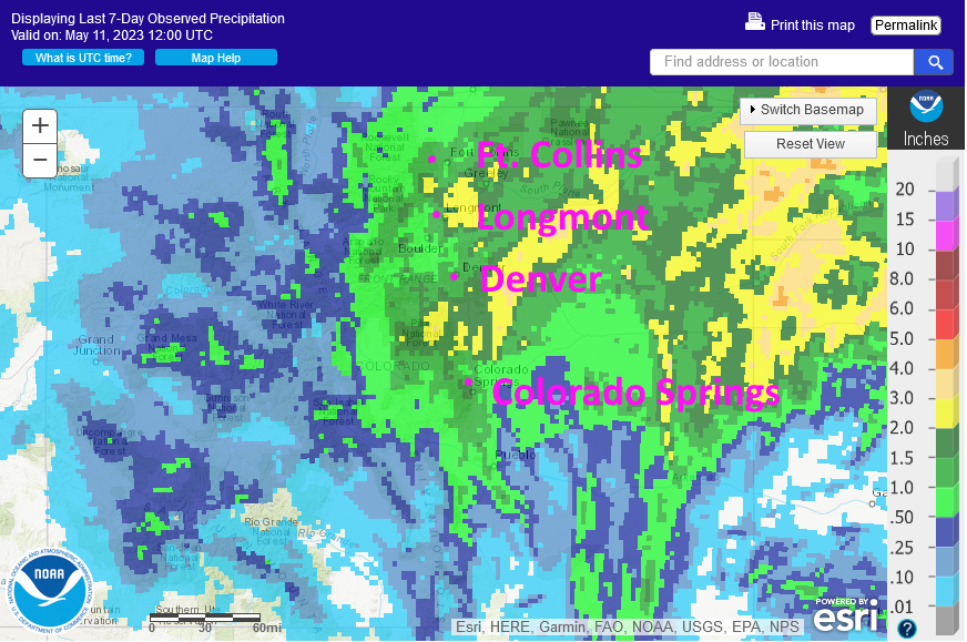
Storm totals are in. That WAS an impressively wet storm as the GFS predicted (good job GFS!). The yellow colors around I-25 are 2-3 inches of water. Many streams are at flood stage and ponding of water is visible in fields across the region (Figure 6 update).
Looking ahead, we might pick up another 1/3 to 3/4th inch of water with a period of upslope flow late Saturday night through early Monday morning. Keep your umbrella out!
End Friday update.
The Wednesday Update:
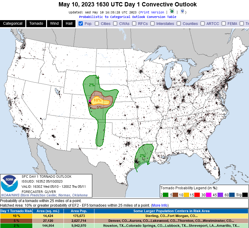
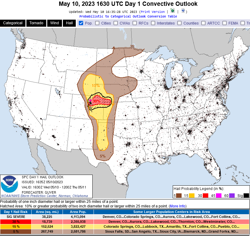
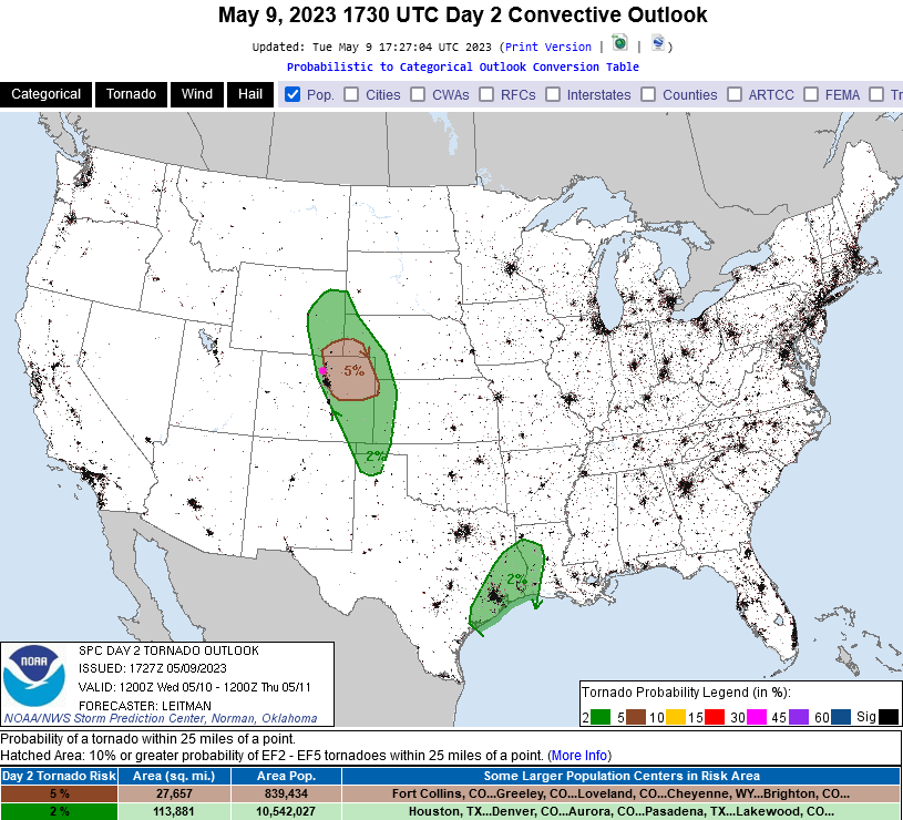
Severe weather chances have increased with an Enhanced (3 out of 5) risk of severe weather back to Denver and Broomfield and just a few miles to the southeast of Longmont. There is a 5-10% chance of a tornado within 25 miles of theses towns (Figure 4 update) and a 30% chance of 1 inch diameter hail or larger within 25 miles of these towns (Figure 5 update) this afternoon. Keep an eye on the sky, your apps, and the news! Be safe!
End Wednesday Update.
The Tuesday Update:
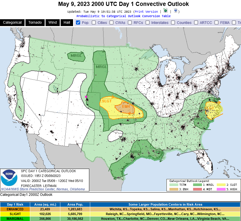
Our first real bout of severe weather is upon us. There is a Marginal risk (1 on a scale of 1-5 with 5 being the worst) of severe weather this afternoon and evening for communities around I-25 and eastward to Kansas. The primary risk around Longmont and Broomfield is for large damaging hail (Figure 1 update).
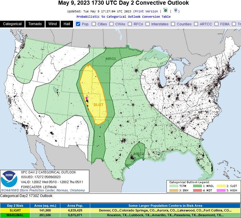
For Wednesday, the risk rises a significant amount to a Slight risk (2 out of 5 - Figure 2 update) with tornadoes, large hail, and strong damaging winds all a possibility. The tornado risk (Figure 3 update) is 5% chance of seeing a tornado within a 25 mile radius of any given point in the areas shaded in brown. The green shading is a 2% risk of a tornado within 25 miles.
Keep an eye on the western skies and your weather apps active with notifications turned on.
One more interesting note - the weatherunderground model give the I-25 corridor and areas east 1-2 inches of water by Friday noon. The GFS gives places 3-4 inches. It went WAY over the top on our last shot of rain, so I'm cautious about this. Flooding, especially on mountain burn scars, could be a problem with this much water and thunderstorms. The European model is sitting on 2-3 inches (splitting the difference). The Canadian gives us 1-2 inches of precipitation.
End Tuesday update.
The Forecast Discussion:
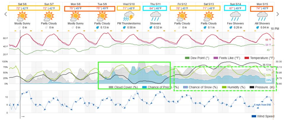
The weekend and week start will see a few storms popping up in the mountains each afternoon and a storm or two drifting out onto the plains. Rain chances are low until Tuesday (Figure 1).
The Longer Range Forecast:
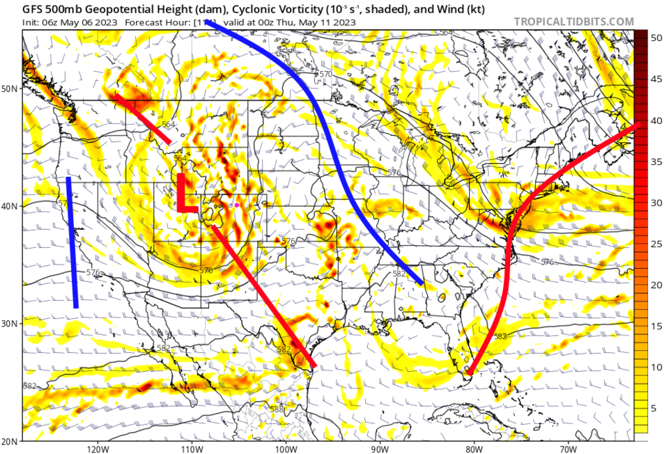
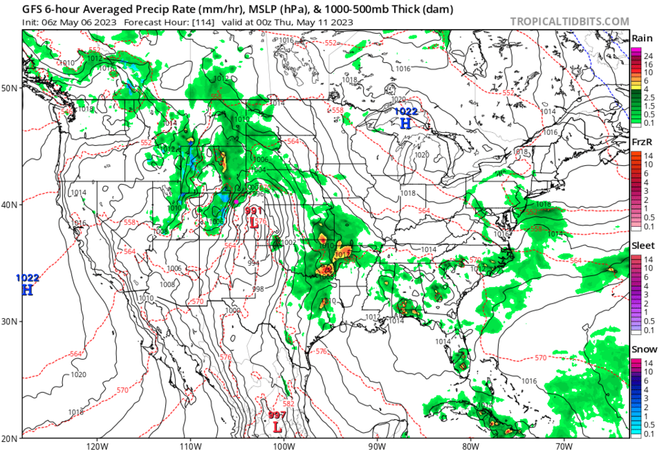
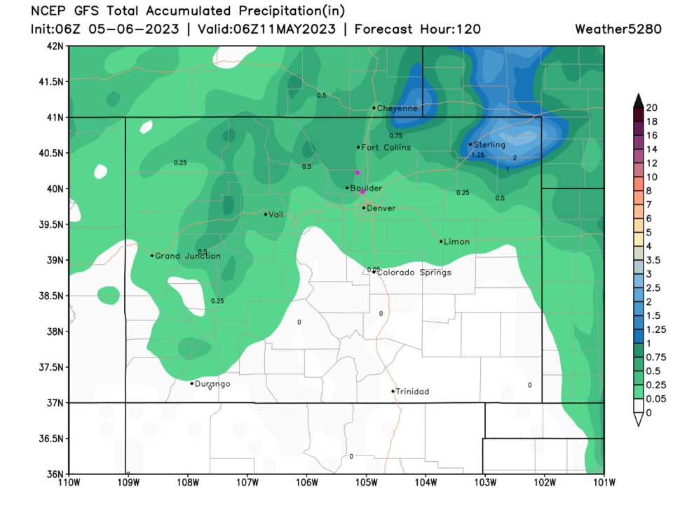
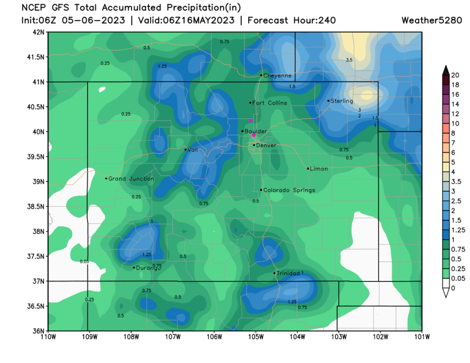
A trough in the upper atmosphere cuts off (circular flow) near Colorado by late Tuesday (Figure 2).The forecast for rain stretching for a number of days (Figure 1) depends on where the upper air and surface lows actually form (Figure 3). There is a potential for some good water or just a few shots of rain. I'll have to update the forecast in a few days. Currently, the GFS is dropping 0.25-0.5" over the next 5 days (Figure 4) and 0.5 to 1 inch over the next 10 days. There is also the potential for severe weather Wednesday. Stay tuned for updates!