In Brief:
Record heat this weekend, moisture returns Sunday PM.
Saturday update:
Storms take a break Saturday with record heat. We should see 101-102F today. The record is 98F set in 1989. Sunday, the record is 102F set in 2016. We might only get to 100-101F. Moisture returns some Sunday night. Expect to see a few more storms coming off the mountains.
We cool to around 90F for a few days with afternoon storms before near 100F highs return Wednesday-Friday.
End Saturday update.
Forecast Discussion:
Moisture is flowing into the state again. Storm motion is keeping most activity in the mountains Tuesday, but a surge of atmospheric water vapor will give us good afternoon storm chances Wednesday and Thursday (Figure 1).
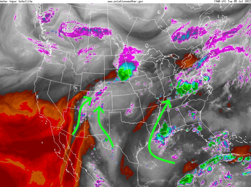
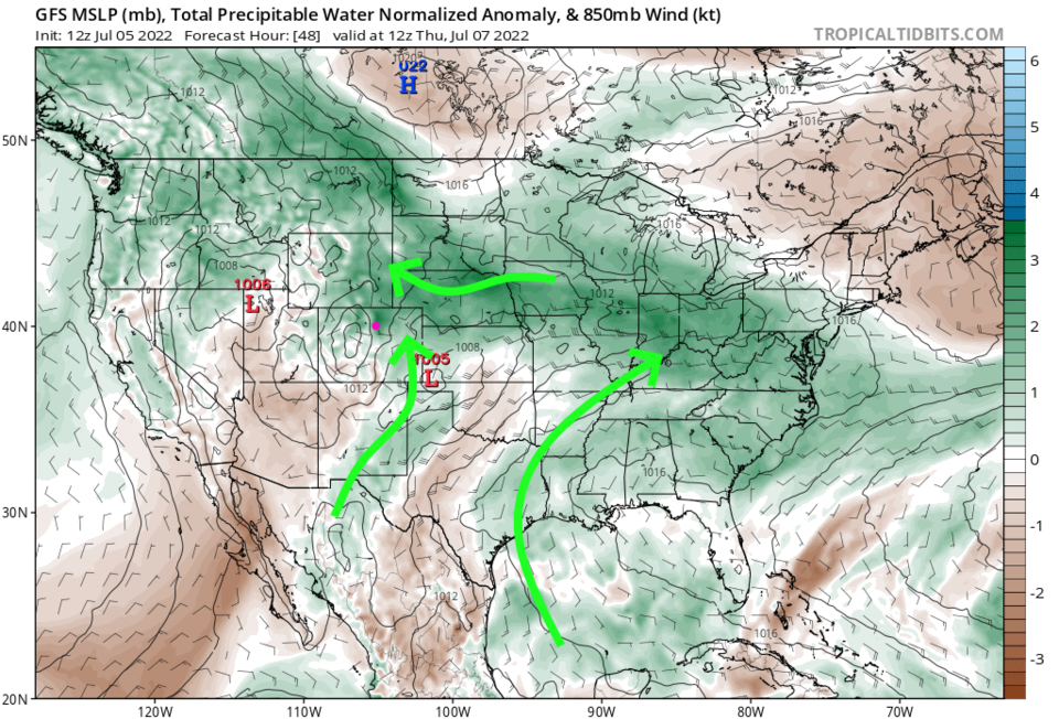
The moisture in place, now, can be seen in the grey/white colorations in Figure 2. I added arrows showing the flow into a few regions of the country. The GFS shows similar data in the forecast of precipitatable water anomaly map for Wednesday (Figure 2). There is an abnormal amount of water available for rain in the atmosphere over the northern half of the state (Figure 3).
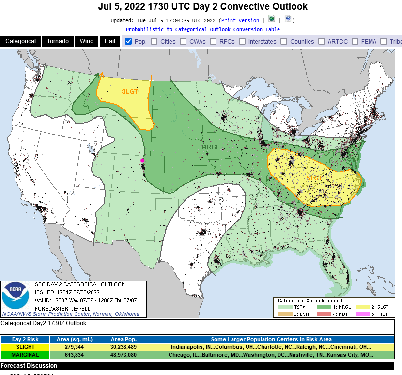
The heat and moisture available for the storms will be sufficient for a Marginal Risk of severe weather just east of I-25 on Wednesday. The primary threat is for strong damaging winds (Figure 4).
The Longer-Range Forecast:
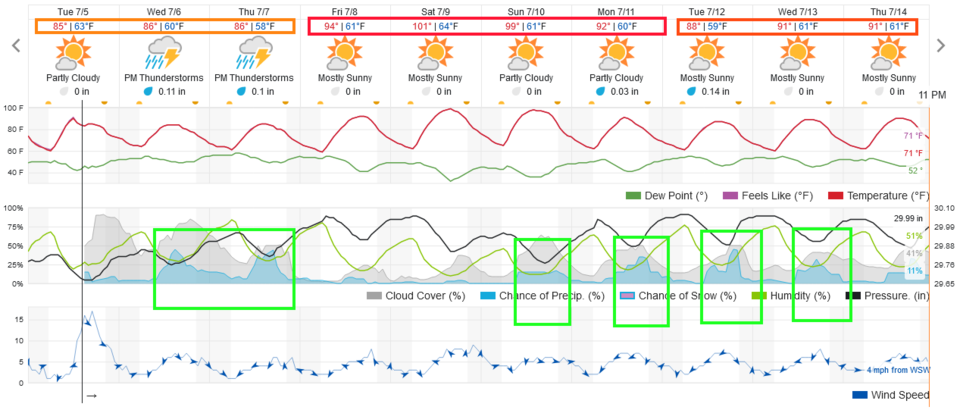
Figure 1 shows that we quickly dry out and heat to around 100F for the weekend. Get ready to roast.
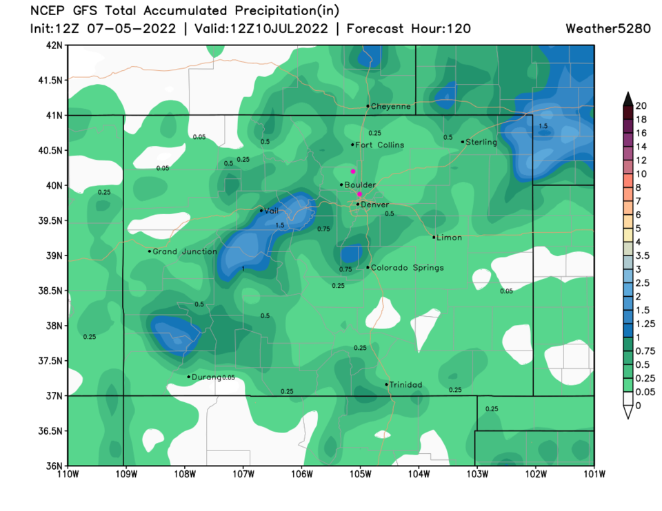
Next week, monsoonal moisture returns and afternoon storm chances begin to pick up beginning on Sunday afternoon. Most areas should receive beneficial moisture over the next five days (Figure 5).
Note, the typical peak of the North American monsoon moisture flow in Denver is mid-July to mid-August. This has started a number of weeks earlier than normal this year. Hurray for the moisture! Let's hope this helps water flow down the Colorado River as well.