Skip to content
Join our Newsletter

Sat UpdateThe Front Range Forecast: Monsoon and severe again

figure1_07292023
Figure 1 update: the severe weather update from the SPC and NOAA for Day 1-Saturday.

In Brief:

Summer heat, 'monsoon' storms. Some severe weather possible again.

Saturday Update:

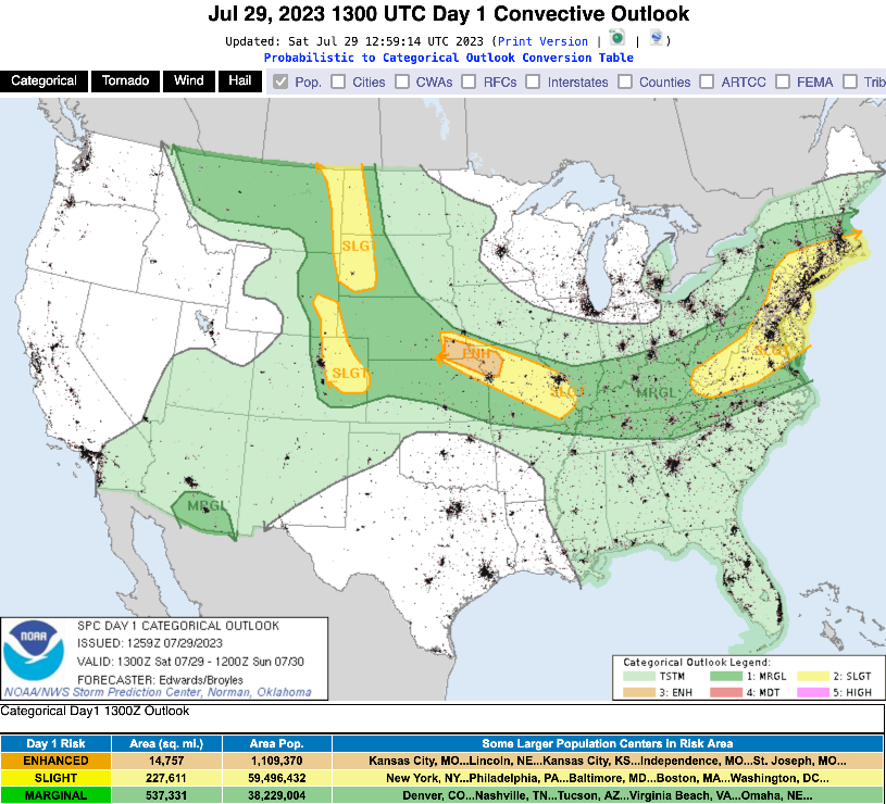
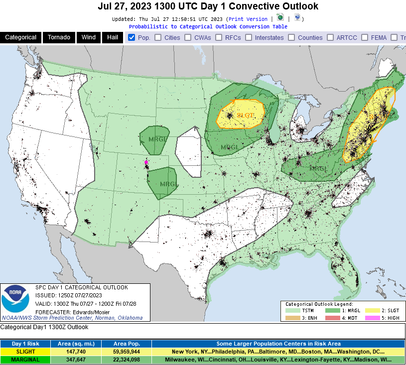
Moisture levels are good and winds are such that strong storms are possible again today along and east of I-25 (Figure 1).  There is a marginal risk of hail and high winds producing storms up into the mountains and a slight risk along I-25 and eastward (yellow coloring).

For Sunday and Monday, there is a Marginal risk down to around Ft. Collins.  Since these areas usually expand by the time we get to those days, be alert for more hail and high winds for the start of the week as well!

figure1_07292023
Figure 1 update: the severe weather update from the SPC and NOAA for Day 1-Saturday.

End Saturday update.

Forecast Discussion:

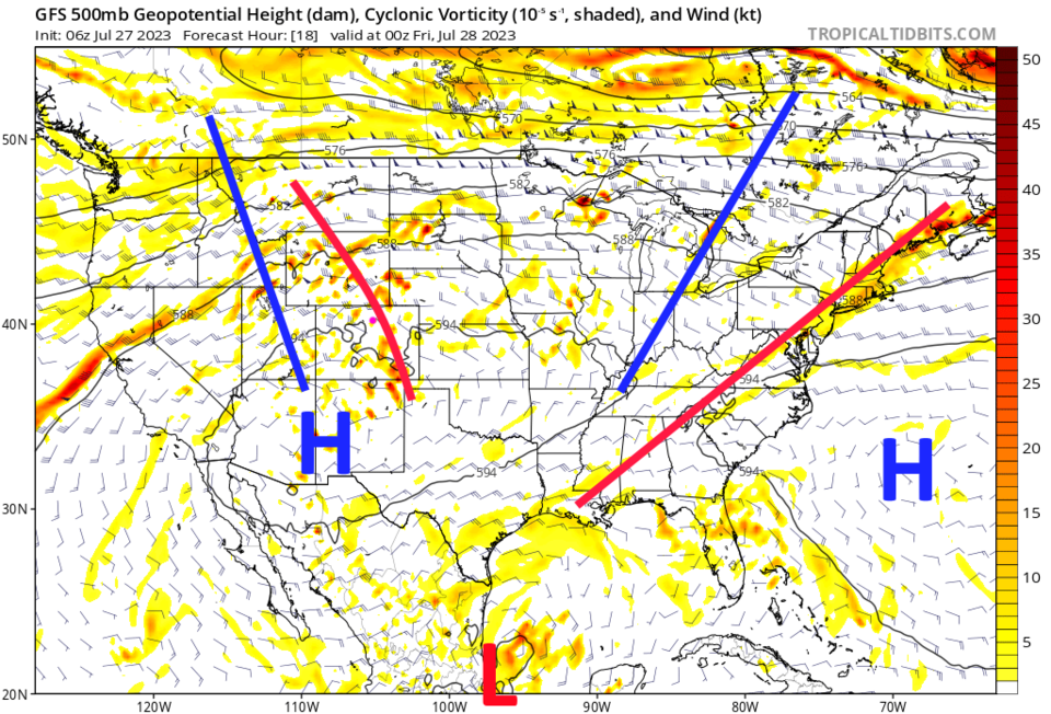
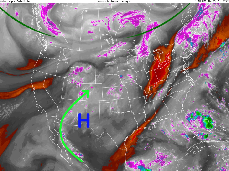
The ridge holds strong near the four corners area through the weekend. We'll see temperatures about 2-6 degrees above normal through Monday (Figure 1). On Thursday, the ridge is sitting just a bit to the south of that location and a trough is rippling over north side of the ridge over our state (red line - Figure 2). There is moisture (grey shading and arrows - Figure 3) flowing in from the tropics (the "North American monsoon" through some meteorologists don't like that term being used since this is a very different mechanism from the more famous Indian Monsoon.

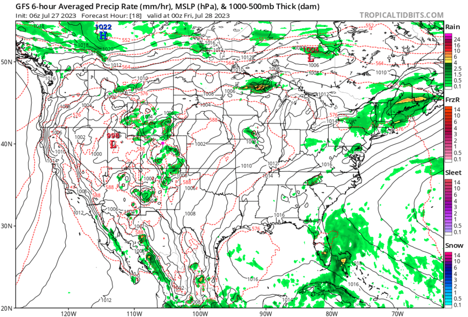
Storms will be fairly scattered across the state today (Figure 4). With the trough helping, there is a chance for severe weather in spots near the Front Range (Figure 5). Hail and high thunderstorms winds are the primary risk (still!!).

figure1_07272023
Figure 1: the 10 day graphical forecast for Denver from weatherunderground.com
figure2_07272023
Figure 2: the 500mb upper air map forecast from the GFS for Thursday from tropicaltidbits.com
figure3_07272023
Figure 3: the water vapor satellite image for Thursday AM from NOAA.
figure4_07272023
Figure 4: the surface precipitation forecast from the GFS and tropicaltidbits.com
figure5_07272023
Figure 5: the Thursday storm outlook from the SPC and NOAA.

The Longer Range forecast:

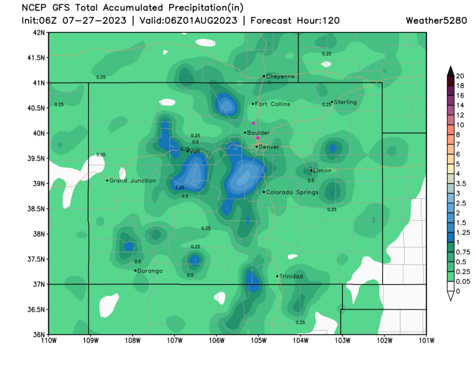
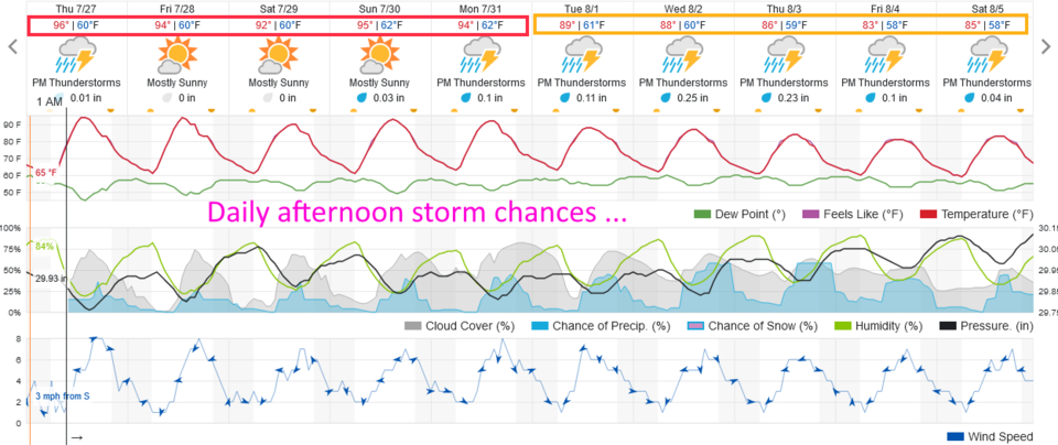
Going forward, there are afternoon storm chances every day.  Severe chances are low going forward. Most of the state should get a bit of rain with local areas getting over an inch if they get a direct hit of a slow moving storm (Figure 6).

figure6_07272023
Figure 6: the 5 day precipitation forecast for Center from weather5280.com


About the Author: John Ensworth

John Ensworth used to work from Longmont as the PI for the NASA through the IGES (The Institute for Global Environmental Strategies). He now teaches technology, algebra, astronomy, meteorology, film school, and Lego robotics to middle/high school.
Read more


Comments


Current Weather

Clear

Clear

62°F

UV Index
0 Low
Pressure
30.05 Rising
Visibility
6 miles
Dewpoint
46 °F
Humidity
55%
Wind
SSE 1.6 mph
Gust
3.9 mph
Wind Chill
62 °F

Hourly Forecast

Today
9 PM
61°F
Mostly clear
Today
10 PM
59°F
Mostly clear
Today
11 PM
58°F
Mostly clear
Tomorrow
12 AM
56°F
Mostly clear
Tomorrow
1 AM
55°F
Mostly clear
Tomorrow
2 AM
54°F
Mostly clear
Tomorrow
3 AM
53°F
Clear
Tomorrow
4 AM
52°F
Clear
Tomorrow
5 AM
51°F
Clear
Tomorrow
6 AM
50°F
Clear
Tomorrow
7 AM
53°F
Sunny
Tomorrow
8 AM
57°F
Sunny

7 Day Forecast

Partly sunny w/ showers

Sunday

73 °F

Brief morning showers; otherwise, clouds giving way to some sun


Clear

Sunday Night

49 °F

Clear


Partly sunny w/ t-storms

Monday

86 °F

Partly sunny and warmer; a thunderstorm around in the afternoon


Partly cloudy

Monday Night

52 °F

Partly cloudy


Partly sunny w/ t-storms

Tuesday

72 °F

Times of clouds and sun with a thunderstorm around in the afternoon


Mostly cloudy

Tuesday Night

50 °F

Increasing clouds


Mostly cloudy w/ t-storms

Wednesday

67 °F

Some sun, then turning cloudy with a couple of thundershowers in the afternoon


Clear

Wednesday Night

50 °F

Clear


Mostly sunny

Thursday

75 °F

Mostly sunny and pleasant


Clear

Thursday Night

47 °F

Clear


Sunrise and Sunset

Sunrise
6:40 AM
Sunset
7:11 PM

Based on AccuWeather data