In Brief:
Very warm weather, fire danger, showers at weeks end.
Forecast Discussion:
Sadly, I need to begin today's forecast with another Red Flag Fire warning:
Red Flag Warning (See Figure 1)
Issued: 3:37 AM Apr. 17, 2022 – National Weather Service
...RED FLAG WARNING REMAINS IN EFFECT FROM NOON TODAY TO 8 PM MDT THIS EVENING FOR WIND AND LOW RELATIVE HUMIDITY FOR THE INTERSTATE 25 CORRIDOR AND THE PALMER DIVIDE.
* Timing...Sunday, 12 PM to 8 PM.
* Winds...Northwest 15 to 25 mph with gusts up to 35 mph.
* Relative Humidity...As low as 14 percent.
* Impacts...Any fire that develops will have the potential to spread rapidly. Outdoor burning should be avoided, as well as any activity that may produce a spark and start a fast moving wildfire.
PRECAUTIONARY/PREPAREDNESS ACTIONS...
A Red Flag Warning means that critical fire weather conditions are either occurring now....or will shortly. A combination of strong winds...low relative humidity...and warm temperatures can contribute to extreme fire behavior.
___________________________________________________________
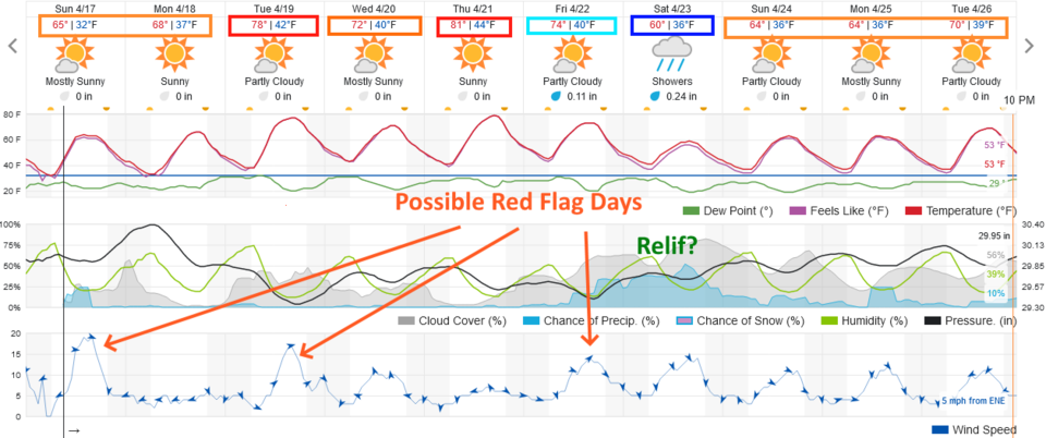
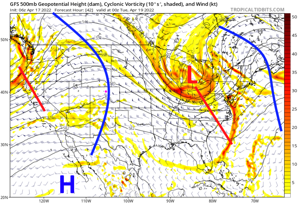
The weather will be very spring-like this week with a chance of high temperatures hitting 80F Tuesday and Thursday (Figure 2). This is due to a large ridge over the west (blue line, Figure 3). As short waves pass, winds will kick up giving us a Red Flag warning for fire risk on Sunday (above) and probably Tuesday and maybe Wednesday and Friday (before showers arrive). Check with your favorite weather apps, websites, TV and radio.
The Longer-Range Forecast:
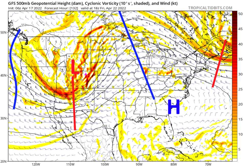
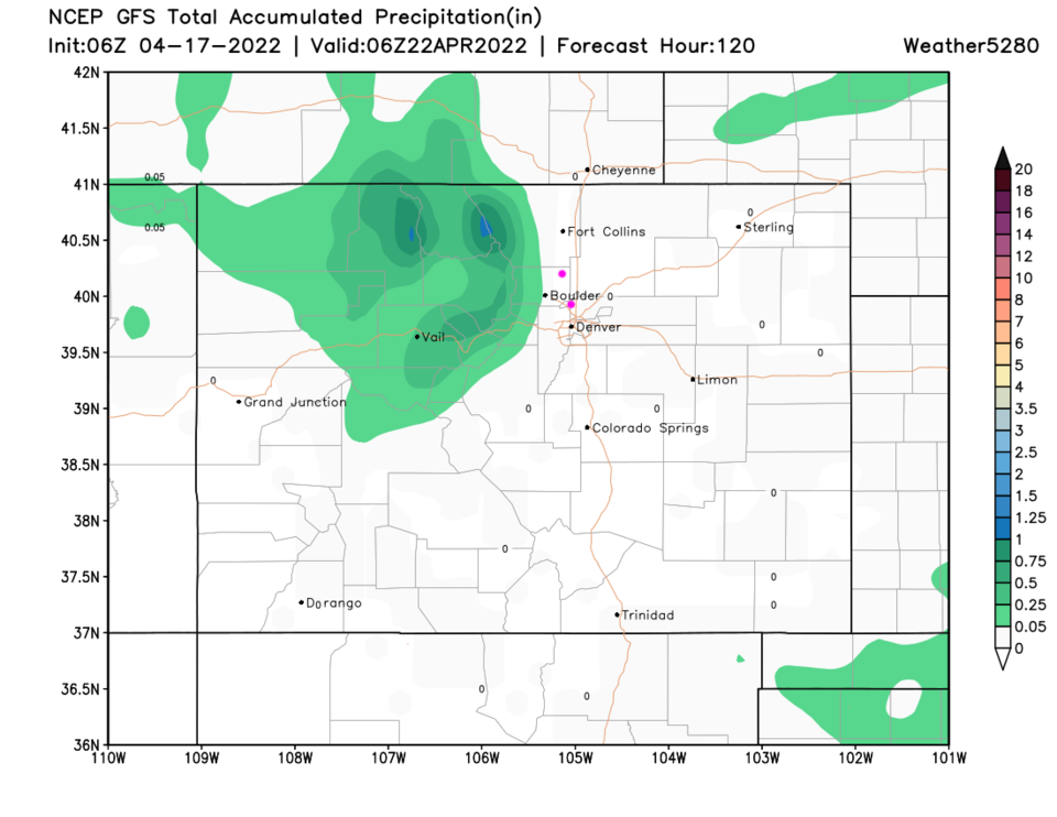
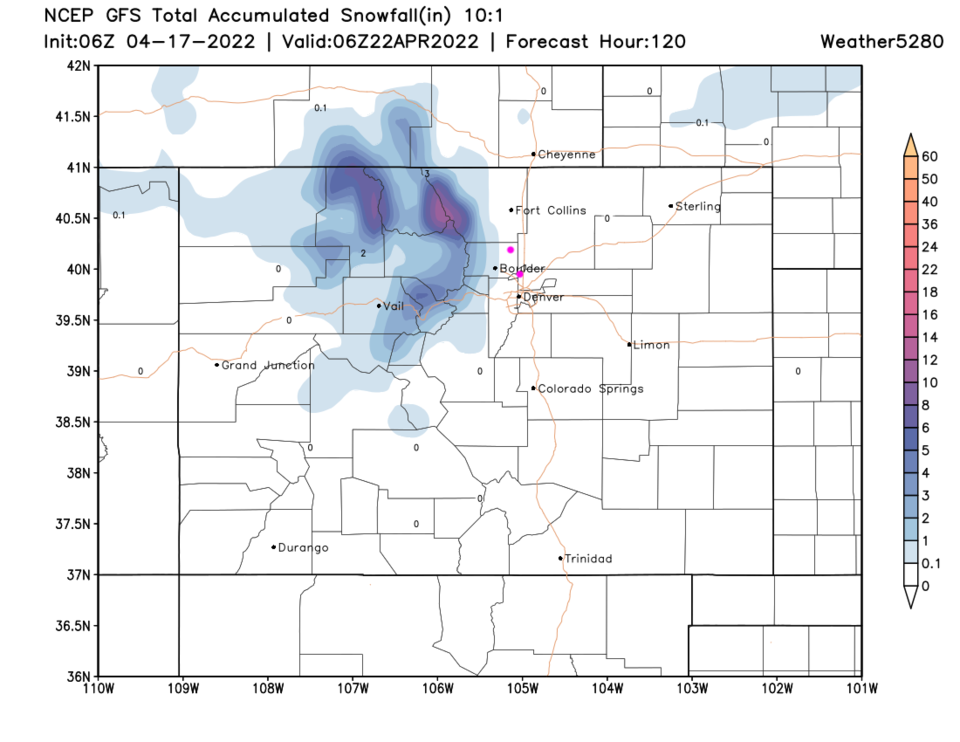
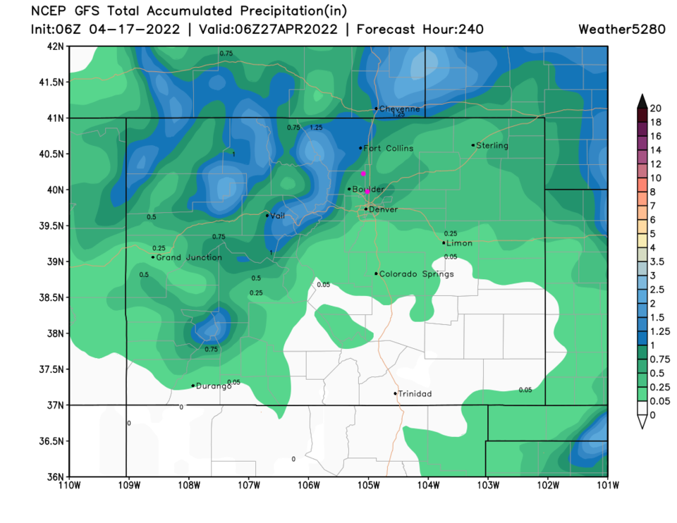
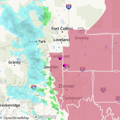
A large trough approaches the state Friday (Figure 4, red line with a low height center). Before this system arrives, the mountains may get a bit of precipitation (Figure 5) with some of that coming down as snow in the higher elevations (Figure 6). The next system brings better rain and snow (mountains) chances Friday and Saturday (Figure 2). We have hope for about 1/4-1/2 inches of water in the lower elevations and more than an inch of water in the mountains (Figure 7). Keep your fingers crossed!