Skip to content
Join our Newsletter

Tue Update: The Front Range Forecast: Snow totals, warming and dry

In Brief:

Slow warm up and dry on the Plains.

Tuesday Update:

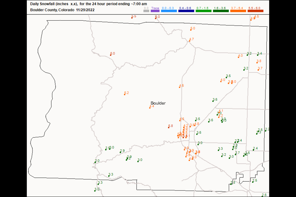
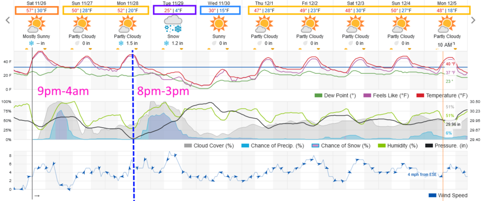
Longmont saw 3.2 to 4 inches of snow. Boulder did better with 4-6 inches overall. (Figure 1 update). Not shown in a figure: Ft. Collins saw 3-5 inches. Estes Park picked up 3-5.3 inches. Western Denver saw 2.5-4.5 inches while the Airport areas got about 2.2-2.4 inches.

We have mostly dry and warming conditions for much of the rest of the week.


figure1_11292022
Figure 1 update: the CoCoRaHS 24 hour snowfall report up to 7am Tuesday.

End Tuesday Update.

Forecast Discussion:

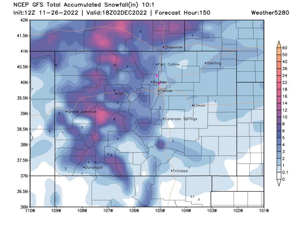
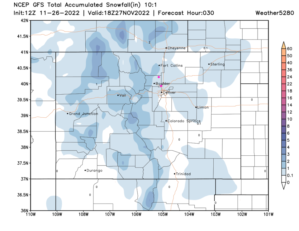
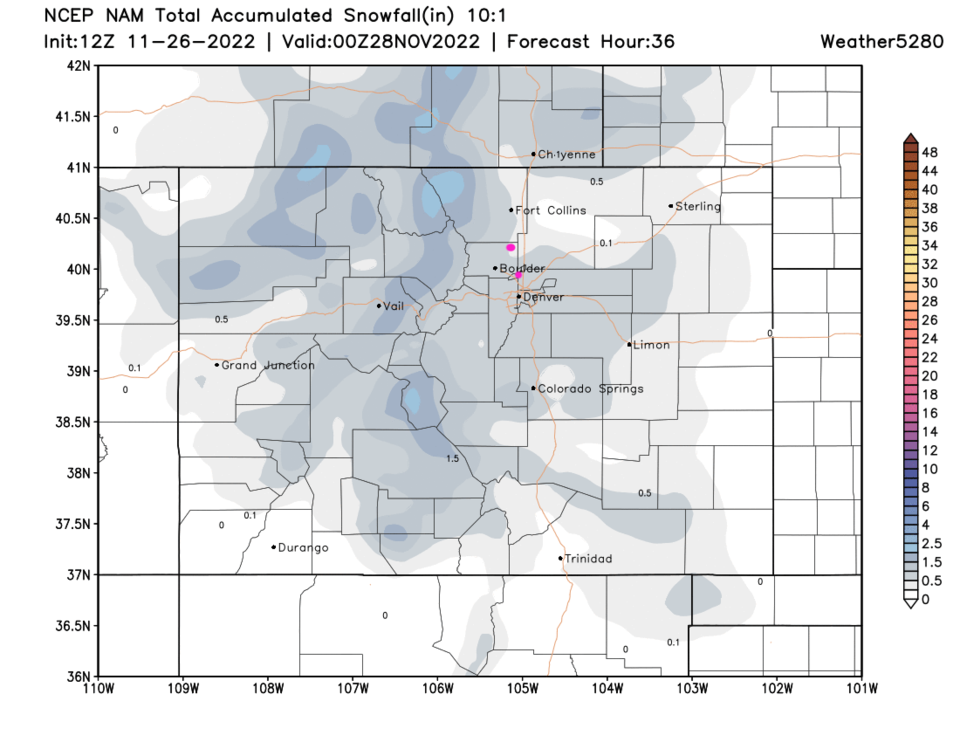
A couple of storms are going to make the end of the Holiday week and start of the workweek interesting. A weak cold front arrives around sunset Saturday and kicks off a brief period of light snow at lower elevations (a Trace to 1.5 inches) and a 1-3 inches in the mountains between about 9pm and 4am Sunday (Figure 1). Light snow totals seem widespread by Sunday morning (Figure 2, the GFS and Figure 3 the NAM).

We warm up again for a couple of days, then the next storm hits...

figure1_11262022
Figure 1: the 10 day graphical forecast for Denver from weatherunderground.com
figure3_11262022
Figure 2: the GFS 10:1 snowfall forecast from weather5280 for the next 24 hours.
figure4_11262022
Figure 3: the NAM 10:1 snowfall forecast from weather5280 for the next 24 hours.

The Longer Range Forecast

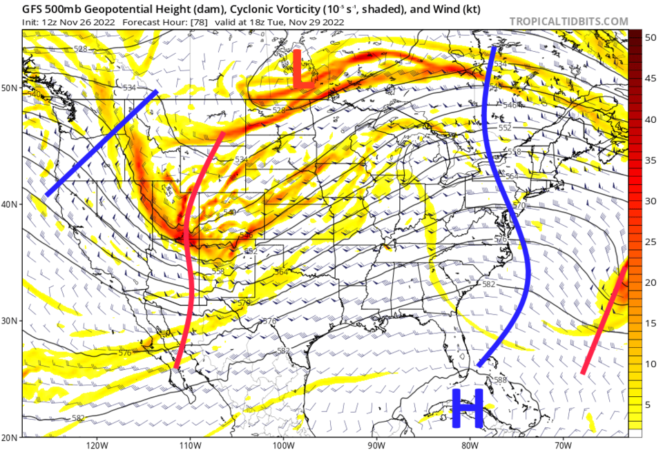
This next storm is powered by a strong shortwave and and a healthy dose of very cold air (Figure 4) again arriving with a sunset-ish front. I try not to forecast details on the next storm until the current storm is done, but it looks like 5-12 inches of snow for the higher mountains, 3-5 inches for the I-25 corridor, and 1-3 inches out on the eastern Plains. Tuesday morning will be another rough commute.

figure2_11262022
Figure 4: the 500mb upper air forecast map from the GFS and
figure5_11262022
Figure 5: the GFS 10:1 snowfall forecast from weather5280 for the next week.


About the Author: John Ensworth

John Ensworth used to work from Longmont as the PI for the NASA through the IGES (The Institute for Global Environmental Strategies). He now teaches technology, algebra, astronomy, meteorology, film school, and Lego robotics to middle/high school.
Read more


Comments


Current Weather

Mostly sunny

Mostly sunny

94°F

UV Index
3 Moderate
Pressure
29.89 Falling
Visibility
8 miles
Dewpoint
40 °F
Humidity
15%
Wind
ESE 2.8 mph
Gust
6.5 mph
Wind Chill
94 °F

Hourly Forecast

Today
5 PM
94°F
Partly sunny
Today
6 PM
92°F
Intermittent clouds
Today
7 PM
90°F
Intermittent clouds
Today
8 PM
86°F
Intermittent clouds
Today
9 PM
82°F
Intermittent clouds
Today
10 PM
79°F
Intermittent clouds
Today
11 PM
75°F
Intermittent clouds
Tomorrow
12 AM
72°F
Intermittent clouds
Tomorrow
1 AM
69°F
Intermittent clouds
Tomorrow
2 AM
68°F
Intermittent clouds
Tomorrow
3 AM
67°F
Intermittent clouds
Tomorrow
4 AM
66°F
Intermittent clouds

7 Day Forecast

Partly sunny

Thursday

96 °F

Very warm with sunshine mixing with some clouds


Intermittent clouds

Thursday Night

64 °F

Partly cloudy


Partly sunny w/ t-storms

Friday

89 °F

Partly sunny with a thundershower in spots in the afternoon


Clear

Friday Night

61 °F

Clear


Partly sunny

Saturday

93 °F

Partly sunny


Clear

Saturday Night

56 °F

Clear


Partly sunny

Sunday

89 °F

Partly sunny with a stray thunderstorm


Clear

Sunday Night

57 °F

Clear


Partly sunny

Monday

93 °F

Partly sunny


Clear

Monday Night

57 °F

Clear


Sunrise and Sunset

Sunrise
5:36 AM
Sunset
8:33 PM

Based on AccuWeather data