In Brief:
Snow totals and a look at our New Years Day storm.
Thursday Update:
I've got to eat "snow" for my forecast. I said I didn't think it would rain first, it poured for a while. I called for Tr to 3 inches in Longmont and (luckily) said that Broomfield could get a lucky 3 to 6 inches. This was a big storm instead.
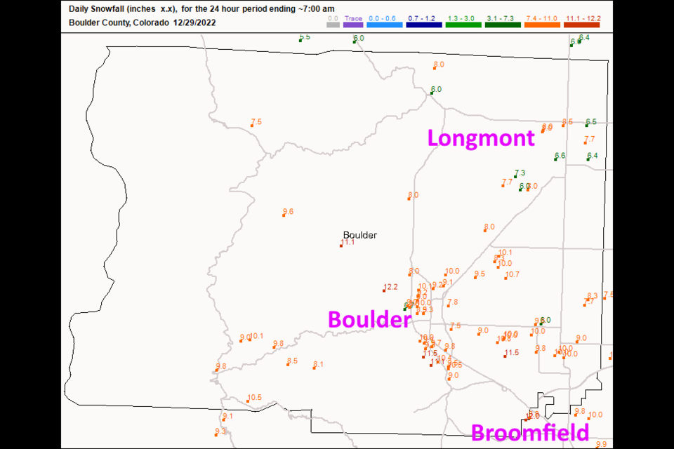
Figure 1 shows that Longmont saw between 6.5 and 8.5 inches of snow. I received 7.7 at my house. The snowfall to liquid ratio was a heavy slushy 8:1 (rather than the normal 10:1 or fluffy 'dry' 15:1 ratios). I shoveled for 2 hours. Boulder pulled 8 to 12 inches. This is going to put us way above for normal for snowfall so far this year and probably above normal for liquid. We received about 1.10" of water out of the rain and eventual snow melt. Much of Denver saw 1 to 1.5 inches of liquid. This was a great 'spring like' storm in the depths of winter.
I do want to point out that the weather5280.com forecasters were on to some aspects of this storm with their hatched area showing 6 or even more inches of snow just south of Longmont and including Boulder and Denver. I need to figure out how I missed it!
Already, our next storm is approaching with snow possible from 4pm Sunday January 1st to 5pm Monday January 2nd. Snow totals look good for this one too with about 3-5 inches around Longmont to Broomfield.
End Thursday update.
Forecast Discussion:
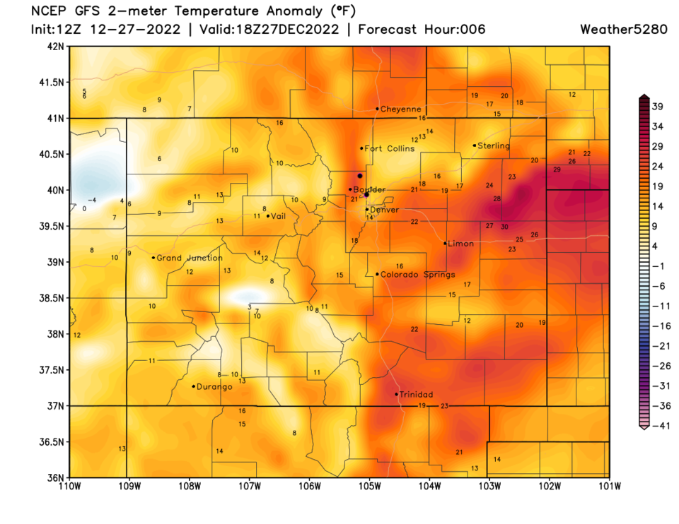
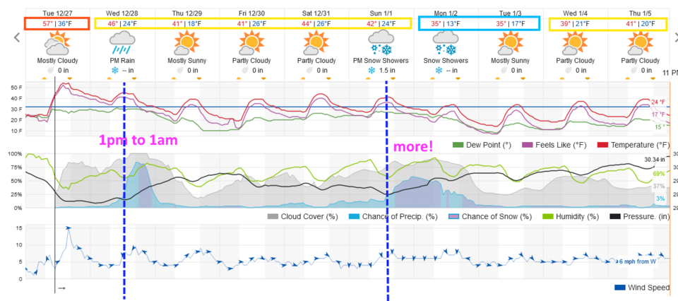
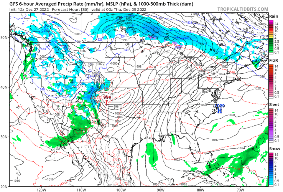
Tuesday saw very warm temperatures and snowmelt ongoing. Some temperatures Tuesday afternoon climbed to 20-30 degrees above normal on the Plains (Figure 1). A front arrives midday Wednesday to bring a change. There is only about a 12 hour window when the main precipitation falls. The NWS and weatherunderground forecasts have temperatures around 47 when the system arrives and predict rain at first, mixing with the becoming snow in the evening. I've not seen many winter storms in Colorado start with rain - they often cool the air as the precipitation begins to fall and we get snow at fairly warm temperatures. We'll see!
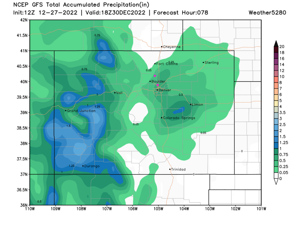
The low slides through southern Colorado Wednesday throwing snow back around the northwest side of the system (Figure 3). The GFS gives Longmont a total (rain + melted snow) of about 0.25 inch of water. Broomfield is in the 0.5 inch of water zone. (Figure 4)
Snowfall Roundup
I'm giving Longmont a Trace to 3 inches of snow, Broomfield 1-4 inches with a chance of banding giving some neighborhoods 3-6 inches.
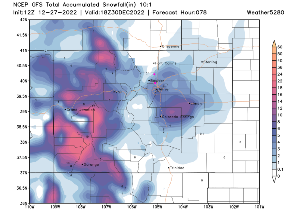
The GFS gives Longmont 1-2 inches and Broomfield 2-4 inches (Figure 5).
The NAM (not shown) gives Longmont 0-1 inch of snow and Broomfield a Trace -2 inches.
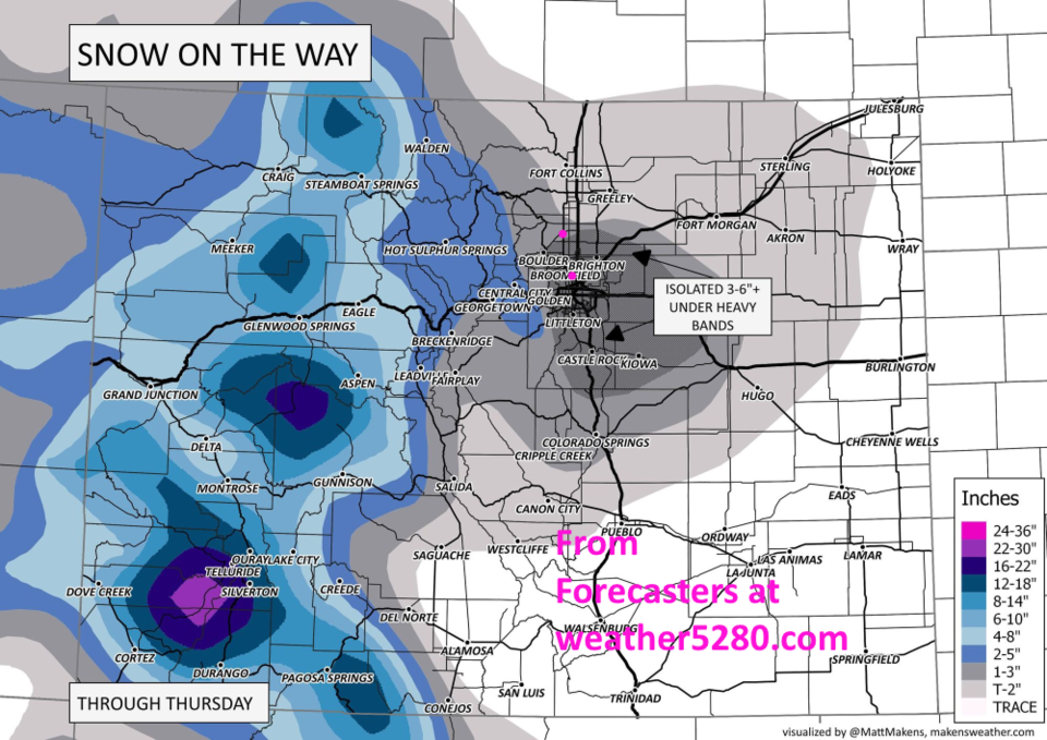
The forecasters at weather5280.com Give Longmont 1-3 inches and Broomfield 1-3 inches with snow bands capable of giving 3-6" + (Figure 6).
The Longer Range Forecast:
We return to the 40's right away (Figure 1) until another front hits on January 1. This could become a bigger storm - stay tuned!


