In Brief:
Snow ends until our next cold front arrives Wednesday.
Forecast Discussion:
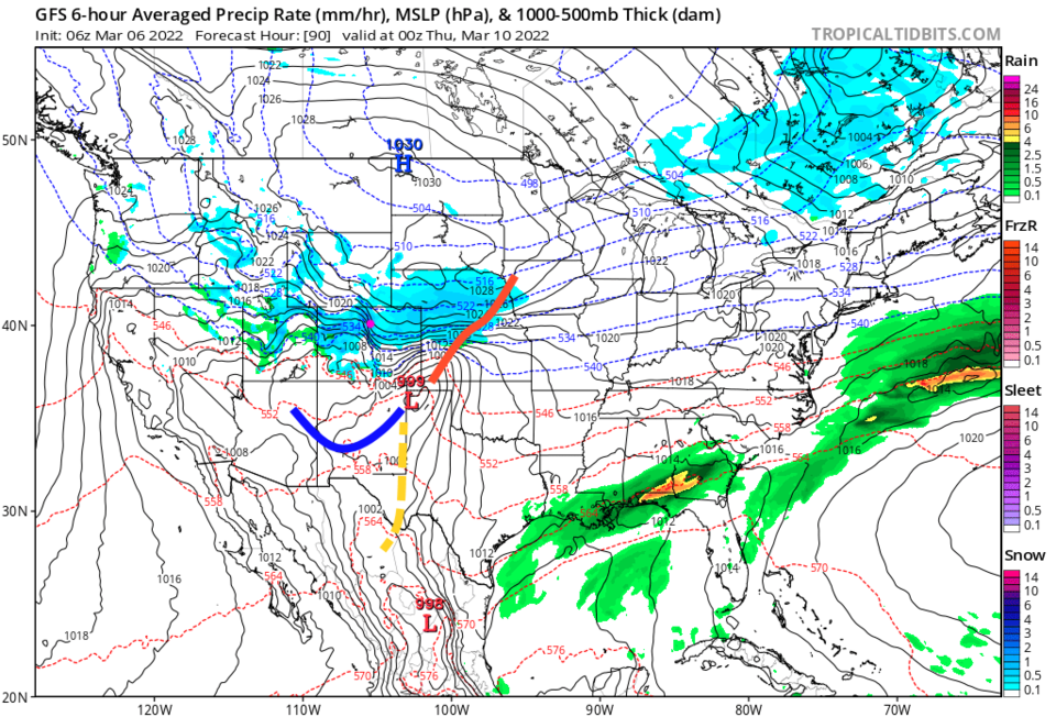
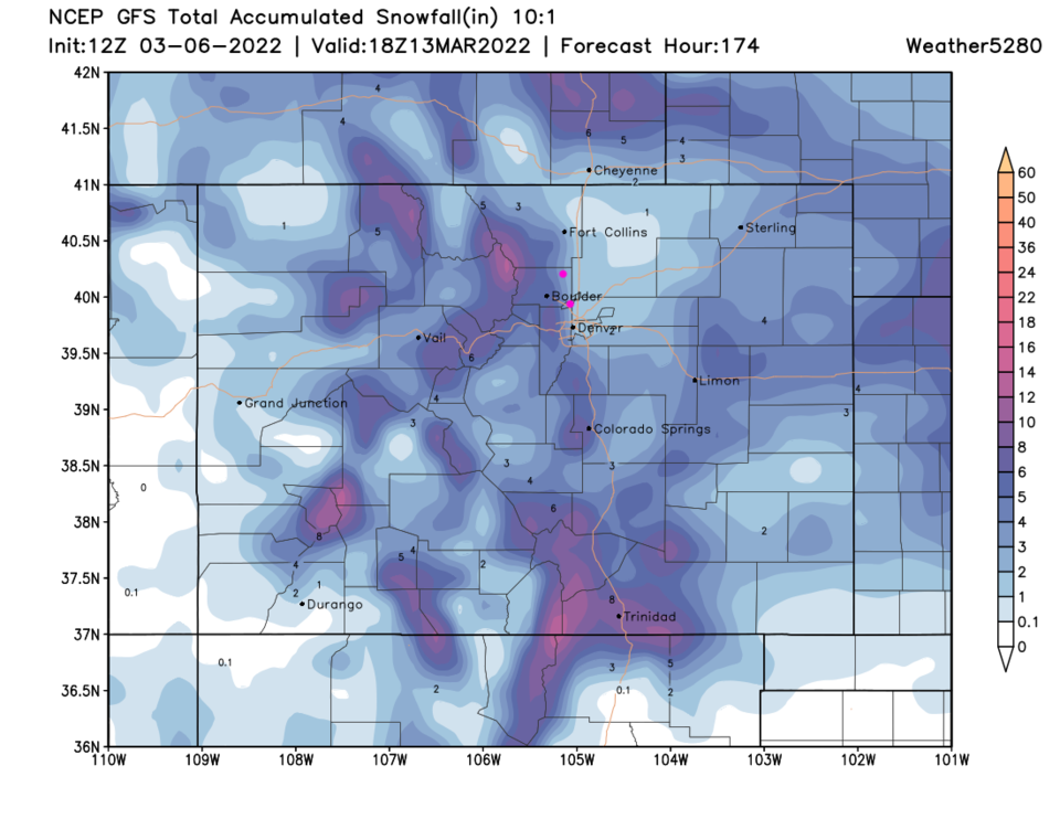
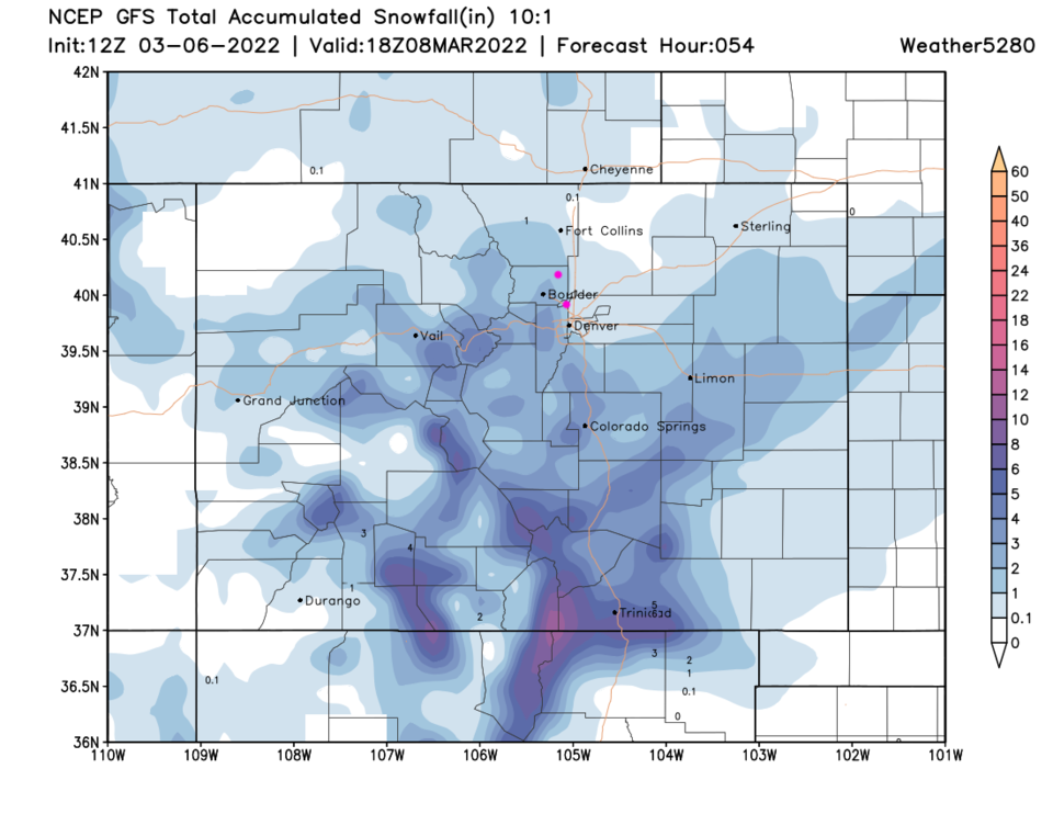
Snow will taper off Sunday evening (Figure 1). The expected rainfall did not occur Saturday as a slot of warm dry air pulled into the first low from the southwest. I was hoping for some good water before the change over to snow. Snowfall between noon and Sunday evening appears to build up 1-3 inches along I-25 and 2-4 inches in the foothills (Figure 2).
The Longer-Range Forecast:
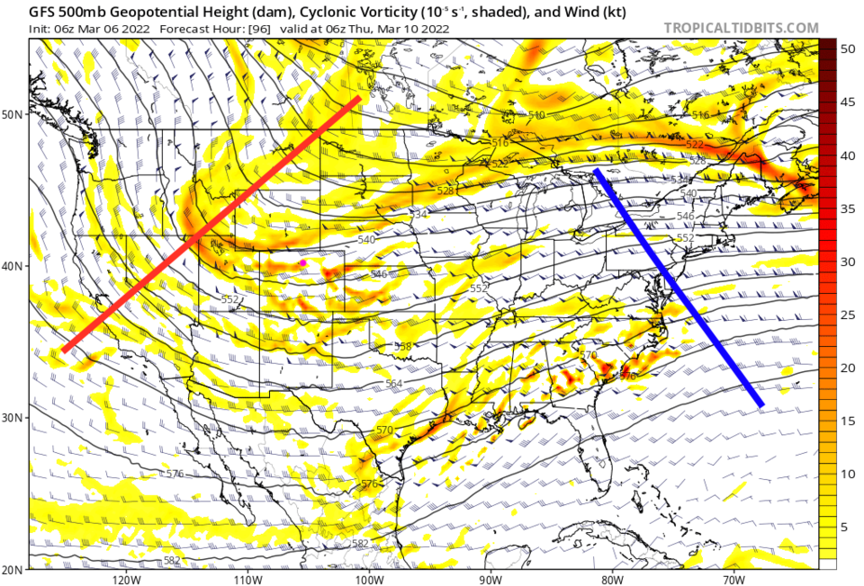
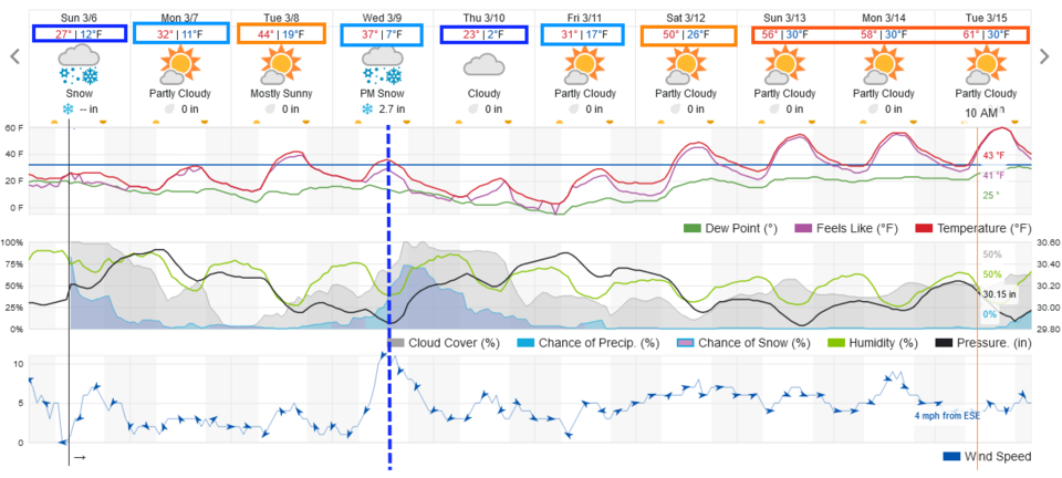
After a cold Monday and chilly Tuesday, our next cold front arrives around 1 p.m. Wednesday bringing in wind, falling temperatures, and snow (Figure 1). That front swings down ahead of a healthy-looking upper air trough (Figure 3) and covers the region with a good amount of snow (Figure 4). Amounts still look somewhat light (2-4 inches for the lower elevations - Figure 1 and Figure 5). We'll have to watch that as the week begins, the trends have been for a little more forecasted snow over the last couple of days.