This content was originally published by the Longmont Observer and is licensed under a Creative Commons license.
Forecast Discussion:
First is today's Red Flag Fire Warning from the National Weather Service
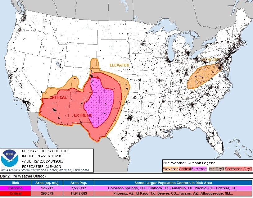
Figure 1 shows the extent of the elevated, critical and extreme fire danger today. Do whatever you can to not create an ignition source outside today. And if you smell or see smoke, get 911 on your phone ASAP!
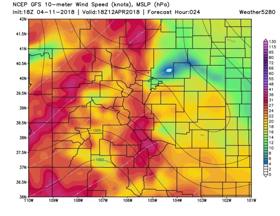
Figure 2 are the winds for today at noon. Sustained winds are 20 mph for Longmont, and 30mph just to our west. Expect gusts to 40 or 50mph.
For Friday, after the cold front comes down and temperatures drop 40F, the winds will pick up even more! Models are indicating sustained winds 30-40mph with gusts from 50mph - 70mph. Colder temperatures and higher humidities will help, some, with the fire danger.
The longer range forecast:
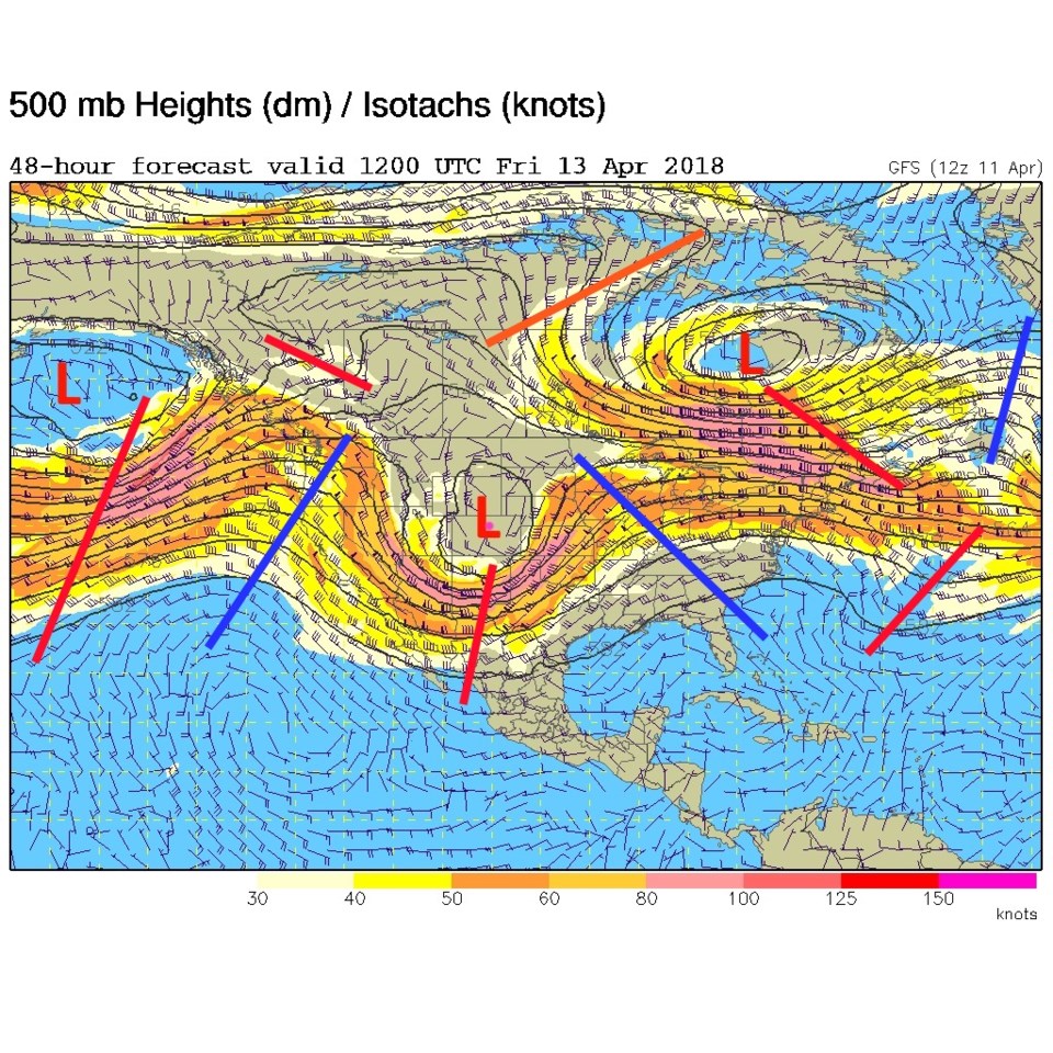
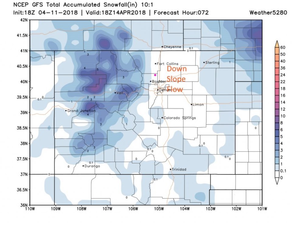
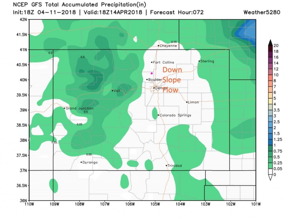
Tomorrow, our upper air low rolls in bringing in much colder air and the high winds described above (Figure 3). We should have substantial down slope flow behind the retreating (eastward) surface low. Figure 4 shows the big hole in the snowfall that includes Longmont. Lucky places in the higher mountains get 10-12 inches of snow. Figure 5 is rainfall, and we get skipped again by this substantial dry slot in the storm/ down slope region.
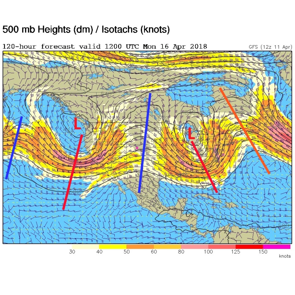
We warm up behind that low on Monday (Figure 6) as another ridge passes. This is a progressive pattern with shorter waves in the jet stream - so we should get cool and windy around Tuesday next week from the trough on the West Coast visible on this map.