Skip to content

The Next Storm/Next Snow Forecast Discussion from the Cherrywood Observatory – April 3, 2018

This content was originally published by the Longmont Observer and is licensed under a Creative Commons license.

Forecast Discussion:

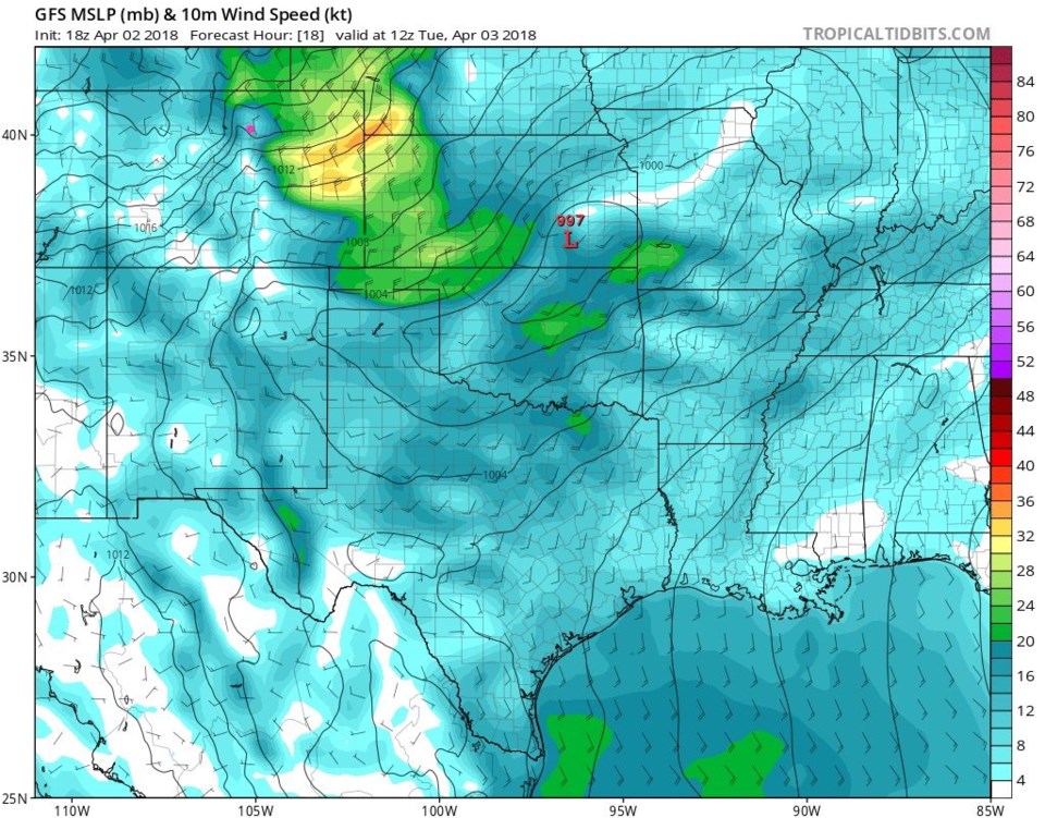
Winds are roaring Monday PM with gusts topping 60mph in places. The down slope flow is keeping us pretty warm.  Today (Tuesday) the winds will continue, even if not quite as high, as one can see Tuesday morning from the GFS in Figure 1.  Very cold air is coming in aloft which will cool temperatures (about 20F lower than Monday), but the down slope will fight that with some warming. It could have been colder. Interesting situation!

The weather gets mild and calm (boring) for a couple of days...then the next storm comes...

Figure 1: The GFS surface wind speed forecast for midday Tuesday from tropicaltidbits.com Longmont is the pink dot.

The longer range forecast:

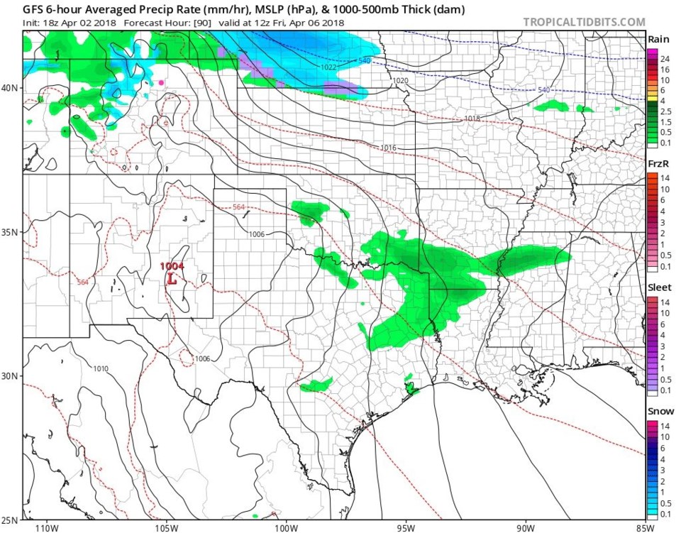
Our next storm comes in from the west and north Friday morning.  Figure 2 is the 6 hour surface pressure and precipitation depiction for Friday at sunrise.  Snow is moving into the mountains and rain and snow are coming in from the west and north.

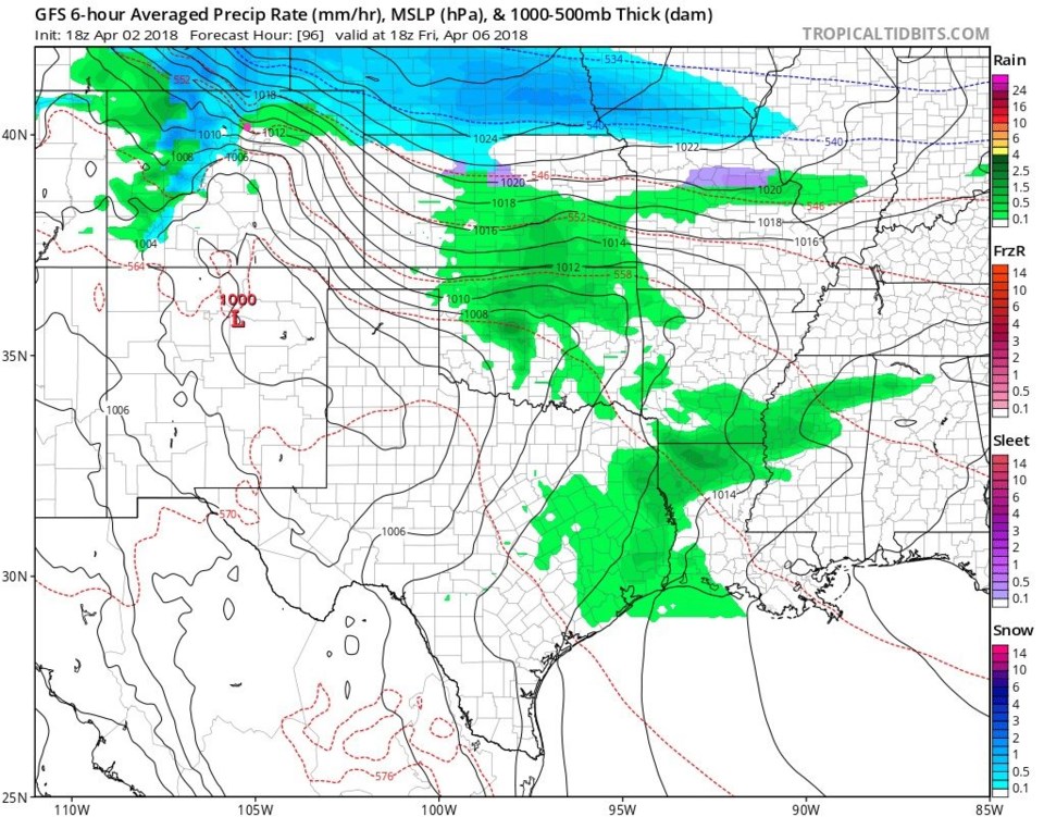
Figure 3 is midday Friday - snow is picking up a lot and rain and snow are pouring southward into the state and beginning to hit Longmont.

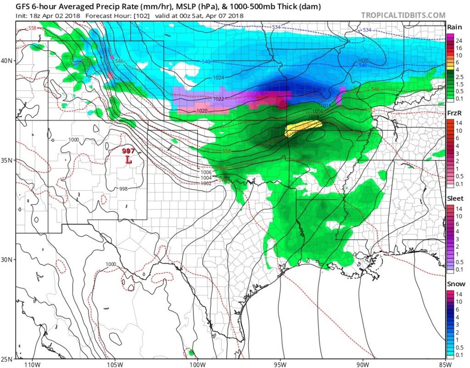
Figure 4, for Friday night, sees very strong winds roaring down the Front Range with moderate to heavy snow falling. The precipitation has made it south of Colorado Springs by this time.

Figure 5 is a (very far out) snowfall total forecast - Longmont gets 1-2 inches in this situation, if correct.  More later!

Figure 2: the 6 hour precipitation snapshot Friday sunrise from the GFS and tropicaltidbits.com Longmont is the pink dot.

Figure 3: the 6 hour precipitation snapshot Friday midday from the GFS and tropicaltidbits.com Longmont is the pink dot.

Figure 4: the 6 hour precipitation snapshot Friday evening from the GFS and tropicaltidbits.com Longmont is the pink dot.

Figure 5: the total snowfall forecast between Monday PM and Friday midnight to Saturday. Longmont is the pink dot.

Current Weather

Mostly cloudy

Mostly cloudy

46°F

UV Index
0 Low
Pressure
30 Steady
Visibility
8 miles
Dewpoint
32 °F
Humidity
58%
Wind
SSE 1.7 mph
Gust
3.5 mph
Wind Chill
46 °F

Hourly Forecast

Today
1 AM
44°F
Cloudy
Today
2 AM
42°F
Cloudy
Today
3 AM
41°F
Cloudy
Today
4 AM
39°F
Mostly cloudy
Today
5 AM
38°F
Intermittent clouds
Today
6 AM
36°F
Partly sunny
Today
7 AM
35°F
Partly sunny
Today
8 AM
41°F
Partly sunny
Today
9 AM
49°F
Partly sunny
Today
10 AM
58°F
Partly sunny
Today
11 AM
62°F
Partly sunny
Today
12 PM
65°F
Partly sunny

7 Day Forecast

Mostly cloudy

Thursday

65 °F

Becoming cloudy


Mostly cloudy

Thursday Night

35 °F

Mostly cloudy


Partly sunny

Friday

71 °F

Pleasant with partial sunshine


Partly cloudy

Friday Night

38 °F

Partly cloudy


Partly sunny

Saturday

66 °F

Partial sunshine


Mostly clear

Saturday Night

41 °F

Clear to partly cloudy


Mostly cloudy

Sunday

76 °F

Rather cloudy; breezy in the afternoon


Intermittent clouds

Sunday Night

46 °F

Partly cloudy


Cloudy

Monday

60 °F

Cloudy and cooler with a shower in spots; windy in the afternoon


Mostly cloudy

Monday Night

41 °F

Breezy in the evening; otherwise, mostly cloudy


Sunrise and Sunset

Sunrise
5:58 AM
Sunset
7:57 PM

Based on AccuWeather data