Skip to content

The Next Storm/Next Snow Forecast Discussion from the Cherrywood Observatory – August 16th, 2018

This content was originally published by the Longmont Observer and is licensed under a Creative Commons license.

Forecast Discussion:

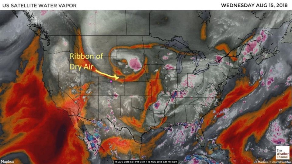
Things were much quieter on Wednesday as compared to Tuesday (when we had our "salad shooter" storm - with what it did to trees and leaves across town).  We had a ribbon of dry air (Figure 1) and a cool front kill most thunderstorm chances.

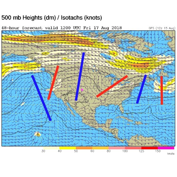
For today, we have a rather healthy ridge overhead with short waves rippling along to the east and west of us (Figure 2). We reached a high of 91F Wednesday and should see about 90F today.

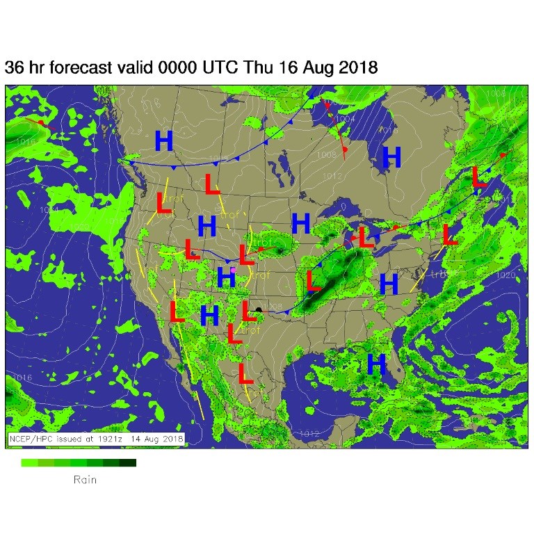
Another cool front is poised to stabilize the lower atmosphere for tomorrow.  Southern Colorado will see more storms that we do (Figure 3).

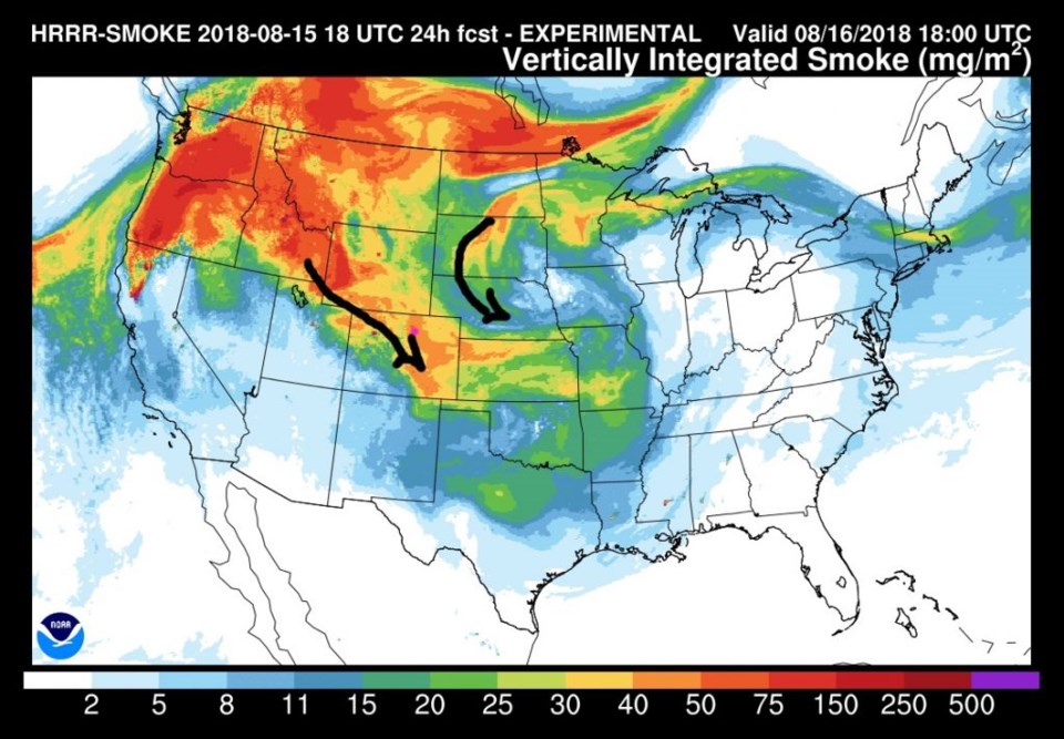
Unfortunately, the flood gates of smoke are opening and it should be pretty thick around here today and tomorrow (Figure 4). The atmospheric flow will be right to tap that deeper smoke.

Figure 1: the water vapor satellite image from Wednesday PM. Reds/Oranges are dry air, greys/whites are moist air regions.

Figure 2: The 500mb forecast upper air analysis for Friday AM. Pink dot is Longmont. Red lines are troughs, blue lines are ridges.

Figure 3: The forecast surface map for Wednesday PM. From NCEP.

Figure 4: The HRRR (high resolution rapid refresh) model forecast of smoke at all levels for Thursday noon.

The longer range forecast:

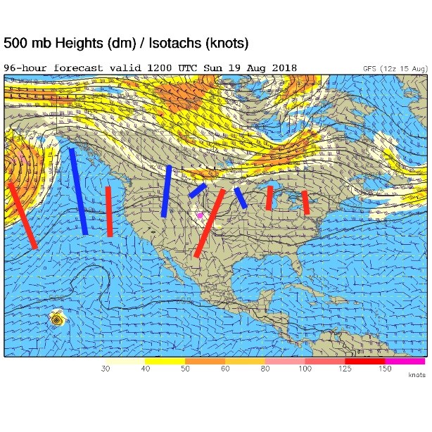
A stronger trough approaches for the weekend.  We cool down and have a chance of some good, possibly severe, thunderstorms again (Figure 5).  More on that as the weekend gets closer.

Figure 5: The 500mb forecast upper air analysis for Sunday AM. Pink dot is Longmont. Red lines are troughs, blue lines are ridges.

Current Weather

Mostly cloudy

Mostly cloudy

52°F

UV Index
4 Moderate
Pressure
29.49 Steady
Visibility
8 miles
Dewpoint
22 °F
Humidity
31%
Wind
W 11.3 mph
Gust
26.8 mph
Wind Chill
52 °F

Hourly Forecast

Today
12 PM
54°F
Showers
Today
1 PM
55°F
Cloudy
Today
2 PM
56°F
Cloudy
Today
3 PM
57°F
Cloudy
Today
4 PM
57°F
Cloudy
Today
5 PM
56°F
Cloudy
Today
6 PM
55°F
Cloudy
Today
7 PM
55°F
Cloudy
Today
8 PM
53°F
Mostly cloudy
Today
9 PM
51°F
Intermittent clouds
Today
10 PM
49°F
Intermittent clouds
Today
11 PM
48°F
Partly cloudy

7 Day Forecast

Showers

Monday

57 °F

Winds gusting past 40 mph; a brief shower or two this morning; otherwise, cloudy and cooler


Intermittent clouds

Monday Night

41 °F

Partly cloudy


Partly sunny w/ showers

Tuesday

58 °F

A couple of showers in the morning; otherwise, windy and cool with times of clouds and sun


Partly cloudy

Tuesday Night

33 °F

Partly cloudy


Intermittent clouds

Wednesday

60 °F

Times of clouds and sun


Mostly cloudy

Wednesday Night

38 °F

Increasing clouds


Partly sunny w/ showers

Thursday

56 °F

Times of clouds and sun with a couple of showers; cool


Cloudy

Thursday Night

37 °F

Cloudy


Mostly cloudy

Friday

62 °F

Mostly cloudy and warmer


Mostly clear

Friday Night

36 °F

Mainly clear


Sunrise and Sunset

Sunrise
5:53 AM
Sunset
8:01 PM

Based on AccuWeather data