Skip to content

The Next Storm/Next Snow Forecast Discussion from the Cherrywood Observatory – August 7th, 2018

This content was originally published by the Longmont Observer and is licensed under a Creative Commons license.

Forecast Discussion:

Storms dropped big hail in a few locations on the eastern plains, but not near Longmont on Monday. It was interesting that the pattern seen on the GFS forecast yesterday DID match what happened fairly closely. Maybe it triggered on orograph (land caused) storm formation. Interesting.

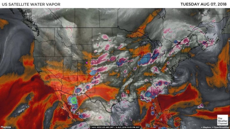
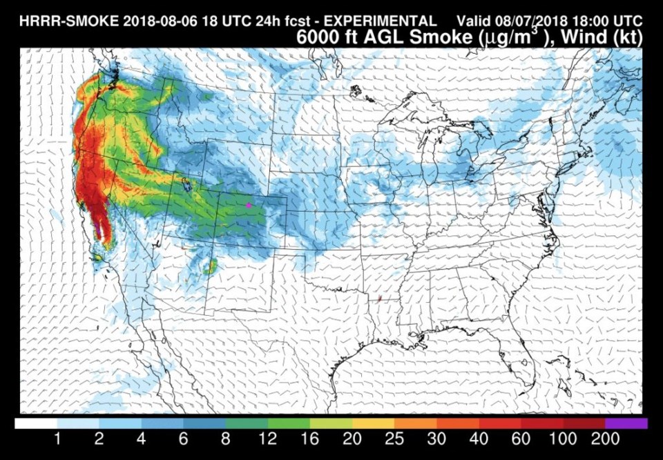
We have less moisture around today and will have a bit less tomorrow (Figure 1). That figure shows some more dry air on the eastern plains (with purple and blue afternoon thunderstorms). The smoke from the west is still present, but lighter than it has been much of the last week (Figure 2).

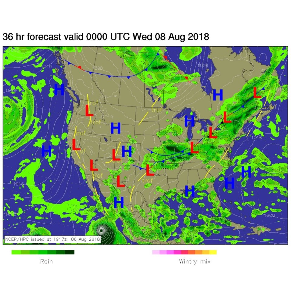
The frontal push of the last few days washes out to our south. Heating and an upper level trough will kick off a bit of a storm or two along the Front Range in the afternoon again (Figure 3).

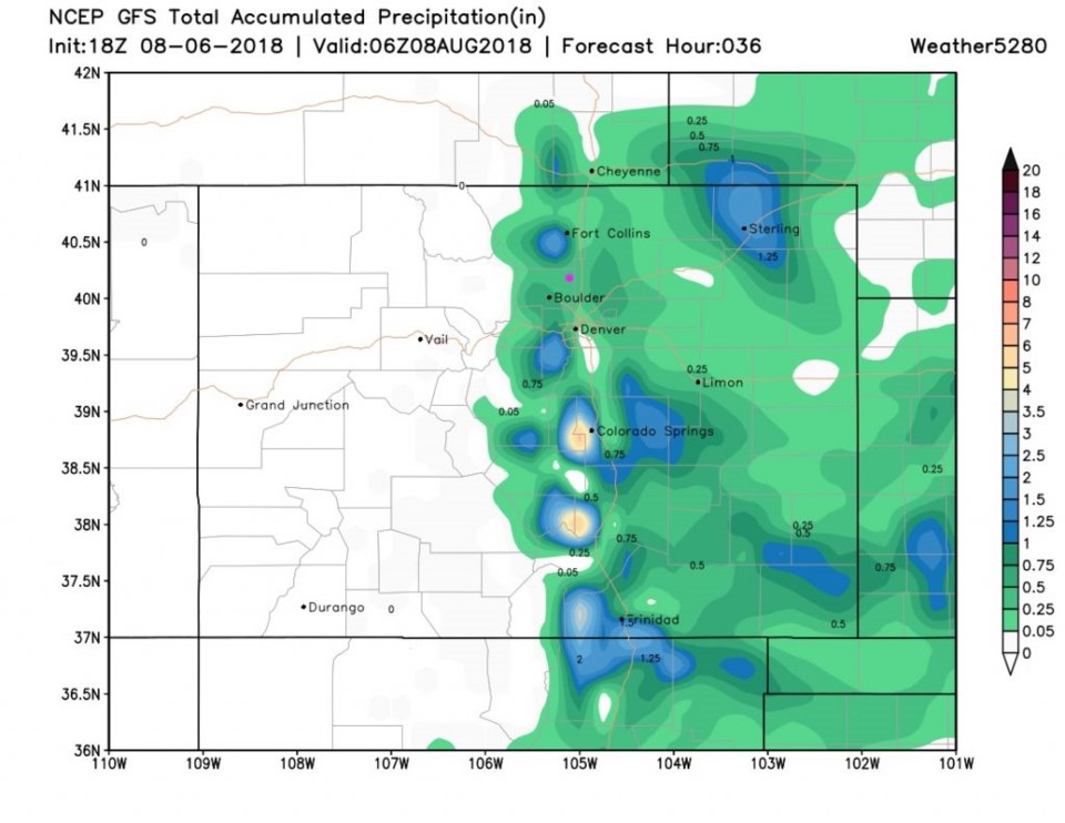
Storms are isolated with many locations seeing only a sprinkle or little rain (Figure 4).

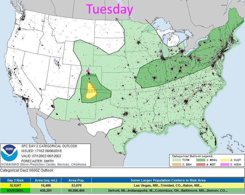
There will be a chance of severe storms today, but mainly in South Denver and south into New Mexico - Figure 5.

Figure 1: the water vapor satellite image from Monday night. Reds/Oranges are dry air, greys/whites are moist air regions.

Figure 2: The HRRR (high resolution rapid refresh) model forecast of smoke at all levels for Tuesday midday.

Figure 3: The forecast surface map for Tuesday midday. From NCEP.

Figure 4: The total accumulated precipitation between Monday PM and Tuesday late PM from the GFS and weather5280.com

Figure 5: the day 2 SPC thunderstorm and severe weather forecast made Monday (valid Tuesday).

The longer range forecast:

We dry out and warm to right around 88°F to 90°F each day. Pretty quiet after that.

Current Weather

Mostly cloudy

Mostly cloudy

52°F

UV Index
4 Moderate
Pressure
29.81 Falling
Visibility
8 miles
Dewpoint
40 °F
Humidity
62%
Wind
NE 1.1 mph
Gust
3.6 mph
Wind Chill
52 °F

Hourly Forecast

Today
11 AM
59°F
Cloudy
Today
12 PM
64°F
Cloudy
Today
1 PM
68°F
Cloudy
Today
2 PM
72°F
Cloudy
Today
3 PM
75°F
Cloudy
Today
4 PM
78°F
Cloudy
Today
5 PM
77°F
Cloudy
Today
6 PM
75°F
Cloudy
Today
7 PM
73°F
Cloudy
Today
8 PM
69°F
Cloudy
Today
9 PM
66°F
Cloudy
Today
10 PM
63°F
Mostly cloudy

7 Day Forecast

Mostly cloudy

Sunday

78 °F

Rather cloudy and warmer; breezy this afternoon


Mostly cloudy

Sunday Night

47 °F

Mostly cloudy and windy


Windy

Monday

56 °F

Winds gusting past 40 mph; cloudy


Intermittent clouds

Monday Night

43 °F

Partly cloudy


Partly sunny w/ showers

Tuesday

59 °F

A couple of showers in the morning; otherwise, windy and cool with times of clouds and sun


Partly cloudy

Tuesday Night

32 °F

Partly cloudy


Intermittent clouds

Wednesday

58 °F

Times of clouds and sun


Intermittent clouds

Wednesday Night

38 °F

Partly cloudy


Intermittent clouds

Thursday

56 °F

Breezy and cool with sun and clouds


Intermittent clouds

Thursday Night

37 °F

Partly cloudy


Sunrise and Sunset

Sunrise
5:54 AM
Sunset
8:00 PM

Based on AccuWeather data