Skip to content

The Next Storm/Next Snow Forecast Discussion from the Cherrywood Observatory – August 9th, 2018

This content was originally published by the Longmont Observer and is licensed under a Creative Commons license.

Forecast Discussion:

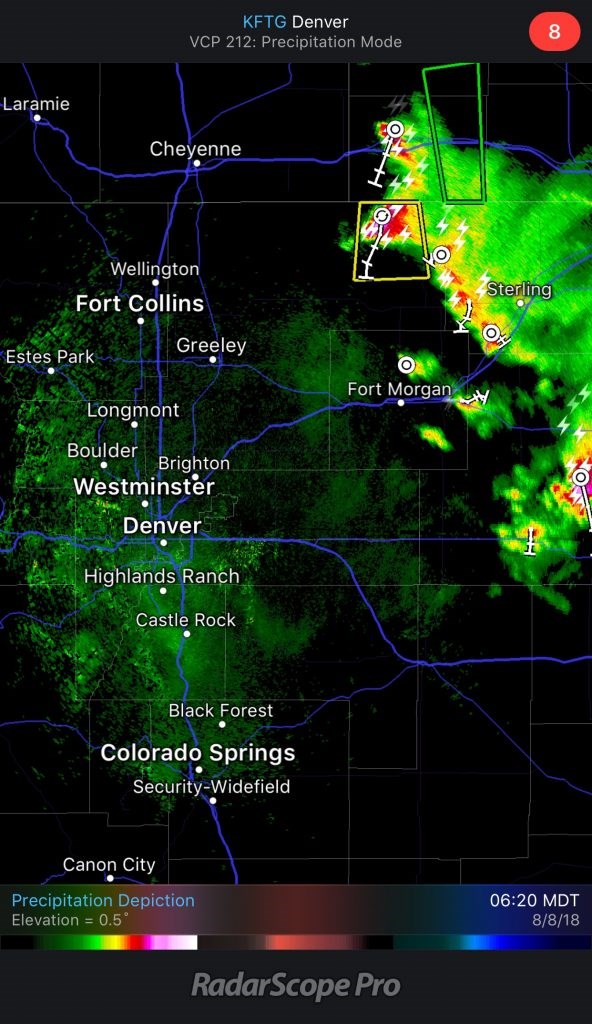
The Nebraska storm forecasted yesterday (Tuesday) DID occur and even dropped a near-dawn tornado Wednesday morning. There was plenty of hail in that storm as well (Figure 1). The outflow did make it to the Front Range, but no storms formed here (except some very small midday cells north and south of Estes Park).

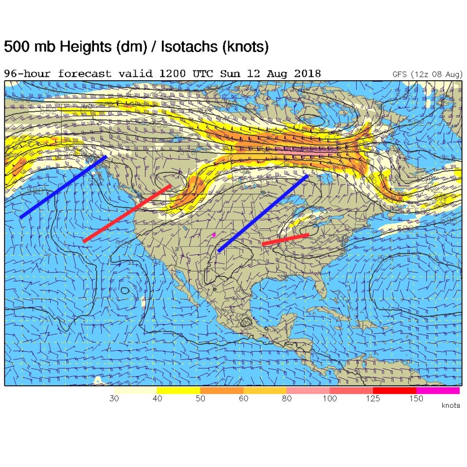
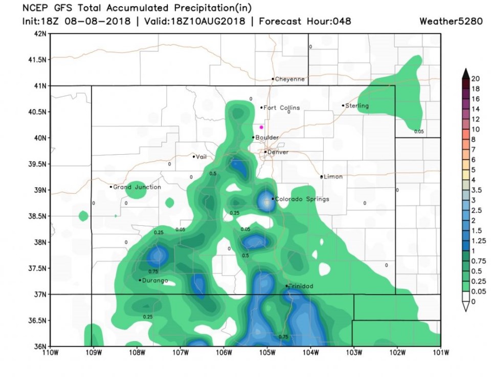
We continue to dry out today. The upper level ridge is now centered overhead (Figure 2) so the atmosphere is sinking, making thunderstorms more scarce. Precipitation over the next 48 hours is nearly zero on the northeastern plains of Colorado (Figure 3). The mountains and southern central regions of the state may see something. But not much.

We have a surface high in place as well today (Figure 4). Things are getting quiet.

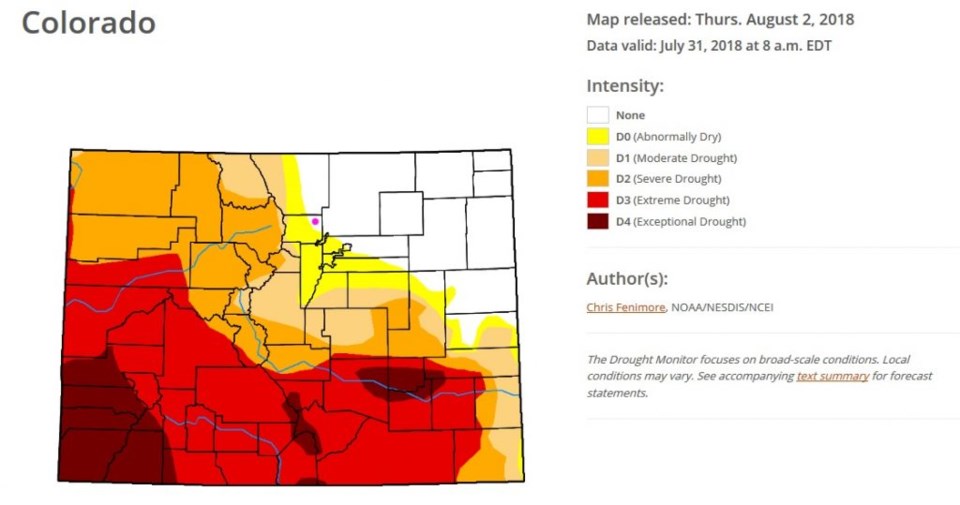
Checking on last week's drought index (Figure 5) dry conditions are creeping up from the southwest as we go longer and longer without widespread rain.

Figure 1: Radar image from iOS app RadarScope Pro. Longmont is the pink dot.

Figure 2: The 500mb forecast upper air analysis for Thursday PM. Pink dot is Longmont. Red lines are troughs, blue lines are ridges.

Figure 3: The total accumulated precipitation between Wednesday PM and Friday noon from the GFS and weather5280.com

Figure 4: The forecast surface map for Thursday PM. From NCEP.

Figure 5: the Colorado drought index map posted a week aga from NOAA NESDIS and NCEI.

The longer range forecast:

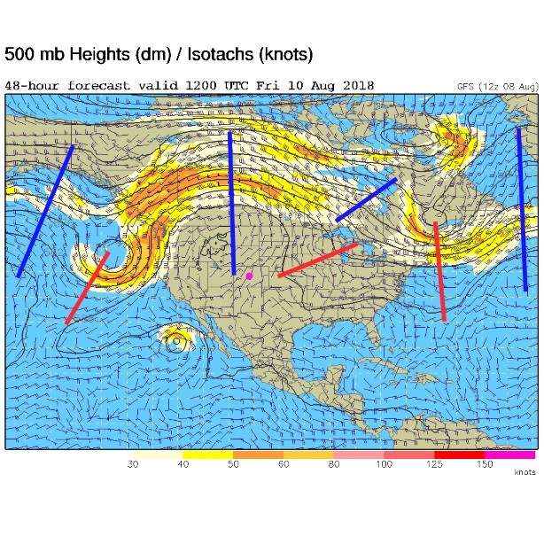
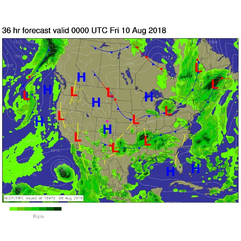
The ridge tilts over by the weekend (Figure 6) but we remain quite dry and very close to normal for temperatures all week. We are normally dry and around 89°F this time of year. That is what you'll get!

Figure 6: The 500mb forecast upper air analysis for Sunday AM. Pink dot is Longmont. Red lines are troughs, blue lines are ridges.

Current Weather

Cloudy

Cloudy

58°F

UV Index
0 Low
Pressure
29.81 Steady
Visibility
7 miles
Dewpoint
34 °F
Humidity
40%
Wind
NNW 4.9 mph
Gust
10 mph
Wind Chill
58 °F

Hourly Forecast

Today
7 PM
58°F
Cloudy
Today
8 PM
56°F
Thunderstorms
Today
9 PM
53°F
Cloudy
Today
10 PM
50°F
Cloudy
Today
11 PM
48°F
Cloudy
Tomorrow
12 AM
46°F
Cloudy
Tomorrow
1 AM
44°F
Cloudy
Tomorrow
2 AM
42°F
Mostly cloudy
Tomorrow
3 AM
40°F
Mostly cloudy
Tomorrow
4 AM
38°F
Mostly cloudy
Tomorrow
5 AM
37°F
Mostly cloudy
Tomorrow
6 AM
35°F
Mostly cloudy

7 Day Forecast

Mostly cloudy w/ t-storms

Wednesday

68 °F

Clouds and breaks of sun; a shower in spots this morning, then a couple of thunderstorms late this afternoon


Thunderstorms

Wednesday Night

35 °F

A thunderstorm this evening; otherwise, mostly cloudy


Intermittent clouds

Thursday

63 °F

A blend of sun and clouds


Mostly cloudy

Thursday Night

39 °F

Mostly cloudy


Partly sunny

Friday

64 °F

Some sun; breezy in the afternoon


Partly cloudy

Friday Night

36 °F

Partly cloudy


Partly sunny

Saturday

66 °F

Partial sunshine


Mostly clear

Saturday Night

41 °F

Clear to partly cloudy


Mostly cloudy

Sunday

78 °F

Rather cloudy and warmer; breezy in the afternoon


Mostly cloudy

Sunday Night

43 °F

Rather cloudy


Sunrise and Sunset

Sunrise
5:59 AM
Sunset
7:56 PM

Based on AccuWeather data