Skip to content

The Next Storm/Next Snow Forecast Discussion from the Cherrywood Observatory – July 13th and 14th, 2018

This content was originally published by the Longmont Observer and is licensed under a Creative Commons license.

Forecast Discussion:

Note, I'm at the end of a 2 week family camping vacation near Red Feather Lakes, CO at this time.  Internet availability is very limited, so these discussions are shorter and simpler than normal.

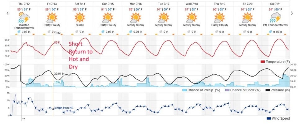
The moisture is finally here and the temperatures are down a bit.  As I write (internet of opportunity at the library) the afternoon storms have yet to form on Thursday, but hopefully Longmont saw some rain.

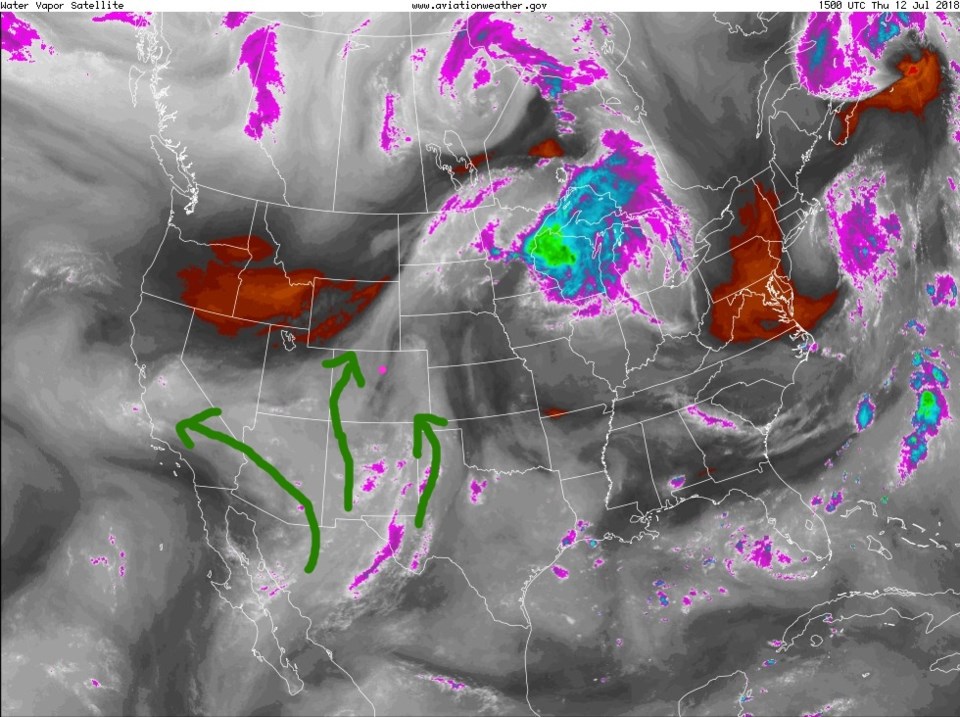
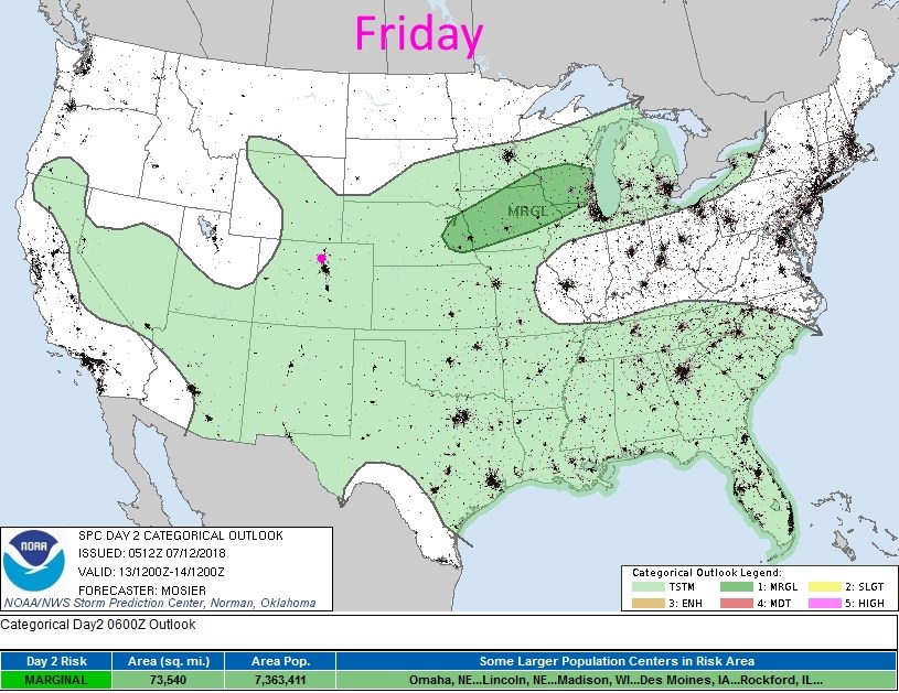
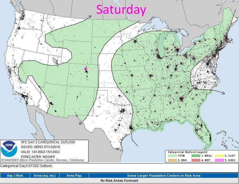
Figure 1 shows the returning moisture from the deep southwest as the high pulls off to the east.  The severe weather chances are minimal and would be brief under heavier cells, but both Friday and Saturday, storms are expected to be more of the normal storm strength (Figures 2 and 3).

Figure 1: the water vapor satellite image from Thursday AM. Reds/Oranges are dry air, greys/whites are moist air regions.

Figure 2: the day 2 SPC thunderstorm and severe weather forecast made Thursday (valid Friday).

Figure 3: the day 3 SPC thunderstorm and severe weather forecast made Thursday (valid Saturday).

The longer range forecast:

A short wave ridge crosses the state on Saturday and depresses storm chances. A bit of moisture returns Sunday and beyond---temperatures return to just a bit above normal with afternoon thunderstorms chances.

Figure 4: the next 10 days of the graphical forecast for Longmont, CO from weatherunderground.com

Current Weather

Sunny

Sunny

49°F

UV Index
4 Moderate
Pressure
30.01 Falling
Visibility
8 miles
Dewpoint
23 °F
Humidity
35%
Wind
SSE 3.9 mph
Gust
9.8 mph
Wind Chill
48 °F

Hourly Forecast

Today
10 AM
51°F
Mostly sunny
Today
11 AM
55°F
Mostly sunny
Today
12 PM
58°F
Mostly sunny
Today
1 PM
60°F
Partly sunny
Today
2 PM
62°F
Intermittent clouds
Today
3 PM
63°F
Mostly cloudy
Today
4 PM
65°F
Mostly cloudy
Today
5 PM
63°F
Cloudy
Today
6 PM
62°F
Cloudy
Today
7 PM
59°F
Mostly cloudy
Today
8 PM
56°F
Mostly cloudy
Today
9 PM
53°F
Mostly cloudy

7 Day Forecast

Mostly cloudy

Thursday

65 °F

Becoming cloudy


Mostly cloudy

Thursday Night

36 °F

Mostly cloudy


Partly sunny

Friday

70 °F

Partial sunshine


Partly cloudy

Friday Night

38 °F

Partly cloudy


Partly sunny

Saturday

66 °F

Partial sunshine


Mostly clear

Saturday Night

41 °F

Clear to partly cloudy


Mostly cloudy

Sunday

76 °F

Rather cloudy; breezy in the afternoon


Intermittent clouds

Sunday Night

43 °F

Partly cloudy


Cloudy

Monday

60 °F

Cloudy and cooler with a shower in spots; windy in the afternoon


Mostly cloudy

Monday Night

43 °F

Breezy in the evening; otherwise, mostly cloudy


Sunrise and Sunset

Sunrise
5:58 AM
Sunset
7:57 PM

Based on AccuWeather data