This content was originally published by the Longmont Observer and is licensed under a Creative Commons license.
Forecast Discussion:
Update 8:30am:
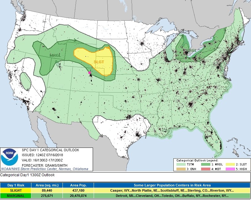
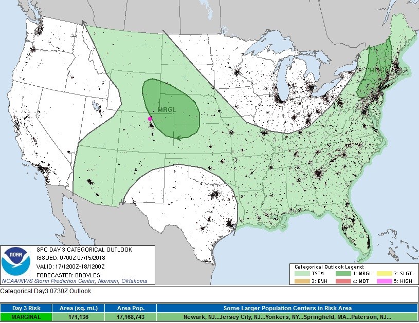
Small short waves are difficult to find and forecast (since the spacing between major airports where upper air soundings are conducted by balloon is so great). These short waves can hide between observation locations. We have a fairly stout short wave moving past northern Colorado today near (a bit after) peak heating time. Wyoming has a risk of tornadoes, large hail, damaging winds and heavy rainfall with localized flooding. We have a risk of all but the tornadoes from north Denver over to Boulder and north to Wyoming. It is a marginal (1 on a scale of 1-5) risk. (See Figure 1 update below.)
The timing of the storms will be mainly late afternoon into the early evening around Longmont due to the need for maximum daytime heating and the best position for the short wave.
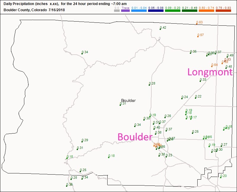
Figure 2 update: shows the rainfall reports on Sunday - Longmont scored with over 1/2 to almost 1 inch of rainfall. Fantastic! Boulder county, as a whole, did pretty well with over 1/3 inch of rainfall in most locations.
End 8:30am update.
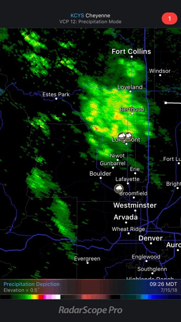
The Sunday storm started about 4 hours early and ended about 4 hours early (for Longmont). Figure 1 shows the first batch of showers that came in mid-morning. It is still raining as I type. It looks like NE Longmont has received about 2/3rds of an inch of water. Temperatures remained in the 60's F as well.
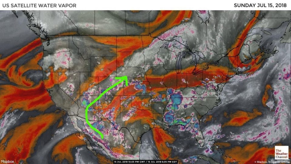
Figure 2 is our, now familiar, water vapor satellite. The grey and white colors are moisture laden air. The moist stream is center on a SW-NE line just to our southeast. It will be nearby for the next couple of days.
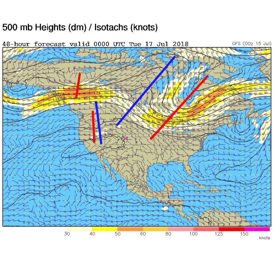
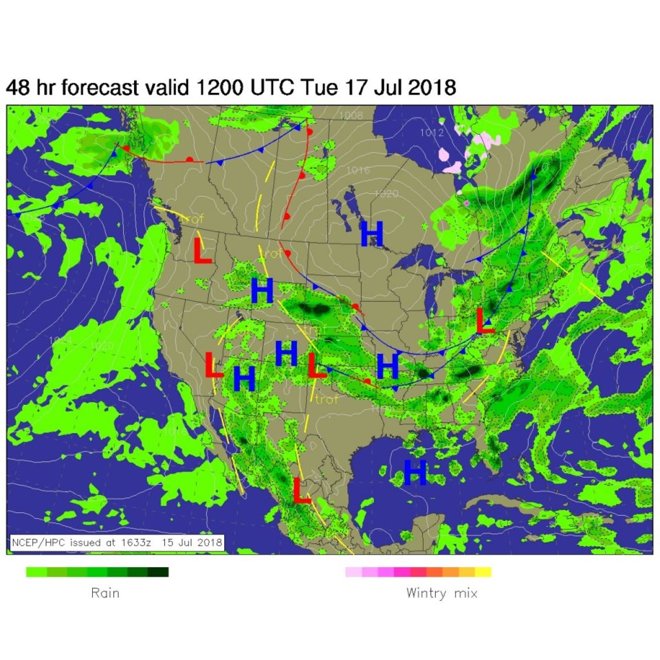
We have a chance of thunderstorms this afternoon, but Figure 3 shows there isn't a trough to correspond to today's max heating hours. The front gets washed out to our south and northern Colorado remains a bit too stable for a lot of rain today (Figure 4). With clear skies, most of the day, and the ridge in Figure 3 overhead, we'll climb to a humid near 90°F today.
Tomorrow, the short wave trough out west in Figure 3 will arrive and make the afternoon thunderstorms stronger. The SPC has a marginal risk of severe weather from Longmont to the northeast (1 on a scale of 1-5 in severity) -see Figure 5.
The longer range forecast:
After the next couple of days, we dry out and heat to nearly 100°F again with a dominant ridge over the west. It looks like the end of the next weekend will be the earliest we see a better chance of storms/rain and cooler weather.


