Skip to content

The Next Storm/Next Snow Forecast Discussion from the Cherrywood Observatory – July 19th, 2018

This content was originally published by the Longmont Observer and is licensed under a Creative Commons license.

Forecast Discussion:

Sorry, it is hot. And is going to be hot through Saturday. And dry.

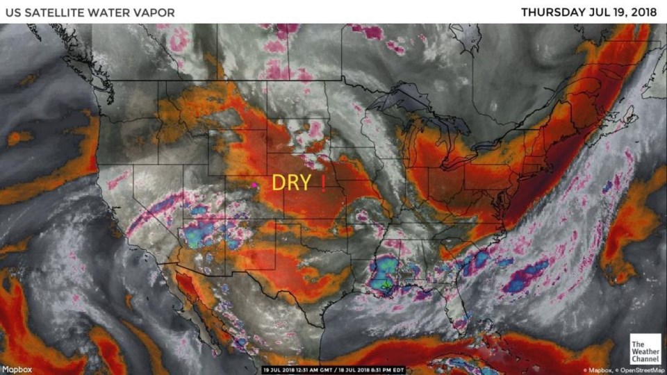
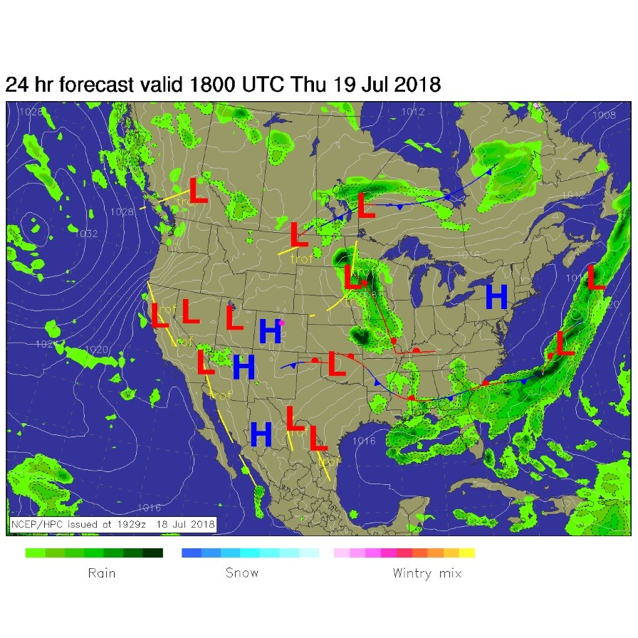
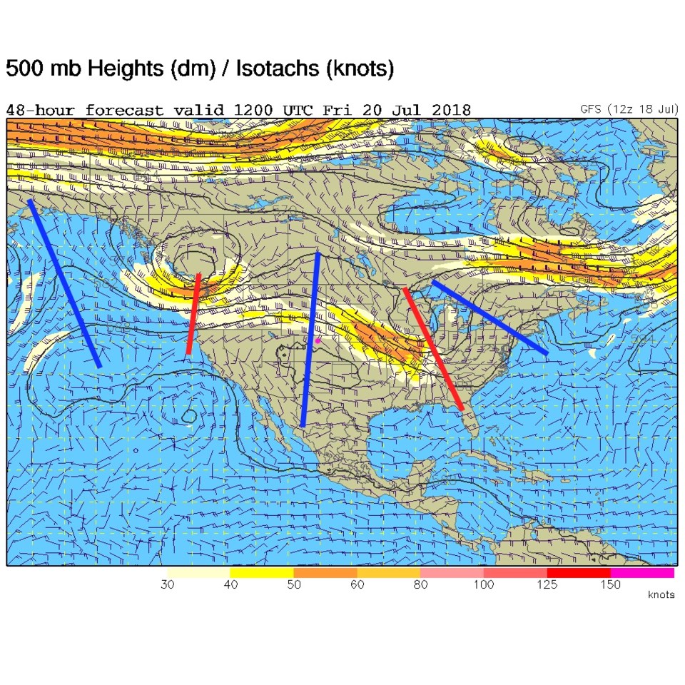
Figure 1 shows the dry air over eastern Colorado Wednesday PM. We have a high pressure center located overhead again for today (Figure 2). And the center of the upper air ridge right over head again (blue line next to the Longmont pink dot in Figure 3). We are just in the doldrums of summer for a bit.

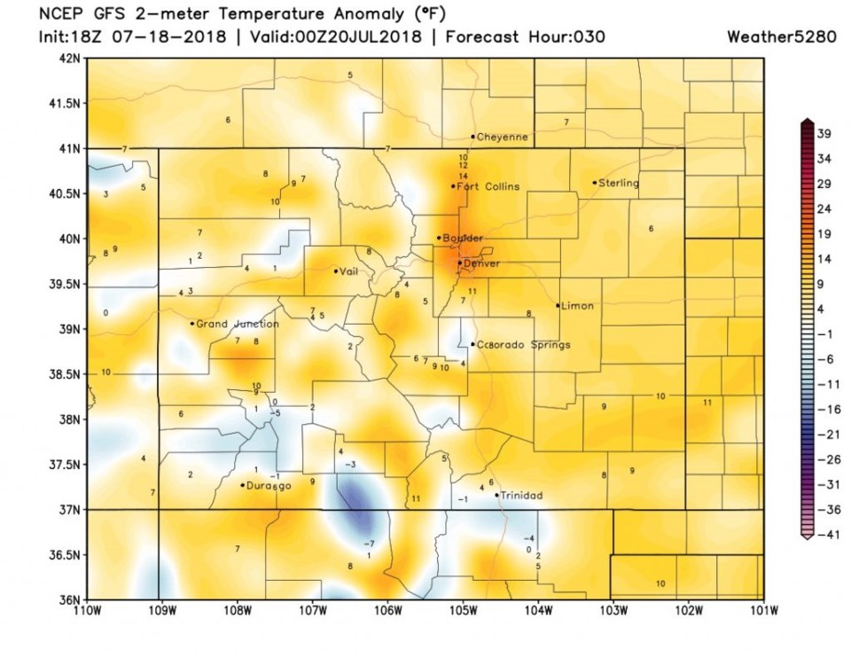
The temperature anomaly this afternoon will be maximal along I-25 with down-slope flow adding to the compressional heating is shown in Figure 4.  This looks to be 10-15 degrees above normal. That puts us in the 99°-102° F area. Oh my.

Figure 1: the water vapor satellite image from Wednesday PM. Reds/Oranges are dry air, greys/whites are moist air regions.

Figure 2: The forecast surface map for Thursday midday. From NCEP.

Figure 3: The 500mb forecast upper air analysis for Friday AM. Pink dot is Longmont. Red lines are troughs, blue lines are ridges.

Figure 4: surface temperature anomaly for Colorado for Thursday PM from the GFS and weather5280.com

The longer range forecast:

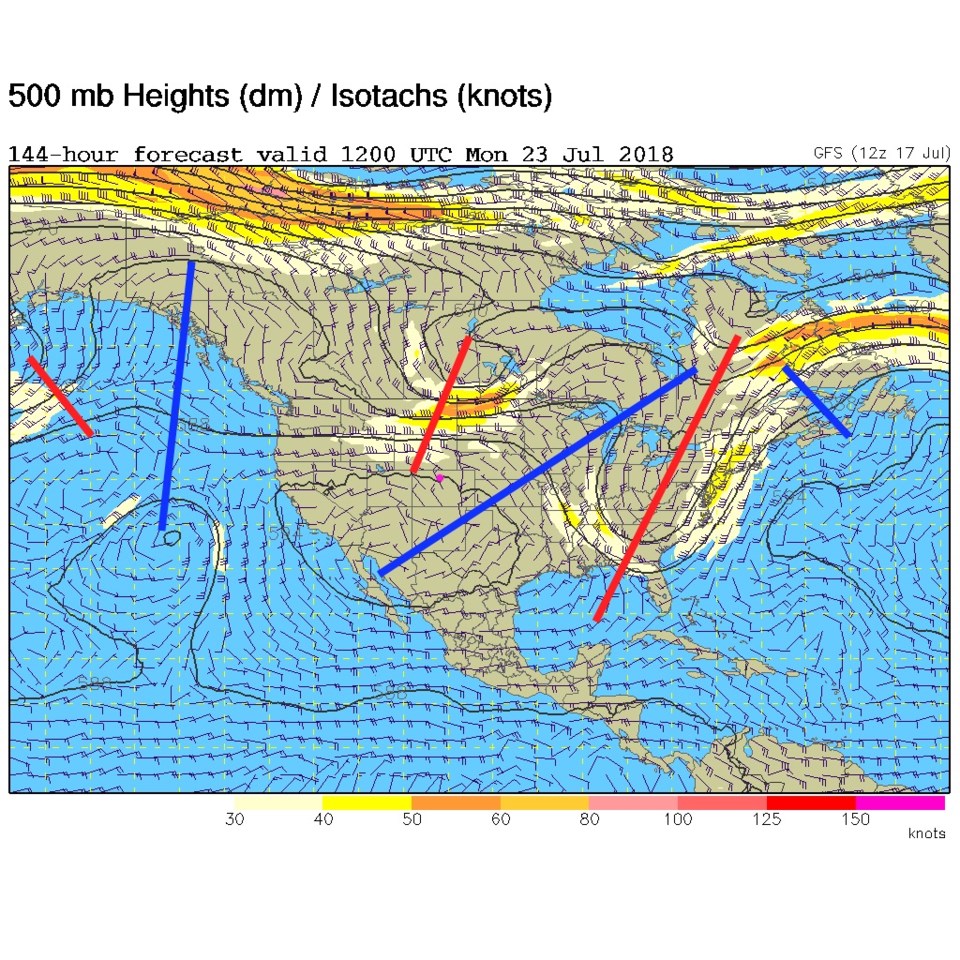
Though some moisture may return, it won't be much and the ridge will hold strong until Saturday passes. Sunday will see our next cool down and better chance of storms as an upper level trough sends a cold front down (Figure 5). Hold on, this is not Phoenix, it does cool down at times.

Figure 5: The 500mb forecast upper air analysis for Monday AM. Pink dot is Longmont. Red lines are troughs, blue lines are ridges.

Current Weather

Clear

Clear

47°F

UV Index
0 Low
Pressure
29.91 Steady
Visibility
7 miles
Dewpoint
37 °F
Humidity
69%
Wind
ESE 2.3 mph
Gust
4 mph
Wind Chill
47 °F

Hourly Forecast

Today
1 AM
46°F
Mostly clear
Today
2 AM
44°F
Mostly clear
Today
3 AM
43°F
Mostly clear
Today
4 AM
42°F
Mostly clear
Today
5 AM
40°F
Mostly clear
Today
6 AM
39°F
Mostly sunny
Today
7 AM
42°F
Mostly sunny
Today
8 AM
48°F
Intermittent clouds
Today
9 AM
53°F
Intermittent clouds
Today
10 AM
59°F
Mostly cloudy
Today
11 AM
64°F
Mostly cloudy
Today
12 PM
67°F
Cloudy

7 Day Forecast

Intermittent clouds

Saturday

64 °F

Cooler with clouds giving way to some sun


Intermittent clouds

Saturday Night

39 °F

Turning out clear


Mostly cloudy

Sunday

78 °F

Cloudy most of the time, breezy and warmer


Mostly cloudy

Sunday Night

47 °F

Rather cloudy and windy


Windy

Monday

60 °F

Very windy; cloudy and cooler


Intermittent clouds

Monday Night

41 °F

Partly cloudy


Intermittent clouds

Tuesday

59 °F

Cool with times of clouds and sun; windy in the afternoon


Partly cloudy

Tuesday Night

32 °F

Partly cloudy


Intermittent clouds

Wednesday

60 °F

Times of clouds and sun


Intermittent clouds

Wednesday Night

35 °F

Partly cloudy


Sunrise and Sunset

Sunrise
5:55 AM
Sunset
7:59 PM

Based on AccuWeather data