Skip to content

Update 10:30am: The Next Storm/Next Snow Forecast Discussion from the Cherrywood Observatory – July 21st, 2018

This content was originally published by the Longmont Observer and is licensed under a Creative Commons license.

The forecast discussion:

10:30am Update:

It looks like we'll have a nice round of storms roll through around 4-5pm today (figure 1 update).  Nothing severe, but a few neighborhoods may pick up a quick heavy dump of moisture.  Most folks won't see that much rain.

composite-ref-msl-wind_08

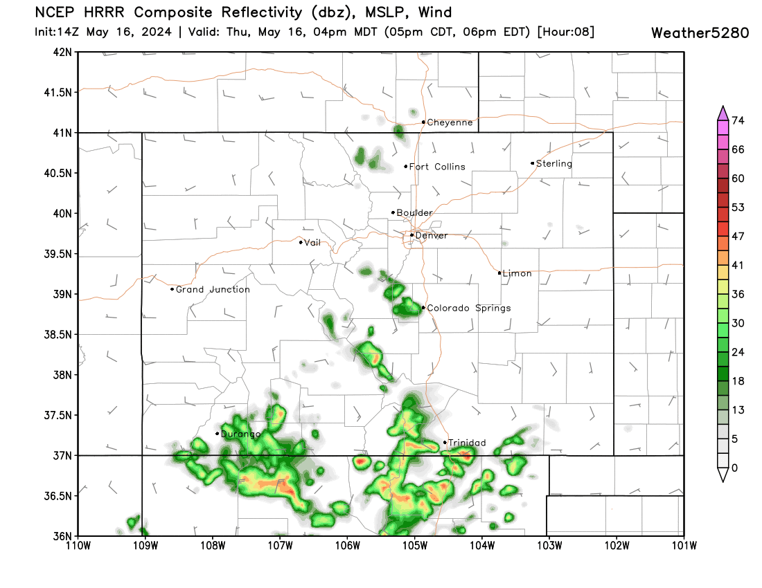
Figure 1 update: the HRRR reflectivity forecast for 4pm Saturday July 21 from weather5280.com

End Update 10:30am.

The heat is beginning to appear in our rear view mirror. As I write, on Friday afternoon, it has already climbed to 98°F. We should only get to 94°F today and 91°F Sunday. (That is 'some' relief.)

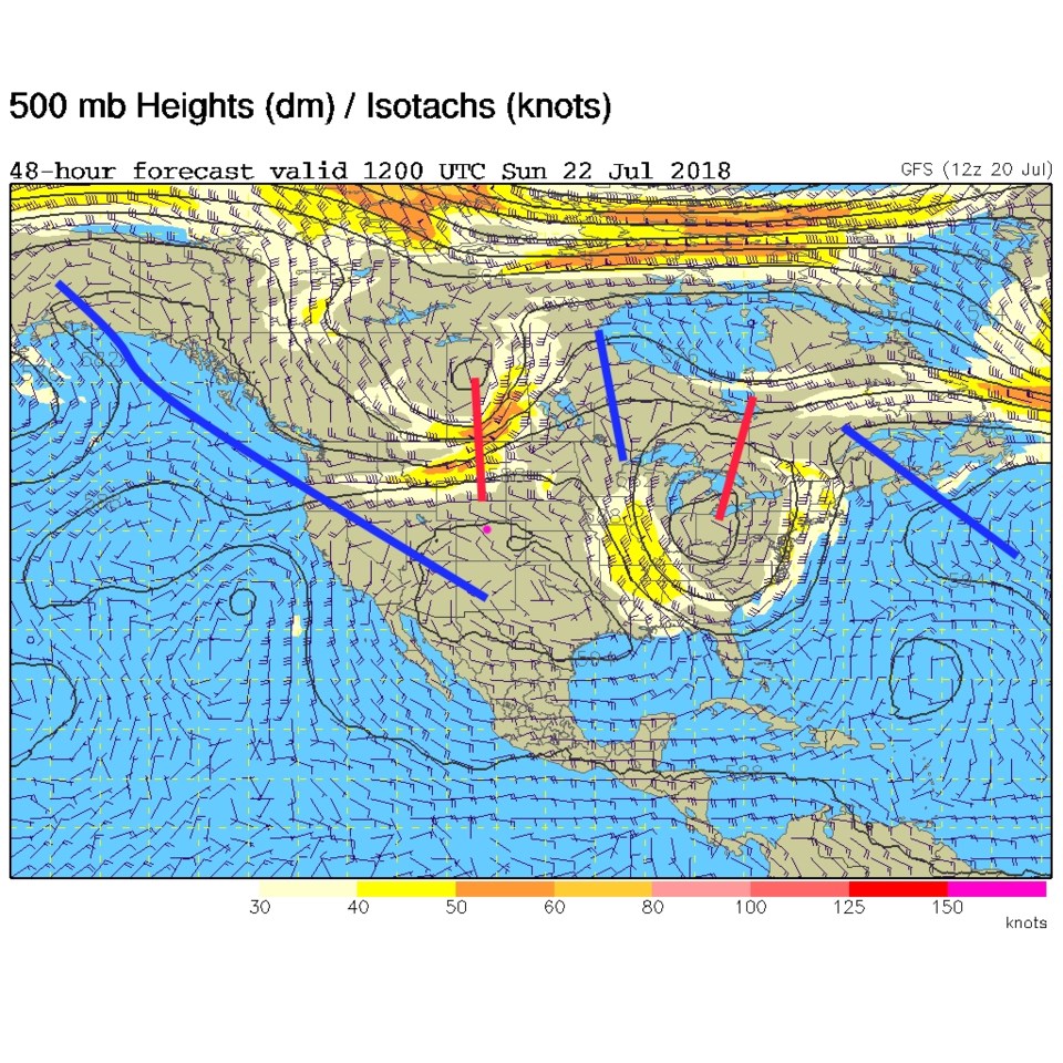
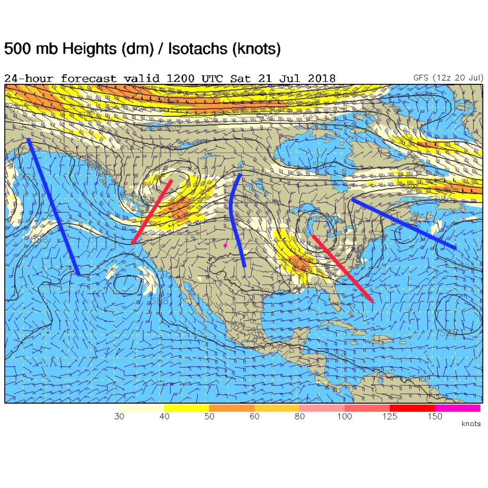
The ridge (Figure 1) is still overhead today- which explains the persistent heat. The next trough is still up in the Pacific Northwest.

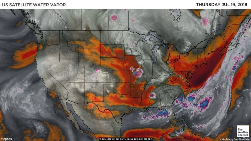
On the western side of the ridge, some moisture is coming in. There is one river of moisture coming out of the Gulf of Mexico and one from the lower tropics up west of Mexico. Both are flowing into the Western U.S. (Figure 2).

Figure 1: The 500mb forecast upper air analysis for Saturday AM. Pink dot is Longmont. Red lines are troughs, blue lines are ridges.

Figure 2: the water vapor satellite image from Friday PM. Reds/Oranges are dry air, greys/whites are moist air regions.

The longer range forecast:

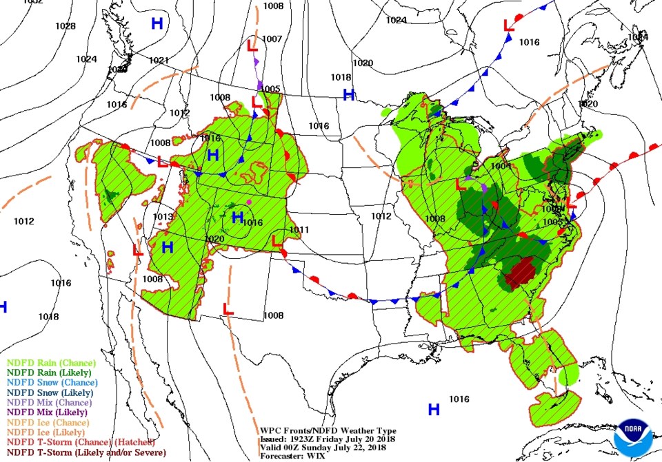
By Sunday AM the trough is slipping in and sending a cold front down into Colorado (Figure 3).  It won't arrive until about 1pm.  The high for the day will occur about noon to 1pm.

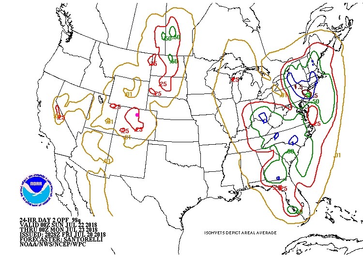
For Saturday PM there is a statewide chance of showers (Figure 4).  Another peak chance of rain occurs after noon Sunday with a possible 1/4th inch of rain locally (Figure 5).  This is less rain than earlier models predicted.  The temperatures on Monday do drop to 79°F.  (Tuesday we climb back to 89°F though...)

Figure 3: The 500mb forecast upper air analysis for Sunday AM. Pink dot is Longmont. Red lines are troughs, blue lines are ridges.

Figure 4: The rain chances (precipitation nationwide) for Saturday PM from the NWS and NOAA.

Figure 5: The rain totals between Saturday PM and Sunday PM from the NWS and NOAA.

Current Weather

Sunny

Sunny

39°F

UV Index
1 Low
Pressure
29.72 Steady
Visibility
8 miles
Dewpoint
18 °F
Humidity
43%
Wind
SW 3.3 mph
Gust
7.3 mph
Wind Chill
37 °F

Hourly Forecast

Today
7 AM
37°F
Intermittent clouds
Today
8 AM
44°F
Intermittent clouds
Today
9 AM
48°F
Intermittent clouds
Today
10 AM
52°F
Intermittent clouds
Today
11 AM
54°F
Intermittent clouds
Today
12 PM
56°F
Intermittent clouds
Today
1 PM
57°F
Intermittent clouds
Today
2 PM
58°F
Intermittent clouds
Today
3 PM
58°F
Intermittent clouds
Today
4 PM
58°F
Intermittent clouds
Today
5 PM
57°F
Intermittent clouds
Today
6 PM
56°F
Intermittent clouds

7 Day Forecast

Intermittent clouds

Wednesday

58 °F

Breezy and cool with times of clouds and sun


Mostly cloudy w/ showers

Wednesday Night

39 °F

Increasing clouds with a shower in spots late


Intermittent clouds

Thursday

54 °F

Cool with times of clouds and sun


Partly cloudy

Thursday Night

43 °F

Partly cloudy


Mostly cloudy

Friday

60 °F

Mostly cloudy


Clear

Friday Night

42 °F

Clear


Mostly sunny

Saturday

68 °F

Mostly sunny


Mostly cloudy w/ t-storms

Saturday Night

43 °F

Mostly cloudy with showers and thunderstorms late


Mostly cloudy

Sunday

68 °F

Becoming cloudy with a thunderstorm in spots in the afternoon


Partly cloudy

Sunday Night

47 °F

A thunderstorm in the evening; otherwise, partly cloudy


Sunrise and Sunset

Sunrise
5:51 AM
Sunset
8:03 PM

Based on AccuWeather data