This content was originally published by the Longmont Observer and is licensed under a Creative Commons license.
Forecast Discussion:
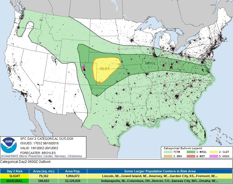
Update 6/19 10:30am
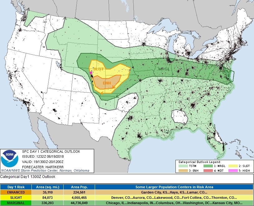
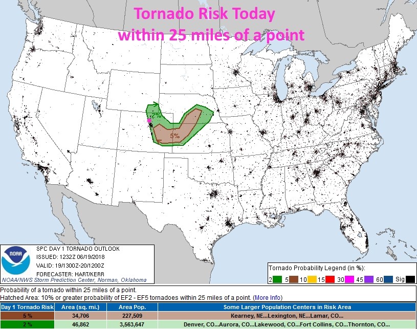
With yesterday’s severe weather as an indicator of how favorable the environment is, today will see even greater severe weather chances. The morning data shows a short wave trough timed well to cross the foothills and I-25 corridor in the mid- late-afternoon when maximum daytime heating is in place. Some models show just a few, isolated, severe storms, other model runs show multiple waves of storm initiation in the foothills moving east and becoming supercell storms with very large hail and a few tornadoes + strong damaging winds. The higher foothills are under a marginal risk (1 on scale of 1-5) including Estes Park. The rest of I-25 corridor is under a slight risk (2 on scale of 1-5). Southeast Denver and off to the east and south of Denver are under an Enhanced risk (3 on a scale of 1-5). (Figure 1 update). Figure 2 update shows that there is a 2% chance of a tornado within 25 miles of any given point in Longmont this afternoon and evening. Figure 3 shows a 15% chance of hail larger than 1 inch in diameter within 25 miles of a point on town for this same time.
The only thing that will limit or hold off storm formation will be a possible persistent low cloud layer over the region. IF you see sunshine a good portion of the day, then storm chances will be better in town. Remember, lighting strikes (that will be frequent with these storms) can, and do kill many people every year.

End update 6/19 10:30m
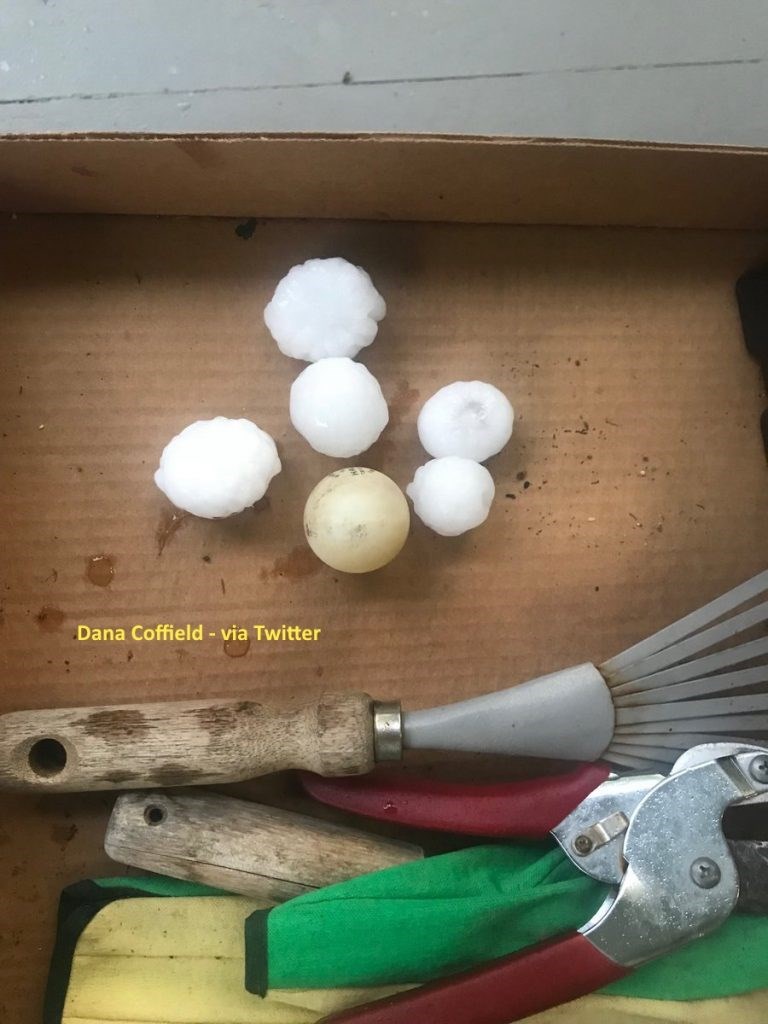
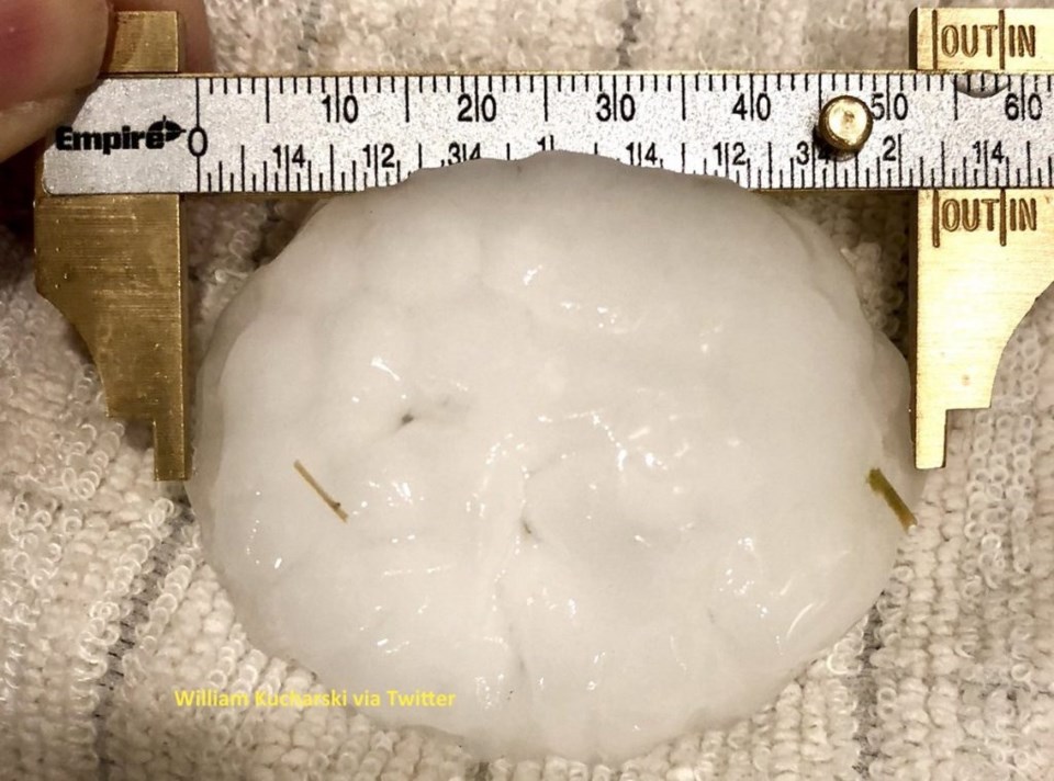
The front and moisture paid off with severe weather and a slew of severe thunderstorm watches and warnings Monday Night. Figure 1 and 2 are a couple examples of hail that fell just south of Longmont last evening (thanks to twitter).
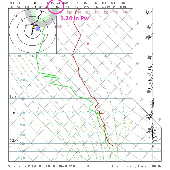
I promised to watch the moisture flow increase - Figure 3 is the sounding again with precipitatable water highlighted.
Going into Monday (Sunday PM), it was up at 1.24 inches of water.
It was 0.47 inches Thursday AM.
The Thursday PM vale was 0.67 inches.
Friday PM was 0.70 inches.
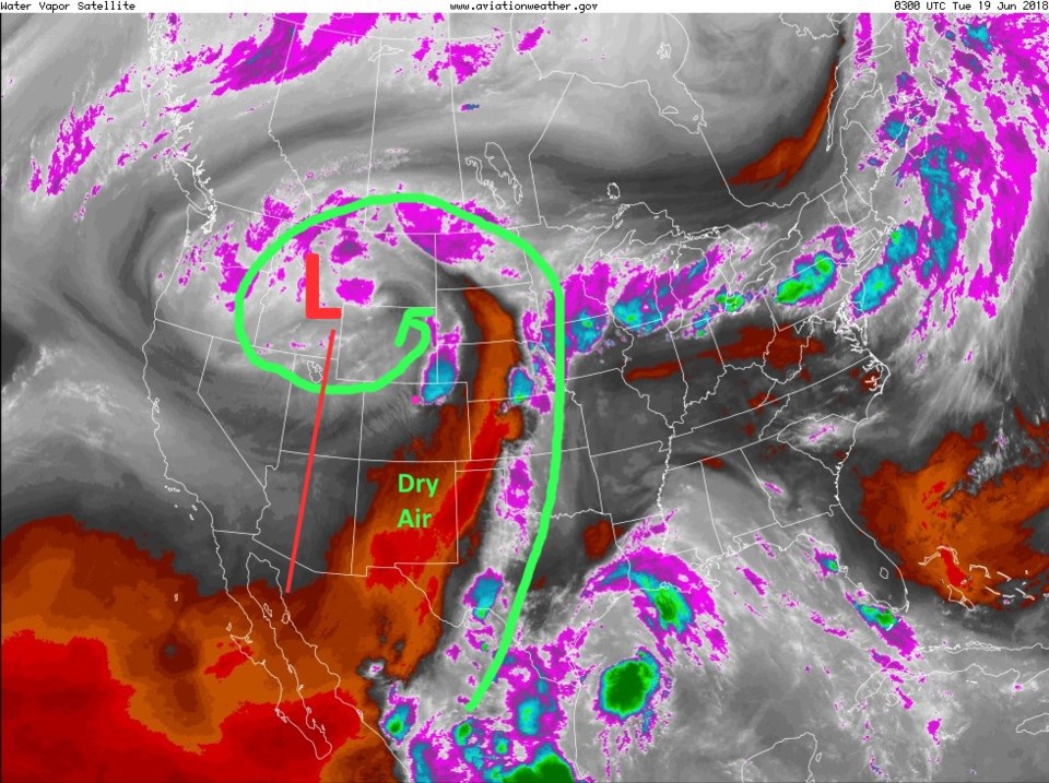
The tropical systems are out of the way (absorbed into the mid-latitude jet stream flow). The Gulf of Mexico fetch is being entrained up and around the cutoff low in the west that is also keeping us quite cool (below normal temperatures). Figure 4 shows the big spiral around the low. The dry notch of air that robbed Colorado of much of its expected rainfall is now over the southeast corner of the state and into Kansas and parts of the western Midwest. The 416 fire didn't get much water dumped on it, but it is up to 35% contained Monday PM thanks to calmer winds, cooler temperatures, and higher humidity levels.
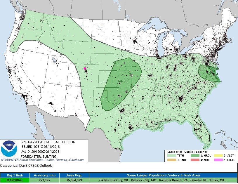
With the low just to our west, and moisture still in place, we'll see another round of thunderstorms up and down the I-25 corridor this afternoon. A marginal risk is forecasted for Longmont (1 on a scale of 1-5 in severity) for hail, high winds, and a few tornadoes (possible) - Figure 5.
The longer range forecast:
The atmosphere begins to come to equilibrium as the western trough moves east and the severe chances move out of the state Wednesday. We still have a chance of afternoon thunderstorms as temperatures begin to rise again (but only into the 80'sF eventually).
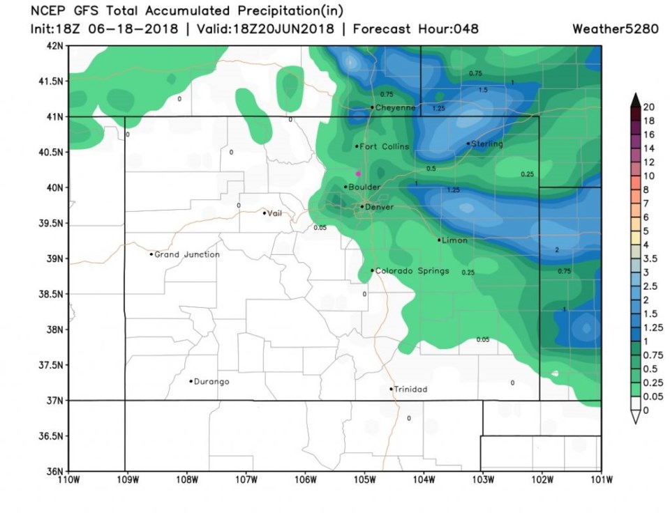
The precipitation expected through Wednesday noon (Figure 7) is confined to the northeast and eastern portions of the state. Longmont (pink dot, usually, on my maps) is sitting around 1/4 inch of rain by the middle of the week. So much for 1-2 inches of water!