Skip to content

The Next Storm/Next Snow Forecast Discussion from the Cherrywood Observatory – June 20, 2018

This content was originally published by the Longmont Observer and is licensed under a Creative Commons license.

Forecast Discussion:

We had severe weather!  I need to get some hours back into life, so lets look at the numbers and the return to quiet weather - briefly- today.

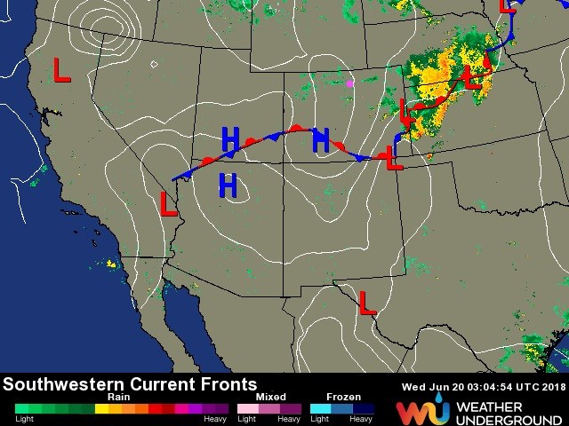
The front has now pushed down deep to the southern counties of Colorado. Cool stable air has filled in across Colorado. Severe weather is raging across Nebraska and Kansas as the upper air trough passes us and heads east.  We have the added stabilizing factor of sinking air on the western side of the trough that has passed (figure 1).

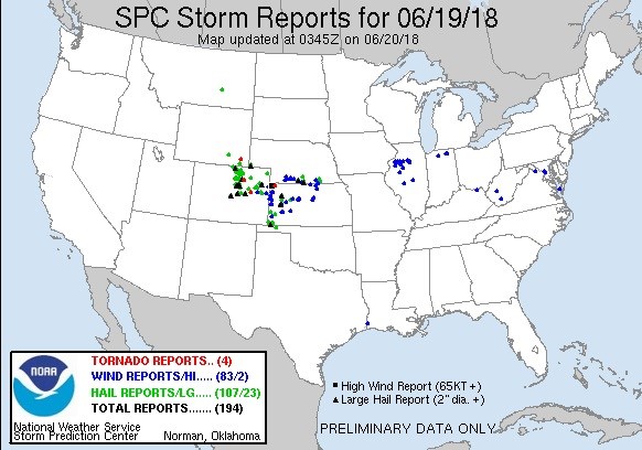
Before things calmed down, we had many reports of severe weather - tornadoes, large hail and damaging winds. Figure 2 shows the reports to the NWS by Tuesday evening.

There were two tornadoes in the state, one in Weld county and one in Lincoln county.

There were 66 reports of large hail.

And there were 7 reports of damaging wind events.  Wow.

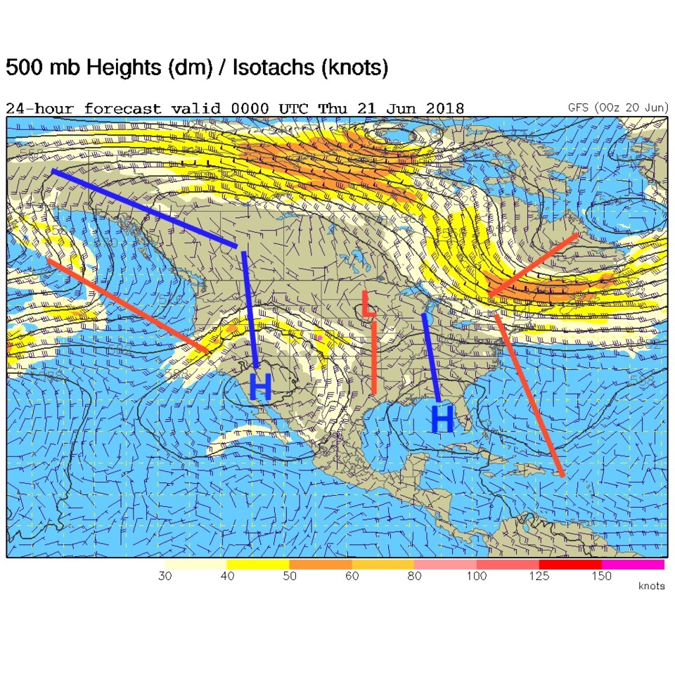
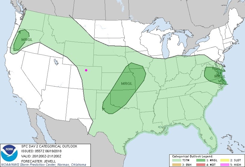
Today, a ridge approaches as the trough departs (blue and red lines respectively, Figure 3).  But with warming temperatures, moisture in place as well as weak up slope flow behind the front, thunderstorms are possible this afternoon- but nothing severe (Figure 4).

Figure 1: The current surface map for Tuesday PM from weatherunderground.com

Figure 2: The SPC storm reports for 6/19 as of 8pm.

Figure 3: The 500mb upper air analysis forecast from the GFS for Wednesday PM. Pink dot is Longmont.

Figure 4: the day 2 SPC thunderstorm and severe weather forecast made Tuesday (valid Wednesday).

The longer range forecast:

We warm from here *almost* to 90F on Friday, then cool a bit on the weekend. There are chances of afternoon thunderstorms almost every day. Sunday is looking more stormy.

Summer begins on Thursday June 21st, 4:07am.

Current Weather

Clear

Clear

41°F

UV Index
0 Low
Pressure
29.96 Rising
Visibility
9 miles
Dewpoint
25 °F
Humidity
54%
Wind
SSE 2.7 mph
Gust
5.2 mph
Wind Chill
39 °F

Hourly Forecast

Today
6 AM
35°F
Mostly cloudy
Today
7 AM
38°F
Mostly cloudy
Today
8 AM
42°F
Mostly sunny
Today
9 AM
47°F
Mostly sunny
Today
10 AM
51°F
Mostly sunny
Today
11 AM
55°F
Mostly sunny
Today
12 PM
58°F
Mostly sunny
Today
1 PM
60°F
Partly sunny
Today
2 PM
62°F
Intermittent clouds
Today
3 PM
63°F
Mostly cloudy
Today
4 PM
64°F
Mostly cloudy
Today
5 PM
63°F
Cloudy

7 Day Forecast

Intermittent clouds

Thursday

64 °F

A blend of sun and clouds; breezy this afternoon


Mostly cloudy

Thursday Night

35 °F

Mostly cloudy


Partly sunny

Friday

68 °F

Increasingly windy with partial sunshine


Partly cloudy

Friday Night

38 °F

Partly cloudy


Partly sunny

Saturday

66 °F

Partial sunshine


Mostly clear

Saturday Night

41 °F

Clear to partly cloudy


Mostly cloudy

Sunday

78 °F

Rather cloudy and warmer; windy in the afternoon


Intermittent clouds

Sunday Night

43 °F

Partly cloudy; windy late


Mostly cloudy

Monday

60 °F

Mostly cloudy, breezy and cooler


Mostly cloudy

Monday Night

43 °F

Mostly cloudy


Sunrise and Sunset

Sunrise
5:58 AM
Sunset
7:57 PM

Based on AccuWeather data