This content was originally published by the Longmont Observer and is licensed under a Creative Commons license.
Forecast Discussion:
This is the best hit of water we've had in months and months. Let's look at the Front Range rundown...
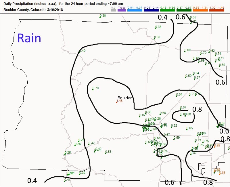
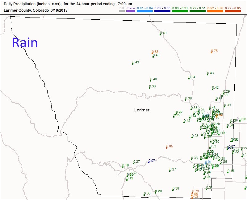
Figure 1 is rainfall for Boulder County. Longmont received 1/2 to 3/4ths of an inch of water (I predicted 1/4th to 1/2 an inch - so this storm over-performed on me. Good!). Boulder was similar in its water amounts.
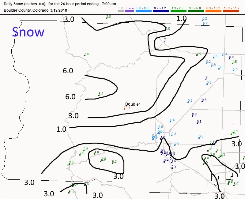
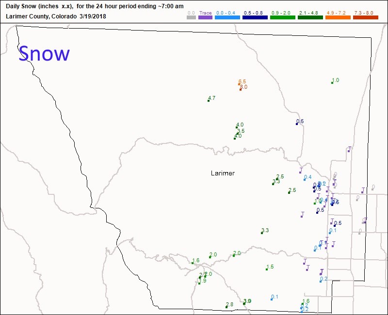
Figure 2 is snowfall for Boulder County - we (Longmont) received 1/2 to 1 inch of snow, on average. Boulder did about the same as well.
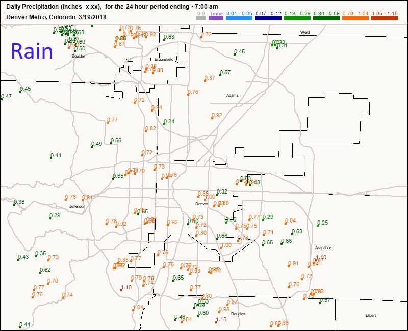
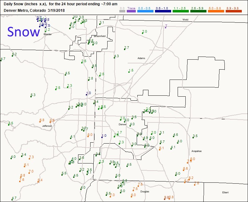
In Figure 3 and 4, Denver saw a lot of 1/2 to 1 inch rainfall amounts and 1-8 inches of snow (heavy amounts on the south and southwest edges).
Figures 5 and 6 show 1/4th to 3/4th's of an inch of water north of Longmont but very little snow, a trace to an inch along I-25.
Additional snow showers moved over all afternoon and evening on Monday. Now we warm to normal and above normal temperatures again.
The longer range forecast:
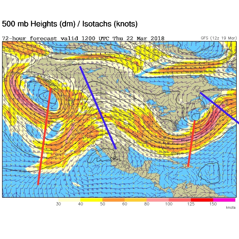
A ridge slowly inches overhead Tuesday through Friday. As a representative image of this ridge, take a look at the blue line in the 500mb upper air forecast map (Figure 7) for Thursday AM.
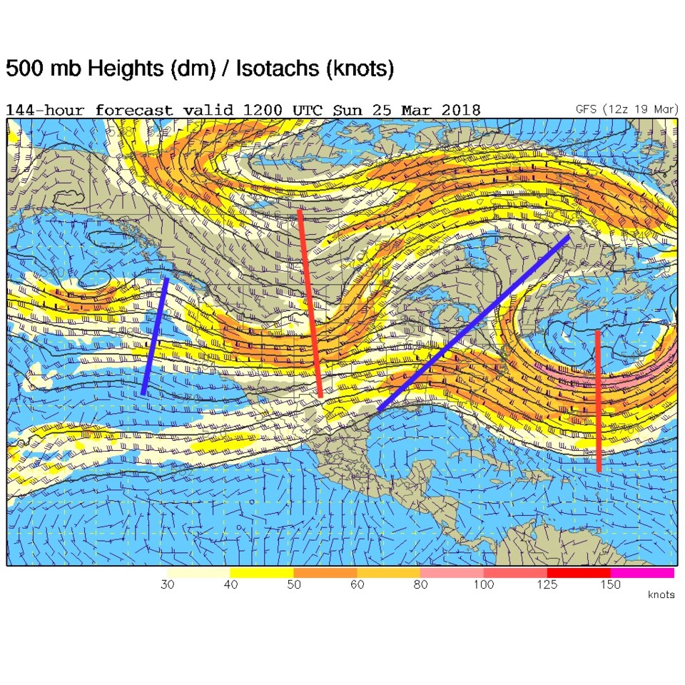
Our next (also possibly nice and wet) storm begins mid-weekend. The trough moving in (the red line in Figure 8) is our next storm.