This content was originally published by the Longmont Observer and is licensed under a Creative Commons license.
Forecast Discussion:
3pm Update: There is a severe thunderstorm watch issued by the NWS through 9m tonight. Keep safe if skies darken!
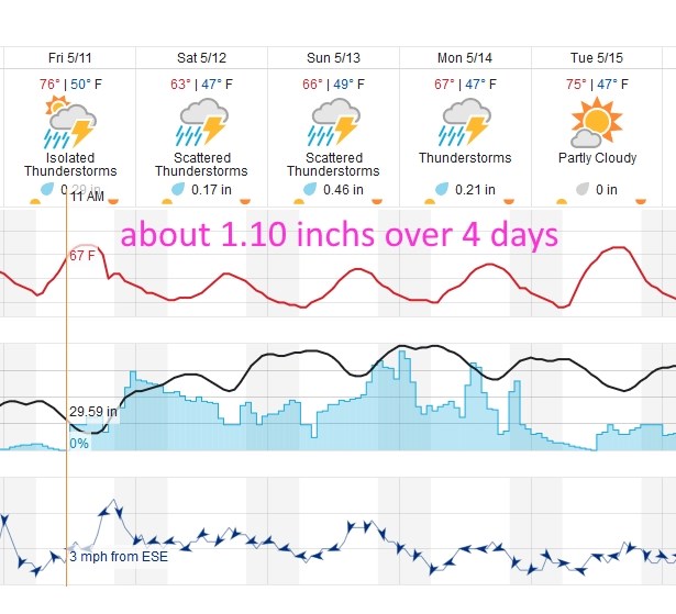
As we get closer and closer to our weekend storm (now stretching into next week), we are seeing really warm temperatures across Colorado. If DIA hit 90F on Thursday, that would be the 4th earliest 90F temperature in weather records for the city. I'll hop in and update this IF it happens. [Quick update, as promised, I'm reporting that DIA did hit 90F yesterday breaking the record for the date. Longmont only got to 85-88F (depending on the station) and had a record for the date of 90F set in 1962, so we didn't make it. For this weekends storm, the main focus of rain and severe thunderstorms will be north of Ft. Collins, but we are still expected to get 0.8 to 1.0 inches of water between tonight and Monday night. Remember, this will not be a continuous heavy rain like the last storm, but more periods of drizzle, clouds, and afternoon thunderstorms and sowers. End update.]
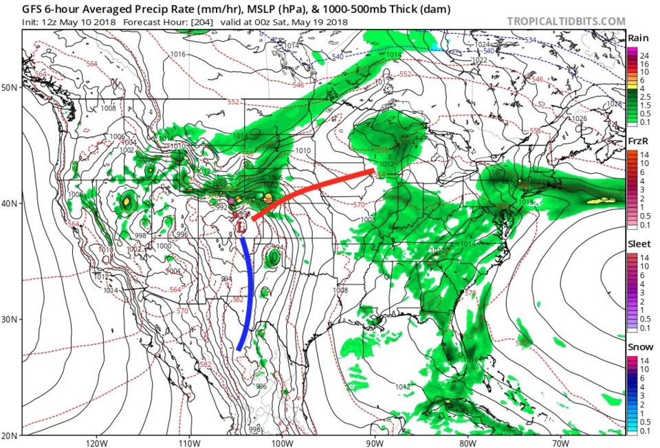
Figure 1 is a quick look at the run of the next storm. We cool back to the 60'sF (near normal) for the weekend and get 1/5th to 1/2 inch of rain each day. The weatherunderground model give us just over an inch of rain through the Friday to Monday period.
As you can see in figure 1, we have a chance of thunderstorms every day (mainly in the afternoon when daytime heating is added as an ingredient). Our front will push down and sit near Longmont. This will be a focus of some storms that may become severe Friday (a marginal risk). The primary risk will be large hail and damaging straight line winds.
The longer range forecast:
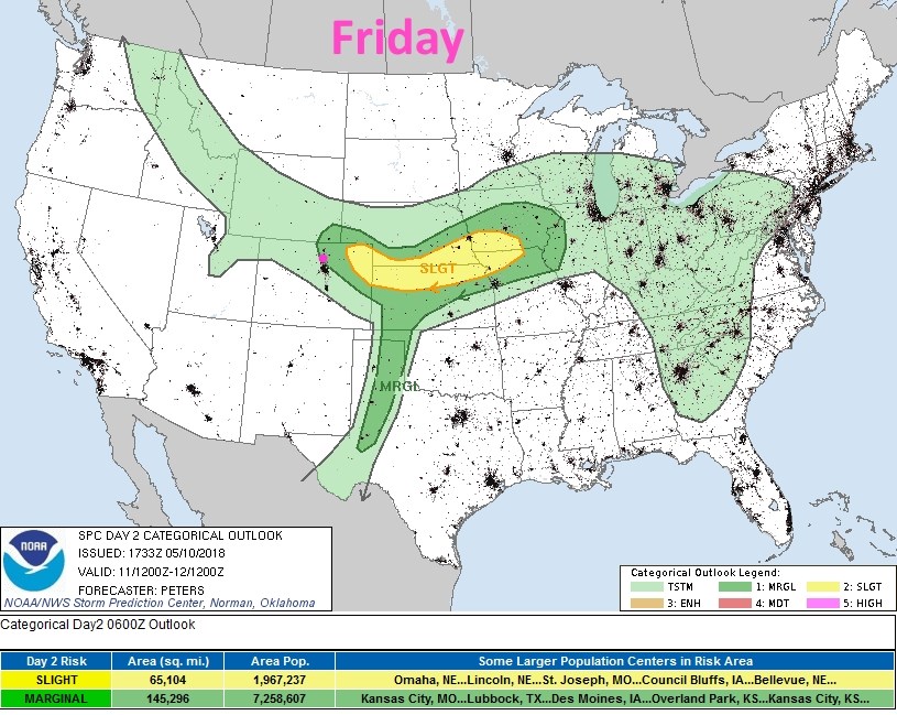
Figure 3 shows that we sill have a marginal risk of severe weather here in town, and to the northeast, on Saturday afternoon. The primary risk is, again, large hail and damaging straight line winds.
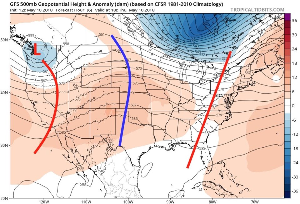
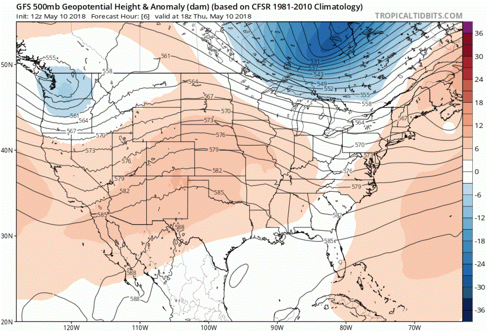
I promised to show the unusual progression of our trough that is powering this storm. Figure 4 is the first frame and Figure 6 is the last frame in the animation found in Figure 5. In figure 4, the trough is arcing from Washington state down into Nevada and into Southern California. The ridge that will block it was over western Kansas on Thursday. By the end, Figure 6, the trough has almost filled in over Utah. Note that part of the western trough has been greatly strengthened further out west and is rolling eastward as a cutoff low that may be our next storm for next weekend.
Watch the trough in Figure 5 move towards us, pause, then back west a bit before filling in.
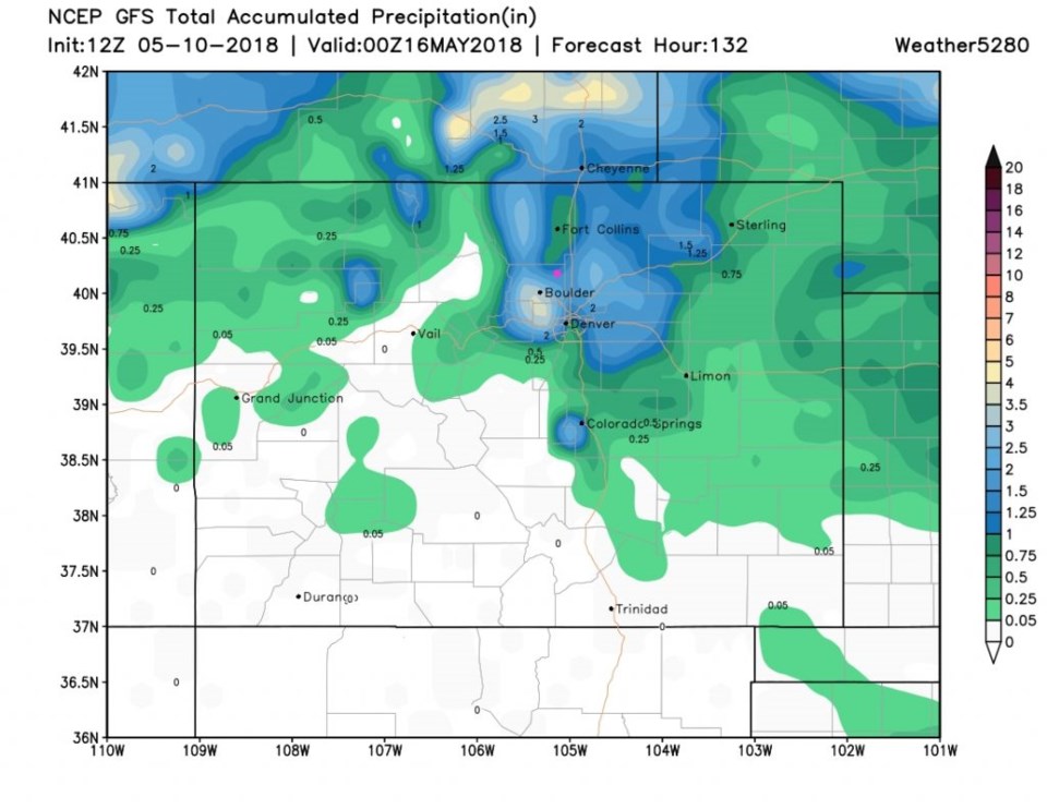
Back to this weekend's storm, the GFS is really only giving NE Colorado the rain in this storm. Longmont (pink dot) is in the 1.25 to 1.5 inch area by Tuesday (See figure 7).
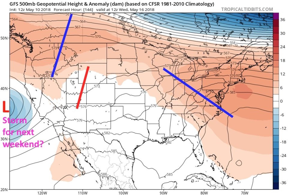
For fun, Figure 8 is a look at the system the GFS thinks that cut off low seen in figure 6 may create. There is another well placed low pressure center in eastern Colorado and rain dumping around town again. We'll see...!