This content was originally published by the Longmont Observer and is licensed under a Creative Commons license.
Forecast Discussion:
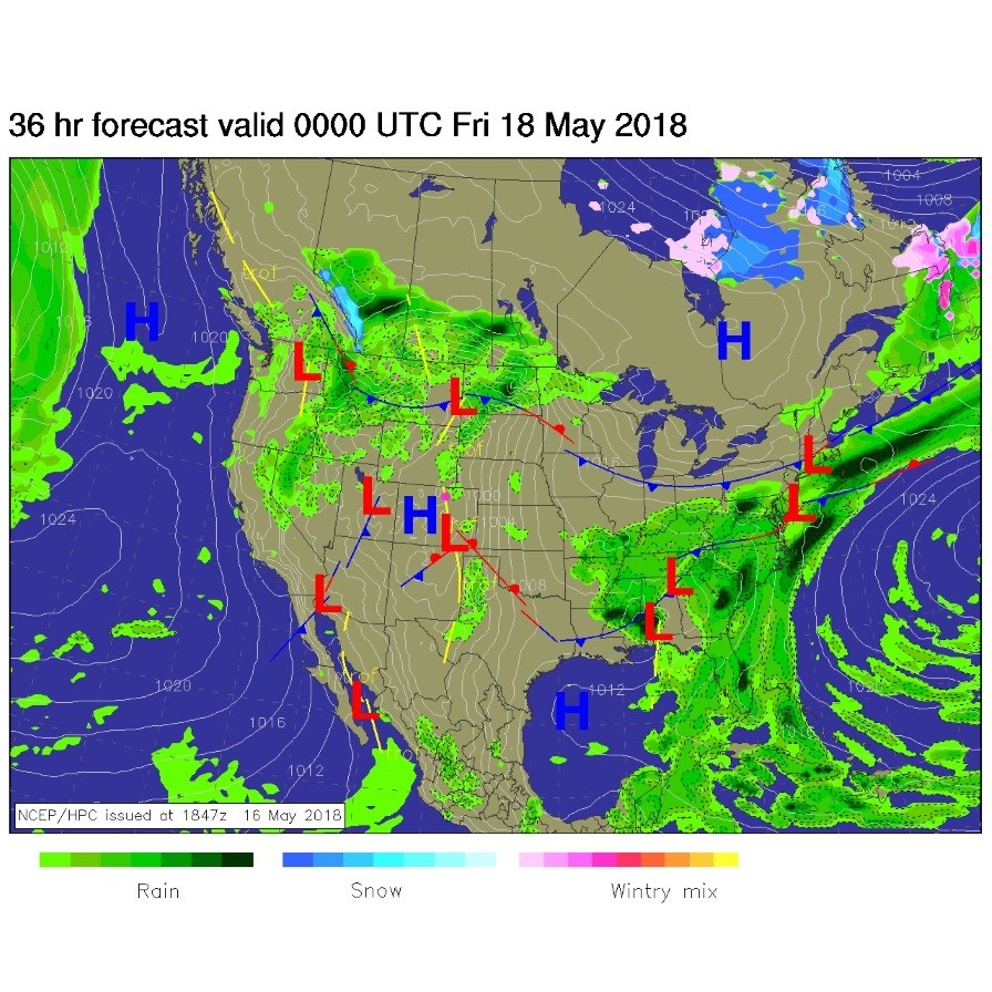
We climbed into the upper 80'sF on Wednesday and will do about the same on Thursday/today. Figure 1 is the surface map for this afternoon. You can see a low pressure trough east of the mountains that may help trigger thunderstorms in the returning moisture (it will provide lift and a convergence zone at the surface). Our weekend storm is visible out in Utah and Arizona with a front up in Montana. They will come together in northern Colorado, but more on that below.
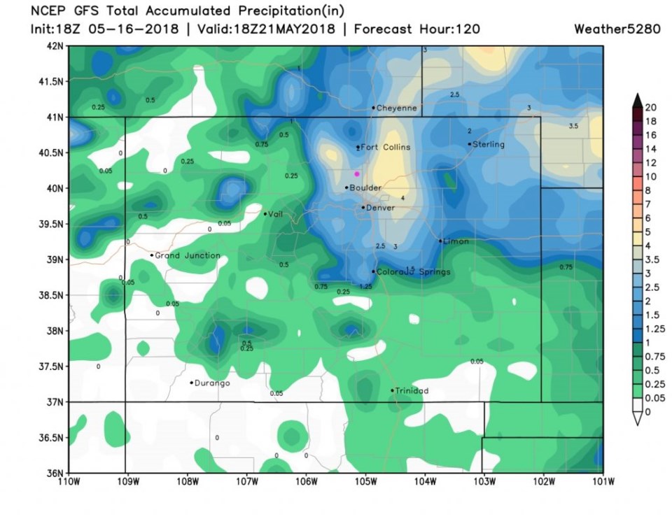
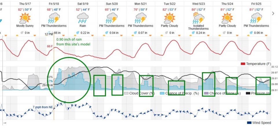
Figure 2 is the next 10 days forecast from weatherunderground.com. We do see an afternoon elevation of rain chances today, but the real action doesn't pick up until late morning or the lunch time hour Friday.
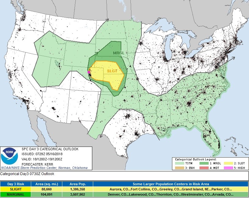
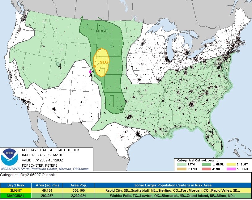
Figure 3 is the SPC severe storm outlook for this afternoon. Longmont is right on the edge between dryness and a chance of a thunderstorm. Just a handful of miles east, the severe risk is Marginal (1 on a scale of 1-5) and almost immediately further east: Slight (2 on a scale of 1-5). The primary risk will be hail and high winds in a few supercells (thunderstorms with rotation and exceptional strength).
The longer range forecast:
Returning to Figure 2, after an initial push of thunderstorms on Friday, a front sweeps south across the state and significant up-slope flow begins from roughly 6pm Friday to 6pm Saturday. Also note the big 20F drop in temperatures again as we pass into Saturday.
Figure 4 shows that with this stronger system moving in, we have a marginal (and are on the edge of a slight) risk of severe weather - hail and strong winds will be the main threat again. Could a weak tornado form though? Always be alert.
The really interesting feature, that we've been watching for a few days, is the expected rainfall. The GFS had a bullseye of a LOT of rain around Longmont two days ago. Yesterday, it moved it up into southern Wyoming, primarily. But today, Figure 5 shows that it is back around Longmont, Boulder and just east of I-25 from Cheyenne down to the Palmer Divide. Longmont would get over 3.5 inches of rainfall (by Monday noon) if this verifies. Figure 2 shows just under an inch of rainfall.
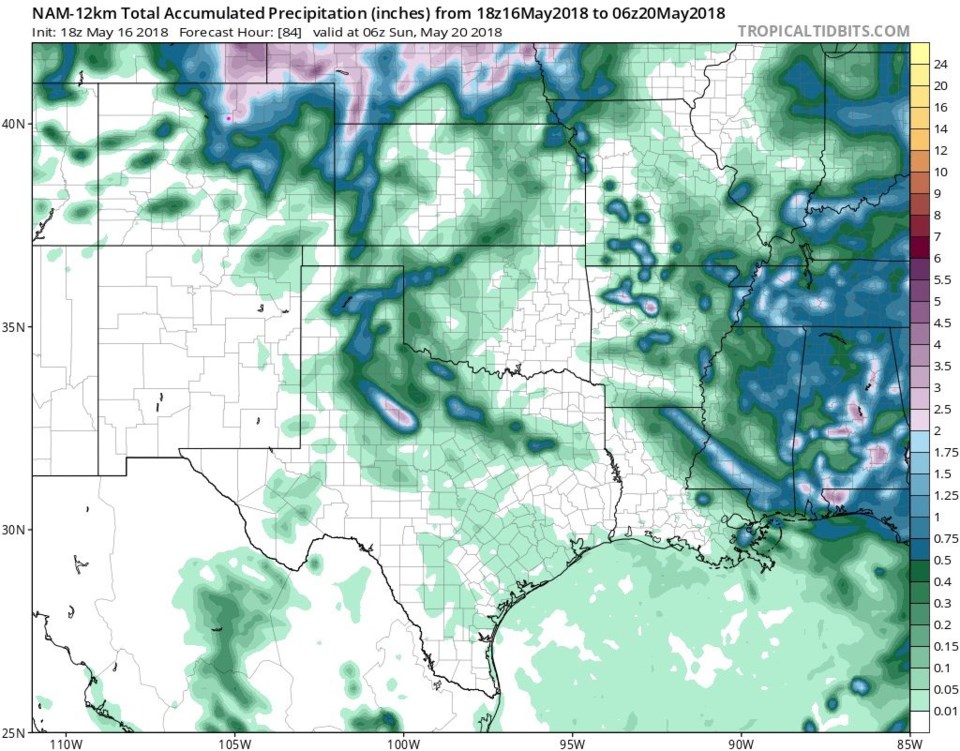
Figure 6 is another model, the NAM, that only goes out to midnight Saturday into Sunday. It gives Longmont 2 to 2.5 inches of rain. Right now, you get to pick 1, 2 or 3 inches as our next storm total. Beyond that, the boxes in Figure 2 again show the afternoon thunderstorm chances that follow this storm for the next full week.